Bull Covert

Wood, Forest in Yorkshire Harrogate

England

Bull Covert

Fountains Abbey Mill A rare surviving Cistercian water mill. The brick extension houses a more modern wheel that operated a sawmill into the 20th century. In the centre of the building is a water turbine that generated electricity but was only turning very slowly.
Fountains Abbey Mill Credit: Chris Allen

Bull Covert, Yorkshire, also known as Wood or Forest, is a picturesque area located in the county of Yorkshire, England. Nestled amidst rolling hills and verdant landscapes, this hidden gem is a haven for nature lovers and outdoor enthusiasts.

Bull Covert is characterized by its dense woodlands, which are predominantly composed of oak and beech trees. These ancient trees create a captivating canopy, providing shade and shelter for a diverse array of flora and fauna. The forest floor is adorned with a carpet of vibrant wildflowers and ferns, offering a visually stunning sight throughout the year.

Tranquility and serenity are key features of Bull Covert, making it an ideal destination for those seeking respite from the hustle and bustle of city life. The area boasts numerous walking trails and footpaths, allowing visitors to explore its natural wonders at their own pace. Wildlife is abundant in the area, with sightings of deer, foxes, and various bird species being common.

For history enthusiasts, Bull Covert offers a glimpse into the past. The forest has been a part of the local heritage for centuries, with evidence of human habitation dating back to ancient times. The remnants of old settlements and historical landmarks can be found scattered throughout the area, adding a sense of intrigue and depth to the overall experience.

In conclusion, Bull Covert, Yorkshire, is a captivating forested area that showcases the beauty and tranquility of the English countryside. With its lush woodlands, diverse wildlife, and rich history, it is a destination that appeals to both nature lovers and history enthusiasts alike.

If you have any feedback on the listing, please let us know in the comments section below.
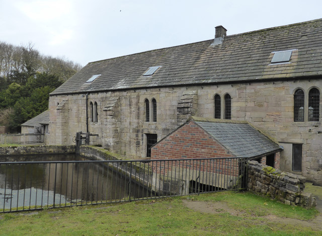
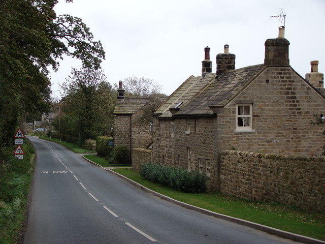
Bull Covert Images

Images are sourced within 2km of 54.094349/-1.6001665 or Grid Reference SE2666. Thanks to Geograph Open Source API. All images are credited.

Fountains Abbey Mill A rare surviving Cistercian water mill. The brick extension houses a more modern wheel that operated a sawmill into the 20th century. In the centre of the building is a water turbine that generated electricity but was only turning very slowly.
Fountains Abbey Mill
A rare surviving Cistercian water mill. The brick extension houses a more modern wheel that operated a sawmill into the 20th century. In the centre of the building is a water turbine that generated electricity but was only turning very slowly.
Along Sawley Moor Lane Near Meadow Brook Farm.
Along Sawley Moor Lane
Near Meadow Brook Farm.
Farmland near Moor Lane Farm Viewed from Sawley Moor Lane.
Farmland near Moor Lane Farm
Viewed from Sawley Moor Lane.
Along Sawley Moor Lane Looking along Sawley Moor Lane near Moor Lane Farm.
Along Sawley Moor Lane
Looking along Sawley Moor Lane near Moor Lane Farm.
Towards Sawley Looking along Middycar Bank at the junction with Sawley Moor Lane.
Towards Sawley
Looking along Middycar Bank at the junction with Sawley Moor Lane.
Middycar Bank Looking along the treelined road to Sawley.
Middycar Bank
Looking along the treelined road to Sawley.
Farmland near Green Bank Wood Looking across Fountains Park towards The Dean.
Farmland near Green Bank Wood
Looking across Fountains Park towards The Dean.
Rough House From the road to Fountains Abbey.
Rough House
From the road to Fountains Abbey.
Tree next to the Skell The River Skell runs just behind the tree.
Tree next to the Skell
The River Skell runs just behind the tree.
Fountains Bridge Fountains Lane crosses the River Skell.
Fountains Bridge
Fountains Lane crosses the River Skell.
Fountains Lane The entrance to Studley Royal is just ahead on the right.
Fountains Lane
The entrance to Studley Royal is just ahead on the right.
Muddy field off Fountains Lane After a lot of heavy rain over the Christmas period.
Muddy field off Fountains Lane
After a lot of heavy rain over the Christmas period.
Fountains Abbey - microhydropower Within the Cistercian watermill there is a water turbine that has been arranged to drive a modern alternator to provide some 'green' power for the estate. On this occasion it was turning very slowly and would not have been generating any useful output.
Fountains Abbey - microhydropower
Within the Cistercian watermill there is a water turbine that has been arranged to drive a modern alternator to provide some 'green' power for the estate. On this occasion it was turning very slowly and would not have been generating any useful output.
Former Cistercian watermill, Fountains Abbey This is a very historic mill and still retains a more modern wheel that drove a sawmill and a water turbine for generating electricity. The original corn mill wheel and machinery is long gone.
Former Cistercian watermill, Fountains Abbey
This is a very historic mill and still retains a more modern wheel that drove a sawmill and a water turbine for generating electricity. The original corn mill wheel and machinery is long gone.
Fountains Hall
Fountains Hall
Fountain's Mill Fountains Abbey is a ruined Cistercian monastery, founded in 1132. Fountains Abbey is one of the largest and best preserved Cistercian houses in England. It is a Grade I listed building and owned by the National Trust. Along with the adjacent Studley Royal Water Garden, it is a UNESCO World Heritage Site.

This <span class="nowrap"><a title="http://g.co/maps/s43sf" rel="nofollow ugc noopener" href="http://g.co/maps/s43sf">Link</a><img style="margin-left:2px;" alt="External link" title="External link - shift click to open in new window" src="https://s1.geograph.org.uk/img/external.png" width="10" height="10"/></span> allows a "virtual tour" of the site using Google Streetview.


<span class="nowrap"><a title="http://www.fountainsabbey.org.uk/" rel="nofollow ugc noopener" href="http://www.fountainsabbey.org.uk/">Link</a><img style="margin-left:2px;" alt="External link" title="External link - shift click to open in new window" src="https://s1.geograph.org.uk/img/external.png" width="10" height="10"/></span> for More details (National Trust)
Fountain's Mill
Fountains Abbey is a ruined Cistercian monastery, founded in 1132. Fountains Abbey is one of the largest and best preserved Cistercian houses in England. It is a Grade I listed building and owned by the National Trust. Along with the adjacent Studley Royal Water Garden, it is a UNESCO World Heritage Site. This LinkExternal link allows a "virtual tour" of the site using Google Streetview. LinkExternal link for More details (National Trust)
How Hill Tower It seems rather odd that the OS map should show this as a church as it has not served that function for several hundred years. Originally built by the monks of nearby Fountains Abbey as a chapel dedicated to St Michael the Archangel sometime before 1346, it became something of a pilgrimage site during the middle ages with a winding pathway leading up the hill which would allow pilgrims views to the abbey and towards both Ripon and York Minsters, the latter being at least 25 miles away. It survived as a chapel for a while after the dissolution, but there's a lack of records after 1570 suggesting that it had fallen out of use.
The current tower, minus some later additions, is the work of John Aislabie who acquired the property around 1717 and rebuilt it as an 'eyecatcher' soon after in 1719, the idea being that it would form the focal point to the view from the proposed new mansion above the NE end of the lake [SE282695 - but never built], with a line of sight along the length of the new canal through the water gardens.   The stone pyramidical roof and four sided cross on the top suggest a Masonic link.  The tower has undergone some further restoration in recent years and is worth visiting for the extensive view in all directions.
How Hill Tower
It seems rather odd that the OS map should show this as a church as it has not served that function for several hundred years. Originally built by the monks of nearby Fountains Abbey as a chapel dedicated to St Michael the Archangel sometime before 1346, it became something of a pilgrimage site during the middle ages with a winding pathway leading up the hill which would allow pilgrims views to the abbey and towards both Ripon and York Minsters, the latter being at least 25 miles away. It survived as a chapel for a while after the dissolution, but there's a lack of records after 1570 suggesting that it had fallen out of use. The current tower, minus some later additions, is the work of John Aislabie who acquired the property around 1717 and rebuilt it as an 'eyecatcher' soon after in 1719, the idea being that it would form the focal point to the view from the proposed new mansion above the NE end of the lake [SE282695 - but never built], with a line of sight along the length of the new canal through the water gardens. The stone pyramidical roof and four sided cross on the top suggest a Masonic link. The tower has undergone some further restoration in recent years and is worth visiting for the extensive view in all directions.
Fountains Abbey from the south west The view is across the hidden River Skell towards the ruins of the guest house with the abbey church beyond.
Fountains Abbey from the south west
The view is across the hidden River Skell towards the ruins of the guest house with the abbey church beyond.
Show me another place!

Bull Covert is located at Grid Ref: SE2666 (Lat: 54.094349, Lng: -1.6001665)

Division: West Riding

Administrative County: North Yorkshire

District: Harrogate

Police Authority: North Yorkshire

What 3 Words

///adjust.elephant.composes. Near Ripon, North Yorkshire

Related Wikis

Sawley, North Yorkshire

Sawley is a village and civil parish in the Harrogate district of North Yorkshire, England. It is about 4 miles (6.4 km) west of Ripon. From this position...

Fountains Hall

Fountains Hall is a country house near Ripon in North Yorkshire, England, located within the World Heritage Site at Studley Royal Park which include the...

Fountains Abbey

Fountains Abbey is one of the largest and best preserved ruined Cistercian monasteries in England. It is located approximately 3 miles (5 km) south-west...

Risplith

Risplith is a village in the civil parish of Sawley, in the Harrogate district of North Yorkshire, England. It is about 4 miles (6.4 km) west of Ripon...

Aldfield

Aldfield is a village and civil parish in the former Harrogate district of North Yorkshire, England, about three miles west of Ripon. It is the closest...

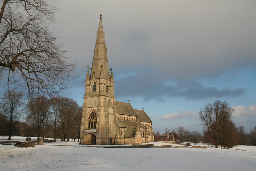
St Mary's, Studley Royal

The Church of St Mary, Studley Royal, is a Victorian Gothic Revival church built in the Early English style by William Burges. It is located in the grounds...

Ripon and Pateley Bridge Rural District

Ripon and Pateley Bridge was a rural district in the West Riding of Yorkshire, England from 1937 to 1974. It was created in 1937 by a County Review Order...

Markington

Markington is a village in the Harrogate district, in the English county of North Yorkshire. The population of the civil parish (including Markenfield...

Nearby Amenities

Located within 500m of 54.094349,-1.6001665
Power: pole
Lat/Long: 54.091869/-1.605514
Power: pole
Lat/Long: 54.0925328/-1.6053584
Power: pole
Lat/Long: 54.0934043/-1.6052109
Power: pole
Lat/Long: 54.0942978/-1.6050768
Power: pole
Lat/Long: 54.0952919/-1.605404
Power: pole
Lat/Long: 54.0961947/-1.6056776
Power: pole
Lat/Long: 54.0971023/-1.6059727
The data included in this document is from www.openstreetmap.org. The data is made available under ODbL.

Have you been to Bull Covert?

Leave your review of Bull Covert below (or comments, questions and feedback).