Eaglestone Flat

Downs, Moorland in Derbyshire Derbyshire Dales

England

Eaglestone Flat

Moorland below Ramsley Moor Looking roughly down the route of Bar Brook towards Baslow, though the trees blot out most of the view of the valley.
Moorland below Ramsley Moor Credit: Bill Boaden

Eaglestone Flat is a picturesque area located in Derbyshire, England. Situated amidst the captivating Downs and Moorland landscapes, this region offers a stunning blend of natural beauty and serene tranquility.

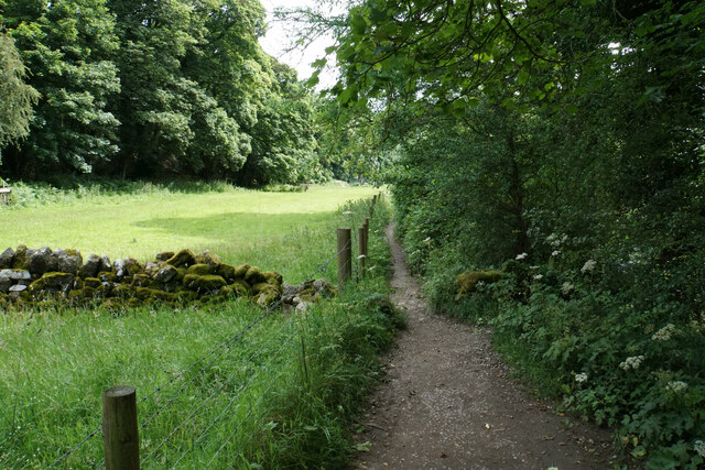
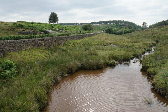
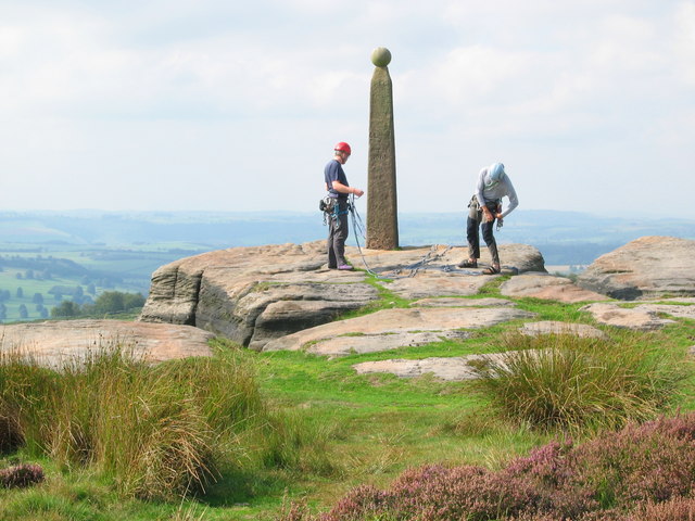
The area is characterized by vast stretches of flat terrain, covered with lush greenery and dotted with charming wildflowers. The Downs, with their gentle slopes and rolling hills, provide a panoramic view of the surrounding countryside. The Moorland, on the other hand, offers a more rugged and untamed landscape, with heather-covered hills and rocky outcrops.

Eaglestone Flat boasts an abundance of wildlife, making it a haven for nature enthusiasts. The open fields attract an array of bird species, including kestrels, skylarks, and peregrine falcons. It is not uncommon to spot rabbits, hares, and even deer roaming freely in this idyllic setting.

For outdoor enthusiasts, Eaglestone Flat offers ample opportunities for hiking, cycling, and horseback riding. The flat terrain makes it ideal for leisurely strolls, while the challenging hills of the Downs provide a more exhilarating experience for those seeking adventure. The area is also crisscrossed by a network of footpaths and bridleways, allowing visitors to explore the region at their own pace.

Eaglestone Flat is a place where time seems to stand still, where one can escape the hustle and bustle of city life and immerse themselves in the beauty of nature. Whether it's admiring the breathtaking views, spotting wildlife, or simply enjoying the peace and quiet, this hidden gem in Derbyshire offers an unforgettable experience for all who visit.

If you have any feedback on the listing, please let us know in the comments section below.

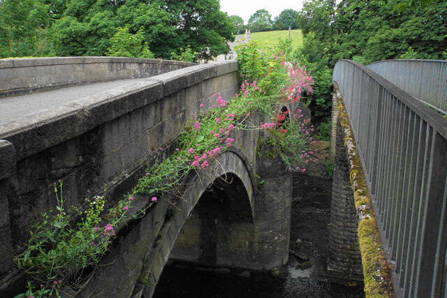
Eaglestone Flat Images

Images are sourced within 2km of 53.262771/-1.606131 or Grid Reference SK2674. Thanks to Geograph Open Source API. All images are credited.

Moorland below Ramsley Moor Looking roughly down the route of Bar Brook towards Baslow, though the trees blot out most of the view of the valley.
Moorland below Ramsley Moor
Looking roughly down the route of Bar Brook towards Baslow, though the trees blot out most of the view of the valley.
Path by the River Derwent You can't see a great deal of the river through the foliage on the right.
Path by the River Derwent
You can't see a great deal of the river through the foliage on the right.
River Derwent near Calver Both sides of this stretch of the river are lined by trees. There is quite a lot of white water below Calver Weir.
River Derwent near Calver
Both sides of this stretch of the river are lined by trees. There is quite a lot of white water below Calver Weir.
Bridges over the River Derwent The bridge on the left carried the old main road from Baslow before it was replaced by a new Calver Bridge. The bridge on the right is a footbridge.
Bridges over the River Derwent
The bridge on the left carried the old main road from Baslow before it was replaced by a new Calver Bridge. The bridge on the right is a footbridge.
Birchen Edge Seen from a path which runs below the edge.
Birchen Edge
Seen from a path which runs below the edge.
Boulder below Birchen Edge An erratic a short distance from the rocks of Birchen Edge.
Boulder below Birchen Edge
An erratic a short distance from the rocks of Birchen Edge.
Trig point on Birchen Edge There are views from the edge to Froggatt Edge and White Edge.
Trig point on Birchen Edge
There are views from the edge to Froggatt Edge and White Edge.
Birchen Edge Near the northern end of Birchen Edge.
Birchen Edge
Near the northern end of Birchen Edge.
Moorland above Birchen Edge A large plateau at around 300 metres above sea level.
Moorland above Birchen Edge
A large plateau at around 300 metres above sea level.
Path off Birchen Edge The northern end where the edge fades away. The A621 can be seen ahead climbing onto Ramsley Moor.
Path off Birchen Edge
The northern end where the edge fades away. The A621 can be seen ahead climbing onto Ramsley Moor.
Path up to Birchen Edge The edge is off to the right and the path approaches it from the northern end. The going on this path was fine in summer, but I would not fancy it in winter when I imagine it would be extremely soggy.
Path up to Birchen Edge
The edge is off to the right and the path approaches it from the northern end. The going on this path was fine in summer, but I would not fancy it in winter when I imagine it would be extremely soggy.
Path down to Clodhall Lane The path descends from Birchen Edge on ground that has the potential to be very soggy. The valley of Bar Brook is ahead.
Path down to Clodhall Lane
The path descends from Birchen Edge on ground that has the potential to be very soggy. The valley of Bar Brook is ahead.
Bar Brook Looking upstream from Clodhall Lane with Ramsley Moor in the background.
Bar Brook
Looking upstream from Clodhall Lane with Ramsley Moor in the background.
Bar Brook Looking downstream from Clodhall Lane. The A621 is above the retaining wall. Gardom's Edge develops in the background.
Bar Brook
Looking downstream from Clodhall Lane. The A621 is above the retaining wall. Gardom's Edge develops in the background.
Clodhall Lane A long straight moorland road, here descending to the valley of Bar Brook and a junction with the A621.
Clodhall Lane
A long straight moorland road, here descending to the valley of Bar Brook and a junction with the A621.
Long wall above Blackstone Edge The wall lines a long distance of the track. On the other side, there are fields maintained by Gorse Bank Farm as a conservation area.
Long wall above Blackstone Edge
The wall lines a long distance of the track. On the other side, there are fields maintained by Gorse Bank Farm as a conservation area.
Cattle above Blackstone Edge The dip just beyond the cattle is the valley of Bar Brook. Birchen Edge is in the background.
Cattle above Blackstone Edge
The dip just beyond the cattle is the valley of Bar Brook. Birchen Edge is in the background.
Barley field on Eaglestone Flat Part of an area of farmland above Baslow Edge.
Barley field on Eaglestone Flat
Part of an area of farmland above Baslow Edge.
Show me another place!

Eaglestone Flat is located at Grid Ref: SK2674 (Lat: 53.262771, Lng: -1.606131)

Administrative County: Derbyshire

District: Derbyshire Dales

Police Authority: Derbyshire

What 3 Words

///dairies.storyline.state. Near Baslow, Derbyshire

Nearby Locations

Eaglestone Flat

Related Wikis

Gardom's Edge

Gardom's Edge is a rocky outcrop near Baslow in Derbyshire, England. The shelf between Gardom's Edge and Birchen Edge is now moorland used for grazing...

Curbar Edge

Curbar Edge is a gritstone moorland escarpment above the village of Curbar, in Derbyshire, England and close to the villages of Baslow, Calver, and Froggatt...

Curbar

Curbar is a village and civil parish in the Derbyshire Dales district of Derbyshire, England. The population based on the 2011 Census was 417. Curbar is...

Cliff College

Cliff College is a Christian theological college in Calver, Derbyshire, that teaches Biblical Theology at the undergraduate level and a number of mission...

All Saints' Church, Curbar

All Saints’ Church, Curbar is a Church of England parish church in Curbar, Derbyshire. == History == Until the church was built, the nearest parish church...

Baslow Hall

Baslow Hall is a Grade II listed building in Baslow, Derbyshire. == History == Baslow Hall, just off Calver Road, was built in 1907 to the designs of the...

Birchen Edge

Birchen Edge is a gritstone rock face in the Peak District, England, popular with walkers and novice climbers as most of the climbing routes are in the...

Baslow

Baslow is a village in Derbyshire, England, in the Peak District, situated between Sheffield and Bakewell, just over 1 mile (1.6 km) north of Chatsworth...

Related Videos

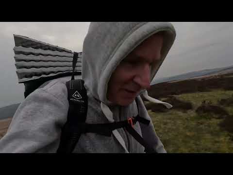
Bank holiday wildcamp on white edge Peak District.

Overnight camp on white edge moor ,weather wasn't spectacular but it was really great to be out away from the city.

Hiking on white edge ,peak district.

Weather too bad to camp settled for a warm coffee on white edge in the Peak District .

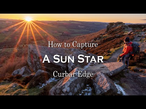
How to capture a Sun Star - Curbar Edge - Peak District

In this video i give a very basic how to get a sun star in your photos Another sunstar video https://youtu.be/eDRWSOCJZJ8 ...

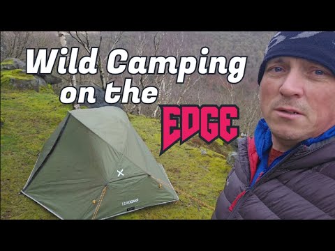
Two Brothers Wild Camping #wildcamping

In this video I was back out wild camping within 7 hours of getting back home from my first hot tent camping night.

Nearby Amenities

Located within 500m of 53.262771,-1.606131
Wellington's Monument
Historic: monument
Lat/Long: 53.2594876/-1.6054076
Eagle Stone
Natural: rock
Lat/Long: 53.2608515/-1.6078896
Bench
Lat/Long: 53.2592139/-1.6076971
Tourism: viewpoint
Lat/Long: 53.2594186/-1.6056975
Bench
Lat/Long: 53.2594046/-1.6056618
The data included in this document is from www.openstreetmap.org. The data is made available under ODbL.

Have you been to Eaglestone Flat?

Leave your review of Eaglestone Flat below (or comments, questions and feedback).