Mar Field

Downs, Moorland in Yorkshire Harrogate

England

Mar Field

Nature Reserve Masham Marfield near Masham was formerly a gravel pit.
Nature Reserve Masham Credit: bronja

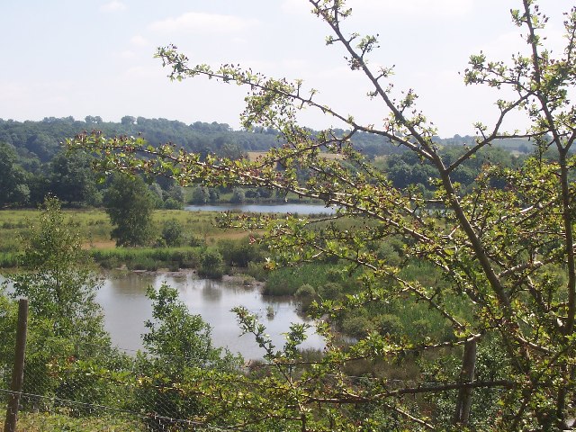
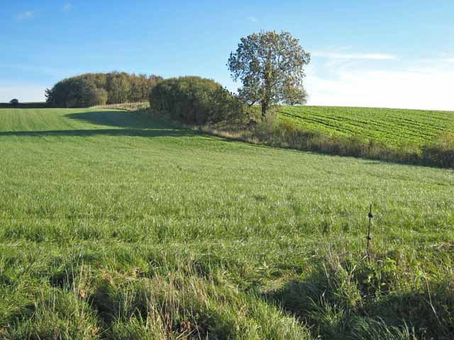
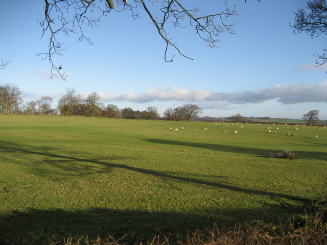
Mar Field is a scenic and expansive area located in the county of Yorkshire, England. It encompasses a range of diverse landscapes, including downs and moorland, making it a popular destination for outdoor enthusiasts and nature lovers alike. The field is known for its natural beauty and is home to a variety of wildlife and plant species.

The downs in Mar Field offer vast open spaces with rolling hills and panoramic views of the surrounding countryside. These downs are characterized by their grassy slopes and provide ample opportunities for hiking, picnicking, and enjoying panoramic views of the landscape. The area is also known for its ancient burial mounds and historical sites, adding a touch of intrigue to the environment.

The moorland in Mar Field is another prominent feature, offering a different experience for visitors. This rugged and wild terrain is covered in heather and bracken, providing a unique and picturesque backdrop. The moorland is home to a diverse range of wildlife, including birds of prey, grouse, and various small mammals.

Mar Field is a haven for outdoor activities such as walking, cycling, and birdwatching, with a network of well-maintained paths and trails crisscrossing the area. The field is also a popular spot for nature photography, as its varied scenery and abundance of wildlife provide ample opportunities for capturing stunning shots.

Overall, Mar Field in Yorkshire is a haven of natural beauty, offering a blend of downs and moorland landscapes that are sure to captivate visitors with their charm and tranquility.

If you have any feedback on the listing, please let us know in the comments section below.

Mar Field Images

Images are sourced within 2km of 54.233442/-1.6661876 or Grid Reference SE2182. Thanks to Geograph Open Source API. All images are credited.

Nature Reserve Masham Marfield near Masham was formerly a gravel pit.
Nature Reserve Masham
Marfield near Masham was formerly a gravel pit.
Masham The location of the annual steam and traction engine rally
Masham
The location of the annual steam and traction engine rally
River Ure near Clifton Castle On a terrace above the ure looking north on the left bank.
River Ure near Clifton Castle
On a terrace above the ure looking north on the left bank.
Masham A rainbow over the Black Sheep Brewery, Masham, as seen from nearby allotments.
Masham
A rainbow over the Black Sheep Brewery, Masham, as seen from nearby allotments.
Masham Market Place Masham main square - not a market day today, but still a lovely little place with plenty of life.
Masham Market Place
Masham main square - not a market day today, but still a lovely little place with plenty of life.
W S Rogers & Son Masham's friendly butcher - the way things used to be!  If you like pork pies, these chaps won't disappoint...
W S Rogers & Son
Masham's friendly butcher - the way things used to be! If you like pork pies, these chaps won't disappoint...
Sutton Penn Farm Field was in process of being ploughed, hence number of birds
Sutton Penn Farm
Field was in process of being ploughed, hence number of birds
Masham, St Mary's Church This Church is on the eastern side of the town of Masham, north east of centre of the O/S grid it occupies
Masham, St Mary's Church
This Church is on the eastern side of the town of Masham, north east of centre of the O/S grid it occupies
Sheep Market, Masham Sheep pens in the market (the signs on the pens say Dalesbred, Texel and Crossbred).
Sheep Market, Masham
Sheep pens in the market (the signs on the pens say Dalesbred, Texel and Crossbred).
Access Lane beside Low Burton Wood This track leaves the B6267 Masham/Skipton on Swale Road to give access to a residence beside Low Burton Wood
Access Lane beside Low Burton Wood
This track leaves the B6267 Masham/Skipton on Swale Road to give access to a residence beside Low Burton Wood
High Burton, near Masham The single storey building in the foreground is a veterinary clinic.
High Burton, near Masham
The single storey building in the foreground is a veterinary clinic.
High Burton, near Masham
Fields near Masham
Fields near Masham
View of Wensleydale The view from a road to the north of Masham looking up into the entrance to Wensleydale.
View of Wensleydale
The view from a road to the north of Masham looking up into the entrance to Wensleydale.
Gebdykes Farm, near Masham
Masham Show Field Masham Steam & Tractor Rally
Masham Show Field
Masham Steam & Tractor Rally
Fields east of Fearby Quiet countryside from the lane that connects Fearby to Masham - about a quarter of a mile from the former
Fields east of Fearby
Quiet countryside from the lane that connects Fearby to Masham - about a quarter of a mile from the former
Show me another place!

Mar Field is located at Grid Ref: SE2182 (Lat: 54.233442, Lng: -1.6661876)

Division: North Riding

Administrative County: North Yorkshire

District: Harrogate

Police Authority: North Yorkshire

What 3 Words

///original.fund.duos. Near Masham, North Yorkshire

Related Wikis

Mar Field Fen

Mar Field Fen is a Site of Special Scientific Interest, or SSSI, north of Masham, North Yorkshire, England, in a rural area known as Marfield. It is situated...
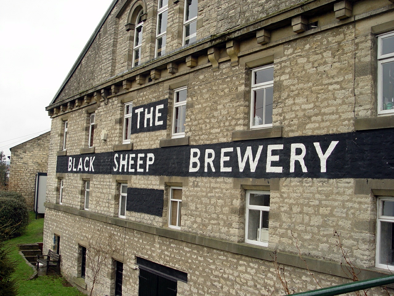
Black Sheep Brewery

The Black Sheep Brewery is a brewery in Masham, North Yorkshire, England. == History == The Black Sheep Brewery was established by Paul Theakston in 1991...
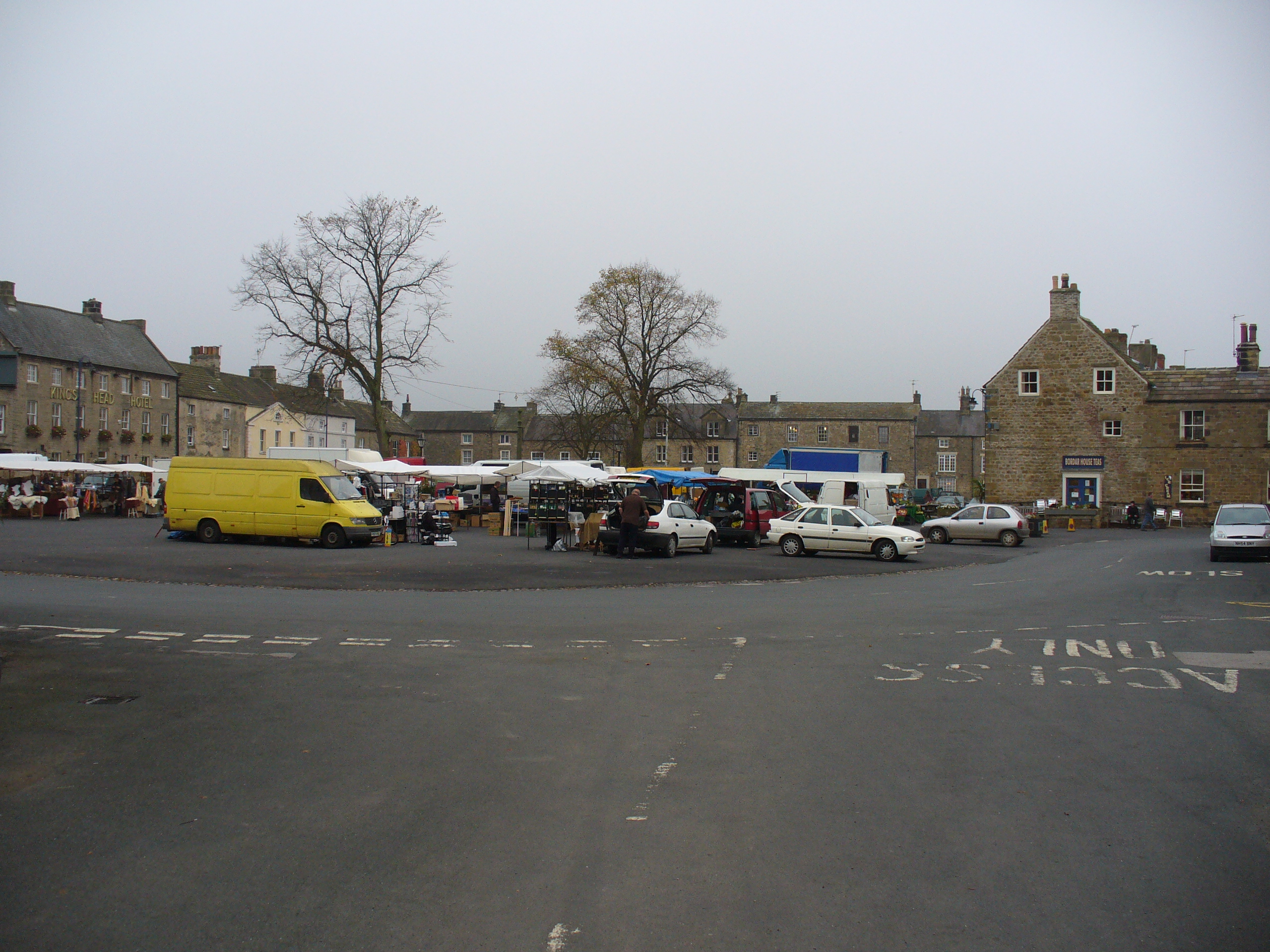
Masham

Masham ( MASS-əm) is a market town and civil parish in North Yorkshire, England. It had a population of 1,205 at the 2011 census. == Etymology == In Wensleydale...
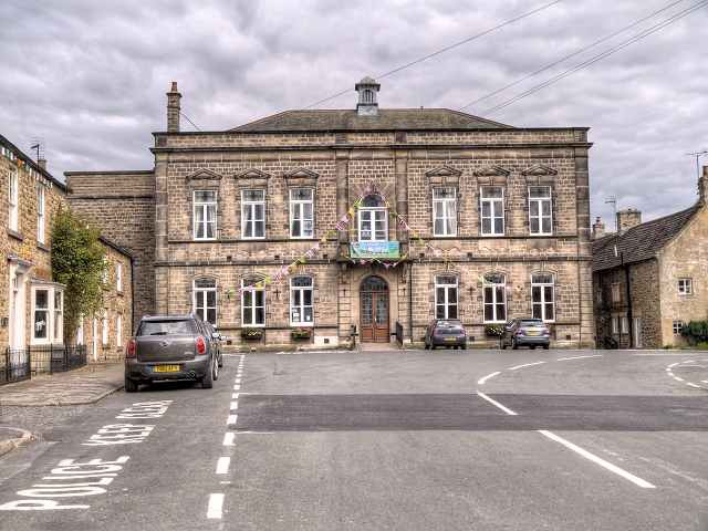
Masham Town Hall

Masham Town Hall is a municipal building in the Little Market Place, Masham, North Yorkshire, England. The structure, which is used as an events venue...

Nearby Amenities

Located within 500m of 54.233442,-1.6661876
Power: pole
Lat/Long: 54.2314159/-1.6704178
Power: pole
Lat/Long: 54.2320963/-1.6712958
Power: pole
Lat/Long: 54.2324574/-1.6716941
Power: pole
Lat/Long: 54.2333279/-1.6726794
Power: pole
Lat/Long: 54.2342363/-1.6736809
Power: pole
Lat/Long: 54.2318929/-1.6632316
Power: pole
Lat/Long: 54.2313779/-1.6644998
Power: pole
Lat/Long: 54.2311251/-1.6651469
Power: pole
Lat/Long: 54.2313948/-1.6679236
Power: pole
Lat/Long: 54.2314691/-1.6686879
Power: pole
Lat/Long: 54.231165/-1.6724143
The data included in this document is from www.openstreetmap.org. The data is made available under ODbL.

Have you been to Mar Field?

Leave your review of Mar Field below (or comments, questions and feedback).