Carlton Moor

Downs, Moorland in Yorkshire

England

Carlton Moor

Beacon Hill, The Chevin One of the summit candidates.
Beacon Hill, The Chevin Credit: Richard Webb

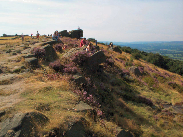
Carlton Moor is a scenic area located in the county of Yorkshire, England. Situated on the very edge of the North York Moors National Park, it is known for its rugged beauty and diverse landscapes, encompassing both downs and moorland.

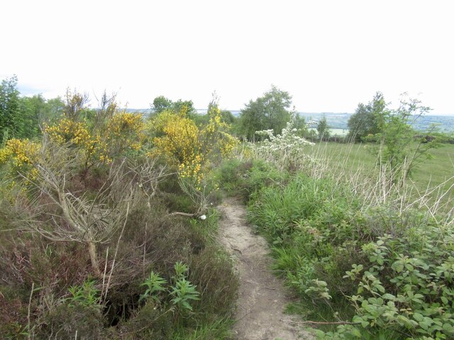
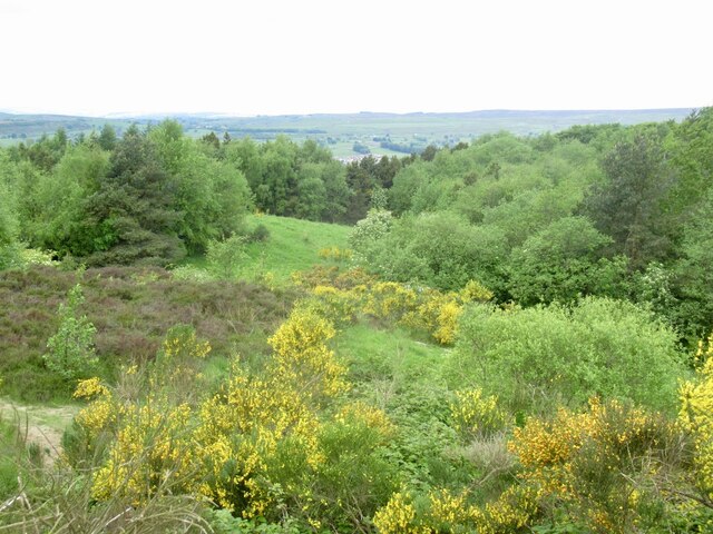
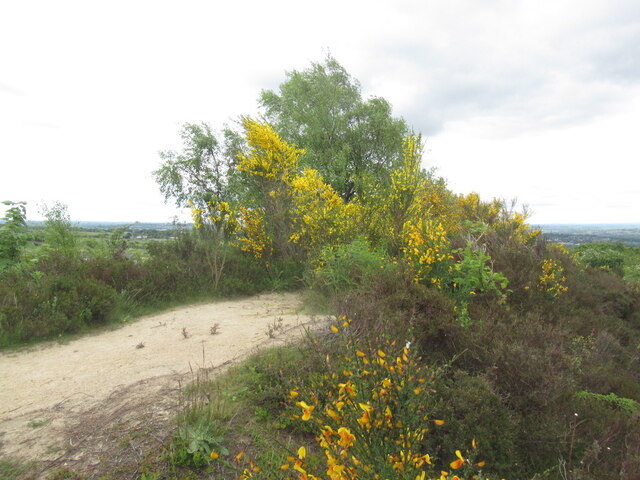
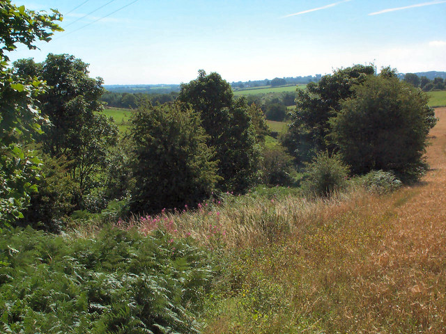
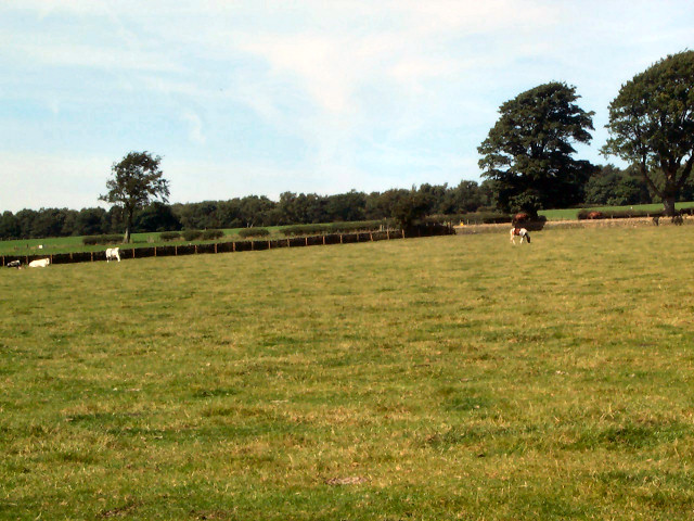
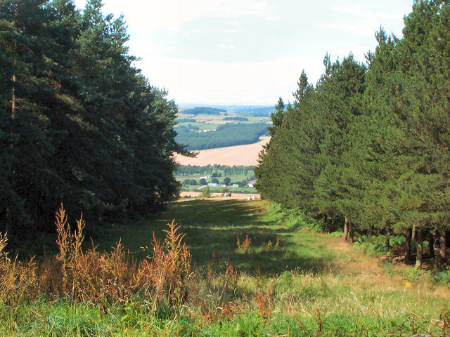
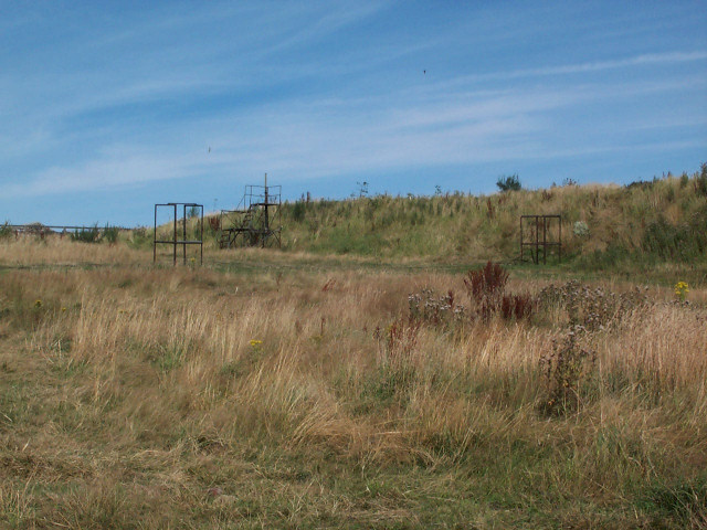
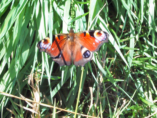
At an elevation of approximately 300 meters, Carlton Moor offers breathtaking panoramic views of the surrounding countryside, making it a popular destination for outdoor enthusiasts and nature lovers. The area is characterized by its rolling hills, heather-covered moors, and scattered woodlands, providing a habitat for a variety of wildlife including birds of prey, small mammals, and rare plant species.

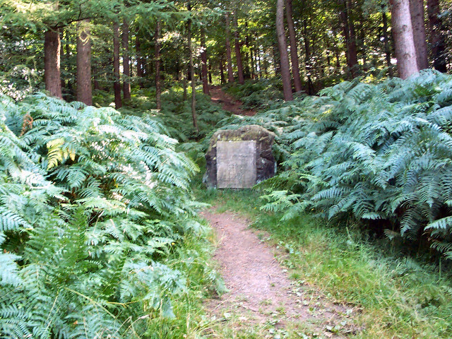
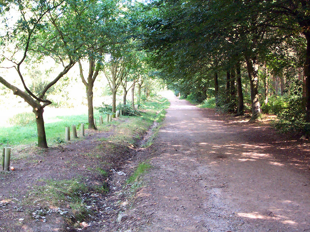
The moorland is crisscrossed by a network of footpaths and bridleways, making it an ideal location for hiking, walking, and horseback riding. The Carlton Moor Circular Walk is a well-known trail that takes visitors on a journey through the area's stunning landscapes, passing by ancient stone formations and historical landmarks.

In addition to its natural beauty, Carlton Moor also boasts a rich history. Evidence of human activity in the region dates back to prehistoric times, with archaeological sites and burial mounds scattered throughout the area. The remains of Carlton Castle, a medieval fortress, can still be seen on the moor, offering a glimpse into the area's past.

Overall, Carlton Moor, Yorkshire provides a unique and captivating experience for those seeking to immerse themselves in the scenic beauty and rich history of the North York Moors.

If you have any feedback on the listing, please let us know in the comments section below.
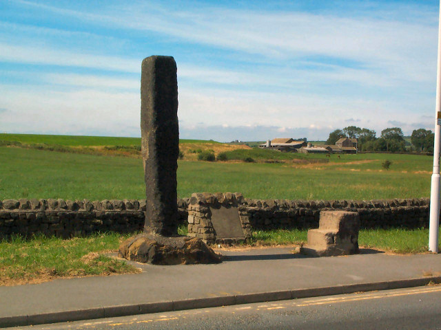
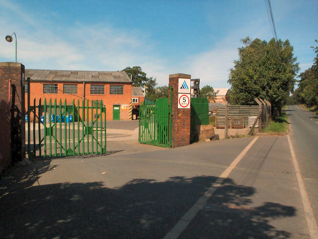
Carlton Moor Images

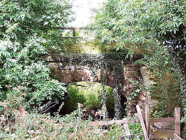
Images are sourced within 2km of 53.886532/-1.67355 or Grid Reference SE2143. Thanks to Geograph Open Source API. All images are credited.

Beacon Hill, The Chevin One of the summit candidates.
Beacon Hill, The Chevin
One of the summit candidates.
Woodland, The Chevin Westward view from Beacon Hill.
Woodland, The Chevin
Westward view from Beacon Hill.
Beacon Hill, The Chevin Probable summit.
Beacon Hill, The Chevin
Probable summit.
Takeoff A JET2.COM 737 on takeoff from Leeds Bradford Airport
Seen from Plane Tree Hill.
Takeoff
A JET2.COM 737 on takeoff from Leeds Bradford Airport Seen from Plane Tree Hill.
Valley of Bramhope Beck View southeast towards None-go-bye's Hill.
Valley of Bramhope Beck
View southeast towards None-go-bye's Hill.
Carlton Church In East Carlton village, this unostentatious former church is now a private house.
Carlton Church
In East Carlton village, this unostentatious former church is now a private house.
Leeds Bradford Airport Industrial Estate The biggest thing in the gridsquare is the enormous, but thankfully well-screened, shed known as Leeds Bradford Airport Industrial Estate. This is the northern entrance gate on the A658. A tiny part of the northern end of the shed can be seen to the right.
Leeds Bradford Airport Industrial Estate
The biggest thing in the gridsquare is the enormous, but thankfully well-screened, shed known as Leeds Bradford Airport Industrial Estate. This is the northern entrance gate on the A658. A tiny part of the northern end of the shed can be seen to the right.
Leeds Heliport On the northwestern side of the A658.
Leeds Heliport
On the northwestern side of the A658.
Long Stoop At the western side of the main Airport roundabout of the A658. The accompanying stone inscription reads: 'THIS MARKER STONE (LONG STOOP) ERECTED HUNDREDS OF YEARS AGO TO GUIDE TRAVELLERS TOWARDS AN ANCIENT SETTLEMENT AT DENE HEAD TO THE EAST WAS MOVED FROM ITS EARLIER SITE 186 YARDS TO THE SOUTH WEST IN THE YEAR 1984 FOR RUNWAY EXTENSIONS. AIREBOROUGH CIVIC SOCIETY.'
Long Stoop
At the western side of the main Airport roundabout of the A658. The accompanying stone inscription reads: 'THIS MARKER STONE (LONG STOOP) ERECTED HUNDREDS OF YEARS AGO TO GUIDE TRAVELLERS TOWARDS AN ANCIENT SETTLEMENT AT DENE HEAD TO THE EAST WAS MOVED FROM ITS EARLIER SITE 186 YARDS TO THE SOUTH WEST IN THE YEAR 1984 FOR RUNWAY EXTENSIONS. AIREBOROUGH CIVIC SOCIETY.'
Carlton Industrial Estate South of East Carlton village, this is the Austin Hayes factory. The area is increasingly characterised by industrial units tucked away in the hinterland of Leeds Bradford Airport.
Carlton Industrial Estate
South of East Carlton village, this is the Austin Hayes factory. The area is increasingly characterised by industrial units tucked away in the hinterland of Leeds Bradford Airport.
Footpath from East Carlton to Yorkgate The path across the field is defined only by the marker at the far side of the field, visible as a tiny yellow dot at the centre-right of the photo.
Footpath from East Carlton to Yorkgate
The path across the field is defined only by the marker at the far side of the field, visible as a tiny yellow dot at the centre-right of the photo.
Chevin Forest Park Looking northwards, through a break in the trees, over the Wharfe valley towards Farnley from the Dales Way Link.
Chevin Forest Park
Looking northwards, through a break in the trees, over the Wharfe valley towards Farnley from the Dales Way Link.
Memorial stone, Chevin Forest Park The rather underwhelming stone reads: REMEMBER / COUNTY ALDERMAN H J BAMBRIDGE OBE JP / COUNCILLOR R T A RENTON JP / ARCHDEACON T J WILLIAMS MC TD MA BD / WHO SERVED / GOD / THEIR COUNTRY / THEIR COUNTY / THIS VALLEY AND TOWNSHIP / 17TH JULY 1960 / THIS PLANTATION OF BRITISH / HARDWOOD TREES WAS THE GIFT OF / MAJOR LE G G W HORTON-FAWKES
Memorial stone, Chevin Forest Park
The rather underwhelming stone reads: REMEMBER / COUNTY ALDERMAN H J BAMBRIDGE OBE JP / COUNCILLOR R T A RENTON JP / ARCHDEACON T J WILLIAMS MC TD MA BD / WHO SERVED / GOD / THEIR COUNTRY / THEIR COUNTY / THIS VALLEY AND TOWNSHIP / 17TH JULY 1960 / THIS PLANTATION OF BRITISH / HARDWOOD TREES WAS THE GIFT OF / MAJOR LE G G W HORTON-FAWKES
Dales Way link, Chevin Forest Park Both the Dales Way link and the Ebor Way are routed east-west through the park. This is a view from the western end of the park, looking eastwards.
Dales Way link, Chevin Forest Park
Both the Dales Way link and the Ebor Way are routed east-west through the park. This is a view from the western end of the park, looking eastwards.
Clay Pigeon Shooting range on Otley Chevin Behind 'The Royalty' pub.
Clay Pigeon Shooting range on Otley Chevin
Behind 'The Royalty' pub.
Otley Chevin Looking westwards; this is the viewpoint, not the summit proper.
Otley Chevin
Looking westwards; this is the viewpoint, not the summit proper.
This is a PEACOCK butterfly :-) It was on the footpath behind Leeds Bradford Airport Industrial Estate. See <a title="https://www.geograph.org.uk/discuss/index.php?&action=vthread&forum=2&topic=603" href="https://www.geograph.org.uk/discuss/index.php?&action=vthread&forum=2&topic=603">Link</a>
This is a PEACOCK butterfly :-)
It was on the footpath behind Leeds Bradford Airport Industrial Estate. See Link
Bridge on former Otley-Pool railway This was the route of the Otley & Ilkley Railway (Midland and N.E.R. Joint). The line closed in 1965 so this represents just 40 years of vegetation.
Bridge on former Otley-Pool railway
This was the route of the Otley & Ilkley Railway (Midland and N.E.R. Joint). The line closed in 1965 so this represents just 40 years of vegetation.
Show me another place!

Carlton Moor is located at Grid Ref: SE2143 (Lat: 53.886532, Lng: -1.67355)

Division: West Riding

Unitary Authority: Leeds

Police Authority: West Yorkshire

What 3 Words

///childcare.retina.defenders. Near Otley, West Yorkshire

Related Wikis

Carlton, Wharfedale

Carlton is a civil parish in the City of Leeds in West Yorkshire, England. It consists of the villages of East Carlton and West Carlton, and in 2001 had...

The Chevin

The Chevin is the ridge on the south side of Wharfedale in Leeds, West Yorkshire, England, overlooking the market town of Otley, and often known as Otley...

Aireborough

Aireborough was a local government district in the West Riding of Yorkshire, England from 1937 to 1974. It was formed through the abolition of the urban...

Otley railway station

Otley railway station was a railway station serving the town of Otley in West Yorkshire, England. == History == It was opened as a joint venture on the...

Nearby Amenities

Located within 500m of 53.886532,-1.67355
Access: no
Barrier: stile
Foot: yes
Material: wood
Stile: stepover
Lat/Long: 53.8885837/-1.6720358
Access: no
Barrier: stile
Foot: yes
Material: wood_stone
Stile: stepover
Lat/Long: 53.8859329/-1.671239
Carlton Moor
Description: Former moorland area, has been pastural fields for many years now but the name lies on.
Place: locality
Source: NLS-OS-1st_Series
Lat/Long: 53.8860002/-1.6769738
Power: pole
Lat/Long: 53.8888894/-1.6715919
Power: pole
Lat/Long: 53.8888356/-1.6703983
Power: pole
Lat/Long: 53.8887977/-1.6691108
Power: pole
Lat/Long: 53.888755/-1.6676839
Access: no
Barrier: stile
Foot: yes
Material: wood
Stile: stepover
Lat/Long: 53.8853734/-1.6708696
Power: pole
Lat/Long: 53.8891716/-1.6786025
Power: pole
Lat/Long: 53.8890891/-1.6763082
Power: pole
Lat/Long: 53.8890405/-1.6751598
Power: pole
Lat/Long: 53.8889873/-1.6739684
Power: pole
Lat/Long: 53.8889394/-1.6727791
Power: pole
Lat/Long: 53.8891367/-1.6775242
The data included in this document is from www.openstreetmap.org. The data is made available under ODbL.

Have you been to Carlton Moor?

Leave your review of Carlton Moor below (or comments, questions and feedback).