Brimham

Downs, Moorland in Yorkshire Harrogate

England

Brimham

Braisty Woods Farm Entrance to Braisty Woods Farm near Low Laithe.
Braisty Woods Farm Credit: David Rogers

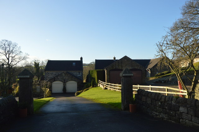
Brimham, located in Yorkshire, England, is a picturesque area known for its stunning landscape featuring a unique formation of rocks scattered across its moorland and downs. Situated in the Nidderdale Area of Outstanding Natural Beauty, Brimham offers visitors a captivating experience with its rugged beauty and panoramic views.

The rocks in Brimham are a result of millions of years of geological activity, including erosion and glaciation. These weathered granite formations have been shaped by the elements, resulting in an array of peculiar shapes and sizes. Visitors can marvel at the impressive balancing acts of the rocks, some of which appear to defy gravity. The most famous rock formations include the Dancing Bear, the Sphinx, and the Idol Rock, each with its own intriguing shape and history.

Aside from its geological wonders, Brimham also boasts an abundance of wildlife and plant species. The moorland and downs provide a habitat for various bird species, including curlews, lapwings, and skylarks. During the spring and summer months, the area is adorned with vibrant heather, creating a breathtaking display of color.

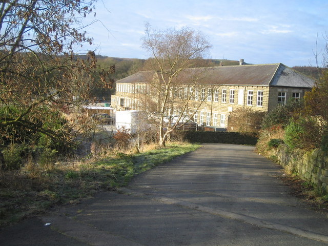
The site is well-equipped to accommodate visitors, with parking facilities, walking trails, and picnic spots available. Walking enthusiasts can explore the various footpaths that wind through the area, allowing them to fully immerse themselves in the natural beauty of Brimham. Additionally, guided tours and educational programs are often available to enhance the visitor experience.

Brimham, Yorkshire, with its unique rock formations, stunning vistas, and diverse wildlife, offers a memorable experience for nature lovers and those seeking a tranquil escape in the heart of the English countryside.

If you have any feedback on the listing, please let us know in the comments section below.

Brimham Images

Images are sourced within 2km of 54.069282/-1.6714623 or Grid Reference SE2163. Thanks to Geograph Open Source API. All images are credited.

Braisty Woods Farm Entrance to Braisty Woods Farm near Low Laithe.
Braisty Woods Farm
Entrance to Braisty Woods Farm near Low Laithe.
Roadside Cottage
Roadside Cottage
Summerbridge Methodist Chapel
Smelthouses, Brimham Rocks Road The rivet benchmark is cut into the top of a left hand gatepost at a field entrance on the north side of the road.
Smelthouses, Brimham Rocks Road
The rivet benchmark is cut into the top of a left hand gatepost at a field entrance on the north side of the road.
Smelthouses, Brimham Rocks Road There is a rivet benchmark cut into the top of the left hand gatepost at this field entrance on the north side of the road.
Smelthouses, Brimham Rocks Road
There is a rivet benchmark cut into the top of the left hand gatepost at this field entrance on the north side of the road.
Terrace of cottages in Summerbridge On the B6165 at the northern end of the town.
Terrace of cottages in Summerbridge
On the B6165 at the northern end of the town.
B6165 nears Summerbridge Methodist Church
Sycamores in Summerbridge
Access track to The Implement Shed, Braisty Woods
Stream crossing
Stream crossing
Footpath to New York Hillside footpath dropping down to the road opposite New York Mills.
Footpath to New York
Hillside footpath dropping down to the road opposite New York Mills.
Minor road towards Braisty Woods
Track approaching Braisty Woods Farm Track adopted by a footpath approaching Braisty Woods Farm, partially screened by trees, from the west.
Track approaching Braisty Woods Farm
Track adopted by a footpath approaching Braisty Woods Farm, partially screened by trees, from the west.
Lane at Hazel Bank The lane is also a bridleway and descends to the B6265 at New York.
Lane at Hazel Bank
The lane is also a bridleway and descends to the B6265 at New York.
Nidderdale Way near Low Wood House The Way follows bridleway 15 55/86/1 up a steady climb towards Brimham.
Nidderdale Way near Low Wood House
The Way follows bridleway 15 55/86/1 up a steady climb towards Brimham.
By the Nidderdale Way A little east of the scene in <a href="https://www.geograph.org.uk/photo/2968139">SE1964 : Towards Low Wood Cottage</a>, with the same drystone wall bordering the Way. The woodland is alongside a small stream descending from Brimham Moor, Brimham Rocks are left of centre on the skyline.
By the Nidderdale Way
A little east of the scene in SE1964 : Towards Low Wood Cottage, with the same drystone wall bordering the Way. The woodland is alongside a small stream descending from Brimham Moor, Brimham Rocks are left of centre on the skyline.
Nidderdale Way near Low Wood House Following bridleway 15 55/86/1 along a track between drystone walls and past silver birches.
Nidderdale Way near Low Wood House
Following bridleway 15 55/86/1 along a track between drystone walls and past silver birches.
Towards Low Wood Cottage A view from the Nidderdale Way following bridleway 15 55/86/1, taken as it passes the field boundary visible on the left of <a href="https://www.geograph.org.uk/photo/2968235">SE1964 : Nidderdale Way near Low Wood House</a>. Above the cottage is  - or are? - White Houses, on the edge of Low Bishopside.
Towards Low Wood Cottage
A view from the Nidderdale Way following bridleway 15 55/86/1, taken as it passes the field boundary visible on the left of SE1964 : Nidderdale Way near Low Wood House. Above the cottage is - or are? - White Houses, on the edge of Low Bishopside.
Show me another place!

Brimham is located at Grid Ref: SE2163 (Lat: 54.069282, Lng: -1.6714623)

Division: West Riding

Administrative County: North Yorkshire

District: Harrogate

Police Authority: North Yorkshire

What 3 Words

///surveyed.bulge.contracts. Near Pateley Bridge, North Yorkshire

Nearby Locations

Brimham

Related Wikis

Hartwith cum Winsley

Hartwith cum Winsley is a civil parish in Harrogate district, North Yorkshire, England. Historically it was a township in the ancient parish of Kirkby...

Brimham Rocks

Brimham Rocks, once known as Brimham Crags, is a 183.9-hectare (454-acre) biological Site of Special Scientific Interest (SSSI) and Geological Conservation...

Warsill

Warsill is a settlement and civil parish in the Harrogate district, in the county of North Yorkshire, England. It consists of a few scattered farms 5 miles...

New York, North Yorkshire

New York is a settlement in Nidderdale in the Harrogate district of North Yorkshire, England. It is on the River Nidd, near Summerbridge, and about 2...

Related Videos

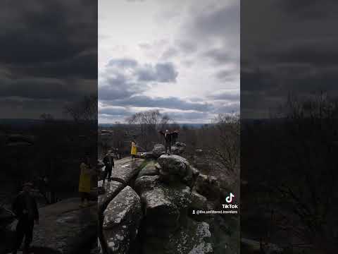
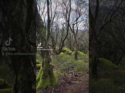
Brimham Rocks | Amazing National Trust Site in Yorkshire for Walking, Climbing & Photography!

If you're looking for an outdoors activity in Yorkshire then visit National Trust's Brimham Rocks. Brimham is home to amazing giant ...

Nearby Amenities

Located within 500m of 54.069282,-1.6714623
Fiddler's Green
Building: yes
Source: NPE
Lat/Long: 54.0665736/-1.671019
The data included in this document is from www.openstreetmap.org. The data is made available under ODbL.

Have you been to Brimham?

Leave your review of Brimham below (or comments, questions and feedback).