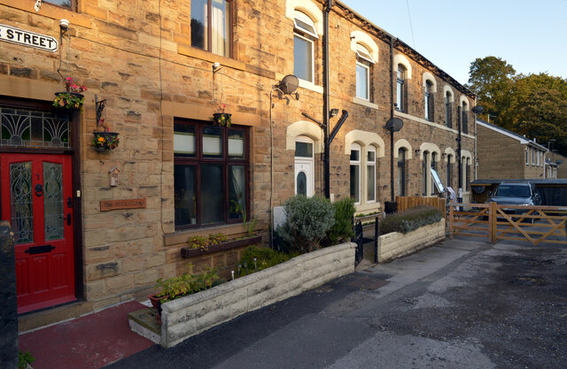
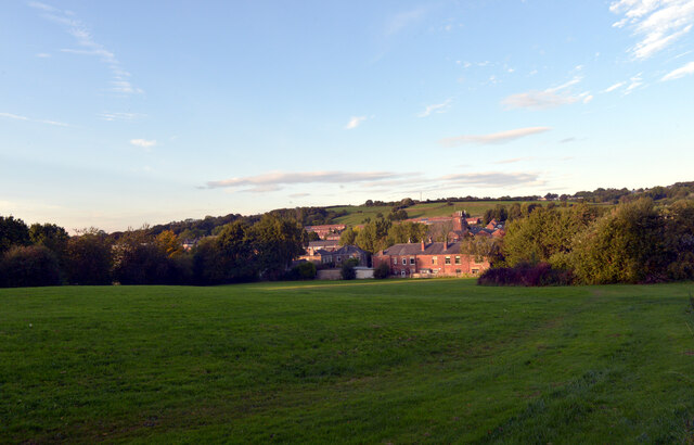
Popeley Fields

Downs, Moorland in Yorkshire

England

Popeley Fields

Holme Street, Millbridge, Liversedge
Holme Street, Millbridge, Liversedge Credit: habiloid

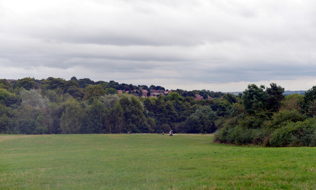
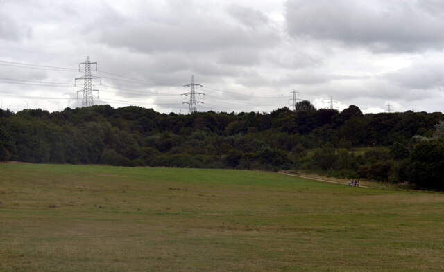
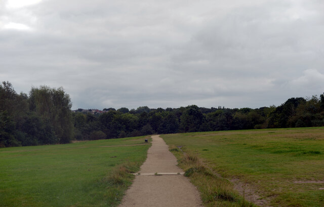
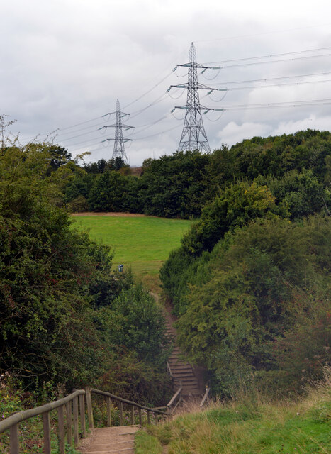
Popeley Fields is a scenic area located in Yorkshire, England. With its picturesque landscape, the region encompasses a diverse mix of downs and moorland. The fields are known for their natural beauty and offer a tranquil escape from the hustle and bustle of urban life.

The downs in Popeley Fields are characterized by their rolling hills and expansive grasslands. These open spaces provide breathtaking panoramic views of the surrounding countryside and are a haven for walkers, hikers, and nature enthusiasts. The downs are home to a variety of flora and fauna, including wildflowers, butterflies, and birds, making it a popular spot for wildlife watching and photography.

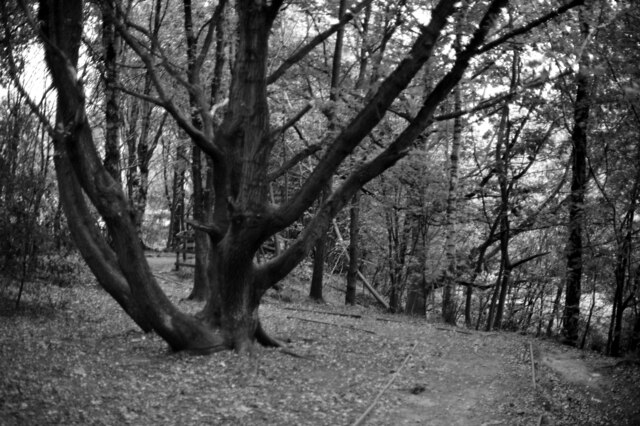
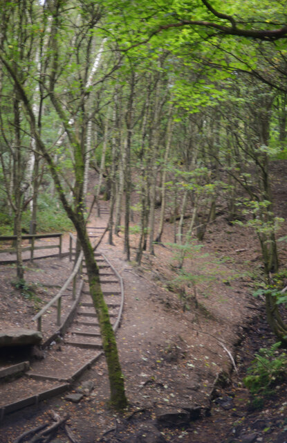
Adjacent to the downs, the moorland of Popeley Fields offers a different but equally captivating environment. The moors are characterized by their rugged, undulating terrain and heather-covered hillsides. This unique landscape provides a stark beauty, especially during the blooming season when the moors burst into a vibrant purple hue.

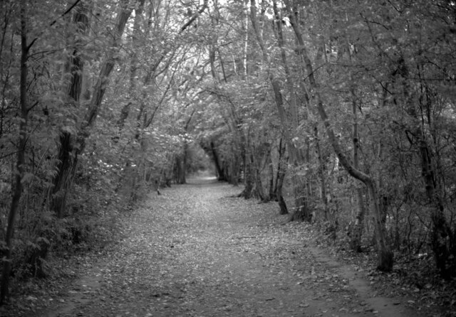
Popeley Fields is a popular destination for outdoor activities such as hiking, mountain biking, and horseback riding. The area boasts a network of well-maintained footpaths and trails that cater to different skill levels and interests. It is also a prime location for picnics and family outings, with several designated areas providing facilities and stunning views.

Overall, Popeley Fields in Yorkshire offers visitors a chance to immerse themselves in the natural beauty of the downs and moorland. Its diverse landscape, rich biodiversity, and peaceful ambiance make it a must-visit destination for those seeking a respite in nature.

If you have any feedback on the listing, please let us know in the comments section below.

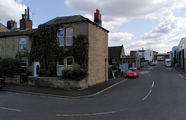
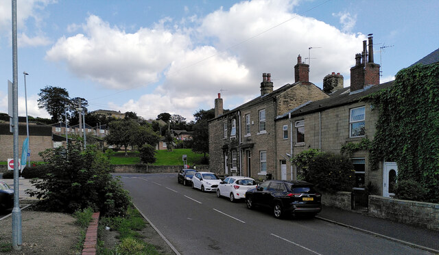
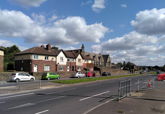
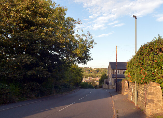
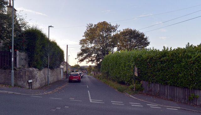
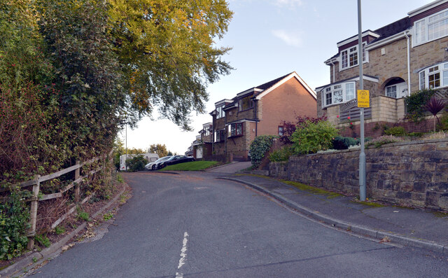
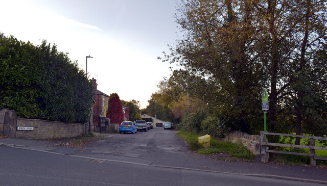
Popeley Fields Images

Images are sourced within 2km of 53.723964/-1.6760218 or Grid Reference SE2125. Thanks to Geograph Open Source API. All images are credited.

Holme Street, Millbridge, Liversedge
Co-Op petrol station and convenience store, Millbridge, Liversedge
Spen Valley Leisure Centre nearing completion, Bradford Road (A638), Liversedge
Bradford Road (A638), Littletown, Liversedge Littletown Junior and Infant School is behind the terrace of houses.
Bradford Road (A638), Littletown, Liversedge
Littletown Junior and Infant School is behind the terrace of houses.
Oakwell Hall Country Park Parts of Oakwell Hall date from the 15th century but the present building is largely due to John Batt in 1583, with some further modifications in the 17th century. In the 19th century it was used as a boarding school. When Charlotte Bronte lived at nearby Hartshead, she allegedly used Oakwell as the basis for 'Fieldhead' in the novel 'Shirley' (Fieldhead is in fact a local name for part of Birstall). The hall and its outbuildings are listed grade I (list entry 11344609) and now operated as a museum by Kirklees council (open at weekends). 

The grounds, along with the site of a former colliery and railway line, form Oakwell Country Park covering 45 hectares of woodland and open fields, which has a separate free car park. There are nature trails and a mountain bike route.
Oakwell Hall Country Park
Parts of Oakwell Hall date from the 15th century but the present building is largely due to John Batt in 1583, with some further modifications in the 17th century. In the 19th century it was used as a boarding school. When Charlotte Bronte lived at nearby Hartshead, she allegedly used Oakwell as the basis for 'Fieldhead' in the novel 'Shirley' (Fieldhead is in fact a local name for part of Birstall). The hall and its outbuildings are listed grade I (list entry 11344609) and now operated as a museum by Kirklees council (open at weekends). The grounds, along with the site of a former colliery and railway line, form Oakwell Country Park covering 45 hectares of woodland and open fields, which has a separate free car park. There are nature trails and a mountain bike route.
Path, Oakwell Hall Country Park Parts of Oakwell Hall date from the 15th century but the present building is largely due to John Batt in 1583, with some further modifications in the 17th century. In the 19th century it was used as a boarding school. When Charlotte Bronte lived at nearby Hartshead, she allegedly used Oakwell as the basis for 'Fieldhead' in the novel 'Shirley' (Fieldhead is in fact a local name for part of Birstall). The hall and its outbuildings are listed grade I (list entry 11344609) and now operated as a museum by Kirklees council (open at weekends). 

The grounds, along with the site of a former colliery and railway line, form Oakwell Country Park covering 45 hectares of woodland and open fields, which has a separate free car park. There are nature trails and a mountain bike route.
Path, Oakwell Hall Country Park
Parts of Oakwell Hall date from the 15th century but the present building is largely due to John Batt in 1583, with some further modifications in the 17th century. In the 19th century it was used as a boarding school. When Charlotte Bronte lived at nearby Hartshead, she allegedly used Oakwell as the basis for 'Fieldhead' in the novel 'Shirley' (Fieldhead is in fact a local name for part of Birstall). The hall and its outbuildings are listed grade I (list entry 11344609) and now operated as a museum by Kirklees council (open at weekends). The grounds, along with the site of a former colliery and railway line, form Oakwell Country Park covering 45 hectares of woodland and open fields, which has a separate free car park. There are nature trails and a mountain bike route.
Path and pylons, Oakwell Hall Country Park Parts of Oakwell Hall date from the 15th century but the present building is largely due to John Batt in 1583, with some further modifications in the 17th century. In the 19th century it was used as a boarding school. When Charlotte Bronte lived at nearby Hartshead, she allegedly used Oakwell as the basis for 'Fieldhead' in the novel 'Shirley' (Fieldhead is in fact a local name for part of Birstall). The hall and its outbuildings are listed grade I (list entry 11344609) and now operated as a museum by Kirklees council (open at weekends). 

The grounds, along with the site of a former colliery and railway line, form Oakwell Country Park covering 45 hectares of woodland and open fields, which has a separate free car park. There are nature trails and a mountain bike route.
Path and pylons, Oakwell Hall Country Park
Parts of Oakwell Hall date from the 15th century but the present building is largely due to John Batt in 1583, with some further modifications in the 17th century. In the 19th century it was used as a boarding school. When Charlotte Bronte lived at nearby Hartshead, she allegedly used Oakwell as the basis for 'Fieldhead' in the novel 'Shirley' (Fieldhead is in fact a local name for part of Birstall). The hall and its outbuildings are listed grade I (list entry 11344609) and now operated as a museum by Kirklees council (open at weekends). The grounds, along with the site of a former colliery and railway line, form Oakwell Country Park covering 45 hectares of woodland and open fields, which has a separate free car park. There are nature trails and a mountain bike route.
Oakwell Hall Country Park Parts of Oakwell Hall date from the 15th century but the present building is largely due to John Batt in 1583, with some further modifications in the 17th century. In the 19th century it was used as a boarding school. When Charlotte Bronte lived at nearby Hartshead, she allegedly used Oakwell as the basis for 'Fieldhead' in the novel 'Shirley' (Fieldhead is in fact a local name for part of Birstall). The hall and its outbuildings are listed grade I (list entry 11344609) and now operated as a museum by Kirklees council (open at weekends). 

The grounds, along with the site of a former colliery and railway line, form Oakwell Country Park covering 45 hectares of woodland and open fields, which has a separate free car park. There are nature trails and a mountain bike route.
Oakwell Hall Country Park
Parts of Oakwell Hall date from the 15th century but the present building is largely due to John Batt in 1583, with some further modifications in the 17th century. In the 19th century it was used as a boarding school. When Charlotte Bronte lived at nearby Hartshead, she allegedly used Oakwell as the basis for 'Fieldhead' in the novel 'Shirley' (Fieldhead is in fact a local name for part of Birstall). The hall and its outbuildings are listed grade I (list entry 11344609) and now operated as a museum by Kirklees council (open at weekends). The grounds, along with the site of a former colliery and railway line, form Oakwell Country Park covering 45 hectares of woodland and open fields, which has a separate free car park. There are nature trails and a mountain bike route.
Path through the woods, Oakwell Hall Country Park
Route of an old railway line passing through the woods, Oakwell Hall Country Park Parts of Oakwell Hall date from the 15th century but the present building is largely due to John Batt in 1583, with some further modifications in the 17th century. In the 19th century it was used as a boarding school. When Charlotte Bronte lived at nearby Hartshead, she allegedly used Oakwell as the basis for 'Fieldhead' in the novel 'Shirley' (Fieldhead is in fact a local name for part of Birstall). The hall and its outbuildings are listed grade I (list entry 11344609) and now operated as a museum by Kirklees council (open at weekends). 

The grounds, along with the site of a former colliery and railway line, form Oakwell Country Park covering 45 hectares of woodland and open fields, which has a separate free car park. There are nature trails and a mountain bike route.
Route of an old railway line passing through the woods, Oakwell Hall Country Park
Parts of Oakwell Hall date from the 15th century but the present building is largely due to John Batt in 1583, with some further modifications in the 17th century. In the 19th century it was used as a boarding school. When Charlotte Bronte lived at nearby Hartshead, she allegedly used Oakwell as the basis for 'Fieldhead' in the novel 'Shirley' (Fieldhead is in fact a local name for part of Birstall). The hall and its outbuildings are listed grade I (list entry 11344609) and now operated as a museum by Kirklees council (open at weekends). The grounds, along with the site of a former colliery and railway line, form Oakwell Country Park covering 45 hectares of woodland and open fields, which has a separate free car park. There are nature trails and a mountain bike route.
Knowler Hill, Liversedge
Fair View, Liversedge
Kirklands, Liversedge
Rock Edge, Liversedge
Vicar Street, Liversedge
A view from Knowler Hill, Liversedge
Show me another place!

Popeley Fields is located at Grid Ref: SE2125 (Lat: 53.723964, Lng: -1.6760218)

Division: West Riding

Unitary Authority: Kirklees

Police Authority: West Yorkshire

What 3 Words

///skip.actor.either. Near Heckmondwike, West Yorkshire

Nearby Locations

Popeley Fields Gomersal

Related Wikis

St Peter's Church, Birstall

St. Peter's Church in Birstall, West Yorkshire, England is an active Anglican parish church in the archdeaconry of Leeds and the Diocese of Leeds. ��2...
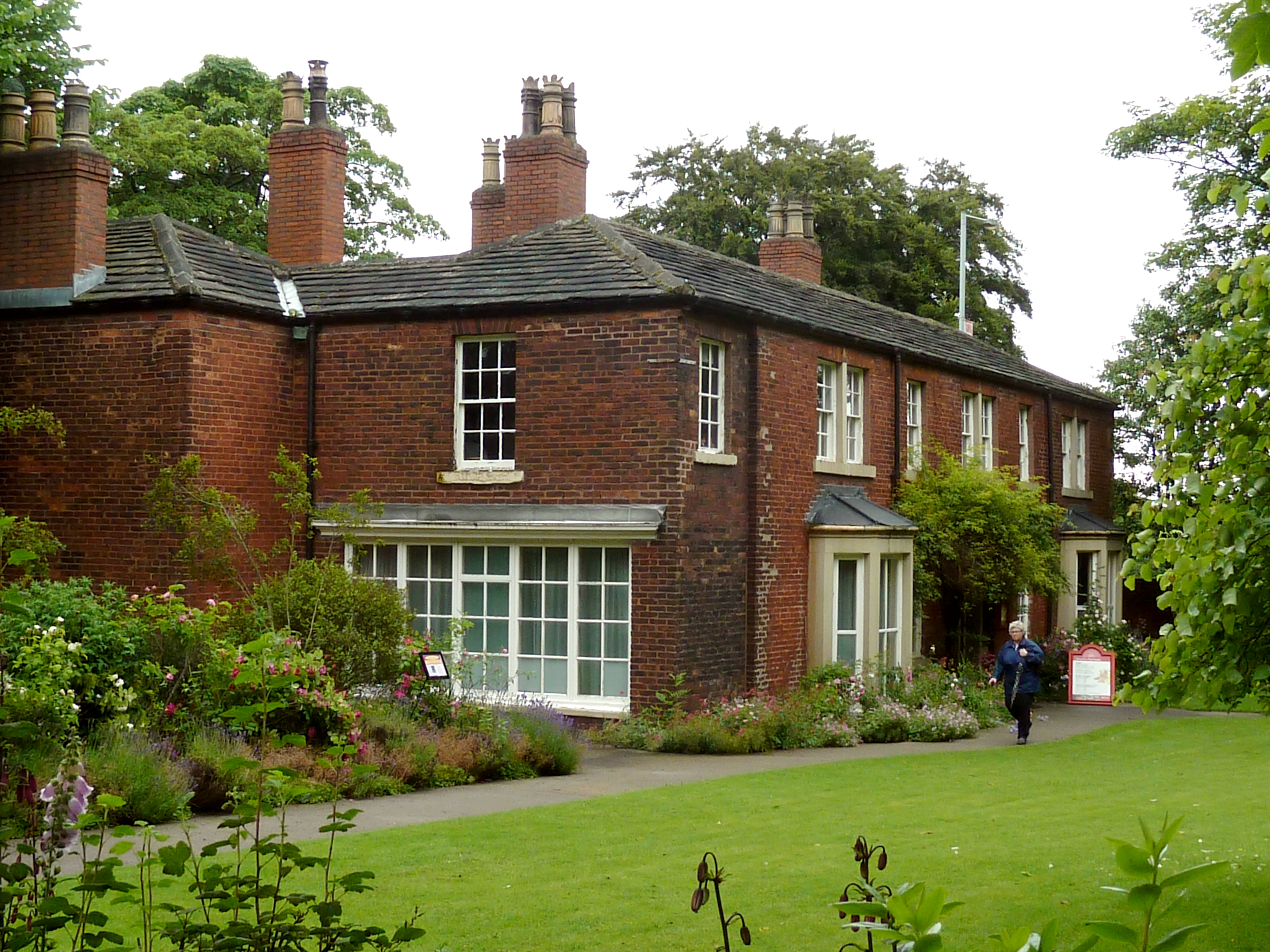
Red House Museum

Red House Museum was a historic house museum, built in 1660 and renovated in the Georgian era. It closed to the public at the end of 2016 but remains as...

Birstall railway station (West Yorkshire)

Birstall railway station served the town of Birstall, in the historic county of West Riding of Yorkshire, England, from 1852 to 1962 on the Birstall Branch...

Murder of Jo Cox

On 16 June 2016, Jo Cox, a British Labour Party politician and Member of Parliament (MP) for Batley and Spen, died after being shot and stabbed multiple...

Nearby Amenities

Located within 500m of 53.723964,-1.6760218
Traffic Calming: chicane
Lat/Long: 53.726244/-1.67115
Popeley Fields
Place: locality
Source: OD Streetview
Lat/Long: 53.7209261/-1.6786554
Generator Method: photovoltaic
Generator Output Electricity: yes
Generator Source: solar
Generator Type: solar_photovoltaic_panel
Location: roof
Power: generator
Lat/Long: 53.7276512/-1.6794736
Generator Method: photovoltaic
Generator Output Electricity: yes
Generator Source: solar
Generator Type: solar_photovoltaic_panel
Location: roof
Power: generator
Lat/Long: 53.7276766/-1.6794253
The data included in this document is from www.openstreetmap.org. The data is made available under ODbL.

Have you been to Popeley Fields?

Leave your review of Popeley Fields below (or comments, questions and feedback).