Gomersal

Settlement in Yorkshire

England

Gomersal

Holme Street, Millbridge, Liversedge
Holme Street, Millbridge, Liversedge Credit: habiloid

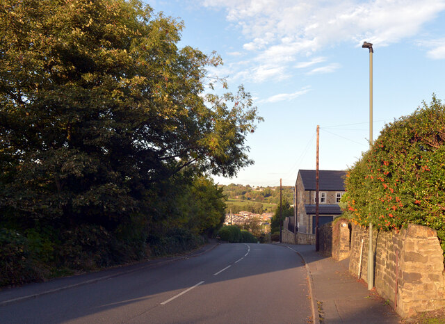
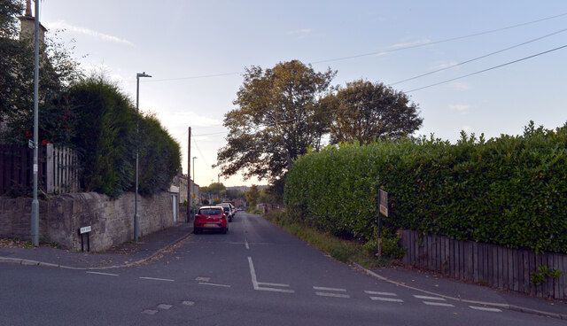
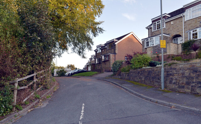
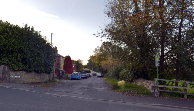
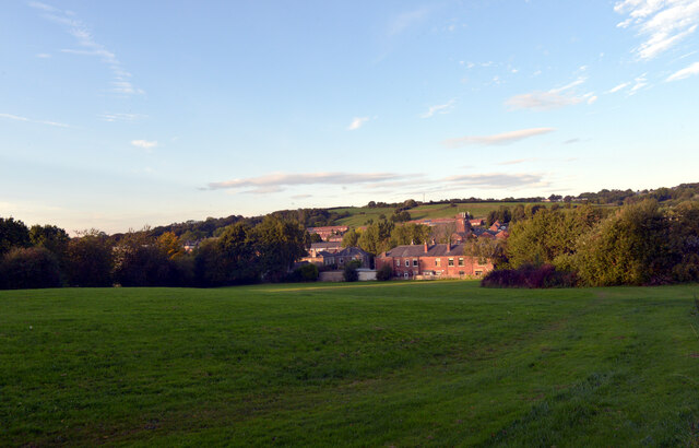
Gomersal is a picturesque village located in the Metropolitan Borough of Kirklees, West Yorkshire, England. Situated on the lower slopes of the Pennines, it lies approximately 8 miles south-west of Leeds and 4 miles south-east of Bradford. Gomersal is known for its rich history, breathtaking countryside, and quaint charm.

The village is home to several historic landmarks, including Red House Museum, which was the former residence of renowned author Charlotte Brontë's best friend, Mary Taylor. The museum offers visitors a glimpse into the literary heritage of the region. Additionally, St. Mary's Church, a Grade I listed building, stands proudly in the heart of the village, showcasing exquisite architecture and a fascinating history dating back to the 12th century.

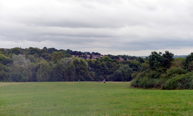
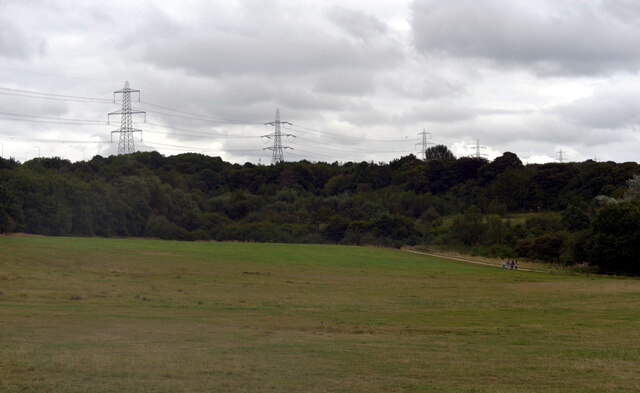
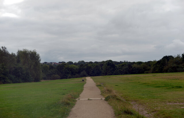
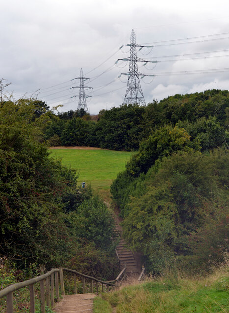
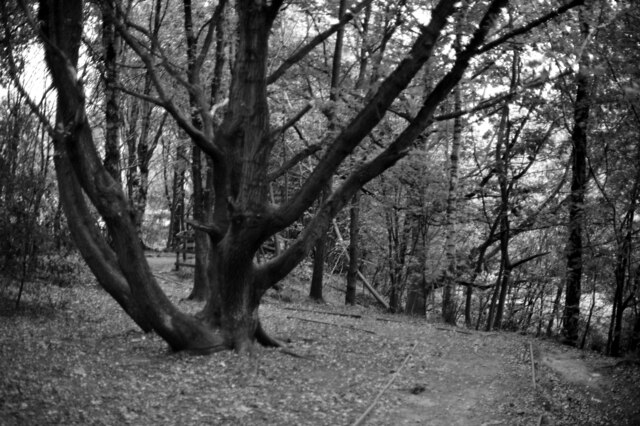
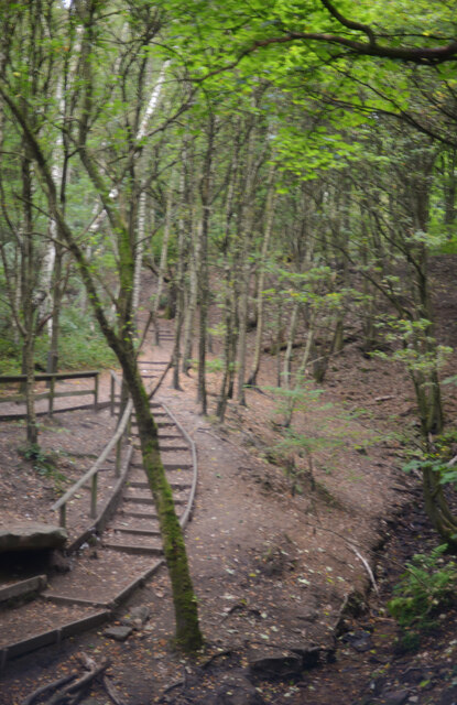
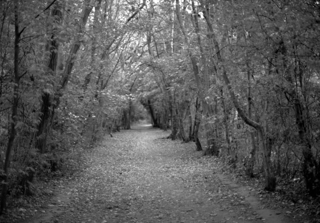
Gomersal is surrounded by stunning natural beauty, with rolling hills and green fields providing a perfect backdrop for outdoor enthusiasts. There are numerous walking and cycling routes, such as the Spen Valley Greenway and the Gomersal Circular Walk, allowing locals and visitors to explore the countryside and enjoy the peaceful surroundings.

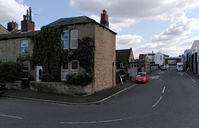
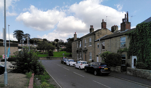
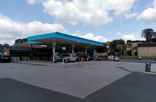
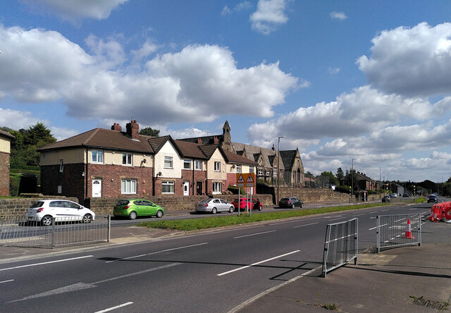
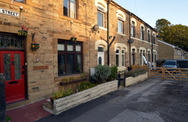
The village itself is characterized by a mix of traditional stone-built cottages and more modern housing developments. It boasts a strong sense of community, with various local amenities including a primary school, shops, pubs, and community centers.

Overall, Gomersal is a delightful village that combines historical significance with natural beauty, making it an idyllic place to live or visit for those seeking a peaceful and scenic location in Yorkshire.

If you have any feedback on the listing, please let us know in the comments section below.
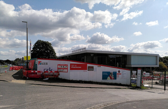
Gomersal Images

Images are sourced within 2km of 53.725378/-1.678812 or Grid Reference SE2125. Thanks to Geograph Open Source API. All images are credited.

Holme Street, Millbridge, Liversedge
Co-Op petrol station and convenience store, Millbridge, Liversedge
Spen Valley Leisure Centre nearing completion, Bradford Road (A638), Liversedge
Bradford Road (A638), Littletown, Liversedge Littletown Junior and Infant School is behind the terrace of houses.
Bradford Road (A638), Littletown, Liversedge
Littletown Junior and Infant School is behind the terrace of houses.
Oakwell Hall Country Park Parts of Oakwell Hall date from the 15th century but the present building is largely due to John Batt in 1583, with some further modifications in the 17th century. In the 19th century it was used as a boarding school. When Charlotte Bronte lived at nearby Hartshead, she allegedly used Oakwell as the basis for 'Fieldhead' in the novel 'Shirley' (Fieldhead is in fact a local name for part of Birstall). The hall and its outbuildings are listed grade I (list entry 11344609) and now operated as a museum by Kirklees council (open at weekends). 

The grounds, along with the site of a former colliery and railway line, form Oakwell Country Park covering 45 hectares of woodland and open fields, which has a separate free car park. There are nature trails and a mountain bike route.
Oakwell Hall Country Park
Parts of Oakwell Hall date from the 15th century but the present building is largely due to John Batt in 1583, with some further modifications in the 17th century. In the 19th century it was used as a boarding school. When Charlotte Bronte lived at nearby Hartshead, she allegedly used Oakwell as the basis for 'Fieldhead' in the novel 'Shirley' (Fieldhead is in fact a local name for part of Birstall). The hall and its outbuildings are listed grade I (list entry 11344609) and now operated as a museum by Kirklees council (open at weekends). The grounds, along with the site of a former colliery and railway line, form Oakwell Country Park covering 45 hectares of woodland and open fields, which has a separate free car park. There are nature trails and a mountain bike route.
Path, Oakwell Hall Country Park Parts of Oakwell Hall date from the 15th century but the present building is largely due to John Batt in 1583, with some further modifications in the 17th century. In the 19th century it was used as a boarding school. When Charlotte Bronte lived at nearby Hartshead, she allegedly used Oakwell as the basis for 'Fieldhead' in the novel 'Shirley' (Fieldhead is in fact a local name for part of Birstall). The hall and its outbuildings are listed grade I (list entry 11344609) and now operated as a museum by Kirklees council (open at weekends). 

The grounds, along with the site of a former colliery and railway line, form Oakwell Country Park covering 45 hectares of woodland and open fields, which has a separate free car park. There are nature trails and a mountain bike route.
Path, Oakwell Hall Country Park
Parts of Oakwell Hall date from the 15th century but the present building is largely due to John Batt in 1583, with some further modifications in the 17th century. In the 19th century it was used as a boarding school. When Charlotte Bronte lived at nearby Hartshead, she allegedly used Oakwell as the basis for 'Fieldhead' in the novel 'Shirley' (Fieldhead is in fact a local name for part of Birstall). The hall and its outbuildings are listed grade I (list entry 11344609) and now operated as a museum by Kirklees council (open at weekends). The grounds, along with the site of a former colliery and railway line, form Oakwell Country Park covering 45 hectares of woodland and open fields, which has a separate free car park. There are nature trails and a mountain bike route.
Path and pylons, Oakwell Hall Country Park Parts of Oakwell Hall date from the 15th century but the present building is largely due to John Batt in 1583, with some further modifications in the 17th century. In the 19th century it was used as a boarding school. When Charlotte Bronte lived at nearby Hartshead, she allegedly used Oakwell as the basis for 'Fieldhead' in the novel 'Shirley' (Fieldhead is in fact a local name for part of Birstall). The hall and its outbuildings are listed grade I (list entry 11344609) and now operated as a museum by Kirklees council (open at weekends). 

The grounds, along with the site of a former colliery and railway line, form Oakwell Country Park covering 45 hectares of woodland and open fields, which has a separate free car park. There are nature trails and a mountain bike route.
Path and pylons, Oakwell Hall Country Park
Parts of Oakwell Hall date from the 15th century but the present building is largely due to John Batt in 1583, with some further modifications in the 17th century. In the 19th century it was used as a boarding school. When Charlotte Bronte lived at nearby Hartshead, she allegedly used Oakwell as the basis for 'Fieldhead' in the novel 'Shirley' (Fieldhead is in fact a local name for part of Birstall). The hall and its outbuildings are listed grade I (list entry 11344609) and now operated as a museum by Kirklees council (open at weekends). The grounds, along with the site of a former colliery and railway line, form Oakwell Country Park covering 45 hectares of woodland and open fields, which has a separate free car park. There are nature trails and a mountain bike route.
Oakwell Hall Country Park Parts of Oakwell Hall date from the 15th century but the present building is largely due to John Batt in 1583, with some further modifications in the 17th century. In the 19th century it was used as a boarding school. When Charlotte Bronte lived at nearby Hartshead, she allegedly used Oakwell as the basis for 'Fieldhead' in the novel 'Shirley' (Fieldhead is in fact a local name for part of Birstall). The hall and its outbuildings are listed grade I (list entry 11344609) and now operated as a museum by Kirklees council (open at weekends). 

The grounds, along with the site of a former colliery and railway line, form Oakwell Country Park covering 45 hectares of woodland and open fields, which has a separate free car park. There are nature trails and a mountain bike route.
Oakwell Hall Country Park
Parts of Oakwell Hall date from the 15th century but the present building is largely due to John Batt in 1583, with some further modifications in the 17th century. In the 19th century it was used as a boarding school. When Charlotte Bronte lived at nearby Hartshead, she allegedly used Oakwell as the basis for 'Fieldhead' in the novel 'Shirley' (Fieldhead is in fact a local name for part of Birstall). The hall and its outbuildings are listed grade I (list entry 11344609) and now operated as a museum by Kirklees council (open at weekends). The grounds, along with the site of a former colliery and railway line, form Oakwell Country Park covering 45 hectares of woodland and open fields, which has a separate free car park. There are nature trails and a mountain bike route.
Path through the woods, Oakwell Hall Country Park
Route of an old railway line passing through the woods, Oakwell Hall Country Park Parts of Oakwell Hall date from the 15th century but the present building is largely due to John Batt in 1583, with some further modifications in the 17th century. In the 19th century it was used as a boarding school. When Charlotte Bronte lived at nearby Hartshead, she allegedly used Oakwell as the basis for 'Fieldhead' in the novel 'Shirley' (Fieldhead is in fact a local name for part of Birstall). The hall and its outbuildings are listed grade I (list entry 11344609) and now operated as a museum by Kirklees council (open at weekends). 

The grounds, along with the site of a former colliery and railway line, form Oakwell Country Park covering 45 hectares of woodland and open fields, which has a separate free car park. There are nature trails and a mountain bike route.
Route of an old railway line passing through the woods, Oakwell Hall Country Park
Parts of Oakwell Hall date from the 15th century but the present building is largely due to John Batt in 1583, with some further modifications in the 17th century. In the 19th century it was used as a boarding school. When Charlotte Bronte lived at nearby Hartshead, she allegedly used Oakwell as the basis for 'Fieldhead' in the novel 'Shirley' (Fieldhead is in fact a local name for part of Birstall). The hall and its outbuildings are listed grade I (list entry 11344609) and now operated as a museum by Kirklees council (open at weekends). The grounds, along with the site of a former colliery and railway line, form Oakwell Country Park covering 45 hectares of woodland and open fields, which has a separate free car park. There are nature trails and a mountain bike route.
Knowler Hill, Liversedge
Fair View, Liversedge
Kirklands, Liversedge
Rock Edge, Liversedge
Vicar Street, Liversedge
A view from Knowler Hill, Liversedge
Show me another place!

Gomersal is located at Grid Ref: SE2125 (Lat: 53.725378, Lng: -1.678812)

Division: West Riding

Unitary Authority: Kirklees

Police Authority: West Yorkshire

What 3 Words

///gladiators.awards.faces. Near Cleckheaton, West Yorkshire

Nearby Locations

Popeley Fields Gomersal

Related Wikis

St Peter's Church, Birstall

St. Peter's Church in Birstall, West Yorkshire, England is an active Anglican parish church in the archdeaconry of Leeds and the Diocese of Leeds. ��2...
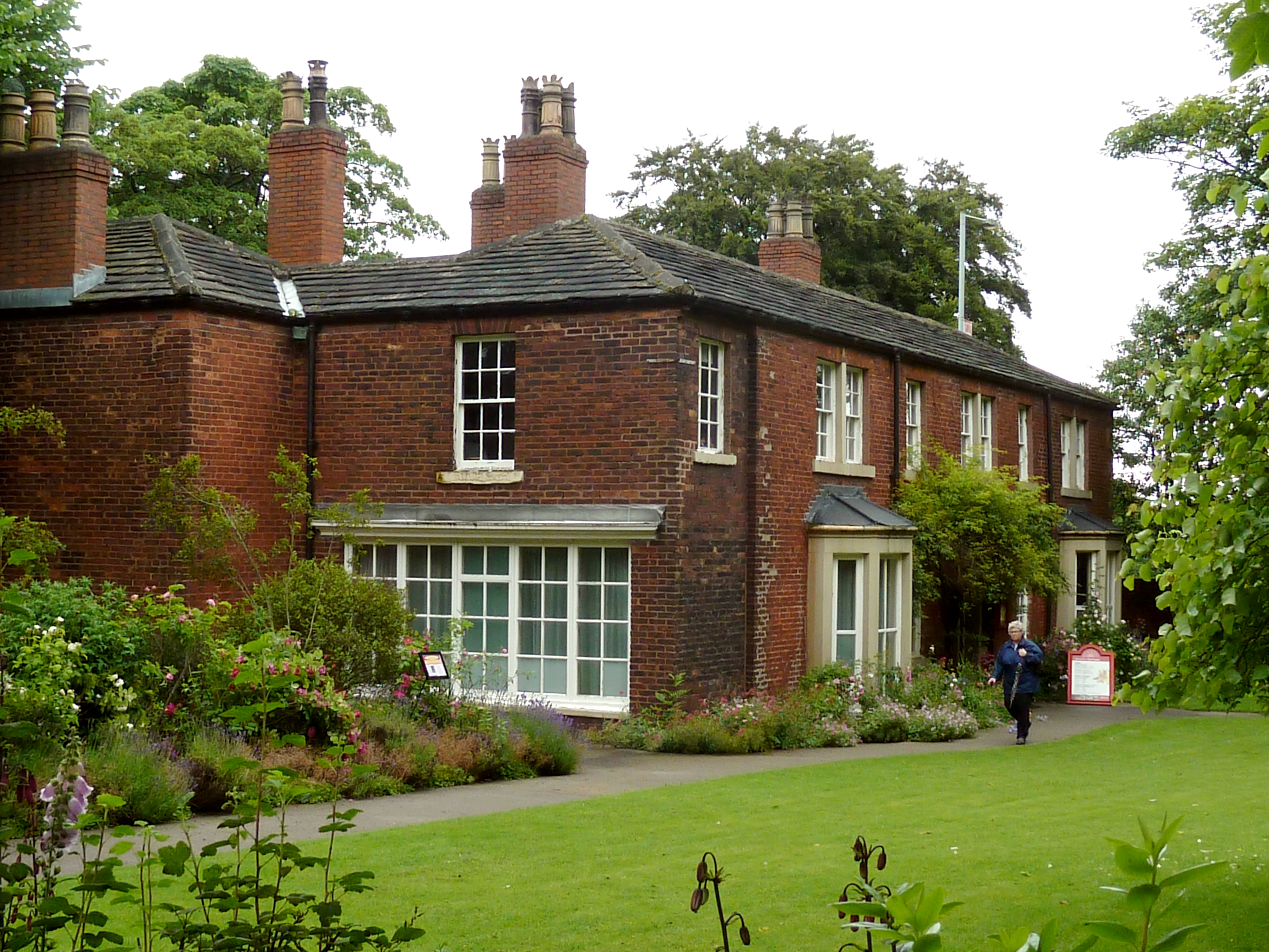
Red House Museum

Red House Museum was a historic house museum, built in 1660 and renovated in the Georgian era. It closed to the public at the end of 2016 but remains as...

Spenborough

Spenborough was, from 1915 to 1974, a local government district in the administrative county of Yorkshire, West Riding, England. Spenborough was created...

Gomersal railway station

Gomersal railway station served the town of Gomersal, West Yorkshire, England, from 1900 to 1953 on the Leeds New Line. == History == The station was opened...

Nearby Amenities

Located within 500m of 53.725378,-1.678812
Bus Stop
Church Lane Muffit Lane
Local Ref: 45014025
Naptan AtcoCode: 450014025
Naptan Bearing: E
Naptan CommonName: Church Lane Muffit Lane
Naptan Crossing: Muffit Lane
Naptan Indicator: Stop 45014025
Naptan Notes: OSR taken place 041005
Naptan PlusbusZoneRef: LEEDS
Naptan ShortCommonName: Muffit Lane
Naptan Street: Church Lane
Naptan Verified: no
Source: naptan_import
Lat/Long: 53.7293364/-1.6783581
Bus Stop
Church Lane Craven Drive
Local Ref: 45014051
Naptan AtcoCode: 450014051
Naptan Bearing: W
Naptan CommonName: Church Lane Craven Drive
Naptan Crossing: Craven Drive
Naptan Indicator: Stop 45014051
Naptan PlusbusZoneRef: LEEDS
Naptan ShortCommonName: Craven Drive
Naptan Street: Church Lane
Naptan Verified: no
Source: naptan_import
Lat/Long: 53.7292398/-1.6791925
Bus Stop
Oxford Road Kirkstone Drive
Local Ref: 45014059
Naptan AtcoCode: 450014059
Naptan Bearing: NW
Naptan CommonName: Oxford Road Kirkstone Drive
Naptan Crossing: Kirkstone Drive
Naptan Indicator: Stop 45014059
Naptan PlusbusZoneRef: LEEDS
Naptan ShortCommonName: Kirkstone Drive
Naptan Street: Oxford Road
Naptan Verified: no
Source: naptan_import
Lat/Long: 53.7283774/-1.682761
Bus Stop
Oxford Road Craven Lane
Local Ref: 45014060
Naptan AtcoCode: 450014060
Naptan Bearing: S
Naptan CommonName: Oxford Road Craven Lane
Naptan Crossing: Craven Lane
Naptan Indicator: Stop 45014060
Naptan PlusbusZoneRef: LEEDS
Naptan ShortCommonName: Craven Lane
Naptan Street: Oxford Road
Naptan Verified: no
Source: naptan_import
Lat/Long: 53.7268208/-1.6821513
Bus Stop
Oxford Road Craven Lane
Local Ref: 45014061
Naptan AtcoCode: 450014061
Naptan Bearing: N
Naptan CommonName: Oxford Road Craven Lane
Naptan Crossing: Craven Lane
Naptan Indicator: Stop 45014061
Naptan Landmark: Gomersal Cricket Club
Naptan PlusbusZoneRef: LEEDS
Naptan ShortCommonName: Craven Lane
Naptan Street: Oxford Road
Naptan Verified: no
Source: naptan_import
Lat/Long: 53.7267945/-1.682394
Bus Stop
Quarry Road Upper Lane
Local Ref: 45015647
Naptan AtcoCode: 450015647
Naptan Bearing: SW
Naptan CommonName: Quarry Road Upper Lane
Naptan Crossing: Upper Lane
Naptan Indicator: Stop 45015647
Naptan PlusbusZoneRef: LEEDS
Naptan ShortCommonName: Upper Lane
Naptan Street: Quarry Road
Naptan Verified: no
Source: naptan_import
Lat/Long: 53.7246876/-1.6844408
Bus Stop
Quarry Road Dalby Court
Local Ref: 45015648
Naptan AtcoCode: 450015648
Naptan Bearing: NE
Naptan CommonName: Quarry Road Dalby Court
Naptan Crossing: Upper Lane
Naptan Indicator: Stop 45015648
Naptan PlusbusZoneRef: LEEDS
Naptan ShortCommonName: Upper Lane
Naptan Street: Quarry Road
Naptan Verified: no
Source: naptan_import
Lat/Long: 53.724939/-1.6843328
Bus Stop
Listing Lane Lower Lane
Local Ref: 45015649
Naptan AtcoCode: 450015649
Naptan Bearing: S
Naptan CommonName: Listing Lane Lower Lane
Naptan Crossing: Lower Lane
Naptan Indicator: Stop 45015649
Naptan Landmark: Bulls Head PH
Naptan PlusbusZoneRef: LEEDS
Naptan ShortCommonName: Lower Lane
Naptan Street: Quarry Road
Naptan Verified: no
Source: naptan_import
Lat/Long: 53.7230878/-1.6844831
Pub
Bulls Head Inn
Addr City: Cleckheaton
Addr Hamlet: Gomersal
Addr Postcode: BD19 4HX
Addr Street: Quarry Road
Fhrs Id: 1041764
Source Addr: FHRS Open Data
Lat/Long: 53.7230466/-1.6848352
Traffic Calming: chicane
Lat/Long: 53.728542/-1.6757157
Turning Circle
Craven Lane
Source: Bing
Lat/Long: 53.7285976/-1.6790042
Popeley Fields
Place: locality
Source: OD Streetview
Lat/Long: 53.7209261/-1.6786554
Generator Method: photovoltaic
Generator Output Electricity: yes
Generator Source: solar
Generator Type: solar_photovoltaic_panel
Location: roof
Power: generator
Lat/Long: 53.7233934/-1.6850418
Generator Method: photovoltaic
Generator Output Electricity: yes
Generator Source: solar
Generator Type: solar_photovoltaic_panel
Location: roof
Power: generator
Lat/Long: 53.7233855/-1.6851947
Generator Method: photovoltaic
Generator Output Electricity: yes
Generator Source: solar
Generator Type: solar_photovoltaic_panel
Location: roof
Power: generator
Lat/Long: 53.7264261/-1.6852913
Generator Method: photovoltaic
Generator Output Electricity: yes
Generator Source: solar
Generator Type: solar_photovoltaic_panel
Location: roof
Power: generator
Lat/Long: 53.7264071/-1.685369
Generator Method: photovoltaic
Generator Output Electricity: yes
Generator Source: solar
Generator Type: solar_photovoltaic_panel
Location: roof
Power: generator
Lat/Long: 53.7259818/-1.685074
Generator Method: photovoltaic
Generator Output Electricity: yes
Generator Source: solar
Generator Type: solar_photovoltaic_panel
Location: roof
Power: generator
Lat/Long: 53.7259358/-1.6849774
Generator Method: photovoltaic
Generator Output Electricity: yes
Generator Source: solar
Generator Type: solar_photovoltaic_panel
Location: roof
Power: generator
Lat/Long: 53.7256977/-1.6851545
Generator Method: photovoltaic
Generator Output Electricity: yes
Generator Source: solar
Generator Type: solar_photovoltaic_panel
Location: roof
Power: generator
Lat/Long: 53.7254026/-1.6849614
Generator Method: photovoltaic
Generator Output Electricity: yes
Generator Source: solar
Generator Type: solar_photovoltaic_panel
Location: roof
Power: generator
Lat/Long: 53.7276512/-1.6794736
Generator Method: photovoltaic
Generator Output Electricity: yes
Generator Source: solar
Generator Type: solar_photovoltaic_panel
Location: roof
Power: generator
Lat/Long: 53.7276766/-1.6794253
Generator Method: photovoltaic
Generator Output Electricity: yes
Generator Source: solar
Generator Type: solar_photovoltaic_panel
Location: roof
Power: generator
Lat/Long: 53.7276899/-1.6803213
The data included in this document is from www.openstreetmap.org. The data is made available under ODbL.

Have you been to Gomersal?

Leave your review of Gomersal below (or comments, questions and feedback).