Long Moor

Downs, Moorland in Yorkshire

England

Long Moor

Muddy field entrance on High Moor Lane, Shepley The bridleway is mostly dry after this muddy start.
Muddy field entrance on High Moor Lane, Shepley Credit: Humphrey Bolton

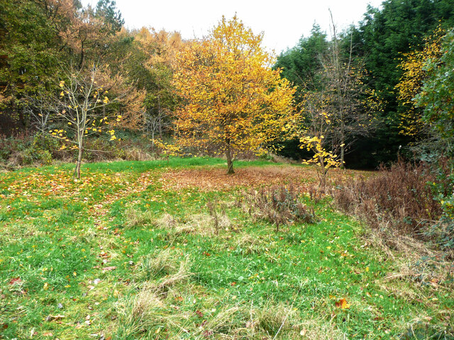
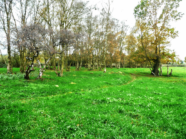
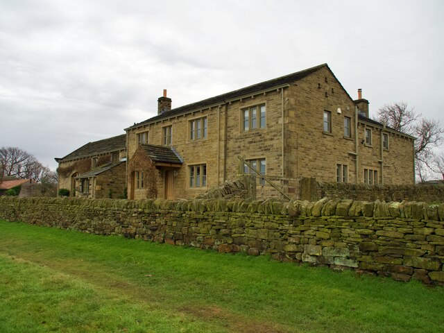
Long Moor is a picturesque area located in Yorkshire, England. Situated on the Yorkshire Downs, this vast expanse of moorland is renowned for its breathtaking natural beauty and diverse wildlife. Spanning over several miles, Long Moor offers a tranquil escape from the bustling city life.

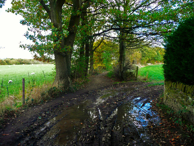
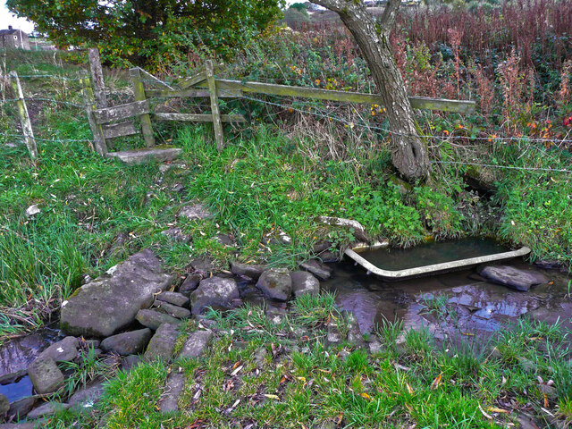
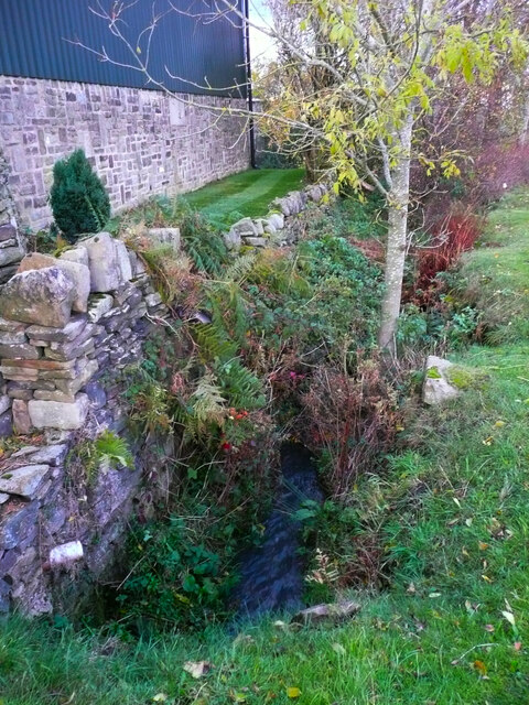
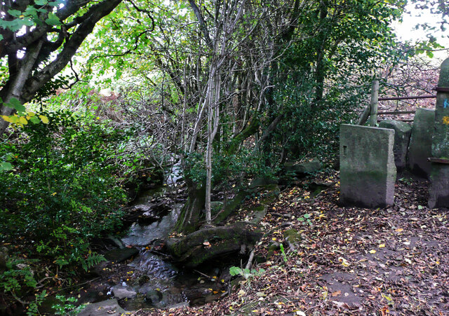
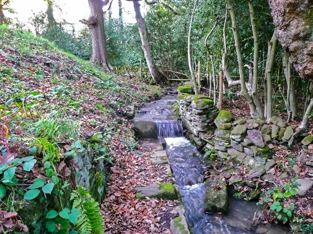
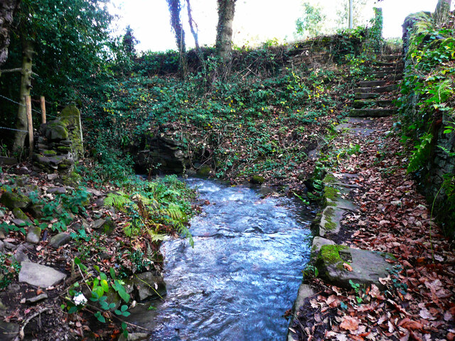
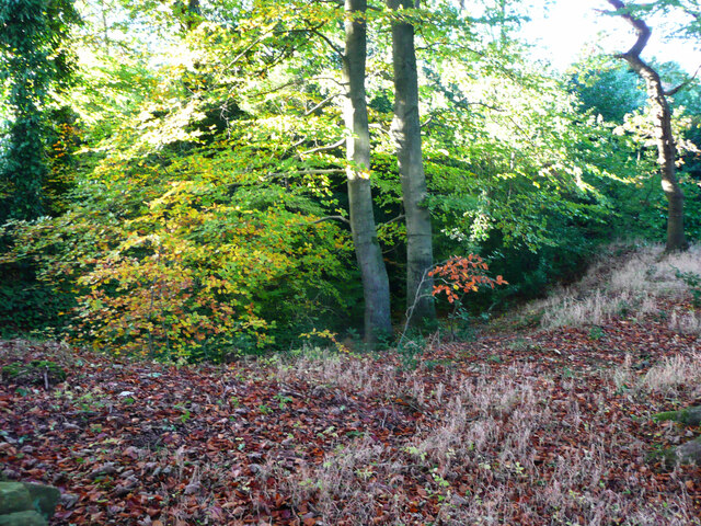
The moorland is characterized by its rolling hills, heather-covered slopes, and vast open spaces. The landscape is dotted with scattered trees and rocky outcrops, creating a striking contrast against the vibrant purple hues of the blooming heather in the summer months. The moorland is also crisscrossed with meandering streams and small rivers, adding to its charm.

Long Moor is home to a variety of wildlife, making it a haven for nature enthusiasts. Birdwatchers can spot a range of species, including the native curlew, lapwing, and red grouse. Mammals such as hares, foxes, and deer can also be spotted roaming freely across the moorland.

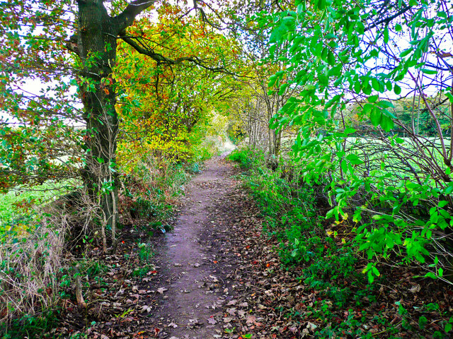
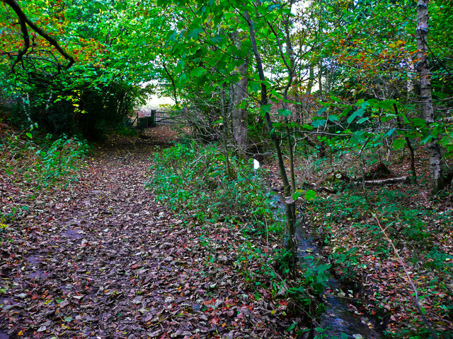
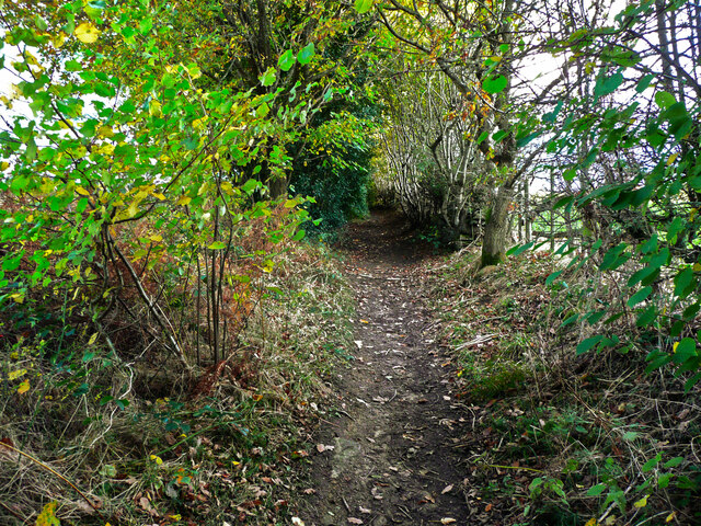
The area is a popular destination for outdoor activities such as hiking and cycling. Numerous trails wind through the moorland, offering breathtaking views and an opportunity to explore the area's natural wonders. Visitors can also enjoy picnicking and camping in designated areas, immersing themselves in the serenity and tranquility of Long Moor.

Overall, Long Moor in Yorkshire is a captivating destination that offers a unique blend of natural beauty, wildlife, and outdoor activities. Whether it be a leisurely walk or an adventurous hike, visitors are sure to be enchanted by the charm and majesty of this moorland.

If you have any feedback on the listing, please let us know in the comments section below.

Long Moor Images

Images are sourced within 2km of 53.59059/-1.6835835 or Grid Reference SE2110. Thanks to Geograph Open Source API. All images are credited.
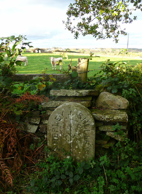
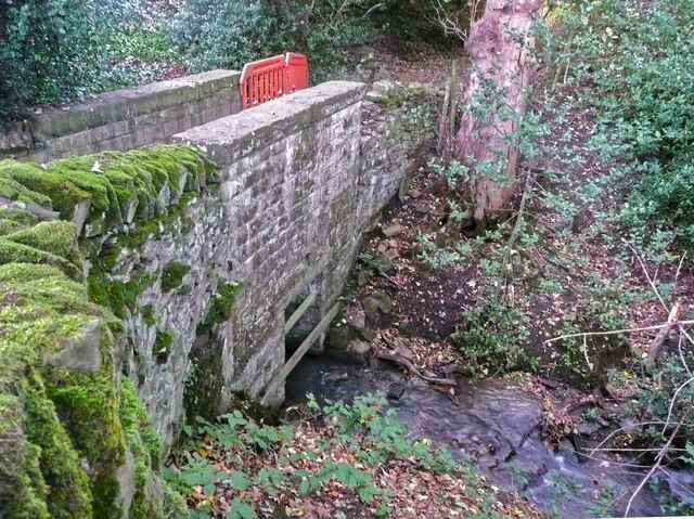
Muddy field entrance on High Moor Lane, Shepley The bridleway is mostly dry after this muddy start.
Muddy field entrance on High Moor Lane, Shepley
The bridleway is mostly dry after this muddy start.
Footpath crossing a stream, Shepley - Cumberworth This stream is here the boundary between Shepley and Cumberworth. It is not named on maps, but is the source tributary of Fenay Beck. The source is a spring below the A635. A bath has been sunk into the bed of the stream to provide a drinking trough for cattle.
Footpath crossing a stream, Shepley - Cumberworth
This stream is here the boundary between Shepley and Cumberworth. It is not named on maps, but is the source tributary of Fenay Beck. The source is a spring below the A635. A bath has been sunk into the bed of the stream to provide a drinking trough for cattle.
High Moor Lane, Shepley A pleasant bridleway.
High Moor Lane, Shepley
A pleasant bridleway.
High Moor Lane passing Yew Tree Wood, Shepley There is a little stream on the right, and a footpath branches off at the gate, where the bridleway bends to the right.
High Moor Lane passing Yew Tree Wood, Shepley
There is a little stream on the right, and a footpath branches off at the gate, where the bridleway bends to the right.
Stream emerging from a culvert under Carr Lane, Cumberworth This is a boundary stream, with Shepley on the left and Cumberworth on the right.
Stream emerging from a culvert under Carr Lane, Cumberworth
This is a boundary stream, with Shepley on the left and Cumberworth on the right.
High Moor Lane, Shepley
Stream leaving High Moor Lane, Shepley This is the stream that comes down through Yew Tree Wood. A stile at the start of a footpath to Copley Lane via Hardingley Farm is on the right.
Stream leaving High Moor Lane, Shepley
This is the stream that comes down through Yew Tree Wood. A stile at the start of a footpath to Copley Lane via Hardingley Farm is on the right.
Boundary stone, High Moor Lane, Shepley / Shelley This stone is not shown on old 1:2500 maps, although others are shown on the boundary. The boundary is along the centre of the lane between two watercourse crossings. Shelley and Shepley Local Boards made an agreement for the joint repair of High Moor Lane in August 1891 (Huddersfield Chronicle via Huddersfield Exposed). As this stone is approximately half-way along the lane between the watercourses perhaps the two local boards decided share the responsibility by dividing the length of lane into two.
Boundary stone, High Moor Lane, Shepley / Shelley
This stone is not shown on old 1:2500 maps, although others are shown on the boundary. The boundary is along the centre of the lane between two watercourse crossings. Shelley and Shepley Local Boards made an agreement for the joint repair of High Moor Lane in August 1891 (Huddersfield Chronicle via Huddersfield Exposed). As this stone is approximately half-way along the lane between the watercourses perhaps the two local boards decided share the responsibility by dividing the length of lane into two.
Footbridge on High Moor Lane, Shelley This is a substantial stone structure, one quarter of which is in Shepley and three quarters in Shelley. The boundary comes down the centre of the stream and then turns left along the centre of the lane.
Footbridge on High Moor Lane, Shelley
This is a substantial stone structure, one quarter of which is in Shepley and three quarters in Shelley. The boundary comes down the centre of the stream and then turns left along the centre of the lane.
Temporary fence on footbridge on High Moor Lane, Shepley In 2015 the wall had lost some capstones but was otherwise sound, see <a href="https://www.geograph.org.uk/photo/7011863">SE2009 : Footbridge on High Moor Lane, Shelley</a>], so I suspect vandalism.
Temporary fence on footbridge on High Moor Lane, Shepley
In 2015 the wall had lost some capstones but was otherwise sound, see SE2009 : Footbridge on High Moor Lane, Shelley], so I suspect vandalism.
Small waterfall on a stream at Copley House, Shelley This man-made waterfall has a paved path going to it. Maybe at was a water supply, or a place to wash items.
Small waterfall on a stream at Copley House, Shelley
This man-made waterfall has a paved path going to it. Maybe at was a water supply, or a place to wash items.
Steps down to stream from Copley Lane, Shelley These lead to the little waterfall shown in [<a href="https://www.geograph.org.uk/photo/7011882">SE2009 : Small waterfall on a stream at Copley House, Shelley</a>.
Steps down to stream from Copley Lane, Shelley
These lead to the little waterfall shown in [SE2009 : Small waterfall on a stream at Copley House, Shelley.
Woodland off Copley Lane, Shelley The stream shown in <a href="https://www.geograph.org.uk/photo/7011892">SE2009 : Steps down to stream from Copley Lane, Shelley</a> flows down below these trees, and presumably in culvert under the railway embankment. Then it goes to Barncliffe Mills.
Woodland off Copley Lane, Shelley
The stream shown in SE2009 : Steps down to stream from Copley Lane, Shelley flows down below these trees, and presumably in culvert under the railway embankment. Then it goes to Barncliffe Mills.
Autumn colour, Upper Cumberworth Whilst exploring a footpath I found that it crosses a field apparently left to nature, with young trees and patches of brambles.  There is a seat behind the tree in the centre of the image, and I thought that this might be a Millennium green, but the nearest ones are at Emley and Clayton West; Upper Cumberworth has a small village garden.
Autumn colour, Upper Cumberworth
Whilst exploring a footpath I found that it crosses a field apparently left to nature, with young trees and patches of brambles. There is a seat behind the tree in the centre of the image, and I thought that this might be a Millennium green, but the nearest ones are at Emley and Clayton West; Upper Cumberworth has a small village garden.
Area of springs, Upper Cumberworth There is water amongst the grass in this area, especially in hollows amongst the birch trees on the other side of the footpath.
Area of springs, Upper Cumberworth
There is water amongst the grass in this area, especially in hollows amongst the birch trees on the other side of the footpath.
The Foresters Arms Public house and restaurant in Lower Cumberworth
The Foresters Arms
Public house and restaurant in Lower Cumberworth
Cumberworth United Cricket Club Pavilion
Long Royd Farm
Long Royd Farm
Show me another place!

Long Moor is located at Grid Ref: SE2110 (Lat: 53.59059, Lng: -1.6835835)

Division: West Riding

Unitary Authority: Kirklees

Police Authority: West Yorkshire

What 3 Words

///morphing.fittingly.steamed. Near Shelley, West Yorkshire

Related Wikis

Shelley railway station

Shelley railway station forms the western terminus of the Whistlestop Valley and serves the village of Shelley, West Yorkshire. England. There was never...

Shelley, West Yorkshire

Shelley is a village in the civil parish of Kirkburton, in the Kirklees district, in the county of West Yorkshire, England. The village is 3 miles (5 km...

Shelley College

Shelley College (formerly known as Shelley High School) is a coeducational upper school and sixth form on the border between the villages of Shelley and...

Shepley railway station

Shepley railway station serves the villages of Shepley and Shelley in West Yorkshire, England. It lies on the Penistone Line operated by Northern. Opened...

Nearby Amenities

Located within 500m of 53.59059,-1.6835835
Shelley
Network: Whistlestop Valley
Operator: Whistlestop Valley
Public Transport: station
Railway: station
Train: yes
Usage: tourism
Lat/Long: 53.5872189/-1.6856984
Barrier: block
Lat/Long: 53.5892585/-1.6794332
Barrier: stile
Stile: stepover
Lat/Long: 53.592377/-1.6856219
Railway: turntable
Lat/Long: 53.5871708/-1.6860893
Railway: level_crossing
Lat/Long: 53.5874145/-1.684632
Barrier: stile
Step Count: 1
Stile: stepover
Lat/Long: 53.5878715/-1.6828975
Barrier: stile
Stile: stepover
Lat/Long: 53.5874809/-1.6840188
Barrier: stile
Stile: stepover
Lat/Long: 53.5873698/-1.684466
Barrier: stile
Step Count: 1
Stile: stepover
Lat/Long: 53.5885589/-1.6811765
Barrier: stile
Stile: stepover
Lat/Long: 53.593062/-1.6892286
Brook Bridge
Place: locality
Source: OD Streetview
Lat/Long: 53.5926414/-1.6887866
Toilets
Lat/Long: 53.5871046/-1.686042
The Whole Groom
Addr City: Huddersfield
Addr Parentstreet: Brook House Lane
Addr Postcode: HD8 8LU
Addr Street: Barncliffe Mills
Addr Suburb: Shelley
Phone: +44 7775 708406
Shop: pet_grooming
Lat/Long: 53.5906813/-1.6874355
Restorr Physio + Pilates
Addr City: Huddersfield
Addr Parentstreet: Brook House Lane
Addr Postcode: HD8 8LU
Addr Street: Barncliffe Mills
Addr Suburb: Shelley
Healthcare: physiotherapist
Website: https://restorrhealth.co.uk/
Lat/Long: 53.590779/-1.6874703
Kirkburton Karate Club & Activity centre
Addr City: Huddersfield
Addr Parentstreet: Brook House Lane
Addr Postcode: HD8 8LU
Addr Street: Barncliffe Mills
Addr Suburb: Shelley
Leisure: sports_centre
Phone: +44 7947 582746
Lat/Long: 53.5908804/-1.6875021
Rodgers Geotechnical Services
Addr City: Huddersfield
Addr Parentstreet: Brook House Lane
Addr Postcode: HD8 8LU
Addr Street: Barncliffe Mills
Addr Suburb: Shelley
Addr Unit: Unit 4
Office: yes
Phone: +44 1484 603085
Lat/Long: 53.5909628/-1.6875409
Cafe
KIN Restaurant
Addr City: Huddersfield
Addr Parentstreet: Brook House Lane
Addr Postcode: HD8 8LU
Addr Street: Barncliffe Mills
Addr Suburb: Shelley
Outdoor Seating: yes
Lat/Long: 53.5910495/-1.6875703
Equi-Sport Horseboxes Ltd
Addr City: Huddersfield
Addr Parentstreet: Brook House Lane
Addr Postcode: HD8 8LU
Addr Street: Barncliffe Mills
Addr Suburb: Shelley
Addr Unit: Unit 1
Phone: +44 1226 292879
Shop: motorhome
Website: https://equi-sport.co.uk/
Lat/Long: 53.5913568/-1.6876802
Sovereign Diet and Fitness Club
Addr City: Huddersfield
Addr Parentstreet: Brook House Lane
Addr Postcode: HD8 8LU
Addr Street: Barncliffe Mills
Addr Suburb: Shelley
Addr Unit: Unit 17
Leisure: fitness_centre
Phone: +44 1484 604174
Lat/Long: 53.5912295/-1.6874013
Arts Centre
Georgie School of Theatre Arts
Addr City: Huddersfield
Addr Parentstreet: Brook House Lane
Addr Postcode: HD8 8LU
Addr Street: Barncliffe Mills
Addr Suburb: Shelley
Phone: +44 1484 606994
Lat/Long: 53.5911483/-1.6873906
Childcare
Barncliffe Day Nursery
Addr City: Huddersfield
Addr Parentstreet: Brook House Lane
Addr Postcode: HD8 8LU
Addr Street: Barncliffe Mills
Addr Suburb: Shelley
Addr Unit: Units 18-19
Phone: +44 1484 604817
Lat/Long: 53.5910241/-1.6872995
K G Auto Engineer Ltd
Addr City: Huddersfield
Addr Parentstreet: Brook House Lane
Addr Postcode: HD8 8LU
Addr Street: Barncliffe Mills
Addr Suburb: Shelley
Addr Unit: Unit 2
Shop: car_repair
Lat/Long: 53.5911738/-1.6872123
Portcullis Site Services
Addr City: Huddersfield
Addr Parentstreet: Brook House Lane
Addr Postcode: HD8 8LU
Addr Street: Barncliffe Mills
Addr Suburb: Shelley
Addr Unit: Unit 6
Office: yes
Lat/Long: 53.5911569/-1.6863104
HD8 Exhibitions
Addr City: Huddersfield
Addr Parentstreet: Brook House Lane
Addr Postcode: HD8 8LU
Addr Street: Barncliffe Mills
Addr Suburb: Shelley
Addr Unit: Unit 5
Office: yes
Lat/Long: 53.5911776/-1.6866484
Post Box
Collection Times: Mo-Fr 16:00; Sa 11:00
Operator: Royal Mail
Post Box Type: lamp
Ref: HD8 313
Royal Cypher: EIIR
Royal Cypher Wikidata: Q33102113
Source: survey
Lat/Long: 53.5898294/-1.6874292
Bench
Backrest: yes
Lat/Long: 53.5898652/-1.6874241
Cliffe House Organics
Addr City: Huddersfield
Addr Parentstreet: Near Bank
Addr Postcode: HD8 8LS
Addr Street: Near Bank Park
Addr Suburb: Shelley
Addr Unit: Unit 4
Email: info@cliffehouseorganics.com
Office: yes
Phone: +44 1484 768610
Website: https://www.cliffehouseorganics.com
Lat/Long: 53.5915746/-1.6848547
Nomadic Pizza Ltd
Addr City: Huddersfield
Addr Parentstreet: Near Bank
Addr Postcode: HD8 8LS
Addr Street: Near Bank Park
Addr Suburb: Shelley
Addr Unit: Unit 3A
Office: yes
Phone: +44 7539 768222
Website: https://nomadicpizza.co.uk
Lat/Long: 53.5917589/-1.6848122
R2 Distillers Ltd
Addr City: Huddersfield
Addr Parentstreet: Near Bank
Addr Postcode: HD8 8LS
Addr Street: Near Bank Park
Addr Suburb: Shelley
Addr Unit: Unit 3B
Email: social@divinegin.com
Office: yes
Phone: +44 7843 255876
Website: https://www.divinegin.com
Lat/Long: 53.5917467/-1.6847165
Marker: aerial
Lat/Long: 53.5867214/-1.6818452
Marker: aerial
Lat/Long: 53.5885954/-1.6813377
The data included in this document is from www.openstreetmap.org. The data is made available under ODbL.

Have you been to Long Moor?

Leave your review of Long Moor below (or comments, questions and feedback).