Haslemere

Settlement in Surrey Waverley

England

Haslemere

Pond beside Green Lane Beyond the pond lies the county border and the edge of the South Downs National Park.
Pond beside Green Lane Credit: Chris Thomas-Atkin

Haslemere is a small town located in the county of Surrey, England. Situated on the border with Hampshire, it lies about 12 miles southwest of Guildford and 40 miles southwest of London. With a population of around 16,000 residents, Haslemere is known for its picturesque surroundings, nestled within the Surrey Hills Area of Outstanding Natural Beauty.

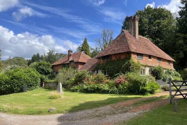
The town boasts a rich history, dating back to Saxon times, and is mentioned in the Domesday Book of 1086. Haslemere grew significantly during the Victorian era, becoming a popular destination for wealthy Londoners seeking a country retreat. Evidence of this can still be seen today in the numerous grand Victorian buildings that line its streets.

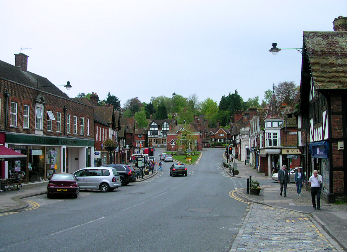
Haslemere offers a charming mix of traditional and modern amenities. The High Street features a variety of independent shops, boutiques, cafes, and restaurants, creating a vibrant and inviting atmosphere. The town also hosts a regular market, providing locals and visitors with access to fresh produce and local goods.

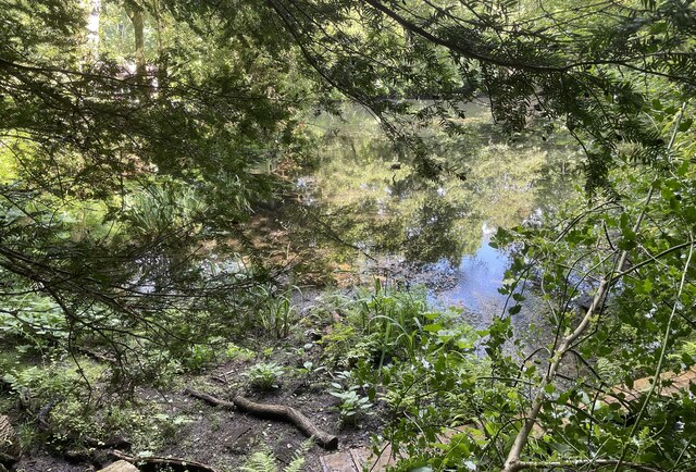
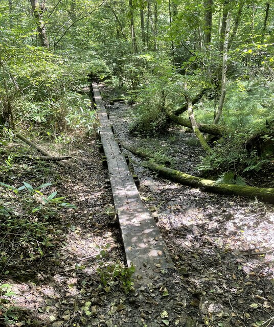
Nature enthusiasts are drawn to Haslemere for its stunning natural landscapes. The surrounding countryside offers ample opportunities for outdoor activities, including hiking, cycling, and horse riding. The Devil's Punch Bowl, a large natural amphitheater and heathland, is a local landmark and a popular spot for walkers.

Transport links in Haslemere are well-developed, with a train station providing direct services to London Waterloo and Portsmouth. The A3 road also passes nearby, ensuring easy access to other major towns and cities.

Overall, Haslemere is a charming town that combines historical charm with natural beauty, making it an attractive place to live or visit for those seeking a tranquil escape from the bustling city life.

If you have any feedback on the listing, please let us know in the comments section below.
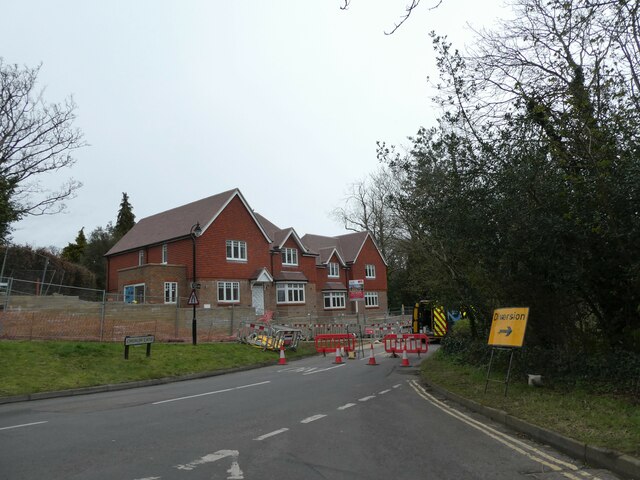
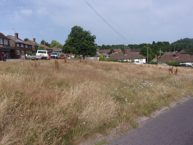
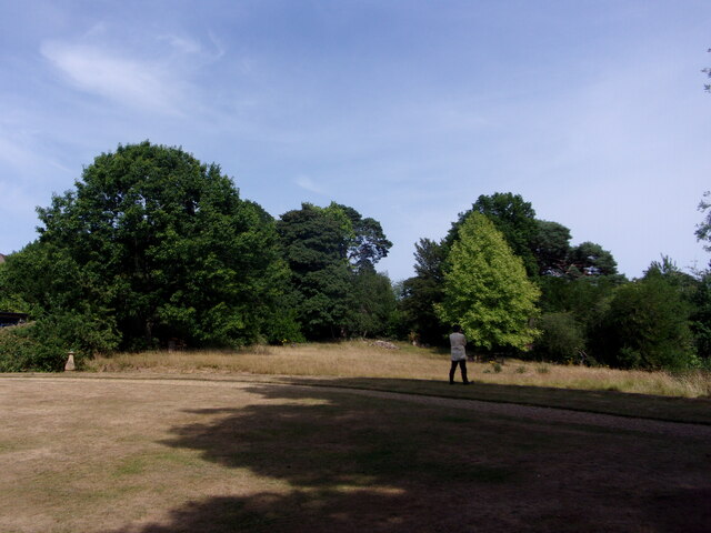
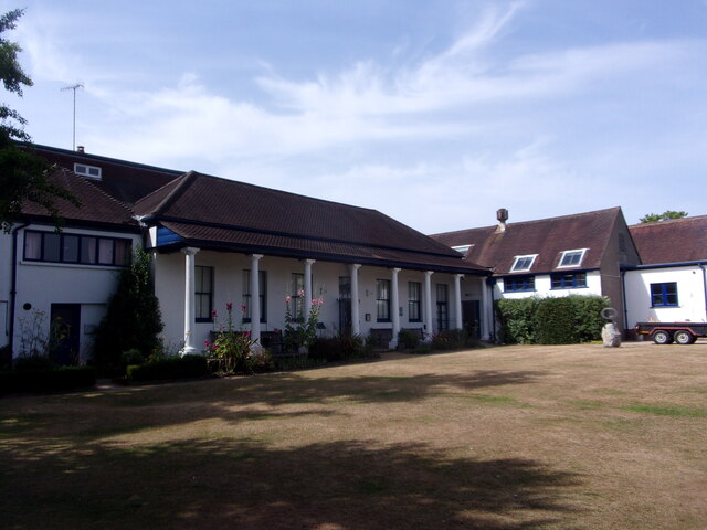
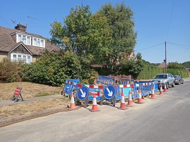
Haslemere Images

Images are sourced within 2km of 51.087599/-0.709589 or Grid Reference SU9032. Thanks to Geograph Open Source API. All images are credited.

Pond beside Green Lane Beyond the pond lies the county border and the edge of the South Downs National Park.
Pond beside Green Lane
Beyond the pond lies the county border and the edge of the South Downs National Park.
Valewood Farmhouse The farmhouse is a Grade II* (star) listed building. See <span class="nowrap"><a title="https://historicengland.org.uk/listing/the-list/list-entry/1354733" rel="nofollow ugc noopener" href="https://historicengland.org.uk/listing/the-list/list-entry/1354733">Link</a><img style="margin-left:2px;" alt="External link" title="External link - shift click to open in new window" src="https://s1.geograph.org.uk/img/external.png" width="10" height="10"/></span>
Valewood Farmhouse
The farmhouse is a Grade II* (star) listed building. See LinkExternal link
Gated Track On the Sussex Border Path in Chase Wood heading for Blackdown.
Gated Track
On the Sussex Border Path in Chase Wood heading for Blackdown.
Walking the planks The public footpath crosses a wet area near Lake House on a boardwalk.
Walking the planks
The public footpath crosses a wet area near Lake House on a boardwalk.
Old Boundary Marker on Museum Hill, Haslemere Manor Boundary Marker in the rockery at the entrance to Museum Court, on the east side of Museum Hill. Haslemere parish. Inscribed 2 on the front and B H on the top. In 1814 the boundaries of the Old Manor of Haslemere were perambulated by the Leet Jury and surveyed by J. Perry. 31 Marker stones were set up, each one foot square and 3 ft 6 ins tall, marked B.H. on the top and numbered on outer face. 9 of these remain.

Milestone Society National ID: SY_HAS02em
Old Boundary Marker on Museum Hill, Haslemere
Manor Boundary Marker in the rockery at the entrance to Museum Court, on the east side of Museum Hill. Haslemere parish. Inscribed 2 on the front and B H on the top. In 1814 the boundaries of the Old Manor of Haslemere were perambulated by the Leet Jury and surveyed by J. Perry. 31 Marker stones were set up, each one foot square and 3 ft 6 ins tall, marked B.H. on the top and numbered on outer face. 9 of these remain. Milestone Society National ID: SY_HAS02em
New build in Haslemere (II) Church Meadows
New build in Haslemere (II)
Church Meadows
Road closure in Church Lane
New bike facility in West Street Car Park Overheard by me today. Car driver pulls into this part of the car park. "I always park there." So I say, "I think it's all part of the council's drive to be eco-friendly"
New bike facility in West Street Car Park
Overheard by me today. Car driver pulls into this part of the car park. "I always park there." So I say, "I think it's all part of the council's drive to be eco-friendly"
No mow May, June (and July) My neighbour in Parsons Green, a keen gardener, says all the seeds have blown into her garden and created "weeds"- which as we know means a plant we don't want on our patch!
No mow May, June (and July)
My neighbour in Parsons Green, a keen gardener, says all the seeds have blown into her garden and created "weeds"- which as we know means a plant we don't want on our patch!
Haslemere Educational Museum: jubilee flags
Haslemere Educational Museum: garden
Haslemere Educational Museum: rear It was originally built for the first Vicar of Haslemere
Haslemere Educational Museum: rear
It was originally built for the first Vicar of Haslemere
Haslemere Educational Museum: stained glass window
Haslemere Educational Museum: The Haslemere Panel It was presented to the  museum by the Haslemere Branch of The Embroiderers' Guild on 3 December 1987
Haslemere Educational Museum: The Haslemere Panel
It was presented to the museum by the Haslemere Branch of The Embroiderers' Guild on 3 December 1987
Haslemere Educational Museum: plaque I also found this about Ponsonby
Haslemere Educational Museum: plaque
I also found this about Ponsonby
Haslemere Educational Museum: toll board This one stood at Chiddingfold
Haslemere Educational Museum: toll board
This one stood at Chiddingfold
Haslemere Educational Museum: entertainment provided
MORE water repairs in Chatsworth Avenue Haslemere has a very high water table but...  very low water pressure
MORE water repairs in Chatsworth Avenue
Haslemere has a very high water table but... very low water pressure
Show me another place!

Haslemere is located at Grid Ref: SU9032 (Lat: 51.087599, Lng: -0.709589)

Administrative County: Surrey

District: Waverley

Police Authority: Surrey

What 3 Words

///lamenting.able.figure. Near Haslemere, Surrey

Related Wikis

Haslemere Town Hall

Haslemere Town Hall is a municipal building in the High Street, Haslemere, Surrey, England. The structure, which serves as the meeting place of Haslemere...

The Curry Club

The Curry Club was founded by Pat Chapman in 1982, to further the understanding and appreciation of the cuisines of the Indian subcontinent. In 2007 it...

Haslemere Educational Museum

Haslemere Educational Museum was founded in 1888 by the eminent surgeon Sir Jonathan Hutchinson to display his growing collection of natural history specimens...

Haslemere

The town of Haslemere () and the villages of Shottermill and Grayswood are in south west Surrey, England, around 38 mi (62 km) south west of London. Together...

Serpent Trail

The Serpent Trail is a 64-mile (103 km) long distance footpath. It runs from Haslemere to Petersfield, which are 11 miles apart in a straight line, by...

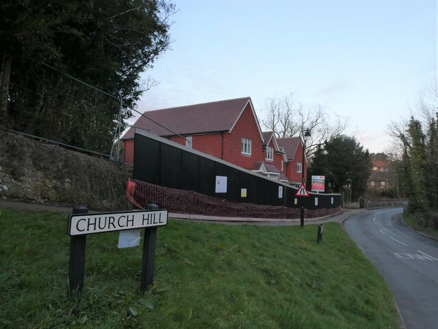
Church Hill House, Haslemere

Church Hill House is a grade II* listed house in Tanners Lane, Haslemere, Surrey. Parts of the walls are grade II listed as well as the adjoining Church...

Haslemere railway station

Haslemere railway station is on the Portsmouth Direct Line, serving the town of Haslemere, Surrey, England. It is 42 miles 79 chains (69.2 km) down the...

Haste Hill

Haste Hill is a hill near Haslemere, Surrey in England which was probably the original settlement of the town of Haslemere. It was used as the site of...

Nearby Amenities

Located within 500m of 51.087599,-0.709589
Haslemere
Alt Name Ur: ہیزل میئر
Name Ru: Хайзелмьер
Name Ur: ہیزل میر
Place: town
Wikidata: Q2449644
Wikipedia: en:Haslemere
Lat/Long: 51.0876062/-0.7097768
Turning Circle
Lat/Long: 51.0866617/-0.7120026
Give Way
Lat/Long: 51.0876399/-0.7093601
Post Box
Collection Plate: CP7D
Collection Times: Mo-Fr 09:00; Sa 07:00
Last Checked: 2020-09-10
Operator: Royal Mail
Post Box Type: lamp
Ref: GU27 149D
Royal Cypher: EIIR
Royal Cypher Wikidata: Q33102113
Wikimedia Commons: File:Post_Box_GU27_149D_Church_Road,_Haslemere.jpg
Lat/Long: 51.0913011/-0.7133694
Give Way
Lat/Long: 51.0874011/-0.7093049
Bus Stop
Town Hall
Bus: yes
Naptan AtcoCode: 40004411135A
Naptan Bearing: NW
Naptan CommonName: Town Hall
Naptan Indicator: Just after
Naptan Landmark: Town Hall
Naptan NaptanCode: surdtpjm
Naptan Street: Lower Street
Naptan Verified: no
Public Transport: platform
Source: naptan_import
Lat/Long: 51.0878755/-0.7107882
Bus Stop
Town Hall
Bench: no
Bin: no
Lit: yes
Naptan AtcoCode: 40004411135B
Naptan Bearing: SE
Naptan CommonName: Town Hall
Naptan Indicator: O/s
Naptan Landmark: Town Hall Petworth Road
Naptan NaptanCode: surdtpjp
Naptan Street: Petworth Road
Naptan Verified: no
Shelter: no
Source: naptan_import
Tactile Paving: no
Lat/Long: 51.0873079/-0.709062
Bus Stop
High Street
Naptan AtcoCode: 40004411136A
Naptan Bearing: NE
Naptan CommonName: High Street
Naptan Indicator: NE-bound
Naptan Landmark: High Street
Naptan NaptanCode: surdtpjt
Naptan Street: High Street
Naptan Verified: yes
Source: naptan_import
Lat/Long: 51.0887502/-0.7088769
Bus Stop
High Street
Naptan AtcoCode: 40004411136B
Naptan Bearing: SW
Naptan CommonName: High Street
Naptan Indicator: SW-bound
Naptan Landmark: High Street
Naptan NaptanCode: surdtpjw
Naptan Street: High Street
Naptan Verified: yes
Source: naptan_import
Lat/Long: 51.0887235/-0.7088166
Church Lane Health Centre
Naptan AtcoCode: 40004411137A
Naptan Bearing: SE
Naptan BusStopType: CUS
Naptan CommonName: Church Lane Health Centre
Naptan Indicator: o/s
Naptan Landmark: Church Lane Health Centre
Naptan NaptanCode: surgpgdj
Naptan Street: Church Lane
Naptan Verified: no
Source: naptan_import
Lat/Long: 51.0917259/-0.7076681
Bus Stop
Church Lane Health Centre
Bench: no
Naptan AtcoCode: 40004411137B
Naptan Bearing: NW
Naptan CommonName: Church Lane Health Centre
Naptan Indicator: opp
Naptan Landmark: Church Lane Health Centre
Naptan NaptanCode: surdtpma
Naptan Street: Church Lane
Naptan Verified: no
Shelter: no
Source: naptan_import
Lat/Long: 51.0915897/-0.7075433
Bus Stop
Ambulance Station
Naptan AtcoCode: 40004411137C
Naptan Bearing: SW
Naptan CommonName: Ambulance Station
Naptan Indicator: Just Before
Naptan Landmark: Ambulance Station
Naptan NaptanCode: surdtpmd
Naptan Street: Grayswood Road
Naptan Verified: no
Source: naptan_import
Lat/Long: 51.0913412/-0.7062222
Bus Stop
Ambulance Station
Naptan AtcoCode: 40004411137D
Naptan Bearing: NE
Naptan CommonName: Ambulance Station
Naptan Indicator: Just after
Naptan Landmark: Ambulance Station
Naptan NaptanCode: surdtpmg
Naptan Street: Grayswood Road
Naptan Verified: no
Source: naptan_import
Lat/Long: 51.0913419/-0.7062793
Bus Stop
Haste Hill
Naptan AtcoCode: 40004411144A
Naptan Bearing: NW
Naptan BusStopType: CUS
Naptan CommonName: Haste Hill
Naptan Indicator: Just after
Naptan Landmark: Haste Hill
Naptan NaptanCode: surgpgwd
Naptan Street: Petworth Road
Naptan Verified: no
Source: naptan_import
Lat/Long: 51.085006/-0.7050283
Bus Stop
Haste Hill
Naptan AtcoCode: 40004411144B
Naptan Bearing: SE
Naptan CommonName: Haste Hill
Naptan Indicator: Just Before
Naptan Landmark: Haste Hill
Naptan NaptanCode: surdtptg
Naptan Street: Petworth Road
Naptan Verified: no
Source: naptan_import
Lat/Long: 51.0850584/-0.7048841
Post Box
Collection Plate: CP1
Collection Times: Mo-Fr 17:45; Sa 12:00
Last Checked: 2020-09-10
Operator: Royal Mail
Post Box Apertures: 2
Post Box Type: pillar
Ref: GU27 165;GU27 1651
Royal Cypher: EIIR
Royal Cypher Wikidata: Q33102113
Source: survey
Lat/Long: 51.0887492/-0.7100067
Post Box
Collection Plate: CP1
Collection Times: Mo-Fr 16:45; Sa 10:30
Operator: Royal Mail
Post Box Type: pillar
Ref: GU27 123
Royal Cypher: GVIR
Royal Cypher Wikidata: Q33102169
Lat/Long: 51.0874696/-0.7096986
Crossing
Crossing: zebra
Lat/Long: 51.0880421/-0.7109879
Bicycle Parking
Capacity: 12
Covered: no
Lat/Long: 51.0884393/-0.708967
Pub
The Georgian
Lat/Long: 51.0890029/-0.7088558
Post Box
Collection Plate: CP1D
Collection Times: Mo-Fr 09:00; Sa 07:00
Last Checked: 2020-09-10
Old Ref: GU27 31
Operator: Royal Mail
Post Box Type: wall
Ref: GU27 31D
Royal Cypher: GVIR
Royal Cypher Wikidata: Q33102169
Source: survey
Lat/Long: 51.0908786/-0.7065582
Post Box
Collection Plate: CP6
Collection Times: Mo-Fr 16:45; Sa 12:00
Colour: green
Last Checked: 2020-09-10
Note: John Penfold, the designer of the penfold postbox, was born and is buried in Haslemere
Note 1: This collection plate CP6 is very rare.
Note 2: This postbox is of a hexagonal prism shape of pillar.
Operator: Royal Mail
Post Box Design: reproduction_penfold
Post Box Type: pillar
Ref: GU27 167
Royal Cypher: VR
Royal Cypher Wikidata: Q33102356
Source: survey
Lat/Long: 51.0889153/-0.7088933
Bench
Backrest: yes
Lat/Long: 51.0886135/-0.7075559
Bench
Backrest: yes
Lat/Long: 51.0884907/-0.7076115
Haslemere Town Well
Historic: well
Wikidata: Q26537223
Lat/Long: 51.0889906/-0.7072704
Bench
Backrest: yes
Lat/Long: 51.0888355/-0.7074509
Haslemere War Memorial
Historic: memorial
Memorial: war_memorial
Wikidata: Q26669956
Lat/Long: 51.087827/-0.709361
Traffic Signals
Button Operated: yes
Crossing: traffic_signals
Crossing Ref: pelican
Kerb: lowered
Traffic Signals Direction: both
Lat/Long: 51.0883095/-0.7091244
Entrance: yes
Lat/Long: 51.0888644/-0.7100328
Bench
Backrest: yes
Mapillary: 373888323874323
Survey Date: 2017-01-13
Lat/Long: 51.0892377/-0.7146227
Waste Basket
Lat/Long: 51.0891164/-0.7147595
Waste Basket
Lat/Long: 51.0892933/-0.714502
Bench
Backrest: yes
Mapillary: 467249487828139
Survey Date: 2017-01-13
Lat/Long: 51.0890069/-0.7149097
Bench
Lat/Long: 51.0886312/-0.7147702
Atm
Lat/Long: 51.0882035/-0.7096049
Playground: aerialrotator
Lat/Long: 51.0890563/-0.7141607
Waste Basket
Covered: no
Source: survey
Lat/Long: 51.0889389/-0.7105323
Bench
Backrest: yes
Lat/Long: 51.0873941/-0.7091161
Bench
Backrest: yes
Check Date: 2022-11-18
Mapillary: 514841463023541
Lat/Long: 51.0875069/-0.7097947
Entrance: main
Lat/Long: 51.0889321/-0.7110078
Bench
Lat/Long: 51.0889052/-0.7088479
Bicycle Parking
Capacity: 4
Covered: no
Lat/Long: 51.0890481/-0.7108307
Bench
Lat/Long: 51.0876249/-0.7094433
Entrance: main
Lat/Long: 51.088124/-0.7093945
Waste Basket
Lat/Long: 51.0884184/-0.7104196
Bench
Backrest: yes
Check Date: 2022-11-18
Mapillary: 496652211383008
Lat/Long: 51.0874682/-0.709792
Bench
Backrest: yes
Mapillary: 1176937036069813
Survey Date: 2017-01-13
Lat/Long: 51.0889372/-0.7153171
Bench
Backrest: yes
Check Date: 2022-11-18
Mapillary: 496652211383008
Lat/Long: 51.0874799/-0.7098215
Bench
Backrest: yes
Check Date: 2022-11-18
Mapillary: 496652211383008
Lat/Long: 51.08749/-0.7097464
Waste Basket
Lat/Long: 51.0881556/-0.709438
Bench
Lat/Long: 51.0875878/-0.7093897
Entrance: main
Lat/Long: 51.0890193/-0.7108111
Post Box
Collection Plate: CP1D
Collection Times: Mo-Fr 09:00; Sa 07:00
Last Checked: 2020-09-22
Operator: Royal Mail
Post Box Mounting: brick_pillar
Post Box Type: wall
Ref: GU27 62D
Royal Cypher: EIIR
Royal Cypher Wikidata: Q33102113
Source: survey
Lat/Long: 51.0860764/-0.7149082
Barrier: bollard
Lat/Long: 51.0862986/-0.7152116
Railway: switch
Lat/Long: 51.0900453/-0.7156008
Waste Basket
Check Date: 2022-11-18
Lat/Long: 51.0837101/-0.7098776
School: entrance
Lat/Long: 51.0847389/-0.7080367
Waste Basket
Check Date: 2022-11-18
Lat/Long: 51.087518/-0.7098238
Barrier: kissing_gate
Lat/Long: 51.0879234/-0.7058373
Historic: memorial
Lat/Long: 51.0884105/-0.7100844
Bench
Lat/Long: 51.0878637/-0.7108031
Waste Basket
Lat/Long: 51.0878098/-0.7106637
Shelter
Bench: yes
Shelter Type: public_transport
Lat/Long: 51.0879396/-0.7109562
Bench
Lat/Long: 51.0898163/-0.7126968
Atm
Lat/Long: 51.0879128/-0.7091308
Waste Basket
Lat/Long: 51.0878849/-0.70915
Barrier: bollard
Lat/Long: 51.0881688/-0.709197
Atm
Lloyds Bank
Brand: Lloyds Bank
Brand Wikidata: Q1152847
Brand Wikipedia: en:Lloyds Bank
Cash In: no
Operator: Lloyds Bank
Operator Wikidata: Q1152847
Lat/Long: 51.0873956/-0.7095233
Waste Basket
Check Date: 2022-11-18
Lat/Long: 51.0873903/-0.7090843
Leisure: swimming_pool
Lat/Long: 51.0890177/-0.7090629
Leisure: spa
Lat/Long: 51.0891256/-0.7094974
Gym
Lat/Long: 51.0891998/-0.7094545
Leisure: sauna
Lat/Long: 51.0890598/-0.7095296
Give Way
Lat/Long: 51.087597/-0.7096864
Crossing
Crossing: zebra
Crossing Island: no
Tactile Paving: yes
Lat/Long: 51.0872928/-0.7091205
Historic: milestone
Source: survey
Lat/Long: 51.0883586/-0.7092276
Addr Housename: Town House
Addr Housenumber: 49
Addr Street: High Street
Lat/Long: 51.0900782/-0.7077085
Addr Housenumber: 43
Addr Street: High Street
Lat/Long: 51.0895943/-0.7080617
Addr Housenumber: 45
Addr Street: High Street
Lat/Long: 51.0896257/-0.708026
Addr Housenumber: 47
Addr Street: High Street
Lat/Long: 51.0897252/-0.70794
Addr Housenumber: 90
Addr Street: High Street
Lat/Long: 51.0907003/-0.7069331
Pottwer, Owtran and Peck, Solicitors
Addr Housenumber: 17
Addr Street: West Street
Office: lawyer
Lat/Long: 51.0889636/-0.7109533
Waste Basket
Lat/Long: 51.0875799/-0.7092402
Bench
Backrest: yes
Lat/Long: 51.0889438/-0.7075097
Bench
Backrest: yes
Lat/Long: 51.0889481/-0.7075339
Defibrillator
Defibrillator Location: The defibrillator is in a green metal box on the wall to the left of the entrance to Waitrose.
Emergency: defibrillator
Indoor: no
Ref GB The Circuit: F153BCF6-E82A-4608-AC3F-AEA700D710EF
Source: survey
Lat/Long: 51.0890093/-0.7107585
Bicycle Parking
Bicycle Parking: stands
Capacity: 6
Covered: no
Lat/Long: 51.0887667/-0.7100432
Post Box
Check Date Collection Times: 2022-11-18
Collection Plate: CP1D
Collection Times: Mo-Fr 09:00; Sa 07:00
Last Checked: 2020-09-22
Operator: Royal Mail
Post Box Mounting: brick_pillar
Post Box Type: wall
Ref: GU27 124D
Royal Cypher: EIIR
Royal Cypher Wikidata: Q33102113
Source: survey
Lat/Long: 51.0851145/-0.7091282
Bench
Backrest: yes
Mapillary: 494085512025910
Survey Date: 2016-05-24
Lat/Long: 51.0875346/-0.7094052
Information: board
Tourism: information
Lat/Long: 51.0884201/-0.7089977
Bench
Backrest: yes
Lat/Long: 51.0888459/-0.7074499
Waste Basket
Lat/Long: 51.0876216/-0.709429
Give Way
Lat/Long: 51.0877343/-0.7104407
Entrance: yes
Lat/Long: 51.0882418/-0.7108973
Entrance: yes
Lat/Long: 51.0882881/-0.7110057
Entrance: yes
Lat/Long: 51.0883377/-0.7109894
Entrance: yes
Lat/Long: 51.0888926/-0.7077666
Bench
Backrest: yes
Mapillary: 3872696432847592
Survey Date: 2016-10-13
Lat/Long: 51.0892192/-0.7099208
Turning Circle
Lat/Long: 51.0908063/-0.7111839
Entrance: yes
Lat/Long: 51.0918486/-0.7075719
Entrance: yes
Lat/Long: 51.0888295/-0.7099455
Entrance: yes
Lat/Long: 51.0889109/-0.7101668
Entrance: staircase
Lat/Long: 51.0889598/-0.7101826
Entrance: staircase
Lat/Long: 51.0889429/-0.7102448
Entrance: yes
Lat/Long: 51.0889555/-0.710281
Entrance: yes
Lat/Long: 51.088986/-0.7103688
Entrance: yes
Lat/Long: 51.0887906/-0.7098232
Entrance: yes
Lat/Long: 51.0887503/-0.709702
Entrance: yes
Lat/Long: 51.0887215/-0.7096125
Entrance: yes
Lat/Long: 51.0887243/-0.7096214
Entrance: staircase
Lat/Long: 51.0889754/-0.7099352
Entrance: yes
Lat/Long: 51.08826/-0.709313
Entrance: yes
Lat/Long: 51.0884376/-0.7091996
Entrance: yes
Lat/Long: 51.0883562/-0.7092398
Entrance: yes
Lat/Long: 51.0883064/-0.7092765
Entrance: staircase
Lat/Long: 51.0882764/-0.7092998
Entrance: yes
Lat/Long: 51.088561/-0.709482
Entrance: yes
Lat/Long: 51.0886206/-0.7096106
Entrance: yes
Lat/Long: 51.0886812/-0.709904
Entrance: yes
Lat/Long: 51.0885874/-0.7092955
Entrance: yes
Lat/Long: 51.088611/-0.7090722
Entrance: yes
Lat/Long: 51.0885615/-0.7092152
Entrance: yes
Lat/Long: 51.0886038/-0.7093464
Entrance: yes
Lat/Long: 51.0887164/-0.7095532
Entrance: yes
Lat/Long: 51.0886741/-0.7095
Post Box
Collection Plate: CP1D
Collection Times: Mo-Fr 09:00; Sa 07:00
Last Checked: 2020-09-22
Operator: Royal Mail
Post Box Type: wall
Ref: GU27 1D
Royal Cypher: GVIR
Royal Cypher Wikidata: Q33102169
Source: survey
Lat/Long: 51.0847179/-0.7043796
Waste Basket
Lat/Long: 51.0891141/-0.7097782
Bench
Backrest: yes
Source: survey
Lat/Long: 51.0912871/-0.7132906
Defibrillator
Defibrillator Location: The defibrillator is to the right of the pedestrian access door. This defibrillator requires a code to open, instructions are on the green and yellow box.
Emergency: defibrillator
Indoor: no
Operator: Surrey Fire and Rescue
Ref GB The Circuit: C3A84B07-E44E-40BF-B1F2-AF5600A93FD0
Lat/Long: 51.089537/-0.7121786
Entrance: main
Lat/Long: 51.0886798/-0.7098114
Bus Stop
Shepherd's Hill
Bus: yes
Naptan AtcoCode: 40004411821C
Naptan NaptanCode: surgmdpd
Public Transport: platform
Lat/Long: 51.0876001/-0.7129312
Waste Basket
Operator: Waverley Borough Council
Source: survey
Lat/Long: 51.0912919/-0.7133368
Grit Bin
Colour: blue
Note: This grit bin is for highways use only.
Operator: Surrey County Council
Ref: 11358
Source: survey
Lat/Long: 51.0853776/-0.7081289
Grit Bin
Colour: yellow
Description: This grit bin is set into the grass.
Note: This grit bin is for highways use only.
Operator: Surrey County Council
Ref: 11357
Source: survey
Lat/Long: 51.0851765/-0.7090083
Grit Bin
Colour: blue
Note: This grit bin is for highways use only.
Operator: Surrey County Council
Ref: 12273
Source: survey
Lat/Long: 51.0850408/-0.7091499
Waste Basket
Ashtray: yes
Colour: black
Covered: yes
Operator: Waverley Borough Council
Source: survey
Website: https://www.waverley.gov.uk/litter
Lat/Long: 51.0851708/-0.7091082
Grit Bin
Colour: yellow
Covered: yes
Note: This grit bin is for highways use only.
Operator: Surrey County Council
Source: survey
Lat/Long: 51.0861901/-0.715117
Grit Bin
Colour: yellow
Description: This grit bin is set into the ground.
Note: This grit bin is for highways use only.
Operator: Surrey County Council
Ref: 11356
Source: survey
Lat/Long: 51.0855358/-0.7106623
Bench
Backrest: yes
Colour: brown
Material: wood
Source: survey
Lat/Long: 51.0911411/-0.706688
Waste Basket
Colour: brown
Covered: no
Source: survey
Lat/Long: 51.0911459/-0.7067385
Generator Method: photovoltaic
Generator Output Electricity: yes
Generator Source: solar
Generator Type: solar_photovoltaic_panel
Location: roof
Power: generator
Lat/Long: 51.0897869/-0.7097018
Generator Method: photovoltaic
Generator Output Electricity: yes
Generator Source: solar
Generator Type: solar_photovoltaic_panel
Location: roof
Power: generator
Lat/Long: 51.0897751/-0.7095194
Generator Method: photovoltaic
Generator Output Electricity: yes
Generator Source: solar
Generator Type: solar_photovoltaic_panel
Location: roof
Power: generator
Lat/Long: 51.0898122/-0.7094497
Generator Method: photovoltaic
Generator Output Electricity: yes
Generator Source: solar
Generator Type: solar_photovoltaic_panel
Location: roof
Power: generator
Lat/Long: 51.0898375/-0.7093719
Generator Method: photovoltaic
Generator Output Electricity: yes
Generator Source: solar
Generator Type: solar_photovoltaic_panel
Location: roof
Power: generator
Lat/Long: 51.0904187/-0.7094282
Generator Method: photovoltaic
Generator Output Electricity: yes
Generator Source: solar
Generator Type: solar_photovoltaic_panel
Location: roof
Power: generator
Lat/Long: 51.0903041/-0.710316
Generator Method: photovoltaic
Generator Output Electricity: yes
Generator Source: solar
Generator Type: solar_photovoltaic_panel
Location: roof
Power: generator
Lat/Long: 51.0910622/-0.7140282
Generator Method: photovoltaic
Generator Output Electricity: yes
Generator Source: solar
Generator Type: solar_photovoltaic_panel
Location: roof
Power: generator
Lat/Long: 51.0913992/-0.7111341
The Cashmere Room
Shop: clothes
Lat/Long: 51.0879797/-0.7111382
Couchman Hanson
Office: lawyer
Lat/Long: 51.0884953/-0.7101547
Headcase
Shop: hairdresser
Lat/Long: 51.0874027/-0.709672
CYC:D
Leisure: fitness_centre
Lat/Long: 51.0881672/-0.7086448
Burley Geach
Office: lawyer
Lat/Long: 51.088621/-0.70926
Bar
Red H
Lat/Long: 51.0885539/-0.7097057
Magic Scissors
Shop: hairdresser
Lat/Long: 51.0888527/-0.7085285
Answers Investigation
Office: private_investigator
Lat/Long: 51.0891152/-0.7080775
Defibrillator
Defibrillator Location: outside Swan Inn, Haslemere
Emergency: defibrillator
Indoor: no
Lat/Long: 51.0879651/-0.7094746
Grit Bin
Colour: yellow
Covered: yes
Source: survey
Survey Date: 2022-08-25
Lat/Long: 51.087738/-0.7112524
Cancer Research UK
Brand: Cancer Research UK
Brand Wikidata: Q326079
Operator: Cancer Research UK
Shop: charity
Lat/Long: 51.0872751/-0.7087969
Noggs
Shop: clothes
Lat/Long: 51.0873121/-0.7088754
Blue Cross
Brand: Blue Cross
Brand Wikidata: Q3520039
Shop: charity
Lat/Long: 51.0871032/-0.7086507
Defibrillator
Access: yes
Defibrillator Location: wall mounted yellow/green box by museum entrance
Emergency: defibrillator
Indoor: no
Lat/Long: 51.0897997/-0.7078278
The data included in this document is from www.openstreetmap.org. The data is made available under ODbL.

Have you been to Haslemere?

Leave your review of Haslemere below (or comments, questions and feedback).