Fiddlers Flat

Downs, Moorland in Yorkshire

England

Fiddlers Flat

Hordron, near Langsett, lots of heather
Hordron, near Langsett, lots of heather Credit: Dave Pickersgill

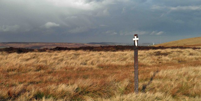
Fiddlers Flat is a picturesque region located in the heart of Yorkshire, England. Nestled amidst the breathtaking Yorkshire Downs and Moorland, this area is renowned for its natural beauty and captivating landscapes. Stretching over several square miles, Fiddlers Flat offers a diverse range of stunning vistas, making it a popular destination for nature enthusiasts and outdoor adventurers.

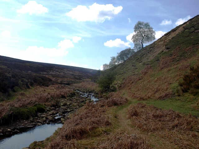
The Yorkshire Downs, with their rolling hills and verdant meadows, dominate the southern part of Fiddlers Flat. The undulating terrain provides a mesmerizing backdrop, dotted with charming villages and scattered patches of ancient woodland. Hikers and walkers are spoiled for choice with a multitude of trails and footpaths, allowing them to explore the vast expanse of this idyllic countryside.

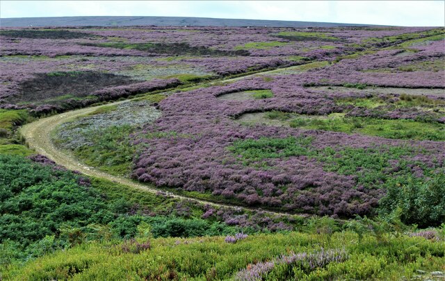
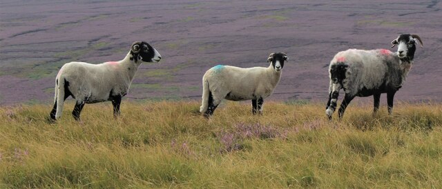
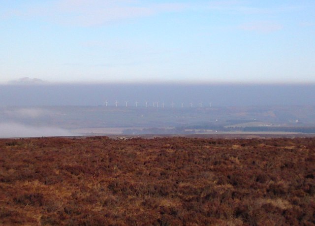
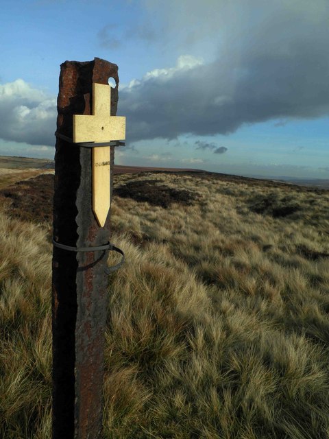
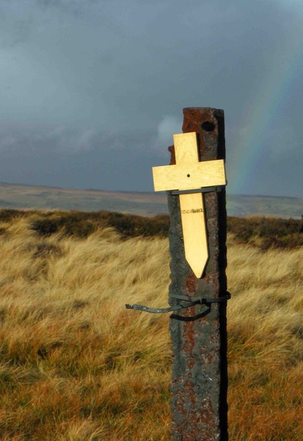
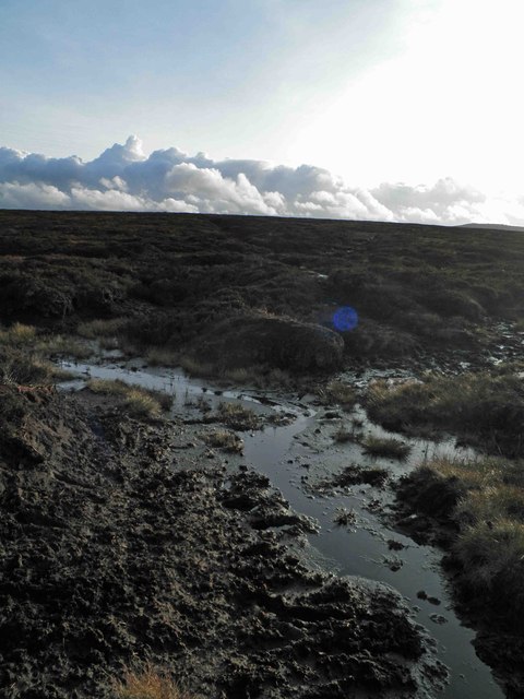
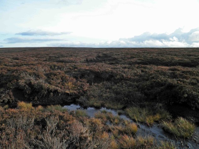
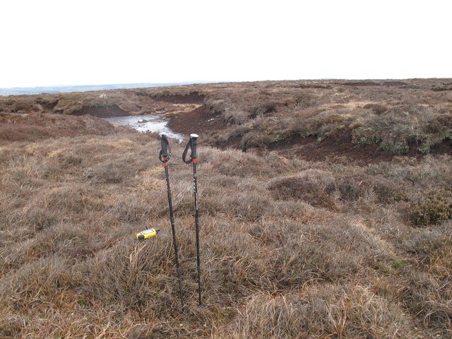
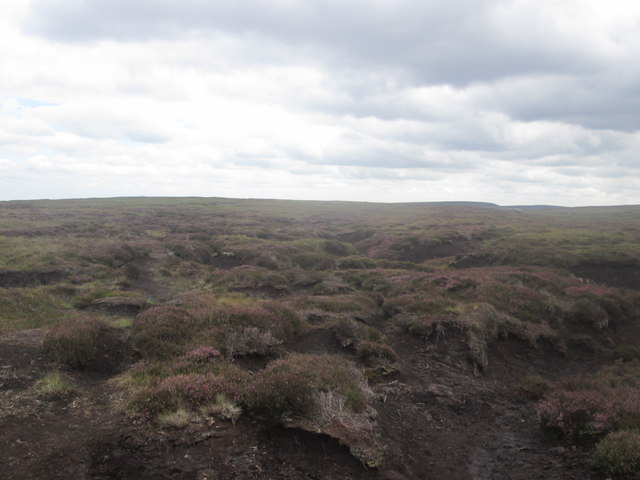
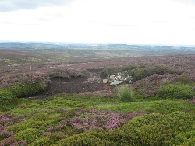
To the north, the Moorland takes center stage, offering a more rugged and wild landscape. Blanketed by heather and bracken, the moors provide a haven for wildlife, including birds of prey and rare species such as the black grouse. Adventurers can traverse the heathland, immersing themselves in its untamed beauty and enjoying panoramic views of the surrounding countryside.

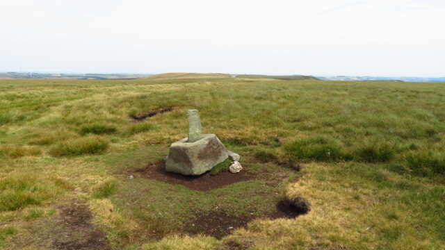
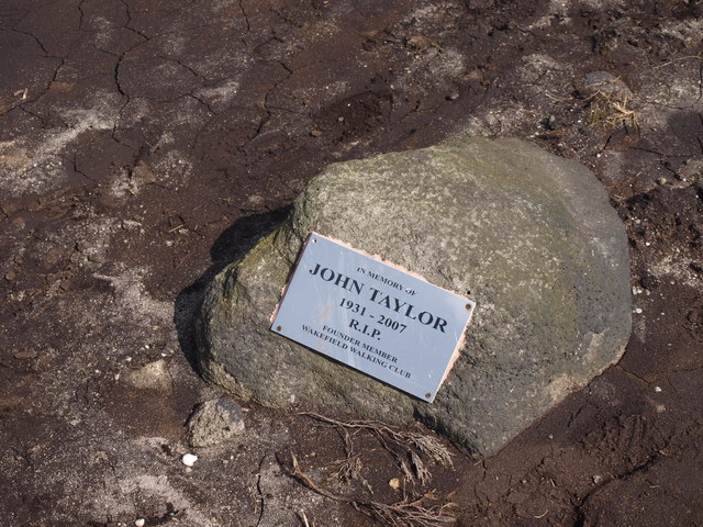
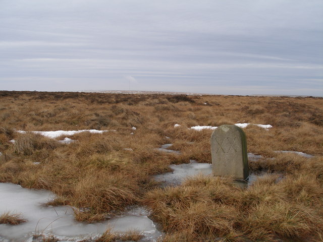
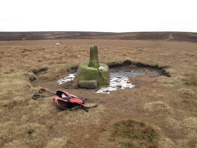
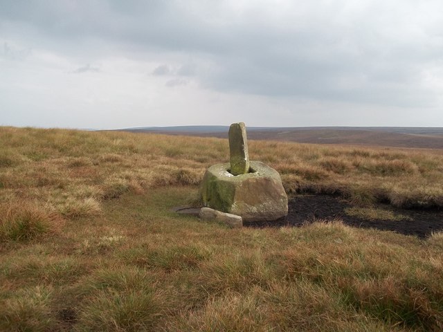
Fiddlers Flat is also home to several historical landmarks that add to its charm. Ancient stone circles, remnants of past civilizations, can be found scattered throughout the region, offering a glimpse into the area's rich history and cultural heritage.

Whether it's exploring the rolling hills of the Yorkshire Downs or venturing into the untamed beauty of the Moorland, Fiddlers Flat offers a captivating and unforgettable experience for those seeking to connect with nature in one of Yorkshire's most breathtaking locations.

If you have any feedback on the listing, please let us know in the comments section below.

Fiddlers Flat Images

Images are sourced within 2km of 53.496335/-1.764252 or Grid Reference SK1599. Thanks to Geograph Open Source API. All images are credited.

Hordron, near Langsett, lots of heather
Sheep on the moors
Sheep on the moors
Lady Cross above Woodhead This ancient cross marked the highest point of the packhorse route over the moors above Woodhead.
Lady Cross above Woodhead
This ancient cross marked the highest point of the packhorse route over the moors above Woodhead.
A vital cairn In some wilderness areas there are too many cairns. Here on the Derwent Watershed they are few and far between so each one is vital especially if you still use a map and compass on days when you can't see more than a few metres ahead and refuse to buy a (cheats) GPS. The section of the watershed from Outer Edge to Bleaklow Stones is very tricky to navigate so this cairn is a vital landmark.
A vital cairn
In some wilderness areas there are too many cairns. Here on the Derwent Watershed they are few and far between so each one is vital especially if you still use a map and compass on days when you can't see more than a few metres ahead and refuse to buy a (cheats) GPS. The section of the watershed from Outer Edge to Bleaklow Stones is very tricky to navigate so this cairn is a vital landmark.
Memorial Plaque On the main Derwent Watershed path across Howden Edge is a tribute to a walker who I hope had a long and fruitful love of the hills as I do.
Memorial Plaque
On the main Derwent Watershed path across Howden Edge is a tribute to a walker who I hope had a long and fruitful love of the hills as I do.
Looking back The Little Don valley in this area is a lovely area to walk. There are paths everywhere, none of which are marked on the OS Maps. Like any area you need to know where the paths are from experience.
Looking back
The Little Don valley in this area is a lovely area to walk. There are paths everywhere, none of which are marked on the OS Maps. Like any area you need to know where the paths are from experience.
Milestone on the old road near Lady Cross
Harden Moor, looking towards Royd Moor wind farm On the border of South Yorkshire and West Yorkshire, yet not far from Derbyshire.

The A628 Woodhead road is in the dip, almost unseen although little more than a mile away. The noise of heavy traffic gives it away, breaking the silence.

On this walk we didn't meet another human for almost 5 hours.
Harden Moor, looking towards Royd Moor wind farm
On the border of South Yorkshire and West Yorkshire, yet not far from Derbyshire. The A628 Woodhead road is in the dip, almost unseen although little more than a mile away. The noise of heavy traffic gives it away, breaking the silence. On this walk we didn't meet another human for almost 5 hours.
Remembrance day On the track to Lady Cross on the Saltersbrook road (track) remembrance day crosses have been placed. See <a href="https://www.geograph.org.uk/photo/3219627">SK1599 : Moorland remembrance</a>
Remembrance day
On the track to Lady Cross on the Saltersbrook road (track) remembrance day crosses have been placed. See SK1599 : Moorland remembrance
Moorland remembrance On the track to Lady Cross on the Saltersbrook road (track) remembrance day crosses have been placed. See <a href="https://www.geograph.org.uk/photo/3219626">SK1599 : Remembrance day</a>
Moorland remembrance
On the track to Lady Cross on the Saltersbrook road (track) remembrance day crosses have been placed. See SK1599 : Remembrance day
Remembrance Cross and rainbow Remembrance crosses attached to moorland fence.
Remembrance Cross and rainbow
Remembrance crosses attached to moorland fence.
Enough mud for one day! The track from Lady Cross and the A628 Woodhead pass is just on long peat mud trot.
Enough mud for one day!
The track from Lady Cross and the A628 Woodhead pass is just on long peat mud trot.
Not much to see today It's a flog in the mud from the A628 Woodhead pass via Lady's Cross and Round Hill to get here.
Not much to see today
It's a flog in the mud from the A628 Woodhead pass via Lady's Cross and Round Hill to get here.
Hoar Stones - Howden Edge Climbed from A628 with easy going due to frozen ground. Small cairn and lower stone with plaque at bottom of peat hag appear close to highest point.
Barnsley current county/UA top.
Name: Hoar Stones - Howden Edge
Hill number: 5482
Height: 514m / 1686ft
Area: 36: Lancashire, Cheshire & the Southern Pennines
Class: CoU
Grid ref: SK 15852 98318
Summit feature: no feature; peat hags
Drop: 7m
Col: 507m  SK158980
Hoar Stones - Howden Edge
Climbed from A628 with easy going due to frozen ground. Small cairn and lower stone with plaque at bottom of peat hag appear close to highest point. Barnsley current county/UA top. Name: Hoar Stones - Howden Edge Hill number: 5482 Height: 514m / 1686ft Area: 36: Lancashire, Cheshire & the Southern Pennines Class: CoU Grid ref: SK 15852 98318 Summit feature: no feature; peat hags Drop: 7m Col: 507m SK158980
Lady Cross Lady Cross photoed on way to Hoar Stones and Horse Stone Naze on a cool morning.
Lady Cross
Lady Cross photoed on way to Hoar Stones and Horse Stone Naze on a cool morning.
Lady Cross Situated around 400 metres south of the A628 Road.
Lady Cross
Situated around 400 metres south of the A628 Road.
Howden Edge towards Hoar Stones
Grouse butt below Howden Edge
Show me another place!

Fiddlers Flat is located at Grid Ref: SK1599 (Lat: 53.496335, Lng: -1.764252)

Division: West Riding

Unitary Authority: Barnsley

Police Authority: South Yorkshire

What 3 Words

///appealing.dragon.enjoy. Near Holmfirth, West Yorkshire

Related Wikis

Longdendale

Longdendale is a valley in the Peak District of England, north of Glossop and southwest of Holmfirth. The name means "long wooded valley" and the valley...

Dunford Bridge railway station

Dunford Bridge railway station was a railway station that served the village of Dunford Bridge on the Sheffield, Ashton-under-Lyne and Manchester Railway...

Dunford Bridge

Dunford Bridge is a remote hamlet in the civil parish of Dunford, lying northwest of Sheffield in South Yorkshire, England, 1.3 miles (2 km) from the...

Winscar Reservoir

Winscar Reservoir (also known as Winscar dam), is a compensation reservoir on the headwaters of the River Don in South Yorkshire, England. The reservoir...

Dunford

Dunford is a civil parish in the Metropolitan Borough of Barnsley, 14.5 miles (23.3 km) northwest of Sheffield in South Yorkshire, England. It lies in...

Carlecotes

Carlecotes is a village in the metropolitan borough of Barnsley in South Yorkshire, England. Carlecotes is within Dunford civil parish. The village is...

Woodhead railway station

Woodhead railway station was a railway station that served the hamlet of Woodhead on the Woodhead Line. == History == The station was opened on 8 April...

Hazlehead Bridge railway station

Hazlehead Bridge railway station was a railway station on the Sheffield, Ashton-under-Lyne and Manchester Railway's Woodhead Line. It served villages scattered...

Nearby Amenities

Located within 500m of 53.496335,-1.764252
Ele: 446.65
Lat/Long: 53.4974098/-1.7669964
South Nab
Natural: peak
Source: NLS - OS 1:25k 1st Series 1937-61
Lat/Long: 53.4993495/-1.7658435
Parking
Parking: street_side
Lat/Long: 53.498641/-1.760967
Parking
Parking: street_side
Lat/Long: 53.4981683/-1.7641417
Man Made: survey_point
Lat/Long: 53.4993491/-1.7658738
The data included in this document is from www.openstreetmap.org. The data is made available under ODbL.

Have you been to Fiddlers Flat?

Leave your review of Fiddlers Flat below (or comments, questions and feedback).