Agra Moor

Downs, Moorland in Yorkshire Harrogate

England

Agra Moor

Track over Witton Moor Much of Witton Moor is now open access land, with this track being the best approach.
Track over Witton Moor Credit: Gordon Hatton

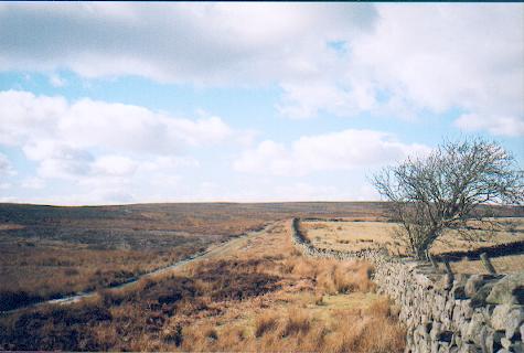
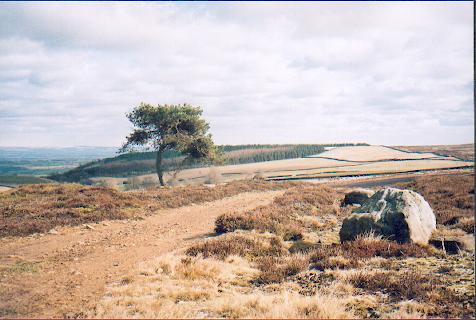
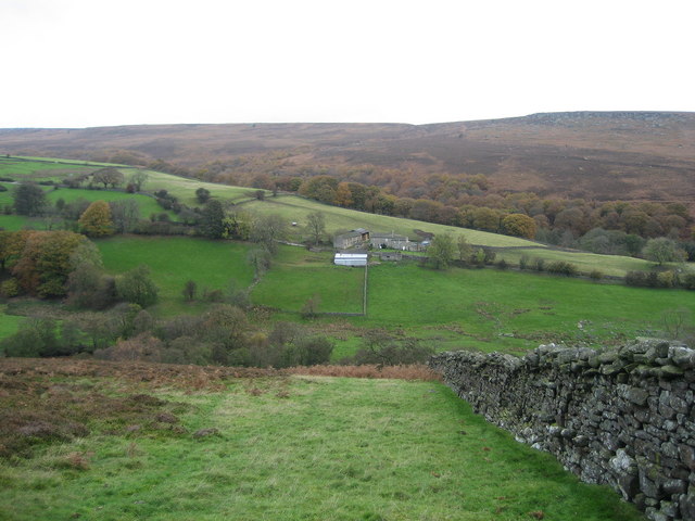
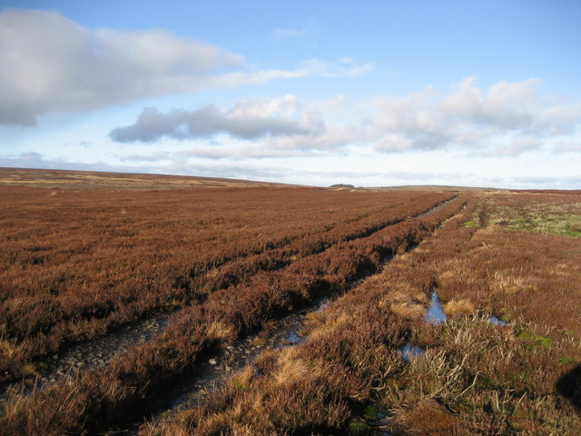
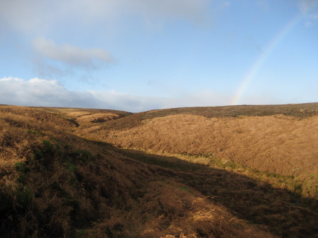
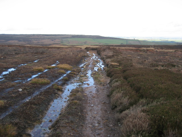
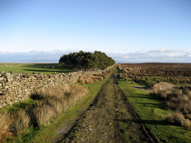
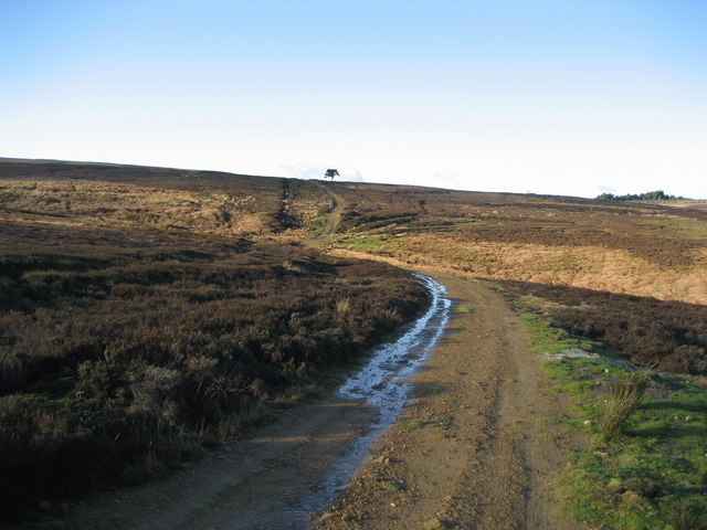
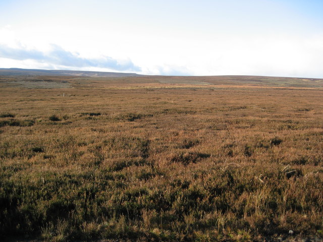
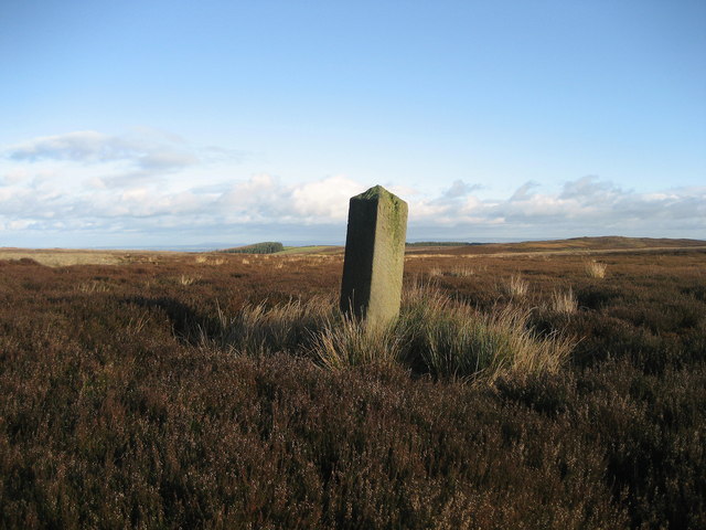
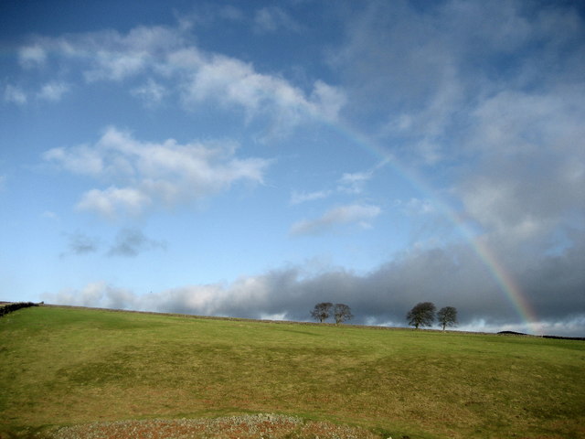
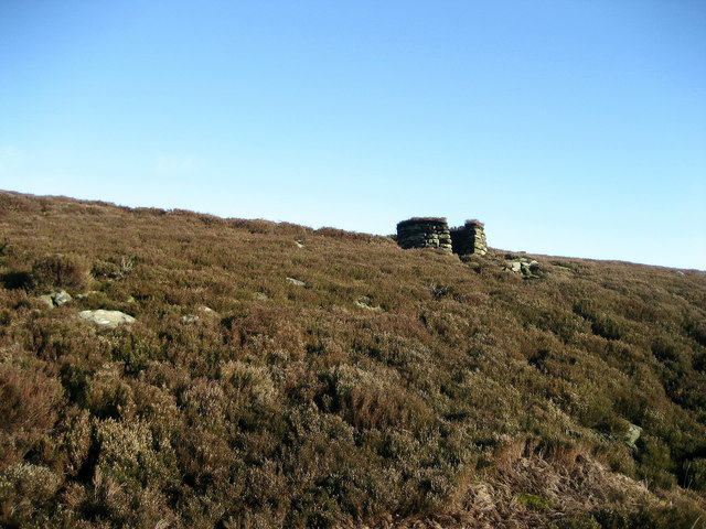
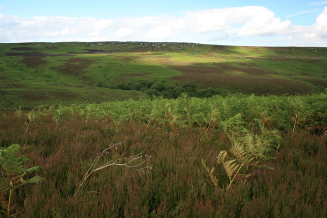
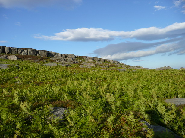
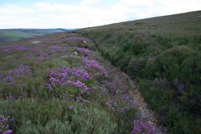
Agra Moor is a vast expanse of moorland located in the county of Yorkshire, England. Situated on the beautiful Yorkshire Downs, it covers an area of approximately 10 square miles. The moorland is characterized by its rolling hills, heather-covered landscapes, and breathtaking views.

Agra Moor is renowned for its rich biodiversity, offering a diverse range of flora and fauna. The moorland is home to several species of birds, including the iconic red grouse, lapwing, and curlew. Additionally, it supports a variety of plant life, such as heather, bilberry, and cotton grass, creating a vibrant and colorful tapestry.

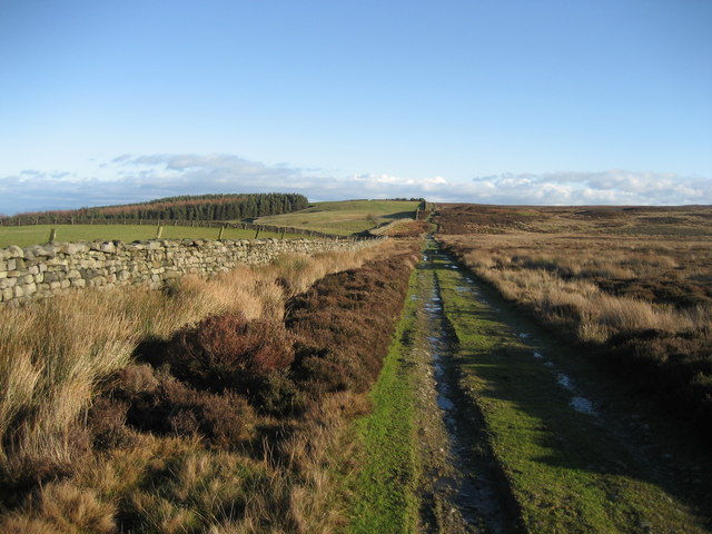
Visitors to Agra Moor can explore its extensive network of walking trails, allowing them to immerse themselves in the natural beauty of the area. Hiking enthusiasts can enjoy the challenging terrain and relish the panoramic views from the hilltops. The moorland also attracts nature lovers, birdwatchers, and photographers, who are captivated by its stunning landscapes and abundant wildlife.

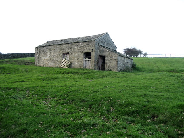
Agra Moor holds historical significance as well, with remnants of ancient settlements and burial sites scattered across the area. These archaeological sites provide insights into the region's past and offer a glimpse into the lives of its early inhabitants.

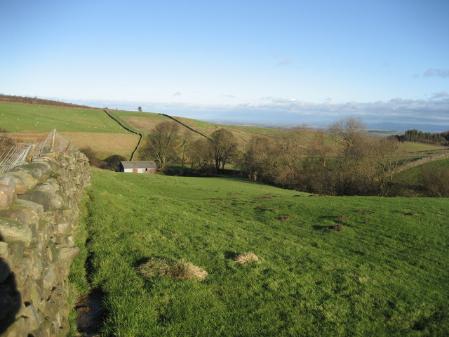
The moorland is easily accessible, with a well-maintained road network connecting it to nearby towns and villages. Agra Moor offers a peaceful and idyllic retreat from the hustle and bustle of city life, inviting visitors to unwind and appreciate the raw beauty of Yorkshire's countryside.

If you have any feedback on the listing, please let us know in the comments section below.

Agra Moor Images

Images are sourced within 2km of 54.241928/-1.7964233 or Grid Reference SE1382. Thanks to Geograph Open Source API. All images are credited.

Track over Witton Moor Much of Witton Moor is now open access land, with this track being the best approach.
Track over Witton Moor
Much of Witton Moor is now open access land, with this track being the best approach.
Lonesome Pine, Witton Fell A lonely Scots pine by the shooting track across Witton Fell.
Lonesome Pine, Witton Fell
A lonely Scots pine by the shooting track across Witton Fell.
Low Houses The farmstead and surrounding area of Colsterdale as seen from below the Coal Road, with Agra Moor in the background
Low Houses
The farmstead and surrounding area of Colsterdale as seen from below the Coal Road, with Agra Moor in the background
Stone Barn, Colsterdale One of several in the scattered community of Colsterdale
Stone Barn, Colsterdale
One of several in the scattered community of Colsterdale
Track over Agra Moor Part of the way that leads from Colsterdale to East Witton in Wensleydale - at this point on windswept Agra Moor
Track over Agra Moor
Part of the way that leads from Colsterdale to East Witton in Wensleydale - at this point on windswept Agra Moor
Field south of Sowden Beck Farm The farm itself is concealed tightly in the valley of the beck, and only one of the outer buildings is visible from this part of the field
Field south of Sowden Beck Farm
The farm itself is concealed tightly in the valley of the beck, and only one of the outer buildings is visible from this part of the field
Watercourse below Tranmire Hill Following this gill upstream to its source on Agra Moor - the rainbow is a bonus, but not a geograph (wrong square).
Watercourse below Tranmire Hill
Following this gill upstream to its source on Agra Moor - the rainbow is a bonus, but not a geograph (wrong square).
Track across Witton Moor Not marked on your map, but it is there. Part of a track that runs from Colsterdale over Agra and Witton Moor, and then down to East Witton in Wensleydale
Track across Witton Moor
Not marked on your map, but it is there. Part of a track that runs from Colsterdale over Agra and Witton Moor, and then down to East Witton in Wensleydale
Track beside Witton Moor This track follows the northern boundary of Witton Moor, at this point approaching East Belt Plantation
Track beside Witton Moor
This track follows the northern boundary of Witton Moor, at this point approaching East Belt Plantation
Track approaching Tom Claypham Beck This track is crossing the north western corner of Witton Moor, executing a little dip to cross the approaching watercourse
Track approaching Tom Claypham Beck
This track is crossing the north western corner of Witton Moor, executing a little dip to cross the approaching watercourse
Agra Moor Wide open and windswept moorland landscape
Agra Moor
Wide open and windswept moorland landscape
Isolated Boundary Stone Lonely boundary marker between Witton and Agra Moors.  It is to be found just off the track that runs from Colsterdale to East Witton in Wensleydale.
Isolated Boundary Stone
Lonely boundary marker between Witton and Agra Moors. It is to be found just off the track that runs from Colsterdale to East Witton in Wensleydale.
Rainbow over Tranmire Hill Pastures attached to the isolated farmstead of Tranmire - an oasis surrounded by moorland
Rainbow over Tranmire Hill
Pastures attached to the isolated farmstead of Tranmire - an oasis surrounded by moorland
Grouse Butt on Witton Moor These moors are mainly given over to the shooting fraternity - open access has allowed the occasional walker in, but clearly unwelcome
Grouse Butt on Witton Moor
These moors are mainly given over to the shooting fraternity - open access has allowed the occasional walker in, but clearly unwelcome
Track approaching Mall Wham Beck Track running along the northern boundary of Witton Moor, approaching the small watercourse with the unlikely title of Mall Wham Beck.  The woods on the horizon to the left are Ramshaw Quarry Plantation
Track approaching Mall Wham Beck
Track running along the northern boundary of Witton Moor, approaching the small watercourse with the unlikely title of Mall Wham Beck. The woods on the horizon to the left are Ramshaw Quarry Plantation
Lobley Craggs As viewed from across the wooded Birk Gill.
Lobley Craggs
As viewed from across the wooded Birk Gill.
Slipstone Crags Slipstone Crags from the footpath below
Slipstone Crags
Slipstone Crags from the footpath below
Path Alongside the South Side of Birk Gill Not a Public Right of Way but within Open Access grouse moorland. The path shows evidence of extensive use by off road motorcycles. The Bell Heather is well in bloom.
Path Alongside the South Side of Birk Gill
Not a Public Right of Way but within Open Access grouse moorland. The path shows evidence of extensive use by off road motorcycles. The Bell Heather is well in bloom.
Show me another place!

Agra Moor is located at Grid Ref: SE1382 (Lat: 54.241928, Lng: -1.7964233)

Division: North Riding

Administrative County: North Yorkshire

District: Harrogate

Police Authority: North Yorkshire

What 3 Words

///loopholes.divided.bleach. Near Leyburn, North Yorkshire

Nearby Locations

Agra Moor

Related Wikis

Colsterdale

Colsterdale is the valley of the River Burn, a tributary of the River Ure, in the Yorkshire Dales in North Yorkshire, England. It gives its name to a hamlet...

Gollinglith Foot

Gollinglith Foot (GOWN-li FOOT), historically also spelt Gownley Foot, is a hamlet in the civil parish of Healey in the Harrogate district of North Yorkshire...

East Witton

East Witton is a village and civil parish in Wensleydale in North Yorkshire, England. It lies south of Leyburn, in the Richmondshire district. Richard...
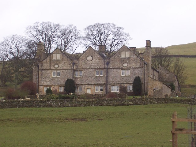
Braithwaite Hall

Braithwaite Hall is a 17th-century manor house in Coverdale in the Yorkshire Dales in England. It lies 1.8 miles (2.9 km) west of the village of East...

River Cover

The River Cover is a river in the Yorkshire Dales in North Yorkshire, England. The Yorkshire Dales Rivers Trust has a remit to conserve the ecological...

Ellingstring

Ellingstring is a village and civil parish in Wensleydale in North Yorkshire, England, about 5 miles (8 km) south-east of Leyburn, and 3.5 miles (5.6 km...

Coverham Abbey

Coverham Abbey, North Yorkshire, England, was a Premonstratensian monastery that was founded at Swainby in 1190 by Helewisia, daughter of the Chief Justiciar...

Coverham

Coverham is a village in Coverdale in the Yorkshire Dales in North Yorkshire, England. It lies 2 miles (3.2 km) west of the town of Middleham. == History... ==

Have you been to Agra Moor?

Leave your review of Agra Moor below (or comments, questions and feedback).