Harts Green

Settlement in Staffordshire

England

Harts Green

Harts Green
Harts Green Credit: Adrian Bailey

Harts Green is a small village located in the county of Staffordshire, England. Situated approximately 6 miles north of the town of Uttoxeter, Harts Green is a rural community surrounded by picturesque countryside.

The village is characterized by its charming cottages and traditional architecture, which gives it a quaint and timeless atmosphere. The area is primarily residential, with a small number of local businesses serving the needs of the community. Harts Green offers a peaceful and tranquil setting, making it an ideal place for those seeking a quiet and idyllic lifestyle.

The village is well-connected to neighboring towns and cities, with good road links to Uttoxeter and other nearby settlements. The A50, a major road artery, runs just a few miles to the south of Harts Green, providing easy access to the wider region.

For amenities, residents can find a range of services and facilities in Uttoxeter, including supermarkets, shops, restaurants, and schools. The town is also home to Uttoxeter Racecourse, a popular venue for horse racing enthusiasts.

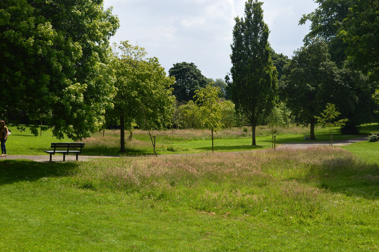
The surrounding Staffordshire countryside offers numerous opportunities for outdoor activities and exploration. With its rolling hills, woodland areas, and meandering rivers, Harts Green is an excellent base for those who enjoy walking, cycling, or simply immersing themselves in nature.

Overall, Harts Green is a charming and peaceful village with a strong sense of community. Its rural location, combined with its proximity to larger towns, makes it an attractive place to live for those seeking a balance between a tranquil lifestyle and access to amenities.

If you have any feedback on the listing, please let us know in the comments section below.
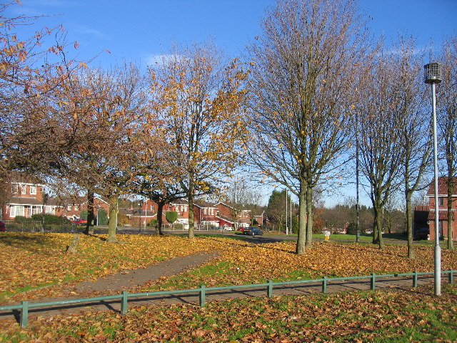
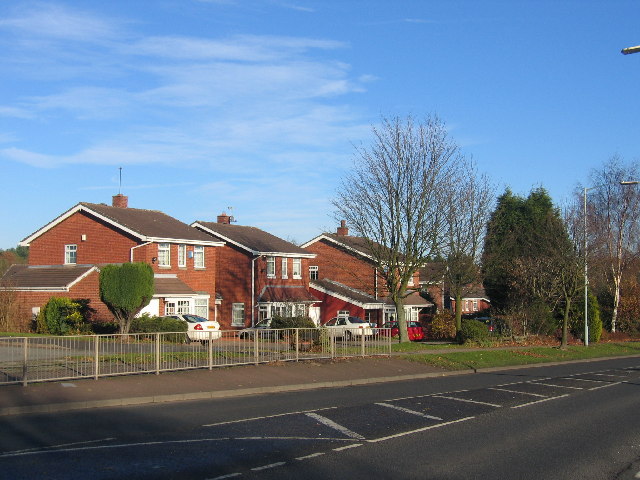
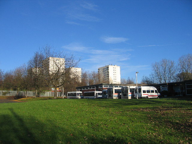
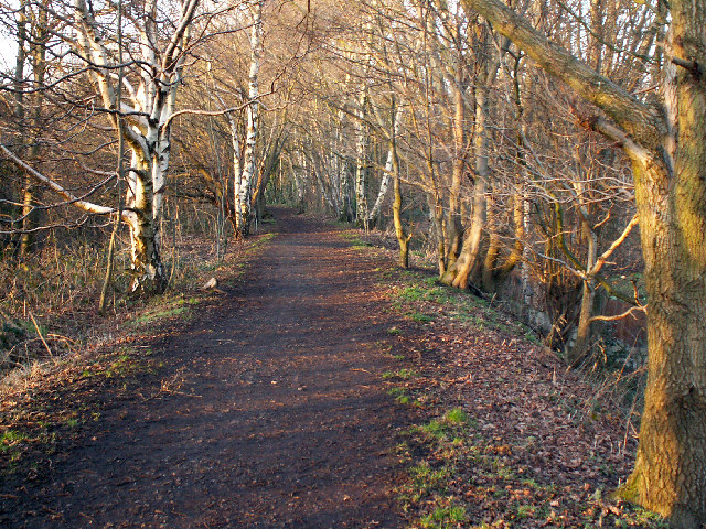
Harts Green Images

Images are sourced within 2km of 52.45428/-1.968917 or Grid Reference SP0284. Thanks to Geograph Open Source API. All images are credited.

Harts Green
Harts Green
Quinton Road, Harborne Looking east along Quinton Road from Langford Grove. Quinton Road has unusually wide verges (a planning feature?) and doesn't actually go to Quinton because the golf course gets in the way.
Quinton Road, Harborne
Looking east along Quinton Road from Langford Grove. Quinton Road has unusually wide verges (a planning feature?) and doesn't actually go to Quinton because the golf course gets in the way.
Weoley Castle ruins The castle, which dates from the 13th-15th centuries, was a fortified manor house owned by, among others, the barons of Dudley. The ruins are in disrepair (!) and closed to the public. The closest you can get is the two information boards visible in the photo, and even that area is closed on weekdays.

Information: <span class="nowrap"><a title="http://www.schoolsliaison.org.uk/weoleycastle/weoleycastle.htm" rel="nofollow ugc noopener" href="http://www.schoolsliaison.org.uk/weoleycastle/weoleycastle.htm">Link</a><img style="margin-left:2px;" alt="External link" title="External link - shift click to open in new window" src="https://s1.geograph.org.uk/img/external.png" width="10" height="10"/></span>
Weoley Castle ruins
The castle, which dates from the 13th-15th centuries, was a fortified manor house owned by, among others, the barons of Dudley. The ruins are in disrepair (!) and closed to the public. The closest you can get is the two information boards visible in the photo, and even that area is closed on weekdays. Information: LinkExternal link
Barnes Hill Looking north down the B4121 in Weoley Castle. The people have just emerged from the bingo hall. In the distance is Hillcrest Girls' Comp.
Barnes Hill
Looking north down the B4121 in Weoley Castle. The people have just emerged from the bingo hall. In the distance is Hillcrest Girls' Comp.
St Peter's St Peter's Church (CofE)
St Peter's
St Peter's Church (CofE)
Harborne Baptist Church On Harborne Park Road
Harborne Baptist Church
On Harborne Park Road
St John's St John's Church (CofE) stands between Harborne High Street (the side pictured) and Vivian Road.
St John's
St John's Church (CofE) stands between Harborne High Street (the side pictured) and Vivian Road.
Former building of Harborne Methodist Church Until 2005 this church on South Street was home to Harborne's Methodist congregation. It is to be developed, with the (listed) exterior preserved.
Former building of Harborne Methodist Church
Until 2005 this church on South Street was home to Harborne's Methodist congregation. It is to be developed, with the (listed) exterior preserved.
Sunny California These trees beside California Way, in the south of this square have now all but lost their leaves for the winter but still lend a splash of colour with the low angle of the sun.
Sunny California
These trees beside California Way, in the south of this square have now all but lost their leaves for the winter but still lend a splash of colour with the low angle of the sun.
California Way Some of the modern housing development adjacent to California Way.
California Way
Some of the modern housing development adjacent to California Way.
Day Centre and flats Looking NNE towards the blocks of flats which form prominent landmarks on the edge of Harbourne.
Day Centre and flats
Looking NNE towards the blocks of flats which form prominent landmarks on the edge of Harbourne.
Local supermarket By the busy roundabout at the junction of Wolverhampton Road South and Court Oak Road.
Local supermarket
By the busy roundabout at the junction of Wolverhampton Road South and Court Oak Road.
The Punchbowl, Ridgacre Road A large town pub at the roundabout with Wolverhampton Road South and Court Oak Road.
The Punchbowl, Ridgacre Road
A large town pub at the roundabout with Wolverhampton Road South and Court Oak Road.
Vincent Drive, Harborne/Edgbaston Vincent Drive leads from the School of Medicine, downhill to the Junction of Harborne Lane and Harborne Park Road. The image shows a typical early evening rush hour scene
Vincent Drive, Harborne/Edgbaston
Vincent Drive leads from the School of Medicine, downhill to the Junction of Harborne Lane and Harborne Park Road. The image shows a typical early evening rush hour scene
Beech Lanes The name of this estate reflects the leafy nature of the area. This road leads to the loop of a road called Fitzroy Avenue.
Beech Lanes
The name of this estate reflects the leafy nature of the area. This road leads to the loop of a road called Fitzroy Avenue.
Blakeney Avenue Due to the busy nature of the Hagley Road certain routes are used to get from Fitzroy Avenue to the Hageley Road. This road is a good way to get to traffic lights which allow one to turn right or left onto the Hagley Road.
Blakeney Avenue
Due to the busy nature of the Hagley Road certain routes are used to get from Fitzroy Avenue to the Hageley Road. This road is a good way to get to traffic lights which allow one to turn right or left onto the Hagley Road.
The Harborne Walkway Looking north along the high embankment which crosses the Chad Valley. This peaceful and attractive path follows the trackbed of the former Harborne Railway. 
The 2 mile 34 chain single track line was opened to Harborne in 1874. Passenger services ended in 1934. Goods services continued into the 1950s, as the line also served the Mitchell & Butler's Brewery and the Chad Valley toy factory. The line was finally closed in 1963.
The Harborne Walkway
Looking north along the high embankment which crosses the Chad Valley. This peaceful and attractive path follows the trackbed of the former Harborne Railway. The 2 mile 34 chain single track line was opened to Harborne in 1874. Passenger services ended in 1934. Goods services continued into the 1950s, as the line also served the Mitchell & Butler's Brewery and the Chad Valley toy factory. The line was finally closed in 1963.
World's End Looking along Simmons Drive in this unusually laid out 1960s/70s housing development along the side of Woodgate Valley.
World's End
Looking along Simmons Drive in this unusually laid out 1960s/70s housing development along the side of Woodgate Valley.
Show me another place!

Harts Green is located at Grid Ref: SP0284 (Lat: 52.45428, Lng: -1.968917)

Unitary Authority: Birmingham

Police Authority: West Midlands

What 3 Words

///smart.faded.roses. Near Bartley Green, West Midlands

Nearby Locations

Harborne Harts Green

Related Wikis

Harborne (ward)

Harborne ward is a local government district, one of 40 wards that make up Birmingham City Council. Harborne lies to the south west of Birmingham city...

Queens Park, Birmingham

Queens Park was laid out in 1898 in celebration of Queen Victoria's Diamond Jubilee, after which Turks Lane was renamed Queens Park Road. The 10-acre plot...

Queen Alexandra College

Queen Alexandra College (QAC) is an independent specialist college of further education based in Harborne, Birmingham for students above the age of sixteen...

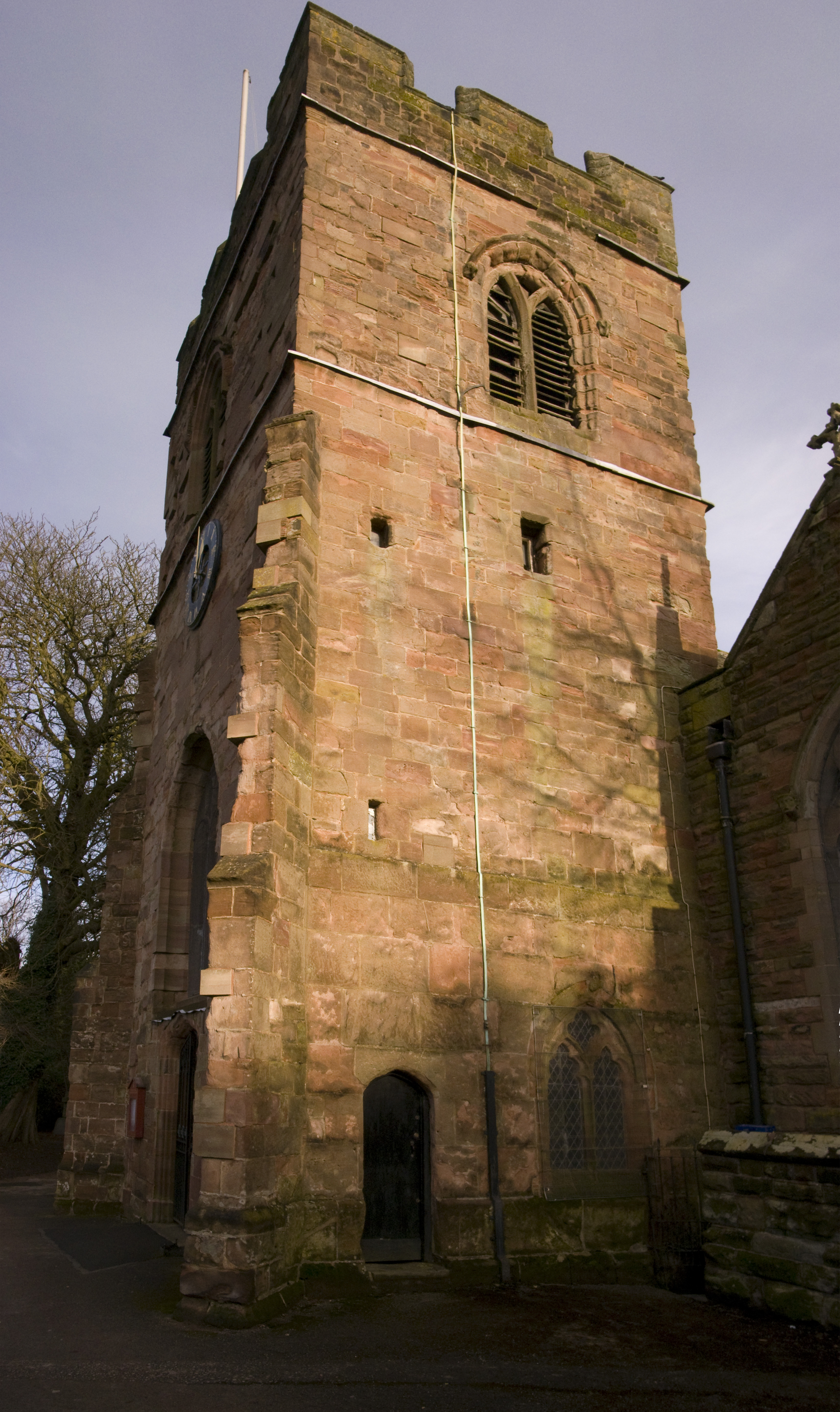
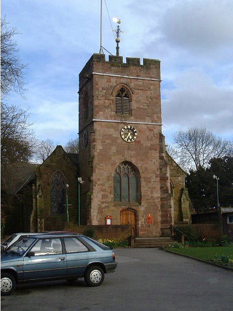
St Peter's Church, Harborne

Saint Peter's is the ancient parish church of Harborne, Birmingham, England. == Background == There has been a church on the site since Saxon times and...

Nearby Amenities

Located within 500m of 52.45428,-1.968917
Turning Circle
Lat/Long: 52.457265/-1.969996
Turning Circle
Lat/Long: 52.4569899/-1.9667254
Turning Circle
Source: bing
Lat/Long: 52.4571109/-1.9682275
Turning Circle
Lat/Long: 52.4573902/-1.9691945
Golf: clubhouse
Lat/Long: 52.4542236/-1.9629082
Turning Circle
Source: bing
Lat/Long: 52.4519176/-1.966348
Bridge: yes
Lat/Long: 52.4509225/-1.9673703
Bridge: yes
Lat/Long: 52.4508859/-1.9680399
Bridge: yes
Lat/Long: 52.4508994/-1.9688285
Bridge: yes
Lat/Long: 52.45091/-1.9691244
Bridge: yes
Lat/Long: 52.4509362/-1.9699196
Bridge: yes
Lat/Long: 52.4509589/-1.9706479
Bridge: yes
Lat/Long: 52.4520245/-1.9730085
Bridge: yes
Lat/Long: 52.4517536/-1.9728061
Bridge: yes
Lat/Long: 52.4515957/-1.9726739
Bridge: yes
Lat/Long: 52.4514345/-1.972531
Post Box
Operator: Royal Mail
Operator Wikidata: Q638098
Ref: B32 897
Lat/Long: 52.457245/-1.9716398
Turning Circle
Lat/Long: 52.4572877/-1.9643221
Post Box
Postal Code: B17
Ref: B17 363
Lat/Long: 52.4559966/-1.9650313
Bus Stop
Rilstone Rd / Tarrant Grove
Bus: yes
Naptan AtcoCode: 43000311701
Naptan Bearing: SE
Naptan BusStopType: MKD
Naptan CommonName: Tarrant Grove
Naptan Indicator: adj
Naptan NaptanCode: nwmapjwp
Naptan PlusbusZoneRef: BHAMNWS
Naptan Status: ACT
Naptan StopType: BCT
Naptan Street: RILSTONE RD
Naptan Towards: Both directions
Naptan Verified: no
Public Transport: platform
Route Ref: 99
Source: WMCA
Lat/Long: 52.4541897/-1.9761337
Rilstone Rd / Tarrant Grove
Naptan AtcoCode: 43000311702
Naptan Bearing: NW
Naptan BusStopType: CUS
Naptan CommonName: Tarrant Grove
Naptan Indicator: opp
Naptan NaptanCode: nwmtjdja
Naptan PlusbusZoneRef: BHAMNWS
Naptan Status: ACT
Naptan StopType: BCT
Naptan Street: RILSTONE RD
Naptan Verified: no
Source: WMCA
Lat/Long: 52.4542582/-1.976079
Bus Stop
Wisley Way / Shipbourne Close
Bus: yes
Naptan AtcoCode: 43000311901
Naptan Bearing: SE
Naptan BusStopType: CUS
Naptan CommonName: Shipbourne Close
Naptan Indicator: adj
Naptan NaptanCode: nwmapmag
Naptan PlusbusZoneRef: BHAMNWS
Naptan Status: ACT
Naptan StopType: BCT
Naptan Street: WISLEY WAY
Naptan Towards: Both directions
Naptan Verified: no
Public Transport: platform
Source: WMCA
Lat/Long: 52.4559369/-1.9749585
Bus Stop
Wisley Way / Shipbourne Close
Bus: yes
Naptan AtcoCode: 43000311902
Naptan Bearing: NW
Naptan BusStopType: MKD
Naptan CommonName: Shipbourne Close
Naptan Indicator: opp
Naptan NaptanCode: nwmapmaj
Naptan PlusbusZoneRef: BHAMNWS
Naptan Status: ACT
Naptan StopType: BCT
Naptan Street: WISLEY WAY
Naptan Verified: no
Public Transport: platform
Route Ref: 99
Source: WMCA
Lat/Long: 52.4555438/-1.974526
Bus Stop
War Lane / Milford Rd
Bus: yes
Naptan AtcoCode: 43000321101
Naptan Bearing: SW
Naptan BusStopType: MKD
Naptan CommonName: Milford Rd
Naptan Indicator: opp
Naptan NaptanCode: nwmapwgd
Naptan PlusbusZoneRef: BHAMNWS
Naptan Status: ACT
Naptan StopType: BCT
Naptan Street: WAR LANE
Naptan Towards: Bartley Green
Naptan Verified: no
Public Transport: platform
Route Ref: 22;23;99
Source: WMCA
Lat/Long: 52.4564576/-1.9627816
Bus Stop
War Lane / Fellows Lane
NaPTANAreaCode: 43000321201
Asset Ref: 608863
Bus: yes
Location: War Lane;Fellows Lane
Naptan AtcoCode: 43000321201
Naptan Bearing: SW
Naptan BusStopType: MKD
Naptan CommonName: Fellows Lane
Naptan Indicator: opp
Naptan NaptanCode: nwmapwgm
Naptan PlusbusZoneRef: BHAMNWS
Naptan Status: ACT
Naptan StopType: BCT
Naptan Street: WAR LANE
Naptan Towards: Bartley Green
Naptan Verified: no
Public Transport: platform
Route Ref: 22;23;99
Shelter: yes
Shelter Ref: 608863
Source: WMCA
Towards: Bartley Green
Lat/Long: 52.4558378/-1.9642243
Bus Stop
War Lane / Fellows Lane
NaPTANAreaCode: 43000321202
Bus: yes
Naptan AtcoCode: 43000321202
Naptan Bearing: NE
Naptan BusStopType: MKD
Naptan CommonName: Fellows Lane
Naptan Indicator: adj
Naptan NaptanCode: nwmapwgp
Naptan PlusbusZoneRef: BHAMNWS
Naptan Status: ACT
Naptan StopType: BCT
Naptan Street: WAR LANE
Naptan Towards: Birmingham
Naptan Verified: no
Public Transport: platform
Route Ref: 22;23;99
Shelter: yes
Shelter Ref: 608817
Source: WMCA
Lat/Long: 52.4558469/-1.9645775
Bus Stop
Tennal Rd / Welsh House Farm Rd
Bus: yes
Naptan AtcoCode: 43000321301
Naptan Bearing: NW
Naptan BusStopType: MKD
Naptan CommonName: Welsh House Farm Rd
Naptan Indicator: adj
Naptan NaptanCode: nwmapwgt
Naptan PlusbusZoneRef: BHAMNWS
Naptan Status: ACT
Naptan StopType: BCT
Naptan Street: TENNAL RD
Naptan Towards: Quinton
Naptan Verified: no
Public Transport: platform
Route Ref: 99
Source: WMCA
Lat/Long: 52.4559829/-1.968801
Bus Stop
Tennal Rd / Welsh House Farm Rd
Bus: yes
Naptan AtcoCode: 43000321302
Naptan Bearing: SE
Naptan BusStopType: MKD
Naptan CommonName: Welsh House Farm Rd
Naptan Indicator: opp
Naptan NaptanCode: nwmapwgw
Naptan PlusbusZoneRef: BHAMNWS
Naptan Status: ACT
Naptan StopType: BCT
Naptan Street: TENNAL RD
Naptan Towards: Harborne
Naptan Verified: no
Public Transport: platform
Route Ref: 99
Source: WMCA
Lat/Long: 52.4558659/-1.9681536
Bus Stop
Northfield Rd / Fredas Grove
Bus: yes
Layby: yes
Naptan AtcoCode: 43000321401
Naptan Bearing: S
Naptan BusStopType: MKD
Naptan CommonName: Fredas Grove
Naptan Indicator: opp
Naptan Landmark: Harborne Golf Course
Naptan NaptanCode: nwmapwja
Naptan PlusbusZoneRef: BHAMNWS
Naptan Status: ACT
Naptan StopType: BCT
Naptan Street: NORTHFIELD RD
Naptan Towards: Bartley Green
Public Transport: platform
Route Ref: 22;23
Shelter: no
Source: WMCA
Lat/Long: 52.4527346/-1.9654813
Bus Stop
Northfield Rd / Fredas Grove
Bus: yes
Layby: yes
Naptan AtcoCode: 43000321402
Naptan Bearing: N
Naptan BusStopType: MKD
Naptan CommonName: Fredas Grove
Naptan Indicator: adj
Naptan Landmark: Harborne Golf Course
Naptan NaptanCode: nwmapwjd
Naptan PlusbusZoneRef: BHAMNWS
Naptan Status: ACT
Naptan StopType: BCT
Naptan Street: NORTHFIELD RD
Naptan Towards: Birmingham
Public Transport: platform
Route Ref: 22;23
Shelter: no
Source: WMCA
Lat/Long: 52.4530681/-1.9657594
Bus Stop
Northfield Rd / Wyckham Close
Bus: yes
Naptan AtcoCode: 43000321501
Naptan Bearing: S
Naptan BusStopType: MKD
Naptan CommonName: Wyckham Close
Naptan Indicator: opp
Naptan NaptanCode: nwmapwjg
Naptan PlusbusZoneRef: BHAMNWS
Naptan Status: ACT
Naptan StopType: BCT
Naptan Street: NORTHFIELD RD
Naptan Towards: Bartley Green
Naptan Verified: no
Public Transport: platform
Route Ref: 22;23
Source: WMCA
Lat/Long: 52.4509655/-1.9658175
Bus Stop
Northfield Rd / Wyckham Close
Bus: yes
Naptan AtcoCode: 43000321502
Naptan Bearing: N
Naptan BusStopType: MKD
Naptan CommonName: Wyckham Close
Naptan Indicator: adj
Naptan NaptanCode: nwmapwjm
Naptan PlusbusZoneRef: BHAMNWS
Naptan Status: ACT
Naptan StopType: BCT
Naptan Street: NORTHFIELD RD
Naptan Towards: Birmingham
Naptan Verified: no
Public Transport: platform
Route Ref: 22;23
Source: WMCA
Lat/Long: 52.451442/-1.9657141
Addr Housenumber: 154
Survey Date: 2013-09-08
Lat/Long: 52.4561494/-1.9635739
Addr Housenumber: 172
Survey Date: 2013-09-08
Lat/Long: 52.4560134/-1.9642263
Addr Housenumber: 2
Survey Date: 2013-09-08
Lat/Long: 52.4529981/-1.9660637
Addr Housenumber: 4
Survey Date: 2013-09-08
Lat/Long: 52.4529438/-1.9660541
Bus Stop
Welsh House Farm Road
Bus: yes
Naptan AtcoCode: 43000311601
Naptan Bearing: SE
Naptan CommonName: Welsh House Farm Road
Naptan Indicator: before
Naptan NaptanCode: nwmapjwm
Naptan PlusbusZoneRef: BHAMNWS
Naptan Street: BLANDFORD RD
Naptan Verified: no
Public Transport: platform
Lat/Long: 52.4528533/-1.9752588
Bus Stop
Welsh House Farm Road
Bus: yes
Naptan AtcoCode: 43000311602
Naptan Bearing: NW
Naptan CommonName: Welsh House Farm Road
Naptan Indicator: after
Naptan NaptanCode: nwmtjdgw
Naptan PlusbusZoneRef: BHAMNWS
Naptan Street: BLANDFORD RD
Naptan Verified: no
Public Transport: platform
Lat/Long: 52.4528001/-1.9753124
Blue Plaque: Francis William Aston 1877-1945 Winner of the Nobel Prize for Chemistry 1922
Historic: memorial
Openplaques Id: 1616
Source: open plaques
Lat/Long: 52.4568828/-1.9706879
Rilstone Rd / Purbeck Croft
Naptan AtcoCode: 43003011602
Naptan Bearing: NW
Naptan BusStopType: CUS
Naptan CommonName: Purbeck Croft
Naptan Indicator: opp
Naptan NaptanCode: nwmwdatd
Naptan Status: ACT
Naptan StopType: BCT
Naptan Street: RILSTONE RD
Naptan Towards: Both directions
Source: WMCA
Lat/Long: 52.4536386/-1.9747929
Bus Stop
Rilstone Rd / Purbeck Croft
Bus: yes
Naptan AtcoCode: 43003011601
Naptan Bearing: SE
Naptan BusStopType: MKD
Naptan CommonName: Purbeck Croft
Naptan Indicator: adj
Naptan NaptanCode: nwmwdata
Naptan Status: ACT
Naptan StopType: BCT
Naptan Street: RILSTONE RD
Public Transport: platform
Route Ref: 99
Source: WMCA
Lat/Long: 52.4536656/-1.9746899
Bus Stop
Welsh House Farm Rd / Capern Grove
Bus: yes
Naptan AtcoCode: 43000315902
Naptan Bearing: SW
Naptan BusStopType: MKD
Naptan CommonName: Capern Grove
Naptan Indicator: opp
Naptan NaptanCode: nwmtjawp
Naptan Status: ACT
Naptan StopType: BCT
Naptan Street: WELSH HOUSE FARM RD
Naptan Towards: Quinton
Public Transport: platform
Source: WMCA
Lat/Long: 52.4546537/-1.9712311
Bus Stop
Welsh House Farm Rd / Capern Grove
Bus: yes
Naptan AtcoCode: 43000315901
Naptan Bearing: NE
Naptan BusStopType: MKD
Naptan CommonName: Capern Grove
Naptan Indicator: adj
Naptan NaptanCode: nwmaptap
Naptan Status: ACT
Naptan StopType: BCT
Naptan Street: WELSH HOUSE FARM RD
Naptan Towards: Harborne
Public Transport: platform
Route Ref: 99
Source: WMCA
Lat/Long: 52.4547346/-1.9712164
Steve’s
Addr City: Birmingham
Addr Housenumber: 27
Addr Postcode: B17 0AQ
Addr Street: Victoria Road
Leisure: fitness_centre
Lat/Long: 52.4552484/-1.9642963
Post Box
Ref: B32 1282
Lat/Long: 52.455193/-1.9739175
Fast Food
Harborne Fish Bar
Addr City: Birmingham
Addr Housenumber: 2
Addr Postcode: B17 0SS
Addr Street: Northfield Road
Contact Facebook: https://www.facebook.com/people/Harborne-Fish-Bar/100044637536864/
Cuisine: friture;fish_and_chips;local
Email: harbornefishbar@gmail.com
Opening Hours: Mo-Sa 12:00-14:00, 16:30-22:30
Phone: +44 121 427 7759
Lat/Long: 52.4558772/-1.9653198
Crossing
Crossing: uncontrolled
Source: bing
Lat/Long: 52.4534775/-1.9657159
Generator Method: photovoltaic
Generator Output Electricity: yes
Generator Source: solar
Generator Type: solar_photovoltaic_panel
Location: roof
Power: generator
Lat/Long: 52.4555779/-1.9665688
Generator Method: photovoltaic
Generator Output Electricity: yes
Generator Source: solar
Generator Type: solar_photovoltaic_panel
Location: roof
Power: generator
Lat/Long: 52.455591/-1.9665018
Generator Method: photovoltaic
Generator Output Electricity: yes
Generator Source: solar
Generator Type: solar_photovoltaic_panel
Location: roof
Power: generator
Lat/Long: 52.4555403/-1.9700718
Generator Method: photovoltaic
Generator Output Electricity: yes
Generator Source: solar
Generator Type: solar_photovoltaic_panel
Location: roof
Power: generator
Lat/Long: 52.4544468/-1.9736257
Generator Method: photovoltaic
Generator Output Electricity: yes
Generator Source: solar
Generator Type: solar_photovoltaic_panel
Location: roof
Power: generator
Lat/Long: 52.4554193/-1.9727057
Generator Method: photovoltaic
Generator Output Electricity: yes
Generator Source: solar
Generator Type: solar_photovoltaic_panel
Location: roof
Power: generator
Lat/Long: 52.4563575/-1.973733
Generator Method: photovoltaic
Generator Output Electricity: yes
Generator Source: solar
Generator Type: solar_photovoltaic_panel
Location: roof
Power: generator
Lat/Long: 52.4569901/-1.974417
Generator Method: photovoltaic
Generator Output Electricity: yes
Generator Source: solar
Generator Type: solar_photovoltaic_panel
Location: roof
Power: generator
Lat/Long: 52.4569655/-1.9744626
Generator Method: photovoltaic
Generator Output Electricity: yes
Generator Source: solar
Generator Type: solar_photovoltaic_panel
Location: roof
Power: generator
Lat/Long: 52.455859/-1.9752592
Generator Method: photovoltaic
Generator Output Electricity: yes
Generator Source: solar
Generator Type: solar_photovoltaic_panel
Location: roof
Power: generator
Lat/Long: 52.4547909/-1.9758976
Generator Method: photovoltaic
Generator Output Electricity: yes
Generator Source: solar
Generator Type: solar_photovoltaic_panel
Location: roof
Power: generator
Lat/Long: 52.4554578/-1.9752391
Generator Method: photovoltaic
Generator Output Electricity: yes
Generator Source: solar
Generator Type: solar_photovoltaic_panel
Location: roof
Power: generator
Lat/Long: 52.4555101/-1.9751707
Golf: pin
Lat/Long: 52.4514254/-1.9635536
Golf: pin
Lat/Long: 52.4513655/-1.9640752
Golf: pin
Lat/Long: 52.4540199/-1.9635724
Golf: pin
Lat/Long: 52.4529489/-1.9637143
The data included in this document is from www.openstreetmap.org. The data is made available under ODbL.

Have you been to Harts Green?

Leave your review of Harts Green below (or comments, questions and feedback).