Camp Down

Downs, Moorland in Wiltshire

England

Camp Down

Old Milestone by the A360, Smithen Down Metal plate attached to stone post by the A360, in parish of South Newton (Salisbury District), Smithen Down; 250m South of track to transmission towers, on the verge, on West side of road. Salisbury plate, erected by the Fisherton, Wilton, Heytesbury, Willoughby Hedge & Redhone turnpike trust in the 18th century. Plate missing in December 2023.

Inscription reads:-
SALISBURY
4
DEVIZES
19 
Carved benchmark below plate.

Grade II listed.
List Entry Number: 1146256 <span class="nowrap"><a title="https://historicengland.org.uk/listing/the-list/list-entry/1146256" rel="nofollow ugc noopener" href="https://historicengland.org.uk/listing/the-list/list-entry/1146256">Link</a><img style="margin-left:2px;" alt="External link" title="External link - shift click to open in new window" src="https://s1.geograph.org.uk/img/external.png" width="10" height="10"/></span>

Milestone Society National ID: WI_DZSA19
Old Milestone by the A360, Smithen Down Credit: Gail Fawcett

Camp Down is a region located in Wiltshire, England, characterized by its rolling hills, vast moorlands, and picturesque landscapes. Situated in the southern part of the county, it covers an extensive area of approximately 100 square miles. The region is renowned for its outstanding natural beauty and is a popular destination for outdoor enthusiasts and nature lovers.

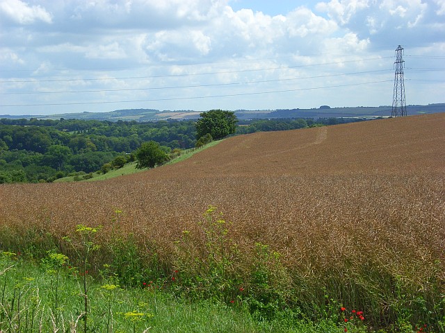
The hills of Camp Down are part of the larger Salisbury Plain, forming a prominent feature in the landscape. These downs are defined by their gently sloping hills and expansive grasslands, providing ample opportunities for walking, hiking, and cycling. The area is rich in diverse flora and fauna, with an abundance of wildflowers, butterflies, and various bird species.

The moorland in Camp Down is a significant aspect of its landscape, characterized by its wide open spaces and heather-covered terrain. This habitat supports a variety of wildlife, including deer, foxes, and rare bird species such as the Eurasian curlew and the Dartford warbler.

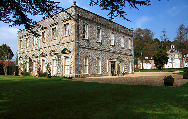
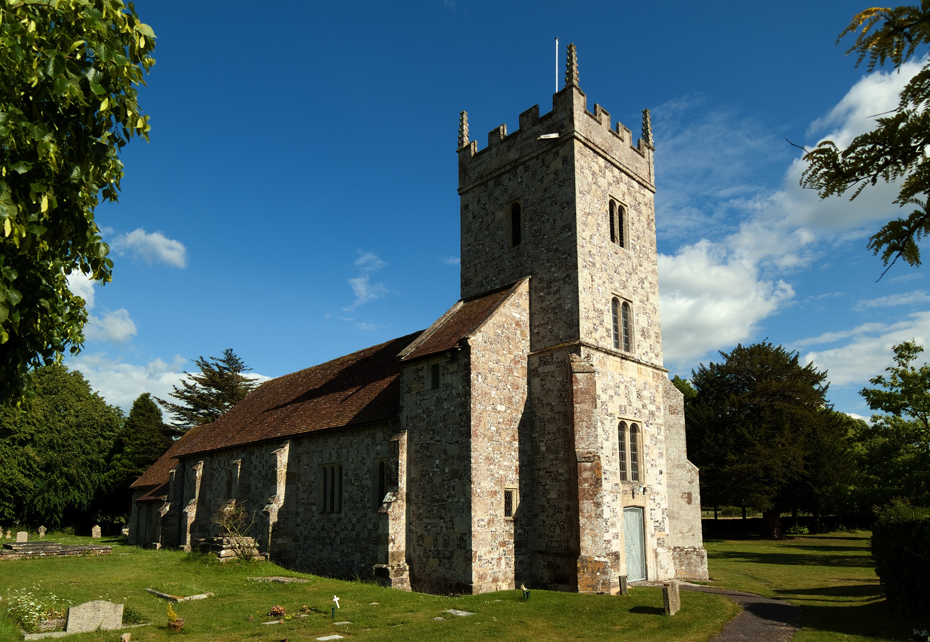
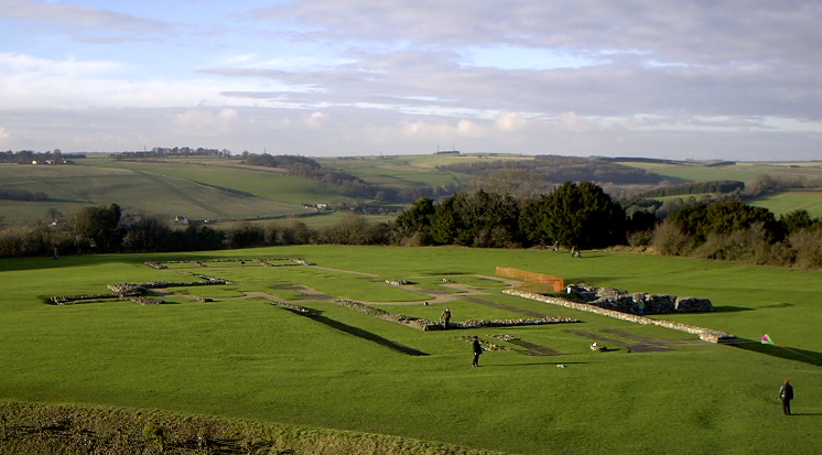
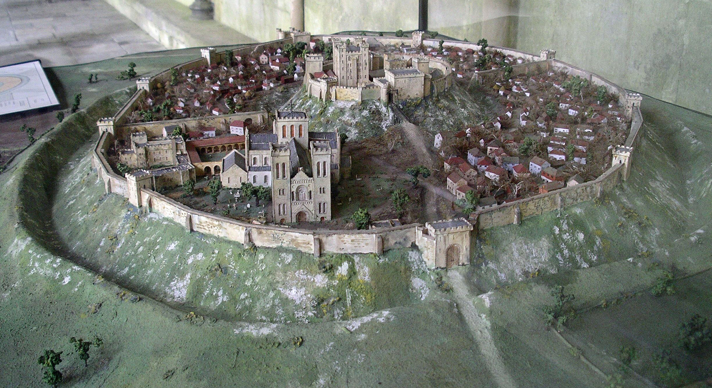
Camp Down also boasts several historical and cultural sites of interest. The region is home to ancient burial mounds, known as barrows, dating back thousands of years, providing insight into the area's prehistoric past. Additionally, the nearby Stonehenge, a world-famous prehistoric monument, attracts visitors from around the globe.

Overall, Camp Down offers a unique blend of natural beauty, historical significance, and outdoor activities, making it a captivating destination for those seeking to immerse themselves in the tranquility and charm of the Wiltshire countryside.

If you have any feedback on the listing, please let us know in the comments section below.

Camp Down Images

Images are sourced within 2km of 51.105045/-1.8329093 or Grid Reference SU1133. Thanks to Geograph Open Source API. All images are credited.

Old Milestone by the A360, Smithen Down Metal plate attached to stone post by the A360, in parish of South Newton (Salisbury District), Smithen Down; 250m South of track to transmission towers, on the verge, on West side of road. Salisbury plate, erected by the Fisherton, Wilton, Heytesbury, Willoughby Hedge & Redhone turnpike trust in the 18th century. Plate missing in December 2023.

Inscription reads:-
SALISBURY
4
DEVIZES
19 
Carved benchmark below plate.

Grade II listed.
List Entry Number: 1146256 <span class="nowrap"><a title="https://historicengland.org.uk/listing/the-list/list-entry/1146256" rel="nofollow ugc noopener" href="https://historicengland.org.uk/listing/the-list/list-entry/1146256">Link</a><img style="margin-left:2px;" alt="External link" title="External link - shift click to open in new window" src="https://s1.geograph.org.uk/img/external.png" width="10" height="10"/></span>

Milestone Society National ID: WI_DZSA19
Old Milestone by the A360, Smithen Down
Metal plate attached to stone post by the A360, in parish of South Newton (Salisbury District), Smithen Down; 250m South of track to transmission towers, on the verge, on West side of road. Salisbury plate, erected by the Fisherton, Wilton, Heytesbury, Willoughby Hedge & Redhone turnpike trust in the 18th century. Plate missing in December 2023. Inscription reads:- SALISBURY 4 DEVIZES 19 Carved benchmark below plate. Grade II listed. List Entry Number: 1146256 LinkExternal link Milestone Society National ID: WI_DZSA19
Gas pipeline pumping station
Field, Salterton The view past the gate shown in <a href="https://www.geograph.org.uk/photo/5199487">SU1235 : White Cottage</a>. I'm drawn to it by a distant burst of sunshine on this disappointingly gloomy morning walk. The houses on the left are at Middle Woodford, across the River Avon.
Field, Salterton
The view past the gate shown in SU1235 : White Cottage. I'm drawn to it by a distant burst of sunshine on this disappointingly gloomy morning walk. The houses on the left are at Middle Woodford, across the River Avon.
Monarch's Way approaching Salterton Farm This is bridleway DURN 17. Rather a narrow path on which to meet a horse. Fortunately I didn't. Below is the Avon valley.
Monarch's Way approaching Salterton Farm
This is bridleway DURN 17. Rather a narrow path on which to meet a horse. Fortunately I didn't. Below is the Avon valley.
Monarch's Way above Salterton Farm Trees overhang bridleway DURN 17 as it approaches the top of a climb from the Avon valley.
Monarch's Way above Salterton Farm
Trees overhang bridleway DURN 17 as it approaches the top of a climb from the Avon valley.
Monarch's Way near Salterton Farm Climbing bridleway DURN 17 from the farm, through a tree-lined stretch.
Monarch's Way near Salterton Farm
Climbing bridleway DURN 17 from the farm, through a tree-lined stretch.
Farmland in the Avon valley A shame there's no sun for a view like this, from the Monarch's Way over the valley at Salterton and Middle Woodford.
Farmland in the Avon valley
A shame there's no sun for a view like this, from the Monarch's Way over the valley at Salterton and Middle Woodford.
Avon valley at Lower Woodford Looking in the other direction to <a href="https://www.geograph.org.uk/photo/5199545">SU1235 : Farmland in the Avon valley</a> from the Monarch's Way, with Lower Woodford across the river.
Avon valley at Lower Woodford
Looking in the other direction to SU1235 : Farmland in the Avon valley from the Monarch's Way, with Lower Woodford across the river.
Monarch's Way near Salterton Farm The Way follows bridleway DURN 15 down the lane to the right, to the River Avon.
Monarch's Way near Salterton Farm
The Way follows bridleway DURN 15 down the lane to the right, to the River Avon.
Footbridge over the Avon Carrying the Monarch's Way and bridleway DURN 15, which becomes footpath WFOR 4 in mid-stream, the river being a parish boundary.
Footbridge over the Avon
Carrying the Monarch's Way and bridleway DURN 15, which becomes footpath WFOR 4 in mid-stream, the river being a parish boundary.
River Avon Like <a href="https://www.geograph.org.uk/photo/309663">SU1235 : Fishing the Wiltshire Avon</a> and <a href="https://www.geograph.org.uk/photo/691804">SU1235 : River Avon, Lower Woodford</a> looking upstream from the bridge shown in <a href="https://www.geograph.org.uk/photo/5199656">SU1235 : Footbridge over the Avon</a>, but, gloomy though it is, in summer rather than winter.
River Avon
Like SU1235 : Fishing the Wiltshire Avon and SU1235 : River Avon, Lower Woodford looking upstream from the bridge shown in SU1235 : Footbridge over the Avon, but, gloomy though it is, in summer rather than winter.
River Avon Looking downstream from the bridge shown in <a href="https://www.geograph.org.uk/photo/5199656">SU1235 : Footbridge over the Avon</a>.
River Avon
Looking downstream from the bridge shown in SU1235 : Footbridge over the Avon.
Mill stream, Lower Woodford From a footbridge on the Monarch's Way.
Mill stream, Lower Woodford
From a footbridge on the Monarch's Way.
Monarch's Way at Lower Woodford #1 The Way follows footpath WFOR 4 past The Granary, which has attractively-patterned flint walls.
Monarch's Way at Lower Woodford #1
The Way follows footpath WFOR 4 past The Granary, which has attractively-patterned flint walls.
Monarch's Way at Lower Woodford #2 The end of the chequerboard flint wall seen in <a href="https://www.geograph.org.uk/photo/5200293">SU1235 : Monarch's Way at Lower Woodford #1</a>, with a glimpse of the house beyond, the listed Court House <span class="nowrap"><a title="https://www.historicengland.org.uk/listing/the-list/list-entry/1284061" rel="nofollow ugc noopener" href="https://www.historicengland.org.uk/listing/the-list/list-entry/1284061">Link</a><img style="margin-left:2px;" alt="External link" title="External link - shift click to open in new window" src="https://s1.geograph.org.uk/img/external.png" width="10" height="10"/></span> .
Monarch's Way at Lower Woodford #2
The end of the chequerboard flint wall seen in SU1235 : Monarch's Way at Lower Woodford #1, with a glimpse of the house beyond, the listed Court House LinkExternal link .
The Court House, Lower Woodford The Monarch's Way runs past the façade of this listed house <span class="nowrap"><a title="https://www.historicengland.org.uk/listing/the-list/list-entry/1284061" rel="nofollow ugc noopener" href="https://www.historicengland.org.uk/listing/the-list/list-entry/1284061">Link</a><img style="margin-left:2px;" alt="External link" title="External link - shift click to open in new window" src="https://s1.geograph.org.uk/img/external.png" width="10" height="10"/></span> ; the image shows the "shaped gable over two central bays, disguising chimneys".
The Court House, Lower Woodford
The Monarch's Way runs past the façade of this listed house LinkExternal link ; the image shows the "shaped gable over two central bays, disguising chimneys".
Monarch's Way at Lower Woodford #3 A "very rare" Victorian postbox (number SP4 51), also shown at <a href="https://www.geograph.org.uk/photo/692499">SU1235 : Postbox, Lower Woodford</a>, is in the wall of an outbuilding: "an 1859 post-box; this is the improved version of the post-box introduced in 1857 and has a pitched top, after the first flat-topped model had been found to leak; both types have flaps and hoods to the aperture" <span class="nowrap"><a title="https://www.historicengland.org.uk/listing/the-list/list-entry/1130984" rel="nofollow ugc noopener" href="https://www.historicengland.org.uk/listing/the-list/list-entry/1130984">Link</a><img style="margin-left:2px;" alt="External link" title="External link - shift click to open in new window" src="https://s1.geograph.org.uk/img/external.png" width="10" height="10"/></span> . The outbuilding is also described in detail (clearly shown here is the "tall red brick plinth with cob above" on the curved south corner); both form part of the listing for Court Farmhouse, off to the left. The Way turns off around the outbuilding and passes in front of The Court House in the background; this is also listed <a href="https://www.geograph.org.uk/photo/5200328">SU1235 : The Court House, Lower Woodford</a> <span class="nowrap"><a title="https://www.historicengland.org.uk/listing/the-list/list-entry/1284061" rel="nofollow ugc noopener" href="https://www.historicengland.org.uk/listing/the-list/list-entry/1284061">Link</a><img style="margin-left:2px;" alt="External link" title="External link - shift click to open in new window" src="https://s1.geograph.org.uk/img/external.png" width="10" height="10"/></span> .
Monarch's Way at Lower Woodford #3
A "very rare" Victorian postbox (number SP4 51), also shown at SU1235 : Postbox, Lower Woodford, is in the wall of an outbuilding: "an 1859 post-box; this is the improved version of the post-box introduced in 1857 and has a pitched top, after the first flat-topped model had been found to leak; both types have flaps and hoods to the aperture" LinkExternal link . The outbuilding is also described in detail (clearly shown here is the "tall red brick plinth with cob above" on the curved south corner); both form part of the listing for Court Farmhouse, off to the left. The Way turns off around the outbuilding and passes in front of The Court House in the background; this is also listed SU1235 : The Court House, Lower Woodford LinkExternal link .
Rare Victorian postbox, Lower Woodford This may be more or less the same view as <a href="https://www.geograph.org.uk/photo/692499">SU1235 : Postbox, Lower Woodford</a>, but, well, such a noteworthy postbox deserves plenty of attention. Here is how the listed building description for Court Farmhouse (in the wall of one of whose outbuildings it sits) explains it: "Set into south west end wall there is a very rare survival of an 1859 post-box; this is the improved version of the post-box introduced in 1857 and has a pitched top, after the first flat-topped model had been found to leak; both types have flaps and hoods to the aperture" <span class="nowrap"><a title="https://www.historicengland.org.uk/listing/the-list/list-entry/1130984" rel="nofollow ugc noopener" href="https://www.historicengland.org.uk/listing/the-list/list-entry/1130984">Link</a><img style="margin-left:2px;" alt="External link" title="External link - shift click to open in new window" src="https://s1.geograph.org.uk/img/external.png" width="10" height="10"/></span> . The number is SP4 51. See also <a href="https://www.geograph.org.uk/photo/5200354">SU1235 : Monarch's Way at Lower Woodford #3</a>.
Rare Victorian postbox, Lower Woodford
This may be more or less the same view as SU1235 : Postbox, Lower Woodford, but, well, such a noteworthy postbox deserves plenty of attention. Here is how the listed building description for Court Farmhouse (in the wall of one of whose outbuildings it sits) explains it: "Set into south west end wall there is a very rare survival of an 1859 post-box; this is the improved version of the post-box introduced in 1857 and has a pitched top, after the first flat-topped model had been found to leak; both types have flaps and hoods to the aperture" LinkExternal link . The number is SP4 51. See also SU1235 : Monarch's Way at Lower Woodford #3.
Show me another place!

Camp Down is located at Grid Ref: SU1133 (Lat: 51.105045, Lng: -1.8329093)

Unitary Authority: Wiltshire

Police Authority: Wiltshire

What 3 Words

///indulgent.enveloped.extremely. Near Woodford, Wiltshire

Nearby Locations

Camp Hill Camp Down

Related Wikis

Related Videos

Introduction to ILS Case Management from Sarah Ransome

ILS specialise in providing Case Management for children, young people and adults with catastrophic injury. When a person's life ...
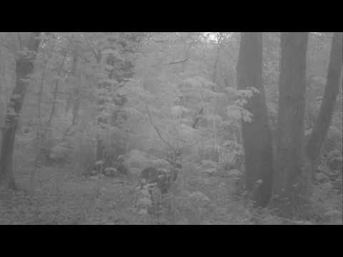
Beautiful Roe Deer

Deer grow a new set of antlers each year. About this time of year, deer will try to speed up the process by rubbing their antlers ...

Nearby Amenities

Located within 500m of 51.105045,-1.8329093
Power: tower
Source: yahoo
Lat/Long: 51.1012233/-1.8361935
Power: tower
Source: yahoo
Lat/Long: 51.1036735/-1.8363174
Power: tower
Source: yahoo
Lat/Long: 51.1063921/-1.8365572
Access: yes
Barrier: stile
Lat/Long: 51.106212/-1.8297833
Barrier: stile
Lat/Long: 51.1087229/-1.8303415
The data included in this document is from www.openstreetmap.org. The data is made available under ODbL.

Have you been to Camp Down?

Leave your review of Camp Down below (or comments, questions and feedback).