Hanghow Pastures

Downs, Moorland in Yorkshire Richmondshire

England

Hanghow Pastures

Field gate for footpath to Caldbergh
Field gate for footpath to Caldbergh Credit: peter robinson

Hanghow Pastures is a picturesque and vast expanse of land located in the county of Yorkshire, England. Situated amidst the stunning landscape of the Yorkshire Downs and Moorland, this area offers a remarkable natural beauty that has captivated visitors for centuries.

Covering a significant area, Hanghow Pastures boasts rolling hills, sprawling meadows, and jagged cliffs, creating a diverse and captivating environment. The pastures are covered with lush green grasses during the summer months, providing ample grazing opportunities for livestock and wildlife alike.

The Yorkshire Downs, known for their gentle slopes and scenic views, are a prominent feature of Hanghow Pastures. These hills offer breathtaking panoramic vistas of the surrounding countryside, making it a popular destination for hikers, nature enthusiasts, and photographers. The moorland, on the other hand, presents a wilder and more rugged landscape, with heather-covered expanses and peat bogs.

The area is also home to a variety of wildlife, including numerous species of birds, such as curlews, lapwings, and grouse, which thrive in this diverse habitat. Visitors may also catch a glimpse of rabbits, hares, and foxes roaming freely across the pastures.

Hanghow Pastures is a place of tranquility and natural beauty, offering visitors the chance to escape the hustle and bustle of everyday life and immerse themselves in the peacefulness of the countryside. With its stunning landscapes, diverse wildlife, and captivating views, it is truly a gem of Yorkshire.

If you have any feedback on the listing, please let us know in the comments section below.

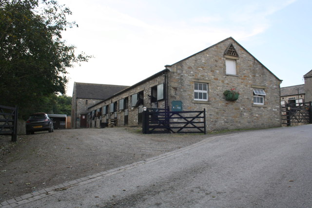
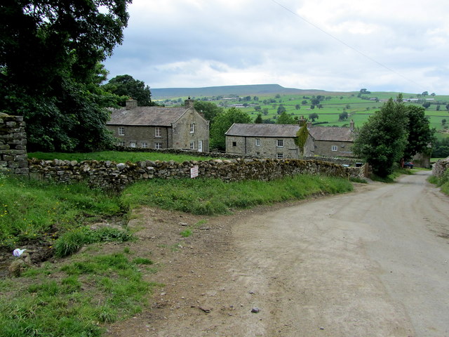
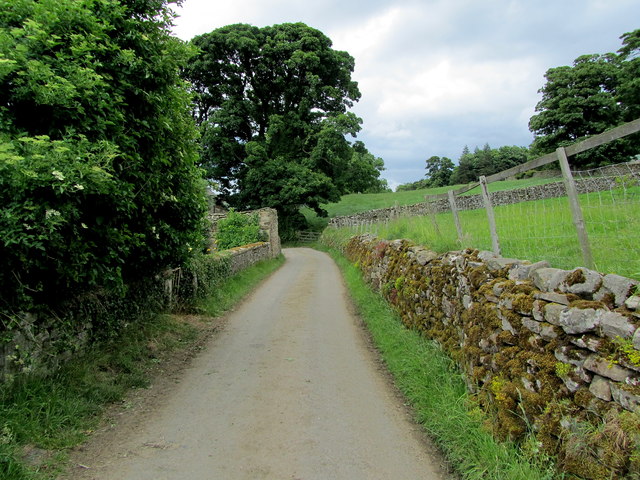
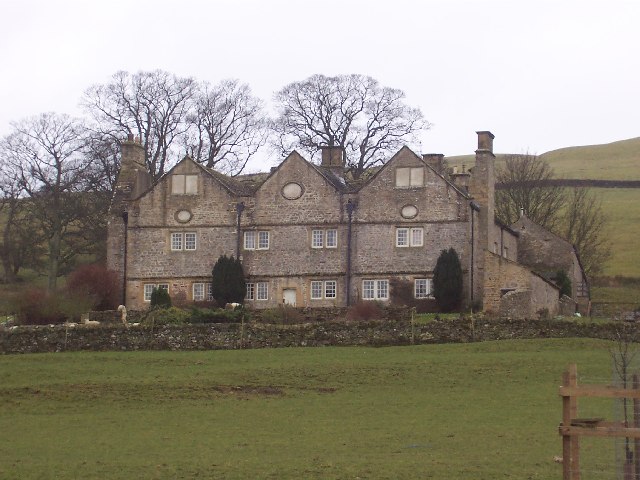
Hanghow Pastures Images

Images are sourced within 2km of 54.266747/-1.8347464 or Grid Reference SE1085. Thanks to Geograph Open Source API. All images are credited.

Field gate for footpath to Caldbergh
Footpath through pasture to Caldbergh in Coverham
Bird Ridding Lane in Coverdale
Green's Beck in Coverham
Ashgill Stables, Tupgill Park
In Caldbergh Tidy farming hamlet on the southern side of Coverdale, affording lovely views across the valley to Pen Hill.
In Caldbergh
Tidy farming hamlet on the southern side of Coverdale, affording lovely views across the valley to Pen Hill.
Narrow Lane leading away from Caldbergh
Stile and footbridge over Little Gill Looking north-eastward.
Stile and footbridge over Little Gill
Looking north-eastward.
Track and cattle grid at Carldbergh Looking north-eastward.
Track and cattle grid at Carldbergh
Looking north-eastward.
Road and Disused Dairy Building near Coverham Looking eastward.
Road and Disused Dairy Building near Coverham
Looking eastward.
Ordnance Survey Flush Bracket 11594 This can be found on the wall of the derelict dairy building in Coverham.
For more detail see : <span class="nowrap"><a title="http://www.bench-marks.org.uk/bm11634" rel="nofollow ugc noopener" href="http://www.bench-marks.org.uk/bm11634">Link</a><img style="margin-left:2px;" alt="External link" title="External link - shift click to open in new window" src="https://s1.geograph.org.uk/img/external.png" width="10" height="10"/></span>
Ordnance Survey Flush Bracket 11594
This can be found on the wall of the derelict dairy building in Coverham. For more detail see : LinkExternal link
Bird Ridding Wath This ford (wath) is found at the foot of Bird Ridding Lane beside Bird Ridding Farm on the River Cover.

<span class="nowrap"><a title="http://youtu.be/cCT4WgeYaak" rel="nofollow ugc noopener" href="http://youtu.be/cCT4WgeYaak">Link</a><img style="margin-left:2px;" alt="External link" title="External link - shift click to open in new window" src="https://s1.geograph.org.uk/img/external.png" width="10" height="10"/></span>
Bird Ridding Wath
This ford (wath) is found at the foot of Bird Ridding Lane beside Bird Ridding Farm on the River Cover. LinkExternal link
Red Way Ford This is a second ford on the byway leading up from Caldbergh.
Red Way Ford
This is a second ford on the byway leading up from Caldbergh.
Ford at Caldbergh This is one of many fords on Red Way, a byway leading from Caldbergh.
Ford at Caldbergh
This is one of many fords on Red Way, a byway leading from Caldbergh.
Ornamental Lake in Tupgill Park Very attractive grounds of Tupgill Park, which also houses the gardens of "Forbidden Corner."
The footpath passes to the left of the lake ascending towards the building on the hill, known as Fern Gill.
Ornamental Lake in Tupgill Park
Very attractive grounds of Tupgill Park, which also houses the gardens of "Forbidden Corner." The footpath passes to the left of the lake ascending towards the building on the hill, known as Fern Gill.
The Fish Temple in Tupgill Park Originally a box that was flooded to allow horses to stand in water for health purposes - but altered in 1985 to provide a curiosity with mosaic floor and fish themed light fittings.
The Fish Temple in Tupgill Park
Originally a box that was flooded to allow horses to stand in water for health purposes - but altered in 1985 to provide a curiosity with mosaic floor and fish themed light fittings.
Ashgill Stables This is racehorse country, with several stables in the vicinity - taking advantage of the facilities offered on Middleham Low Moor.
Ashgill Stables
This is racehorse country, with several stables in the vicinity - taking advantage of the facilities offered on Middleham Low Moor.
Bridleway leaving Tupgill Park Exiting Tupgill Park onto Middleham Low Moor
Bridleway leaving Tupgill Park
Exiting Tupgill Park onto Middleham Low Moor
Show me another place!

Hanghow Pastures is located at Grid Ref: SE1085 (Lat: 54.266747, Lng: -1.8347464)

Division: North Riding

Administrative County: North Yorkshire

District: Richmondshire

Police Authority: North Yorkshire

What 3 Words

///village.switch.access. Near Leyburn, North Yorkshire

Related Wikis

Coverham

Coverham is a village in Coverdale in the Yorkshire Dales in North Yorkshire, England. It lies 2 miles (3.2 km) west of the town of Middleham. == History... ==

Coverham Abbey

Coverham Abbey, North Yorkshire, England, was a Premonstratensian monastery that was founded at Swainby in 1190 by Helewisia, daughter of the Chief Justiciar...

Holy Trinity Church, Coverham

Holy Trinity Church is a redundant Anglican church in the village of Coverham, North Yorkshire, England. It is recorded in the National Heritage List...

Braithwaite Hall

Braithwaite Hall is a 17th-century manor house in Coverdale in the Yorkshire Dales in England. It lies 1.8 miles (2.9 km) west of the village of East...

Have you been to Hanghow Pastures?

Leave your review of Hanghow Pastures below (or comments, questions and feedback).