Caldbergh Pasture

Downs, Moorland in Yorkshire Richmondshire

England

Caldbergh Pasture

Field gate for footpath to Caldbergh
Field gate for footpath to Caldbergh Credit: peter robinson

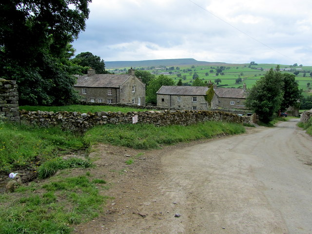
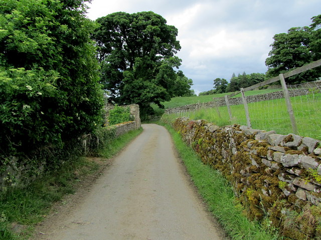
Caldbergh Pasture is a picturesque expanse of land located in the heart of Yorkshire, England. Situated amidst the stunning surroundings of the Yorkshire Dales, this vast area of pastureland is known for its captivating beauty and diverse natural features. The region is primarily characterized by its rolling hills, lush green meadows, and scattered patches of woodland, creating a quintessential countryside setting.

The landscape of Caldbergh Pasture is predominantly hilly, with the terrain gradually ascending to the moorland at its highest points. This creates a visually striking panorama, offering breathtaking views of the surrounding Yorkshire Downs. The area is renowned for its rich biodiversity, with a myriad of plant and animal species inhabiting the region. Visitors can expect to encounter an array of wildlife such as rabbits, foxes, and various bird species.

Caldbergh Pasture is also home to several walking trails, making it a popular destination for outdoor enthusiasts. These paths provide an opportunity to explore the area at a leisurely pace, allowing visitors to take in the serene beauty of the landscape. The pastures are dotted with dry stone walls, adding to the charm and character of the surroundings.

In addition to its natural beauty, Caldbergh Pasture boasts a rich history and cultural heritage. The area is dotted with historical landmarks, including ancient stone circles and burial mounds, which date back thousands of years. These remnants of the past offer a glimpse into the region's fascinating history and provide a sense of connection to its ancient inhabitants.

Overall, Caldbergh Pasture in Yorkshire is a captivating destination that combines stunning natural beauty with a rich historical and cultural significance. It offers visitors a chance to immerse themselves in the tranquil countryside and experience the charm of rural England.

If you have any feedback on the listing, please let us know in the comments section below.

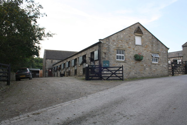
Caldbergh Pasture Images

Images are sourced within 2km of 54.261605/-1.8474013 or Grid Reference SE1085. Thanks to Geograph Open Source API. All images are credited.

Field gate for footpath to Caldbergh
Footpath through pasture to Caldbergh in Coverham
Bird Ridding Lane in Coverdale
Green's Beck in Coverham
Ashgill Stables, Tupgill Park
Red Way Seen here descending towards Caldbergh - part of an ancient thoroughfare that linked Coverdale with Colsterdale.
Red Way
Seen here descending towards Caldbergh - part of an ancient thoroughfare that linked Coverdale with Colsterdale.
Gate across The Red Way
In Caldbergh Tidy farming hamlet on the southern side of Coverdale, affording lovely views across the valley to Pen Hill.
In Caldbergh
Tidy farming hamlet on the southern side of Coverdale, affording lovely views across the valley to Pen Hill.
Narrow Lane leading away from Caldbergh
St Simon's Bridge Looking south-westward.
St Simon's Bridge
Looking south-westward.
Stile and footbridge over Little Gill Looking north-eastward.
Stile and footbridge over Little Gill
Looking north-eastward.
Track and cattle grid at Carldbergh Looking north-eastward.
Track and cattle grid at Carldbergh
Looking north-eastward.
Road and Disused Dairy Building near Coverham Looking eastward.
Road and Disused Dairy Building near Coverham
Looking eastward.
Ordnance Survey Flush Bracket 11594 This can be found on the wall of the derelict dairy building in Coverham.
For more detail see : <span class="nowrap"><a title="http://www.bench-marks.org.uk/bm11634" rel="nofollow ugc noopener" href="http://www.bench-marks.org.uk/bm11634">Link</a><img style="margin-left:2px;" alt="External link" title="External link - shift click to open in new window" src="https://s1.geograph.org.uk/img/external.png" width="10" height="10"/></span>
Ordnance Survey Flush Bracket 11594
This can be found on the wall of the derelict dairy building in Coverham. For more detail see : LinkExternal link
Bird Ridding Wath This ford (wath) is found at the foot of Bird Ridding Lane beside Bird Ridding Farm on the River Cover.

<span class="nowrap"><a title="http://youtu.be/cCT4WgeYaak" rel="nofollow ugc noopener" href="http://youtu.be/cCT4WgeYaak">Link</a><img style="margin-left:2px;" alt="External link" title="External link - shift click to open in new window" src="https://s1.geograph.org.uk/img/external.png" width="10" height="10"/></span>
Bird Ridding Wath
This ford (wath) is found at the foot of Bird Ridding Lane beside Bird Ridding Farm on the River Cover. LinkExternal link
Red Way Ford This is a second ford on the byway leading up from Caldbergh.
Red Way Ford
This is a second ford on the byway leading up from Caldbergh.
Ford at Caldbergh This is one of many fords on Red Way, a byway leading from Caldbergh.
Ford at Caldbergh
This is one of many fords on Red Way, a byway leading from Caldbergh.
Ornamental Lake in Tupgill Park Very attractive grounds of Tupgill Park, which also houses the gardens of "Forbidden Corner."
The footpath passes to the left of the lake ascending towards the building on the hill, known as Fern Gill.
Ornamental Lake in Tupgill Park
Very attractive grounds of Tupgill Park, which also houses the gardens of "Forbidden Corner." The footpath passes to the left of the lake ascending towards the building on the hill, known as Fern Gill.
Show me another place!

Caldbergh Pasture is located at Grid Ref: SE1085 (Lat: 54.261605, Lng: -1.8474013)

Division: North Riding

Administrative County: North Yorkshire

District: Richmondshire

Police Authority: North Yorkshire

What 3 Words

///stirs.loves.shovels. Near Leyburn, North Yorkshire

Related Wikis

Caldbergh with East Scrafton

Caldbergh with East Scrafton is a civil parish in the Richmondshire district of North Yorkshire, England. The parish includes the settlements of Caldbergh...

Caldbergh

Caldbergh (Caldeber in the Domesday Book) is a hamlet within the Yorkshire Dales, North Yorkshire, England. It lies about four miles south of Leyburn....

East Scrafton

East Scrafton is a hamlet in the Yorkshire Dales in the Richmondshire district of North Yorkshire, England. It is about 3 miles (5 km) south-west of Leyburn...

Coverham

Coverham is a village in Coverdale in the Yorkshire Dales in North Yorkshire, England. It lies 2 miles (3.2 km) west of the town of Middleham. == History... ==

Nearby Amenities

Located within 500m of 54.261605,-1.8474013
old mine shaft?
Historic: mine_shaft
Source: Bing
Lat/Long: 54.2627144/-1.8434559
old mine shaft?
Historic: mine_shaft
Source: Bing
Lat/Long: 54.262407/-1.8458275
old mine shaft?
Historic: mine_shaft
Source: Bing
Lat/Long: 54.2624634/-1.8451403
old mine shaft?
Historic: mine_shaft
Source: Bing
Lat/Long: 54.2624634/-1.8449472
old mine shaft?
Historic: mine_shaft
Source: Bing
Lat/Long: 54.2613856/-1.8440889
old mine shaft?
Historic: mine_shaft
Source: Bing
Lat/Long: 54.2626264/-1.843531
old mine shaft?
Historic: mine_shaft
Source: Bing
Lat/Long: 54.2627457/-1.8433271
Building: yes
Lat/Long: 54.2653395/-1.843799
Building: yes
Lat/Long: 54.2627202/-1.8521675
Power: pole
Lat/Long: 54.2620573/-1.8505741
Power: pole
Lat/Long: 54.2619614/-1.85218
Power: pole
Lat/Long: 54.2618561/-1.8540187
Power: pole
Lat/Long: 54.2612698/-1.8502593
Power: pole
Lat/Long: 54.2616696/-1.8504189
Power: pole
Lat/Long: 54.2624304/-1.850695
Power: pole
Lat/Long: 54.2628141/-1.8508638
Power: pole
Lat/Long: 54.2631592/-1.8510257
The data included in this document is from www.openstreetmap.org. The data is made available under ODbL.

Have you been to Caldbergh Pasture?

Leave your review of Caldbergh Pasture below (or comments, questions and feedback).