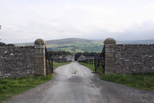
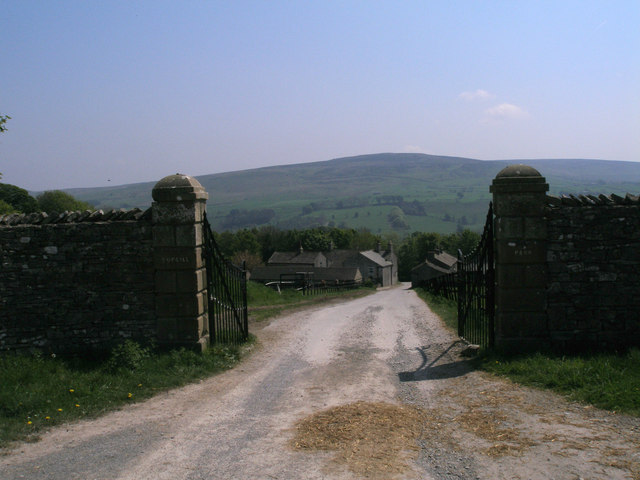
Cotescue Park

Downs, Moorland in Yorkshire Richmondshire

England

Cotescue Park

Field gate for footpath to Caldbergh
Field gate for footpath to Caldbergh Credit: peter robinson

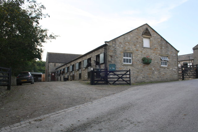
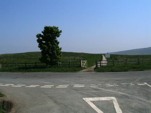
Cotescue Park is a picturesque area located in the heart of Yorkshire, England. Situated in the stunning Yorkshire Downs, this park spans across vast moorland, offering visitors a unique and breathtaking experience.

Covering an area of approximately 20 square miles, Cotescue Park boasts a diverse landscape with rolling hills, expansive meadows, and rugged moorland. The park is renowned for its stunning panoramic views, providing visitors with a sense of tranquility and serenity. The heather-covered moors, especially during late summer, create a vibrant purple carpet that stretches as far as the eye can see.

The park is home to a rich variety of wildlife, making it a popular destination for nature enthusiasts and bird watchers. Visitors may catch a glimpse of the park's resident red grouse, curlews, lapwings, and other unique bird species. The park also supports a healthy population of deer, which can often be spotted gracefully roaming through the open fields.

For those seeking outdoor activities, Cotescue Park offers an extensive network of walking trails and hiking routes. The well-maintained paths cater to all levels of fitness, allowing visitors to explore the park's hidden gems at their own pace. The park also offers opportunities for cycling, horse riding, and picnicking, ensuring there is something for everyone to enjoy.

Cotescue Park is a true gem in the Yorkshire countryside, offering visitors a chance to escape the hustle and bustle of city life and immerse themselves in the beauty of nature. Whether it's a leisurely stroll, a challenging hike, or simply admiring the stunning views, this park is a must-visit destination for those seeking an unforgettable experience in Yorkshire.

If you have any feedback on the listing, please let us know in the comments section below.

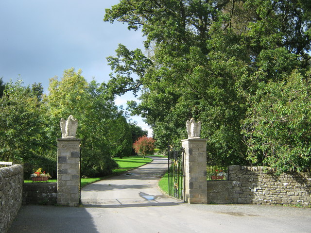
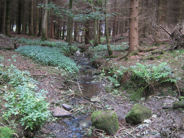
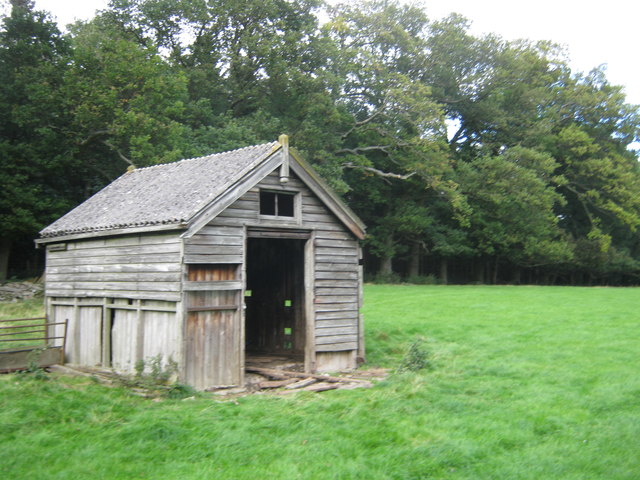
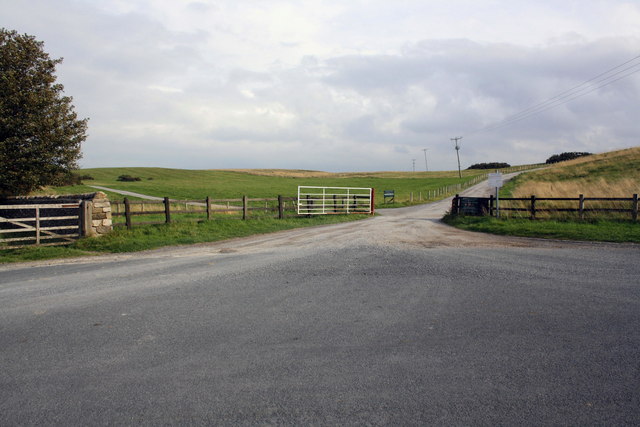
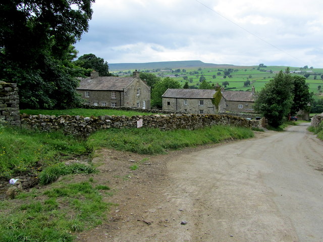
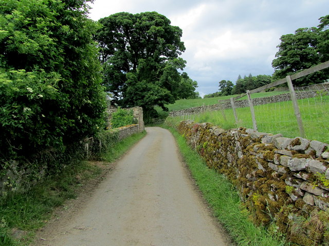
Cotescue Park Images

Images are sourced within 2km of 54.275456/-1.8416683 or Grid Reference SE1086. Thanks to Geograph Open Source API. All images are credited.

Field gate for footpath to Caldbergh
Footpath through pasture to Caldbergh in Coverham
Bird Ridding Lane in Coverdale
Green's Beck in Coverham
Entrance drive to Spigot Lodge, Coverham
Unnamed watercourse in Millers Gill Plantation
Derelict hut north of Millers Gill Plantation
Roads at Middleham Low Moor near Spigot Lodge
Entrance gates to Tupgill Park
Ashgill Stables, Tupgill Park
Western entrance to Middleham Low Moor
Entrance to Tupgill Park
In Caldbergh Tidy farming hamlet on the southern side of Coverdale, affording lovely views across the valley to Pen Hill.
In Caldbergh
Tidy farming hamlet on the southern side of Coverdale, affording lovely views across the valley to Pen Hill.
Narrow Lane leading away from Caldbergh
Track and cattle grid at Carldbergh Looking north-eastward.
Track and cattle grid at Carldbergh
Looking north-eastward.
Road and Disused Dairy Building near Coverham Looking eastward.
Road and Disused Dairy Building near Coverham
Looking eastward.
Ordnance Survey Flush Bracket 11594 This can be found on the wall of the derelict dairy building in Coverham.
For more detail see : <span class="nowrap"><a title="http://www.bench-marks.org.uk/bm11634" rel="nofollow ugc noopener" href="http://www.bench-marks.org.uk/bm11634">Link</a><img style="margin-left:2px;" alt="External link" title="External link - shift click to open in new window" src="https://s1.geograph.org.uk/img/external.png" width="10" height="10"/></span>
Ordnance Survey Flush Bracket 11594
This can be found on the wall of the derelict dairy building in Coverham. For more detail see : LinkExternal link
Bird Ridding Wath This ford (wath) is found at the foot of Bird Ridding Lane beside Bird Ridding Farm on the River Cover.

<span class="nowrap"><a title="http://youtu.be/cCT4WgeYaak" rel="nofollow ugc noopener" href="http://youtu.be/cCT4WgeYaak">Link</a><img style="margin-left:2px;" alt="External link" title="External link - shift click to open in new window" src="https://s1.geograph.org.uk/img/external.png" width="10" height="10"/></span>
Bird Ridding Wath
This ford (wath) is found at the foot of Bird Ridding Lane beside Bird Ridding Farm on the River Cover. LinkExternal link
Show me another place!

Cotescue Park is located at Grid Ref: SE1086 (Lat: 54.275456, Lng: -1.8416683)

Division: North Riding

Administrative County: North Yorkshire

District: Richmondshire

Police Authority: North Yorkshire

What 3 Words

///stream.housework.walled. Near Leyburn, North Yorkshire

Related Wikis

Holy Trinity Church, Coverham

Holy Trinity Church is a redundant Anglican church in the village of Coverham, North Yorkshire, England. It is recorded in the National Heritage List...

Coverham Abbey

Coverham Abbey, North Yorkshire, England, was a Premonstratensian monastery that was founded at Swainby in 1190 by Helewisia, daughter of the Chief Justiciar...

Coverham

Coverham is a village in Coverdale in the Yorkshire Dales in North Yorkshire, England. It lies 2 miles (3.2 km) west of the town of Middleham. == History... ==
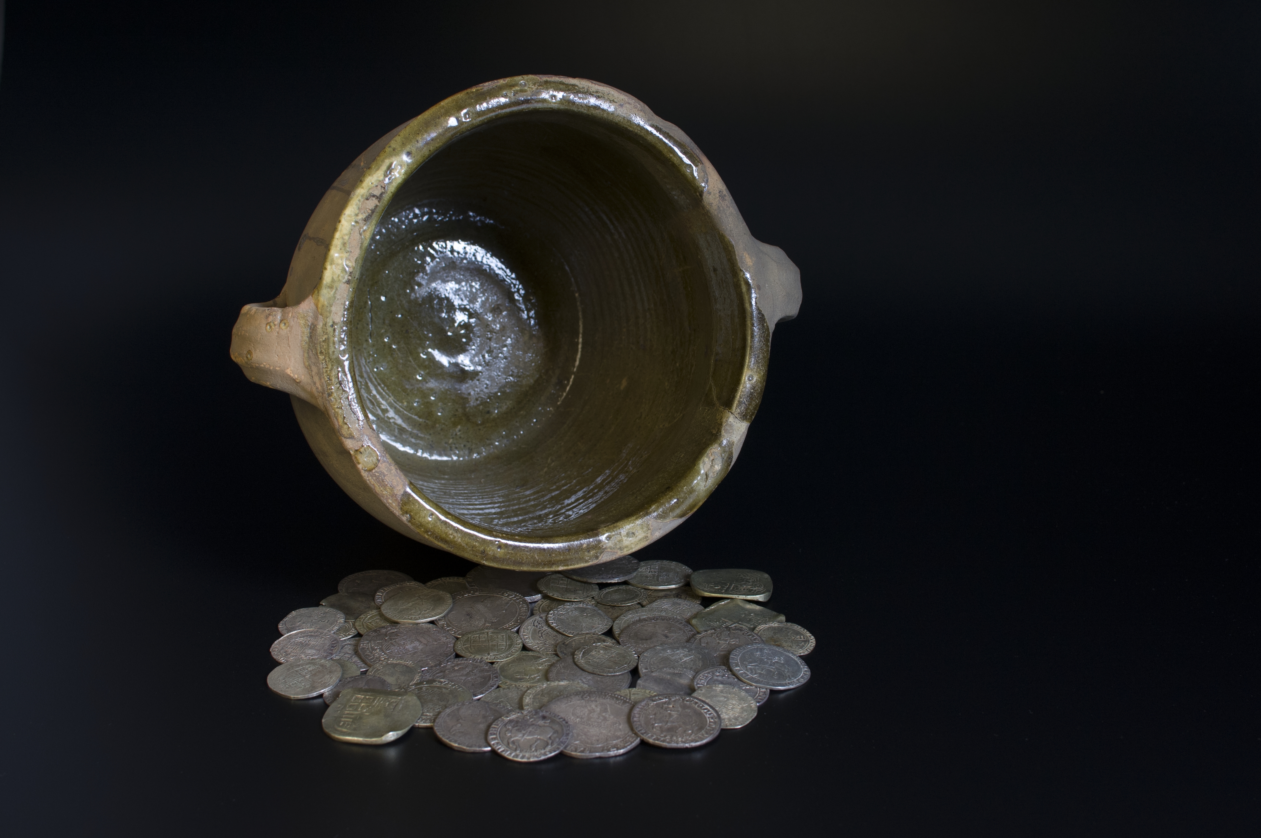
Middleham Hoard

The Middleham Hoard is a coin hoard found near Middleham, North Yorkshire in England. It dates from the period of the English Civil War, and consists of...

Forbidden Corner

The Forbidden Corner is a folly garden located in the Tupgill Park Estate, at Coverham in Coverdale, in the Yorkshire Dales National Park, England. It...
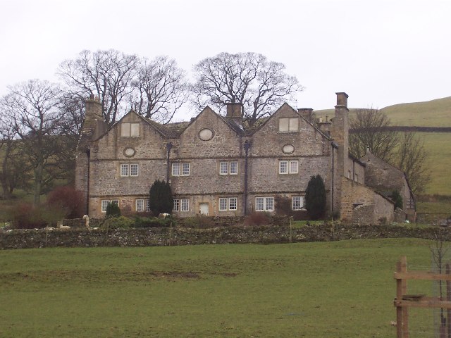
Braithwaite Hall

Braithwaite Hall is a 17th-century manor house in Coverdale in the Yorkshire Dales in England. It lies 1.8 miles (2.9 km) west of the village of East...

Agglethorpe

Agglethorpe is a hamlet in the Richmondshire district of North Yorkshire, England, it lies in northern Coverdale, approximately 4 miles (6.4 km) south...

Caldbergh with East Scrafton

Caldbergh with East Scrafton is a civil parish in the Richmondshire district of North Yorkshire, England. The parish includes the settlements of Caldbergh...

Nearby Amenities

Located within 500m of 54.275456,-1.8416683
Coverham
Place: village
Wikidata: Q5179245
Wikipedia: en:Coverham
Lat/Long: 54.2735391/-1.8463501
Cotescue Park
Place: isolated_dwelling
Lat/Long: 54.2776152/-1.8382216
Access: yes
Entrance: yes
Lat/Long: 54.2728096/-1.8419062
Power: pole
Lat/Long: 54.2755601/-1.8413392
Power: pole
Lat/Long: 54.2755445/-1.84021
Power: pole
Lat/Long: 54.2755131/-1.838944
Power: pole
Lat/Long: 54.27525/-1.8377289
Barrier: stile
Foot: yes
Stile: stepover
Lat/Long: 54.2756342/-1.83592
Power: pole
Lat/Long: 54.2741005/-1.8480635
Power: pole
Lat/Long: 54.2746502/-1.8473741
Power: pole
Lat/Long: 54.2758053/-1.8476182
Power: pole
Lat/Long: 54.2763604/-1.8477684
Power: pole
Lat/Long: 54.2772562/-1.8479455
Power: pole
Lat/Long: 54.2761421/-1.8464587
Power: pole
Lat/Long: 54.2759497/-1.8453097
Power: pole
Lat/Long: 54.2757723/-1.844304
Power: pole
Lat/Long: 54.2756099/-1.8433753
Power: pole
Lat/Long: 54.2771333/-1.8483031
Power: pole
Lat/Long: 54.2778712/-1.8382157
Power: pole
Lat/Long: 54.2777779/-1.8393722
Power: pole
Lat/Long: 54.2772132/-1.8396962
Power: pole
Lat/Long: 54.2763408/-1.8401684
The data included in this document is from www.openstreetmap.org. The data is made available under ODbL.

Have you been to Cotescue Park?

Leave your review of Cotescue Park below (or comments, questions and feedback).