Black Pasture

Downs, Moorland in Yorkshire Craven

England

Black Pasture

Gateway on Brown Bank One of several gateways leading to grouse butts on the east side of Barden Fell.
Gateway on Brown Bank Credit: Ray Woodcraft

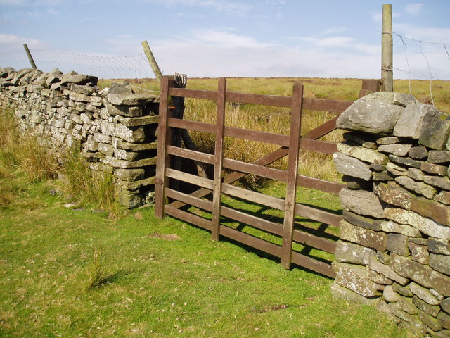
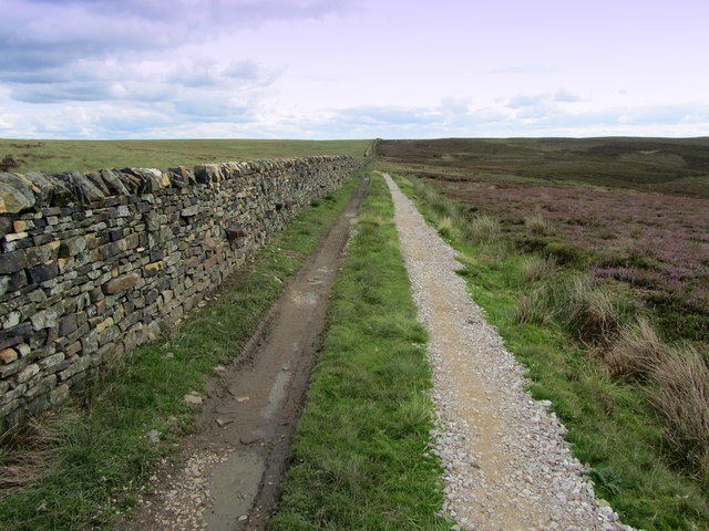
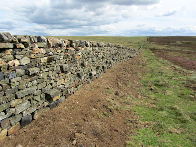
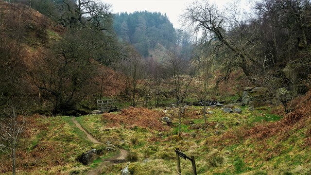
Black Pasture is a vast and picturesque landscape located in Yorkshire, England. Situated primarily in the Yorkshire Dales National Park, it encompasses a combination of downs, moorland, and rolling hills. This area is renowned for its natural beauty and rich biodiversity, attracting visitors from far and wide.

The downs of Black Pasture present a stunning sight, with their gently sloping hills adorned by vibrant green grass and scattered shrubs. The landscape is characterized by its open spaces and uninterrupted views, providing a sense of tranquility and peacefulness. The downs are home to a variety of plant species, including heather, gorse, and wildflowers, which create a beautiful tapestry of colors throughout the seasons.

Moving towards the moorland, the terrain becomes more rugged and undulating. Here, heather dominates the landscape, covering vast stretches of land with its purple hues. Moorland birds such as curlews, grouse, and lapwings can be spotted, adding to the area's natural charm and appeal.

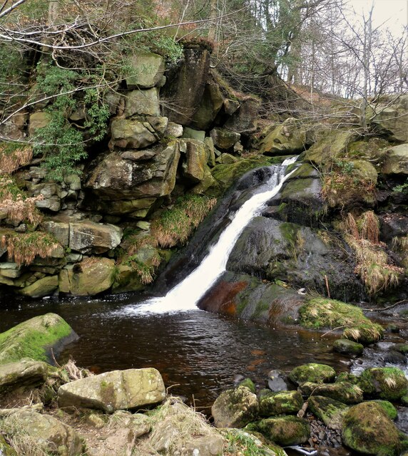
Black Pasture offers numerous opportunities for outdoor activities, including hiking, cycling, and wildlife observation. The network of footpaths and trails allows visitors to explore the area at their own pace, immersing themselves in the breathtaking scenery. The solitude and serenity of Black Pasture provide an ideal escape from the hustle and bustle of city life, offering a chance to connect with nature and rejuvenate the mind and soul.

In conclusion, Black Pasture in Yorkshire is a stunning landscape that seamlessly combines downs, moorland, and rolling hills. Its natural beauty, diverse flora, and fauna, and abundance of outdoor activities make it a must-visit destination for nature enthusiasts and those seeking a peaceful retreat.

If you have any feedback on the listing, please let us know in the comments section below.

Black Pasture Images

Images are sourced within 2km of 54.012103/-1.8692198 or Grid Reference SE0857. Thanks to Geograph Open Source API. All images are credited.

Gateway on Brown Bank One of several gateways leading to grouse butts on the east side of Barden Fell.
Gateway on Brown Bank
One of several gateways leading to grouse butts on the east side of Barden Fell.
Shooting Track near Rom Shaw Head Track and Dry Stone Wall side by side on lonely moorland
Shooting Track near Rom Shaw Head
Track and Dry Stone Wall side by side on lonely moorland
Boundary Wall near Rom Shaw Head Following this boundary wall that runs south east/north west in a straight line over Barden Fell
Boundary Wall near Rom Shaw Head
Following this boundary wall that runs south east/north west in a straight line over Barden Fell
Track to Rocking Hall Moorland track crossing Barden Fell en route to isolated Rocking Hall
Track to Rocking Hall
Moorland track crossing Barden Fell en route to isolated Rocking Hall
Looking Down Middle Tongue Gill Endless moors - preserve of the grouse
Looking Down Middle Tongue Gill
Endless moors - preserve of the grouse
Approaching the gate at Gledstones
Gledstones Gate
Gledstones Gate
Posforth Gill waterfall Posforth Gill waterfall.
Posforth Gill waterfall
Posforth Gill waterfall.
A circular walk along the River Wharfe [29] Posforth Bridge carries the minor road over Posforth Gill Beck.
Starting from the Cavendish Pavilion, the walk follows the west bank of the River Wharfe upstream, passing The Strid, to the Barden Aqueduct Bridge. Crossing to the east bank, the walk continues downstream to return to the starting point. Just over 3½ miles.
A circular walk along the River Wharfe [29]
Posforth Bridge carries the minor road over Posforth Gill Beck. Starting from the Cavendish Pavilion, the walk follows the west bank of the River Wharfe upstream, passing The Strid, to the Barden Aqueduct Bridge. Crossing to the east bank, the walk continues downstream to return to the starting point. Just over 3½ miles.
A circular walk along the River Wharfe [30] The footbridge, alongside Posforth Bridge <a href="https://www.geograph.org.uk/photo/7019749">SE0755 : A circular walk along the River Wharfe [29]</a>, carries the path over Posforth Gill Beck.
Starting from the Cavendish Pavilion, the walk follows the west bank of the River Wharfe upstream, passing The Strid, to the Barden Aqueduct Bridge. Crossing to the east bank, the walk continues downstream to return to the starting point. Just over 3½ miles.
A circular walk along the River Wharfe [30]
The footbridge, alongside Posforth Bridge SE0755 : A circular walk along the River Wharfe [29], carries the path over Posforth Gill Beck. Starting from the Cavendish Pavilion, the walk follows the west bank of the River Wharfe upstream, passing The Strid, to the Barden Aqueduct Bridge. Crossing to the east bank, the walk continues downstream to return to the starting point. Just over 3½ miles.
Footbridge to Valley of Desolation Path across Posforth Gill Beck
Footbridge to Valley of Desolation
Path across Posforth Gill Beck
Waterfall on Sheepshaw Beck This is just after the Valley of Desolation where the stream is Posforth Gill Beck
Waterfall on Sheepshaw Beck
This is just after the Valley of Desolation where the stream is Posforth Gill Beck
Bolton Abbey, Bolton Park Farm On the 1909 OS map of this location there is a benchmark cut into the north face of the older building on the left. The new building on the right is virtually up against the old building and nothing could be seen.
Bolton Abbey, Bolton Park Farm
On the 1909 OS map of this location there is a benchmark cut into the north face of the older building on the left. The new building on the right is virtually up against the old building and nothing could be seen.
Bolton Abbey, Stead Dike The 1909 OS map shows a benchmark in this location, to the west of the beck. This is quality pasture land and no cutmark was found.
Bolton Abbey, Stead Dike
The 1909 OS map shows a benchmark in this location, to the west of the beck. This is quality pasture land and no cutmark was found.
Bolton Abbey, Bolton Park Farm There is a benchmark marked at this location on the 1909 OS map. A rivet benchmark is cut into the south facing wall on the east side of the cattle grid.
Bolton Abbey, Bolton Park Farm
There is a benchmark marked at this location on the 1909 OS map. A rivet benchmark is cut into the south facing wall on the east side of the cattle grid.
Bolton Abbey, Stead Dike The pivot benchmark is cut into a boulder on the west side of the Dike and at the top of the ravine. It is a short distance from the path.
Bolton Abbey, Stead Dike
The pivot benchmark is cut into a boulder on the west side of the Dike and at the top of the ravine. It is a short distance from the path.
Bolton Abbey, Stead Dike There is a pivot benchmark cut into a boulder on the west side of the Dike and at the top of the ravine. It is a short distance from the path.
Bolton Abbey, Stead Dike
There is a pivot benchmark cut into a boulder on the west side of the Dike and at the top of the ravine. It is a short distance from the path.
Show me another place!

Black Pasture is located at Grid Ref: SE0857 (Lat: 54.012103, Lng: -1.8692198)

Division: West Riding

Administrative County: North Yorkshire

District: Craven

Police Authority: North Yorkshire

What 3 Words

///twist.lance.initiated. Near Addingham, West Yorkshire

Related Wikis

Simon's Seat

Simon's Seat is a peak in the Yorkshire Dales in northern England. It is a prominent outcrop of millstone grit on the eastern side of Wharfedale. Although...

Hazlewood with Storiths

Hazlewood with Storiths is a civil parish in the Craven district of North Yorkshire, England. The population of the civil parish as of the 2011 census...

Cavendish memorial fountain

The Cavendish memorial fountain is a drinking fountain erected in 1886 at Bolton Abbey, North Yorkshire, England as a memorial to Lord Frederick Cavendish...

Bolton Abbey

Bolton Abbey in Wharfedale, North Yorkshire, England, takes its name from the ruins of the 12th-century Augustinian monastery now known as Bolton Priory...

Bolton Priory

Bolton Priory, whose full title is The Priory Church of St Mary and St Cuthbert, Bolton Abbey, is a Grade I listed parish church of the Church of England...

Hazlewood

Hazlewood is a hamlet in the English county of North Yorkshire. Hazlewood lies to the east of the town of Skipton by 7.5 miles (12.1 km) and is located...

Barden Tower

Barden Tower is a ruined building in the Parish of Barden, in Wharfedale, North Yorkshire, England. The tower was used as a hunting lodge in the 15th and...

Barden, Craven

Barden is a civil parish in the Craven district of North Yorkshire, England. It consists of the hamlet of Drebley and a few scattered houses in Wharfedale...

Nearby Amenities

Located within 500m of 54.012103,-1.8692198
Ford: yes
Lat/Long: 54.01306/-1.8664955
Dicken Nook
Place: locality
Source: OS sheet 152, publ. 1854
Lat/Long: 54.009271/-1.8706421
Natural: spring
Source: OS sheet 152, publ. 1854
Lat/Long: 54.0108347/-1.8730292
Black Pasture
Natural: fell
Source: OS sheet 152, publ. 1854
Lat/Long: 54.0124294/-1.8709213
Natural: spring
Source: NLS-OS-1st_Series
Lat/Long: 54.0085756/-1.8723947
Natural: spring
Source: NLS-OS-1st_Series
Lat/Long: 54.0157002/-1.8667513
The data included in this document is from www.openstreetmap.org. The data is made available under ODbL.

Have you been to Black Pasture?

Leave your review of Black Pasture below (or comments, questions and feedback).