Mickley Common

Downs, Moorland in Northumberland

England

Mickley Common

New Ridley village, not looking its best.
New Ridley village, not looking its best. Credit: Ann Hodgson

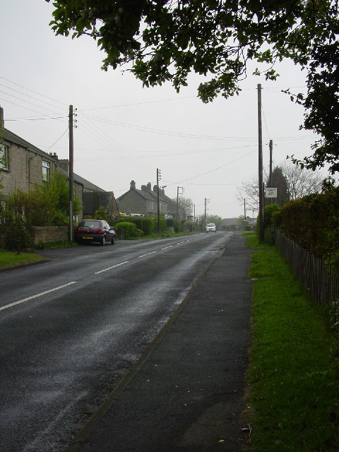
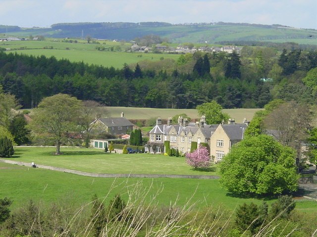
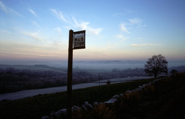
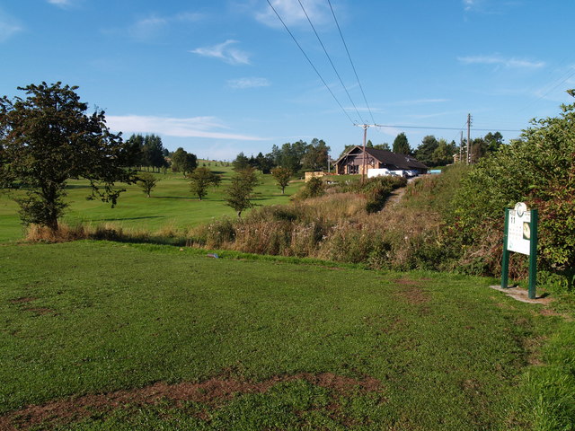
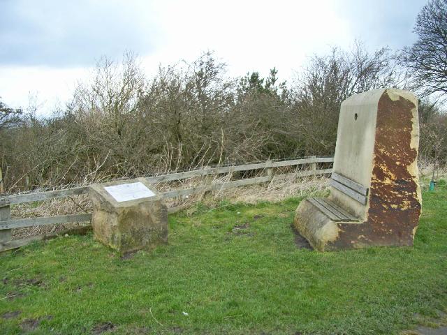
Mickley Common, located in the county of Northumberland in England, is a picturesque area known for its stunning downs and moorland landscapes. Spanning approximately 200 acres, Mickley Common is a designated Site of Special Scientific Interest (SSSI) due to its rich biodiversity and significant geological features.

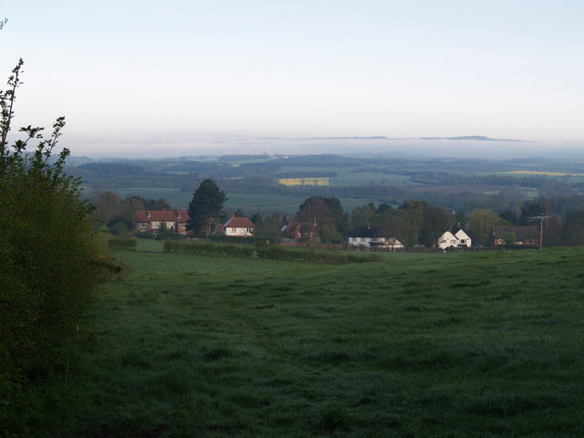
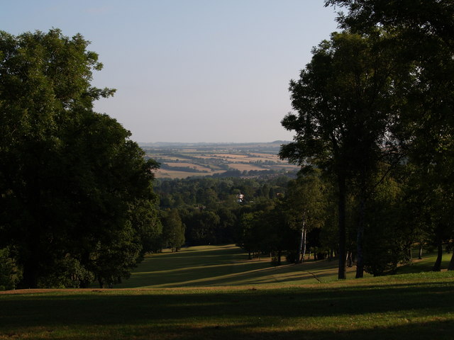
The downs of Mickley Common are characterized by gently rolling hills covered in lush grasses and wildflowers, creating a vibrant and colorful scenery throughout the year. This area provides habitat for a variety of bird species, including skylarks and meadow pipits, attracting birdwatchers and nature enthusiasts alike.

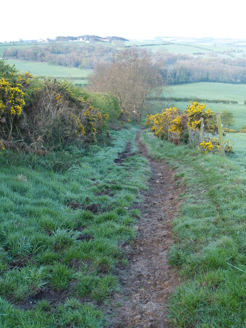
In contrast, the moorland of Mickley Common offers a more rugged and wild environment. Here, heather dominates the landscape, painting the hillsides in vibrant hues of purple during the summer months. The moorland is also home to several species of ground-nesting birds, such as curlews and lapwings, which thrive in the open and undisturbed habitat.

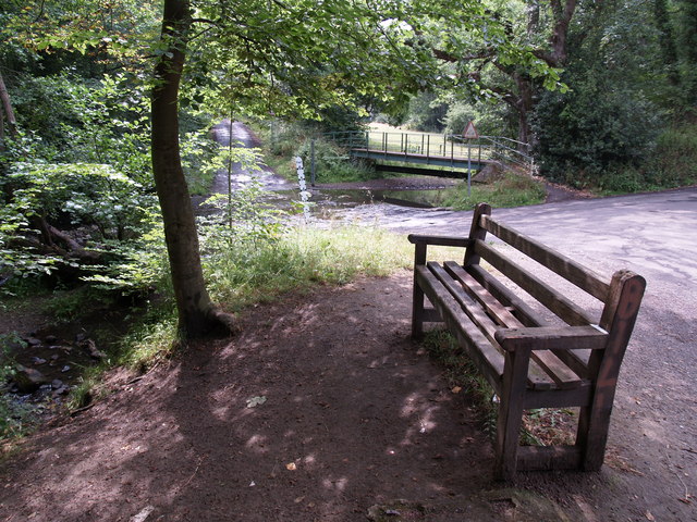
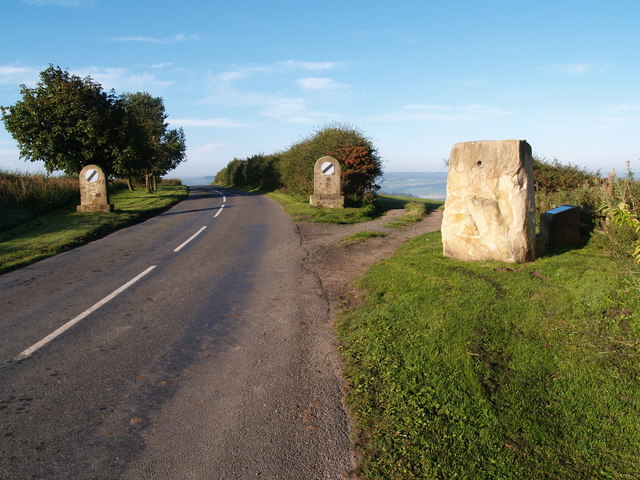
Visitors to Mickley Common can enjoy a range of activities, including walking and hiking along the numerous trails that crisscross the area. The stunning vistas from the downs and moorland provide excellent opportunities for photography and painting, attracting artists and photographers from near and far.

Mickley Common is a haven for nature lovers and a vital ecosystem within Northumberland. Its diverse landscapes and abundant wildlife make it a must-visit destination for those seeking a peaceful retreat in the heart of nature.

If you have any feedback on the listing, please let us know in the comments section below.

Mickley Common Images

Images are sourced within 2km of 54.941502/-1.8932471 or Grid Reference NZ0660. Thanks to Geograph Open Source API. All images are credited.
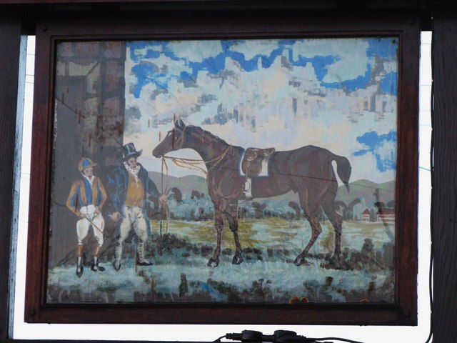
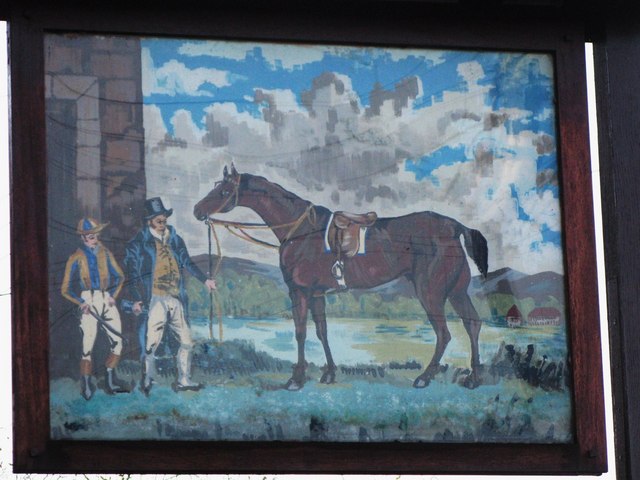
New Ridley village, not looking its best.
Hindley from Bale Hill
Bus Stop, New Ridley
Foot Bridge and Ford on Batt House Road
Stocksfield Golf Club and Course
Hedley on the Hill village limits and Millennium Stone The road climbs up the steep hill from Stocksfield and enters the village from the west. The Millennium Stone has a seat on the other side for those wanting to enjoy the grand view of the Tyne valley.
Hedley on the Hill village limits and Millennium Stone
The road climbs up the steep hill from Stocksfield and enters the village from the west. The Millennium Stone has a seat on the other side for those wanting to enjoy the grand view of the Tyne valley.
Hedley on the Hill A village perched perched high on the crest of the ridge between the Derwent valley and Tynedale at an altitudeof about 240 metres.
Hedley on the Hill
A village perched perched high on the crest of the ridge between the Derwent valley and Tynedale at an altitudeof about 240 metres.
T-Rex, Hedley on the Hill
The Feathers Public house in the dramatically sited village of Hedley-on-the-Hill. The name the Feathers derives from the feathers on the plumes of the horses used to carry lead ore from the mines at Allendale to the smelters at Blaydon. Hedley was an overnight stop on the "Lead road" in the 19th century.
The Feathers
Public house in the dramatically sited village of Hedley-on-the-Hill. The name the Feathers derives from the feathers on the plumes of the horses used to carry lead ore from the mines at Allendale to the smelters at Blaydon. Hedley was an overnight stop on the "Lead road" in the 19th century.
Hedley-on-the-Hill Millennium Stone A seat has been factored in to the Millennium Stone which stands at the western end of the village. An interpretive plaque stands close by. From the seat, dramatic views of the Tyne valley and of Northumberland can be seen.
Hedley-on-the-Hill Millennium Stone
A seat has been factored in to the Millennium Stone which stands at the western end of the village. An interpretive plaque stands close by. From the seat, dramatic views of the Tyne valley and of Northumberland can be seen.
East Ridley, Stocksfield Houses at East Ridley
East Ridley, Stocksfield
Houses at East Ridley
Modigars Lane footpath
The Dr. Syntax Dr Syntax was born in 1811 and won the Preston Gold Cup seven times, the Richmond Gold Cup five times, and Lancaster Gold Cup five times.  He was trained in Middleham near Leyburn, was the sire of the famous racehorse Beeswing and died in 1838. [My thanks to Trish Steel for this information.] See also <a href="https://www.geograph.org.uk/photo/1034808">NZ0962 : The Dr. Syntax</a>.
The Dr. Syntax
Dr Syntax was born in 1811 and won the Preston Gold Cup seven times, the Richmond Gold Cup five times, and Lancaster Gold Cup five times. He was trained in Middleham near Leyburn, was the sire of the famous racehorse Beeswing and died in 1838. [My thanks to Trish Steel for this information.] See also NZ0962 : The Dr. Syntax.
Sign for the Dr. Syntax See <a href="https://www.geograph.org.uk/photo/1056661">NZ0559 : The Dr. Syntax</a>.
Sign for the Dr. Syntax
Sign for the Dr. Syntax - the other side: spot the differences See <a href="https://www.geograph.org.uk/photo/1056668">NZ0559 : Sign for the Dr. Syntax</a>. The jockey, who is looking in a slightly different direction, appears to have bushier eyebrows and has also done something to his sideboards; he has also taken off his white scarf. The owner, who has moved back slightly (so that there is no gap of sky between him and the building) has either a smaller hat or a larger head or both, and now wears a plain white scarf; also, his waistcoat now sports several buttons, possibly transferred from his gaiters. The horse's reins are different (below its neck) and the stirrup is of a different type. In the background below the horse's head there is now only one hill where there used to be two. The whole of the right hand building with the red roof is now visible. Oh, and the sky is completely different. Otherwise quite similar.
Sign for the Dr. Syntax - the other side: spot the differences
See NZ0559 : Sign for the Dr. Syntax. The jockey, who is looking in a slightly different direction, appears to have bushier eyebrows and has also done something to his sideboards; he has also taken off his white scarf. The owner, who has moved back slightly (so that there is no gap of sky between him and the building) has either a smaller hat or a larger head or both, and now wears a plain white scarf; also, his waistcoat now sports several buttons, possibly transferred from his gaiters. The horse's reins are different (below its neck) and the stirrup is of a different type. In the background below the horse's head there is now only one hill where there used to be two. The whole of the right hand building with the red roof is now visible. Oh, and the sky is completely different. Otherwise quite similar.
1st Tee Stocksfield Golf Course
Stocksfield Golf Course
Fairway at Stocksfield Golf Course
Show me another place!

Mickley Common is located at Grid Ref: NZ0660 (Lat: 54.941502, Lng: -1.8932471)

Unitary Authority: Northumberland

Police Authority: Northumbria

What 3 Words

///evenings.spinning.unloads. Near Stocksfield, Northumberland

Related Wikis

Painshawfield Estate

The Painshawfield, Batt House and Birches Nook Estate is a housing estate in the village of Stocksfield in Northumberland, England. It is commonly known...

Branch End

Branch End is part of the village of Stocksfield in Northumberland, England. It is situated at the junction of the A695 Main Road with New Ridley Road...

West Mickley

West Mickley is a hamlet east of Stocksfield, in the southern part of Northumberland, England. Along with the neighbouring settlements of High Mickley...

Mickley, Northumberland

Mickley is a cluster of small settlements and former civil parish, now in the parish of Prudhoe, in the Tyne Valley, between Prudhoe and Stocksfield in...

Nearby Amenities

Located within 500m of 54.941502,-1.8932471
Crossing: informal
Lat/Long: 54.9411142/-1.899141
Crossing: informal
Lat/Long: 54.9414045/-1.8990841
Noexit: yes
Lat/Long: 54.940872/-1.8960556
Noexit: yes
Lat/Long: 54.9407426/-1.8965223
Noexit: yes
Lat/Long: 54.9404514/-1.8963882
Noexit: yes
Lat/Long: 54.9384184/-1.8950977
Post Box
Ref: NE43 597
Lat/Long: 54.940104/-1.8963709
Generator Method: photovoltaic
Generator Output Electricity: yes
Generator Source: solar
Generator Type: solar_photovoltaic_panel
Location: roof
Power: generator
Lat/Long: 54.9411868/-1.898113
Generator Method: photovoltaic
Generator Output Electricity: yes
Generator Source: solar
Generator Type: solar_photovoltaic_panel
Location: roof
Power: generator
Lat/Long: 54.9406415/-1.8991855
Generator Method: photovoltaic
Generator Output Electricity: yes
Generator Source: solar
Generator Type: solar_photovoltaic_panel
Location: roof
Power: generator
Lat/Long: 54.9408015/-1.8992774
Generator Method: photovoltaic
Generator Output Electricity: yes
Generator Source: solar
Generator Type: solar_photovoltaic_panel
Location: roof
Power: generator
Lat/Long: 54.9408096/-1.8992105
Generator Method: photovoltaic
Generator Output Electricity: yes
Generator Source: solar
Generator Type: solar_photovoltaic_panel
Location: roof
Power: generator
Lat/Long: 54.942099/-1.89938
Generator Method: photovoltaic
Generator Output Electricity: yes
Generator Source: solar
Generator Type: solar_photovoltaic_panel
Location: roof
Power: generator
Lat/Long: 54.9428862/-1.899431
Defibrillator
Access: yes
Emergency: defibrillator
Image: https://i.imgur.com/GyejkSB.jpeg
Image 0: https://i.imgur.com/B6hI7pi.jpeg
Indoor: no
Lat/Long: 54.9411484/-1.8992065
Street Lamp
Ref: 35BS
Lat/Long: 54.9426693/-1.9001951
Street Lamp
Ref: 37BS
Support: pole
Lat/Long: 54.9427019/-1.9001994
Generator Method: photovoltaic
Generator Output Electricity: yes
Generator Source: solar
Generator Type: solar_photovoltaic_panel
Location: roof
Power: generator
Lat/Long: 54.9394748/-1.8985807
Grit Bin
Colour: yellow
Material: plastic
Lat/Long: 54.941956/-1.8994697
Grit Bin
Colour: yellow
Material: plastic
Lat/Long: 54.9434987/-1.8993366
Grit Bin
Colour: yellow
Material: plastic
Lat/Long: 54.9408778/-1.8983837
Grit Bin
Colour: yellow
Material: plastic
Lat/Long: 54.9437757/-1.8982148
Bench
Lat/Long: 54.943897/-1.8979184
Grit Bin
Colour: yellow
Material: plastic
Lat/Long: 54.9430862/-1.8996574
Generator Method: photovoltaic
Generator Output Electricity: yes
Generator Source: solar
Generator Type: solar_photovoltaic_panel
Location: roof
Power: generator
Lat/Long: 54.9386425/-1.897787
Charging Station
Access: private
Bicycle: no
Capacity: 1
Motorcar: yes
Socket Type2: 1
Lat/Long: 54.9408092/-1.8985359
The data included in this document is from www.openstreetmap.org. The data is made available under ODbL.

Have you been to Mickley Common?

Leave your review of Mickley Common below (or comments, questions and feedback).