Brocka Bank Moor

Downs, Moorland in Yorkshire

England

Brocka Bank Moor

Beware! Lots of obstacles Narrow lane at the north side of Addingham. The bridge in the distance carried the former Ilkley to Skipton railway.
Beware! Lots of obstacles Credit: Malcolm Street

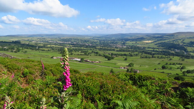
Brocka Bank Moor is a picturesque area located in the county of Yorkshire, England. Situated on the outskirts of the town of Malton, it is renowned for its stunning natural beauty and diverse ecosystems. Covering an extensive area of downs and moorland, Brocka Bank Moor offers visitors a unique opportunity to immerse themselves in the tranquility of the countryside.

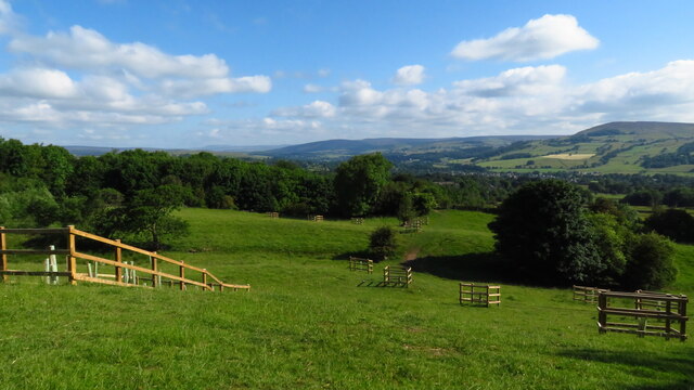
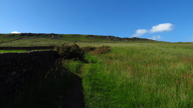
The moorland of Brocka Bank is characterized by its vast stretches of heather-covered hills, providing a breathtaking display of purple hues during the summer months. The undulating landscape is interspersed with small streams and glistening tarns, adding to the area's charm. This type of environment is home to a variety of wildlife, including grouse, curlews, and various species of butterflies.

In addition to its natural splendor, Brocka Bank Moor also boasts a rich cultural heritage. The area has a long history of human occupation, with evidence of ancient settlements and burial mounds dating back thousands of years. Visitors can explore these historical sites and gain insight into the lives of the people who once called this place home.

The moorland is crisscrossed with a network of walking trails, making it a popular destination for hikers and nature enthusiasts. These paths provide stunning views of the surrounding countryside and allow visitors to fully appreciate the raw beauty of the landscape.

Overall, Brocka Bank Moor offers a perfect blend of natural beauty, cultural history, and recreational opportunities. Whether it be for a peaceful walk, birdwatching, or simply admiring the breathtaking scenery, this area is a must-visit for anyone seeking an authentic Yorkshire experience.

If you have any feedback on the listing, please let us know in the comments section below.

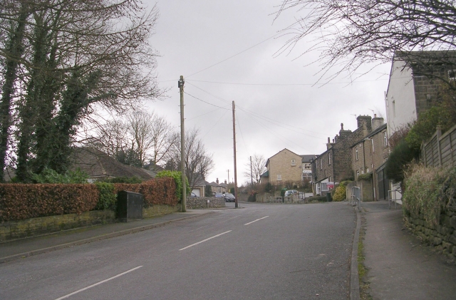
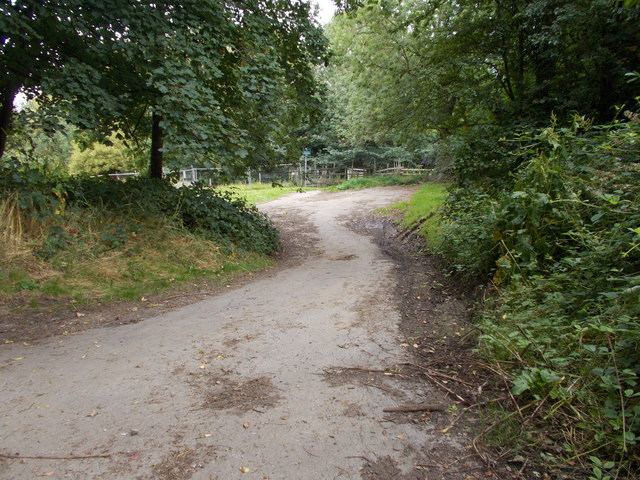
Brocka Bank Moor Images

Images are sourced within 2km of 53.93057/-1.9006346 or Grid Reference SE0648. Thanks to Geograph Open Source API. All images are credited.

Beware! Lots of obstacles Narrow lane at the north side of Addingham. The bridge in the distance carried the former Ilkley to Skipton railway.
Beware! Lots of obstacles
Narrow lane at the north side of Addingham. The bridge in the distance carried the former Ilkley to Skipton railway.
Footpath - School Lane
The Green - Green Lane
Hodgson Fold - Skipton Road
Well Close - Skipton Road
Moor Lane - Skipton Road
Moor Park Drive - Moor Lane
Footpath - School Lane
Skipton Road - viewed from School Lane
The Green - viewed from Skipton Road
On hill path at Addingham Moorside with view towards Small Banks
Path leading uphill from Addingham Moorside towards Black Hill
Cragg House from Piper's Crag, Rombalds Moor
Milestone Brown Bank Lane / Turner Lane Junction Freshly painted and refurbished
Milestone Brown Bank Lane / Turner Lane Junction
Freshly painted and refurbished
High House Mews, Addingham
Old Sighting Tower A listed building grade II, built for surveying the route of Bradford Waterworks conduit from Barden and Chelker Reservoirs.
Old Sighting Tower
A listed building grade II, built for surveying the route of Bradford Waterworks conduit from Barden and Chelker Reservoirs.
Show me another place!

Brocka Bank Moor is located at Grid Ref: SE0648 (Lat: 53.93057, Lng: -1.9006346)

Division: West Riding

Unitary Authority: Bradford

Police Authority: West Yorkshire

What 3 Words

///dissolves.countries.stilted. Near Addingham, West Yorkshire

Related Wikis

Addingham

Addingham (formerly Haddincham c. 972, Odingehem 1086) is a village and civil parish in the City of Bradford in West Yorkshire, England. It is situated...

Craven (Bradford ward)

Craven is an electoral ward within the City of Bradford Metropolitan District Council, West Yorkshire, England. The population of the ward at the 2011...

Addingham railway station

Addingham railway station was on the Midland Railway route from Skipton to Ilkley. It served the village of Addingham in West Yorkshire, England. ��2...

St Peter's Church, Addingham

St Peter's Church is a Church of England parish church in Addingham, West Yorkshire. It is a Grade I listed building, with the main structure dating to...

Nearby Amenities

Located within 500m of 53.93057,-1.9006346
High House
Building: yes
Source: NPE
Wikidata: Q26600684
Lat/Long: 53.9296182/-1.8939346
Slade
Building: yes
Source: NPE
Source Name: OS 1:25k
Lat/Long: 53.9262182/-1.899181
Turner Lane
Local Ref: 45024552
Naptan AtcoCode: 450024552
Naptan Bearing: N
Naptan BusStopType: CUS
Naptan CommonName: Turner Lane
Naptan Crossing: Brown Bank Lane
Naptan Indicator: Stop 45024552
Naptan PlusbusZoneRef: LEEDS
Naptan ShortCommonName: Brown Bank Lane
Naptan Street: Turner Lane
Naptan Verified: no
Source: naptan_import
Lat/Long: 53.9311643/-1.9051597
Nudge Hill
Natural: peak
Source: OS 1:25k
Lat/Long: 53.9302733/-1.902967
Brocka Bank Moor
Natural: moor
Source: OS 1:25k
Lat/Long: 53.9314608/-1.89992
Brocka Bank Hill
Natural: peak
Source: OS 1:25k
Lat/Long: 53.9330021/-1.8979888
Pentley Hill
Natural: peak
Source: OS OpenData StreetView
Lat/Long: 53.9306729/-1.9074737
Power: pole
Source: Bing
Lat/Long: 53.9268911/-1.9032845
Power: pole
Source: Bing
Lat/Long: 53.9274218/-1.9037781
Power: pole
Source: Bing
Lat/Long: 53.9263605/-1.902791
Power: pole
Source: Bing
Lat/Long: 53.9263889/-1.9007203
Power: pole
Source: Bing
Lat/Long: 53.9270794/-1.8985429
Power: pole
Source: Bing
Lat/Long: 53.9273984/-1.8974164
Barrier: stile
Lat/Long: 53.9325926/-1.8945737
Barrier: stile
Lat/Long: 53.9330616/-1.8945795
Nudge Well
Natural: spring
Source: NLS-OS-NatGrid-110k-1940-60
Lat/Long: 53.9315903/-1.903183
Nudge Hill End
Man Made: survey_point
Natural: peak
Source: OS 1853 sheet 169
Lat/Long: 53.9308203/-1.9037173
Long Gate Head
Place: locality
Source: OS 1853 sheet 169
Lat/Long: 53.9298418/-1.9024781
Power: pole
Lat/Long: 53.9280137/-1.8954849
Power: pole
Lat/Long: 53.9277152/-1.8964478
Barrier: cattle_grid
Source: Bing
Lat/Long: 53.9297895/-1.8949942
Power: pole
Source: Bing
Lat/Long: 53.9267407/-1.8996102
The data included in this document is from www.openstreetmap.org. The data is made available under ODbL.

Have you been to Brocka Bank Moor?

Leave your review of Brocka Bank Moor below (or comments, questions and feedback).