Bellridge Fell

Downs, Moorland in Northumberland

England

Bellridge Fell

Bygate Hill Standing Stone A standing stone of Bronze Age date, situated on the highest part of Bygate Hill now within a forest plantation. The stone, which is much weathered in appearance is 1.1 metre high and 0.6 metres by 0.65 metres wide. It is fashioned from a large block of stone which is square in profile and leans slightly to the south east. If it wasn't for the dense forest plantation in which the stone is now embedded, the hilltop location would command extensive views in all directions, including north to the Simonside Hills.
Pastscape: <span class="nowrap"><a title="http://www.pastscape.org.uk/hob.aspx?hob_id=20718" rel="nofollow ugc noopener" href="http://www.pastscape.org.uk/hob.aspx?hob_id=20718">Link</a><img style="margin-left:2px;" alt="External link" title="External link - shift click to open in new window" src="https://s1.geograph.org.uk/img/external.png" width="10" height="10"/></span> <span class="nowrap"><a title="https://web.archive.org/web/20170223114618/http://www.pastscape.org.uk/hob.aspx?hob_id=20718" rel="nofollow ugc noopener" href="https://web.archive.org/web/20170223114618/http://www.pastscape.org.uk/hob.aspx?hob_id=20718">Archive Link</a><img style="margin-left:2px;" alt="External link" title="External link - shift click to open in new window" src="https://s1.geograph.org.uk/img/external.png" width="10" height="10"/></span>
The standing stone is a Scheduled Ancient Monument <span class="nowrap"><a title="https://historicengland.org.uk/listing/the-list/list-entry/1015843" rel="nofollow ugc noopener" href="https://historicengland.org.uk/listing/the-list/list-entry/1015843">Link</a><img style="margin-left:2px;" alt="External link" title="External link - shift click to open in new window" src="https://s1.geograph.org.uk/img/external.png" width="10" height="10"/></span>
Antiquarian reports from 1827 suggested that a double stone circle once stood on Heddon Hill (now Bygate Hill). The inner circle was described as being 60 yards in diameter with an outer concentric circle 15 to 20 yards from it. At the centre was a standing stone over 3m high. The stone circles and central stone were said to have been broken up for gateposts and walls. However, later descriptions suggest that the 'stone circle' was in fact the remains of a prehistoric settlement, including possible hut circles. Traces of an earth bank were later reported close to the highest point of the hill, but detailed investigation couldn't be carried out as it was covered by a dense fir plantation <span class="nowrap"><a title="http://ads.ahds.ac.uk/catalogue/collections/nsmr03abstracts/10236.html" rel="nofollow ugc noopener" href="http://ads.ahds.ac.uk/catalogue/collections/nsmr03abstracts/10236.html">Link</a><img style="margin-left:2px;" alt="External link" title="External link - shift click to open in new window" src="https://s1.geograph.org.uk/img/external.png" width="10" height="10"/></span>
Megalithic Portal: <span class="nowrap"><a title="http://www.megalithic.co.uk/article.php?sid=7073" rel="nofollow ugc noopener" href="http://www.megalithic.co.uk/article.php?sid=7073">Link</a><img style="margin-left:2px;" alt="External link" title="External link - shift click to open in new window" src="https://s1.geograph.org.uk/img/external.png" width="10" height="10"/></span>
Modern Antiquarian: <span class="nowrap"><a title="http://www.themodernantiquarian.com/site/3342/bygate_hill.html" rel="nofollow ugc noopener" href="http://www.themodernantiquarian.com/site/3342/bygate_hill.html">Link</a><img style="margin-left:2px;" alt="External link" title="External link - shift click to open in new window" src="https://s1.geograph.org.uk/img/external.png" width="10" height="10"/></span>
Bygate Hill Standing Stone Credit: Andrew Curtis

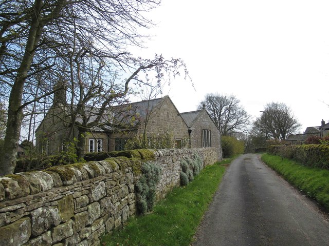
Bellridge Fell is a prominent geographical feature located in the county of Northumberland, England. Situated in the northern part of the county, it is part of the Northumberland National Park and is characterized by its rolling downs and moorland landscape.

Covering an area of approximately 10 square miles, Bellridge Fell is known for its rugged beauty and unspoiled wilderness. The landscape is dominated by heather-covered moorland, interspersed with patches of grassland and scattered rocky outcrops. The fell is also home to a variety of wildlife, including red grouse, curlews, and golden plovers, making it a popular destination for nature enthusiasts and birdwatchers.

The terrain of Bellridge Fell is undulating, with the highest point reaching an elevation of 1,500 feet. This elevation provides stunning panoramic views of the surrounding countryside, including the Cheviot Hills to the west and the North Sea to the east. The fell is crisscrossed by a network of footpaths and trails, allowing visitors to explore its natural beauty on foot.

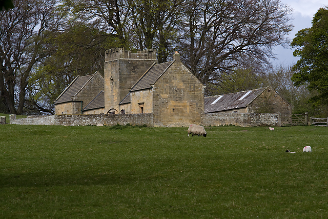
In addition to its natural attractions, Bellridge Fell also holds cultural significance. The area contains several ancient monuments and historical landmarks, including Bronze Age burial mounds and the remnants of old shepherds' huts, providing a glimpse into the region's rich history.

Overall, Bellridge Fell offers a unique blend of natural beauty, tranquil surroundings, and historical interest. Whether it is hiking, birdwatching, or simply enjoying the peacefulness of the moorland, visitors to Bellridge Fell are sure to be captivated by its charm and splendor.

If you have any feedback on the listing, please let us know in the comments section below.

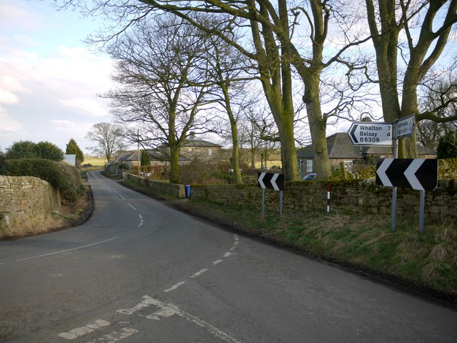
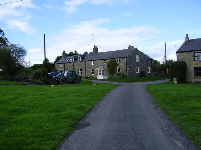
Bellridge Fell Images

Images are sourced within 2km of 55.080827/-1.9220275 or Grid Reference NZ0576. Thanks to Geograph Open Source API. All images are credited.

Bygate Hill Standing Stone A standing stone of Bronze Age date, situated on the highest part of Bygate Hill now within a forest plantation. The stone, which is much weathered in appearance is 1.1 metre high and 0.6 metres by 0.65 metres wide. It is fashioned from a large block of stone which is square in profile and leans slightly to the south east. If it wasn't for the dense forest plantation in which the stone is now embedded, the hilltop location would command extensive views in all directions, including north to the Simonside Hills.
Pastscape: <span class="nowrap"><a title="http://www.pastscape.org.uk/hob.aspx?hob_id=20718" rel="nofollow ugc noopener" href="http://www.pastscape.org.uk/hob.aspx?hob_id=20718">Link</a><img style="margin-left:2px;" alt="External link" title="External link - shift click to open in new window" src="https://s1.geograph.org.uk/img/external.png" width="10" height="10"/></span> <span class="nowrap"><a title="https://web.archive.org/web/20170223114618/http://www.pastscape.org.uk/hob.aspx?hob_id=20718" rel="nofollow ugc noopener" href="https://web.archive.org/web/20170223114618/http://www.pastscape.org.uk/hob.aspx?hob_id=20718">Archive Link</a><img style="margin-left:2px;" alt="External link" title="External link - shift click to open in new window" src="https://s1.geograph.org.uk/img/external.png" width="10" height="10"/></span>
The standing stone is a Scheduled Ancient Monument <span class="nowrap"><a title="https://historicengland.org.uk/listing/the-list/list-entry/1015843" rel="nofollow ugc noopener" href="https://historicengland.org.uk/listing/the-list/list-entry/1015843">Link</a><img style="margin-left:2px;" alt="External link" title="External link - shift click to open in new window" src="https://s1.geograph.org.uk/img/external.png" width="10" height="10"/></span>
Antiquarian reports from 1827 suggested that a double stone circle once stood on Heddon Hill (now Bygate Hill). The inner circle was described as being 60 yards in diameter with an outer concentric circle 15 to 20 yards from it. At the centre was a standing stone over 3m high. The stone circles and central stone were said to have been broken up for gateposts and walls. However, later descriptions suggest that the 'stone circle' was in fact the remains of a prehistoric settlement, including possible hut circles. Traces of an earth bank were later reported close to the highest point of the hill, but detailed investigation couldn't be carried out as it was covered by a dense fir plantation <span class="nowrap"><a title="http://ads.ahds.ac.uk/catalogue/collections/nsmr03abstracts/10236.html" rel="nofollow ugc noopener" href="http://ads.ahds.ac.uk/catalogue/collections/nsmr03abstracts/10236.html">Link</a><img style="margin-left:2px;" alt="External link" title="External link - shift click to open in new window" src="https://s1.geograph.org.uk/img/external.png" width="10" height="10"/></span>
Megalithic Portal: <span class="nowrap"><a title="http://www.megalithic.co.uk/article.php?sid=7073" rel="nofollow ugc noopener" href="http://www.megalithic.co.uk/article.php?sid=7073">Link</a><img style="margin-left:2px;" alt="External link" title="External link - shift click to open in new window" src="https://s1.geograph.org.uk/img/external.png" width="10" height="10"/></span>
Modern Antiquarian: <span class="nowrap"><a title="http://www.themodernantiquarian.com/site/3342/bygate_hill.html" rel="nofollow ugc noopener" href="http://www.themodernantiquarian.com/site/3342/bygate_hill.html">Link</a><img style="margin-left:2px;" alt="External link" title="External link - shift click to open in new window" src="https://s1.geograph.org.uk/img/external.png" width="10" height="10"/></span>
Bygate Hill Standing Stone
A standing stone of Bronze Age date, situated on the highest part of Bygate Hill now within a forest plantation. The stone, which is much weathered in appearance is 1.1 metre high and 0.6 metres by 0.65 metres wide. It is fashioned from a large block of stone which is square in profile and leans slightly to the south east. If it wasn't for the dense forest plantation in which the stone is now embedded, the hilltop location would command extensive views in all directions, including north to the Simonside Hills. Pastscape: LinkExternal link Archive LinkExternal link The standing stone is a Scheduled Ancient Monument LinkExternal link Antiquarian reports from 1827 suggested that a double stone circle once stood on Heddon Hill (now Bygate Hill). The inner circle was described as being 60 yards in diameter with an outer concentric circle 15 to 20 yards from it. At the centre was a standing stone over 3m high. The stone circles and central stone were said to have been broken up for gateposts and walls. However, later descriptions suggest that the 'stone circle' was in fact the remains of a prehistoric settlement, including possible hut circles. Traces of an earth bank were later reported close to the highest point of the hill, but detailed investigation couldn't be carried out as it was covered by a dense fir plantation LinkExternal link Megalithic Portal: LinkExternal link Modern Antiquarian: LinkExternal link
Bygate Hill Standing Stone See description here <a href="https://www.geograph.org.uk/photo/5055030">NZ0677 : Bygate Hill Standing Stone</a>
Small pebbles and monetary offerings have been left within the grooves on the top of the stone and there are a few wind-chimes and celtic ornaments hanging from the surrounding trees.
Bygate Hill Standing Stone
See description here NZ0677 : Bygate Hill Standing Stone Small pebbles and monetary offerings have been left within the grooves on the top of the stone and there are a few wind-chimes and celtic ornaments hanging from the surrounding trees.
Farmhouse, Sandyway Heads There is a photo of the farm here <a href="https://www.geograph.org.uk/photo/1190994">NZ0474 : Sandyway Heads, Ingoe</a>
The three stones lying by the gate are described here <a href="https://www.geograph.org.uk/photo/5082299">NZ0474 : Archaeological curiosities, Sandyway Heads</a>
Farmhouse, Sandyway Heads
There is a photo of the farm here NZ0474 : Sandyway Heads, Ingoe The three stones lying by the gate are described here NZ0474 : Archaeological curiosities, Sandyway Heads
Archaeological curiosities, Sandyway Heads Sitting beside the garden gate outside the farmhouse of Sandyway Heads <a href="https://www.geograph.org.uk/photo/5082290">NZ0474 : Farmhouse, Sandyway Heads</a> are the upper and lower stones of a rotary-type beehive quern (of possible Iron Age or Romano-British date) and a nice cup and ring marked stone (late Neolithic or Bronze Age). The marked triangular-shaped stone has a deep cup surrounded by three rings and a groove leading to a smaller cup on the upper side, and a single cup and short groove on the underside, and is considered likely to have been part of a burial cairn or cist. The farmer at Sandyway Heads told us it had originally been found in the rubble of the track leading from Ingoe to the farm, so its original location is unknown.

A cup-marked standing stone, The Warrior Stone, stands in a field about 200m south of the farm <a href="https://www.geograph.org.uk/photo/1190980">NZ0474 : The Warrior Stone, Ingoe</a> and a Bronze Age round cairn stands on the edge of a scarp in another field just to its east. During the 19th century several Bronze Age objects were discovered in this area including fragments of two bronze shields and a small axe.

The quern stone, of a later date, may be associated with the three hut circles of the Romano-British type located 180m north-east of the farm. There is another hut circle above Moralees Crag just south of the round cairn.
Archaeological curiosities, Sandyway Heads
Sitting beside the garden gate outside the farmhouse of Sandyway Heads NZ0474 : Farmhouse, Sandyway Heads are the upper and lower stones of a rotary-type beehive quern (of possible Iron Age or Romano-British date) and a nice cup and ring marked stone (late Neolithic or Bronze Age). The marked triangular-shaped stone has a deep cup surrounded by three rings and a groove leading to a smaller cup on the upper side, and a single cup and short groove on the underside, and is considered likely to have been part of a burial cairn or cist. The farmer at Sandyway Heads told us it had originally been found in the rubble of the track leading from Ingoe to the farm, so its original location is unknown. A cup-marked standing stone, The Warrior Stone, stands in a field about 200m south of the farm NZ0474 : The Warrior Stone, Ingoe and a Bronze Age round cairn stands on the edge of a scarp in another field just to its east. During the 19th century several Bronze Age objects were discovered in this area including fragments of two bronze shields and a small axe. The quern stone, of a later date, may be associated with the three hut circles of the Romano-British type located 180m north-east of the farm. There is another hut circle above Moralees Crag just south of the round cairn.
The Warrior Stone, Ingoe View of the west face of the standing stone towards the location of a Bronze Age round cairn ('tumulus') located on the edge of the ridge in the neighbouring field. The east side of the stone has at least one cup mark and possibly others more eroded.
The Warrior Stone, Ingoe
View of the west face of the standing stone towards the location of a Bronze Age round cairn ('tumulus') located on the edge of the ridge in the neighbouring field. The east side of the stone has at least one cup mark and possibly others more eroded.
'Tumulus' above cultivation terraces east of The Warrior Stone The remains of a round cairn of Bronze Age date stand on the edge of a scarp with fine views of the south and east. The cairn, built of earth and stones, is 16m wide. During the 19th century several Bronze Age objects were found in this area, including fragments of two shields and an axe.
<span class="nowrap"><a title="http://www.keystothepast.info/article/10339/Site-Details?PRN=N10301" rel="nofollow ugc noopener" href="http://www.keystothepast.info/article/10339/Site-Details?PRN=N10301">Link</a><img style="margin-left:2px;" alt="External link" title="External link - shift click to open in new window" src="https://s1.geograph.org.uk/img/external.png" width="10" height="10"/></span>

The cultivation terraces on the south-facing slope are probably of medieval date.
'Tumulus' above cultivation terraces east of The Warrior Stone
The remains of a round cairn of Bronze Age date stand on the edge of a scarp with fine views of the south and east. The cairn, built of earth and stones, is 16m wide. During the 19th century several Bronze Age objects were found in this area, including fragments of two shields and an axe. LinkExternal link The cultivation terraces on the south-facing slope are probably of medieval date.
House at Ingoe Old house, ornate porch and modern solar panels.
House at Ingoe
Old house, ornate porch and modern solar panels.
Ornate Carvings above Porch House at Ingoe
Ornate Carvings above Porch
House at Ingoe
Old and New Housing at Ingoe
Former Ingoe School Now a house.
Former Ingoe School
Now a house.
North Crag near Ingoe
Lynup Hill Farm
Lynup Hill Farm
Prehistoric rock-art on Wallridge Moor See close-up here <a href="https://www.geograph.org.uk/photo/6480616">NZ0577 : Prehistoric rock-art on Wallridge Moor</a>
Prehistoric rock-art on Wallridge Moor
Prehistoric rock-art on Wallridge Moor Cup and ring marked bedrock in the Neolithic/Bronze Age tradition.
See also: <a href="https://www.geograph.org.uk/photo/6480609">NZ0577 : Prehistoric rock-art on Wallridge Moor</a>

There is a 3D model of the panel here: <span class="nowrap"><a title="https://sketchfab.com/3d-models/wallridge-moor-cae5dc90e7354c33bd423b2821e82991" rel="nofollow ugc noopener" href="https://sketchfab.com/3d-models/wallridge-moor-cae5dc90e7354c33bd423b2821e82991">Link</a><img style="margin-left:2px;" alt="External link" title="External link - shift click to open in new window" src="https://s1.geograph.org.uk/img/external.png" width="10" height="10"/></span>
Prehistoric rock-art on Wallridge Moor
Cup and ring marked bedrock in the Neolithic/Bronze Age tradition. See also: NZ0577 : Prehistoric rock-art on Wallridge Moor There is a 3D model of the panel here: LinkExternal link
Poultry houses at Kearsley Two of many.
Poultry houses at Kearsley
Two of many.
Fields below Tongues Hill
Farm road to Tongues Farm
Driveway to Tongues Farm
Show me another place!

Bellridge Fell is located at Grid Ref: NZ0576 (Lat: 55.080827, Lng: -1.9220275)

Unitary Authority: Northumberland

Police Authority: Northumbria

What 3 Words

///overtime.grounded.scream. Near Meldon, Northumberland

Related Wikis

Black Heddon

Black Heddon is a village and former civil parish, now in the parish of Belsay, in the county of Northumberland, England. It is situated to the north-west...

Fenwick Tower, Northumberland

Fenwick Tower was a 12th-century tower house at Fenwick, Matfen, Northumberland, England. The house was the home of the Fenwick family from the 12th century...

Kirkheaton, Northumberland

Kirkheaton (English: ) is a village and former civil parish, now in the parish of Capheaton, in the county of Northumberland, England. The village lies...

Ryal, Northumberland

Ryal or Ryall is a village and former civil parish about 13 miles from Hexham, now in the parish of Matfen, in the county of Northumberland, England. In...

Belsay Castle

Belsay Castle is a 14th-century medieval castle situated at Belsay, Northumberland, England. It is a Scheduled Monument and a Grade I listed building.The...
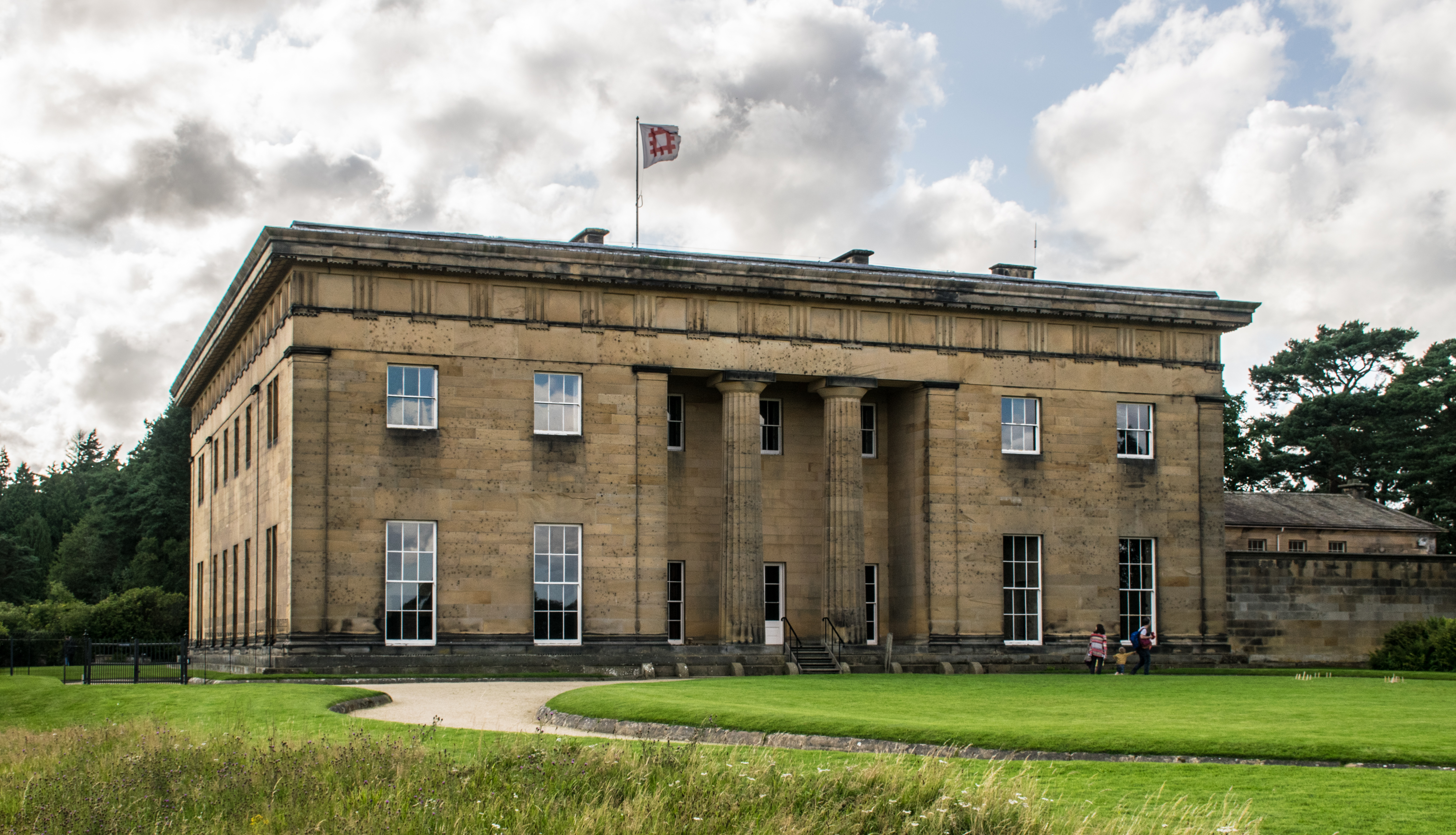
Belsay Hall

Belsay Hall is a Regency style country house located at Belsay, Northumberland. It is regarded as the first British country house to be built entirely...

Bitchfield Tower

Bitchfield Tower or West Bitchfield Tower is a 15th-century medieval pele tower near Belsay, Northumberland, England. It is a Grade I listed building.The...

Capheaton

Capheaton is a village and civil parish in Northumberland, England, about 25 miles (40 km) to the northwest of Newcastle upon Tyne. The population at the...

Nearby Amenities

Located within 500m of 55.080827,-1.9220275
Ingoe Moor
Place: locality
Lat/Long: 55.0812349/-1.9159826
The data included in this document is from www.openstreetmap.org. The data is made available under ODbL.

Have you been to Bellridge Fell?

Leave your review of Bellridge Fell below (or comments, questions and feedback).