Warren Down

Downs, Moorland in Wiltshire

England

Warren Down

Candown Copse, Wiltshire Looking south over Westdown Artillery Range from the vicinity of Candown Copse.
Candown Copse, Wiltshire Credit: Rebecca A Wills

Warren Down, located in Wiltshire, England, is a picturesque area known for its beautiful downs and moorland landscape. Stretching across a vast expanse, this natural paradise offers visitors a tranquil and serene escape from the hustle and bustle of modern life.

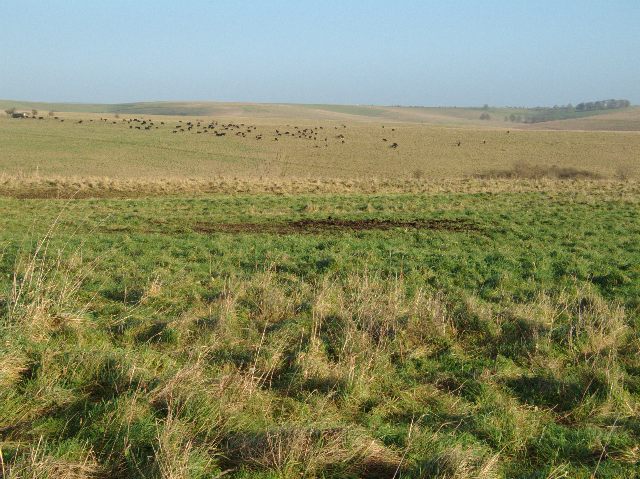
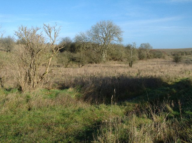
The downs of Warren Down are characterized by their rolling hills, covered in lush green grasses and dotted with wildflowers. These hills provide breathtaking views of the surrounding countryside, making it an ideal spot for hiking and nature walks. The area is also home to a variety of wildlife, including rabbits, foxes, and a diverse range of bird species.

In addition to the downs, Warren Down features expansive moorland, which adds to the area's natural beauty. The moorland is characterized by its open, treeless landscape, covered with heather and gorse. It offers a unique habitat for rare plant species and serves as a breeding ground for several bird species, including the iconic curlew.

Warren Down is also steeped in history, with evidence of human activity dating back thousands of years. Ancient burial mounds and archaeological sites can be found scattered throughout the area, providing a glimpse into the region's rich past.

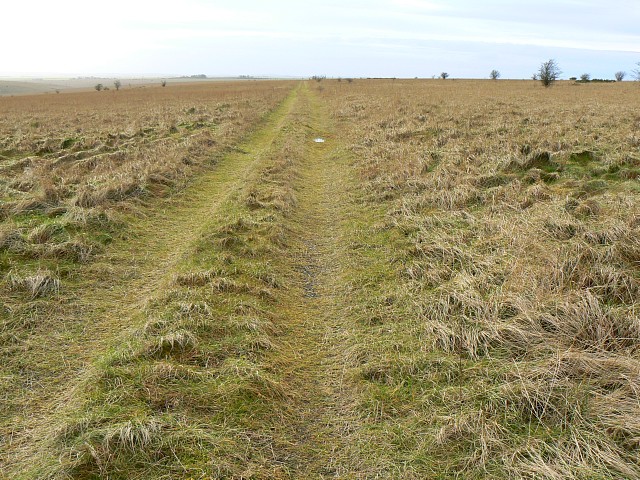
Visitors to Warren Down can enjoy a range of recreational activities, including picnicking, birdwatching, and photography. The area is also popular with outdoor enthusiasts, who can explore the numerous walking trails and cycling routes that crisscross the downs and moorland.

Overall, Warren Down offers a tranquil escape to nature lovers, history enthusiasts, and those seeking a peaceful retreat in the heart of Wiltshire's breathtaking countryside.

If you have any feedback on the listing, please let us know in the comments section below.
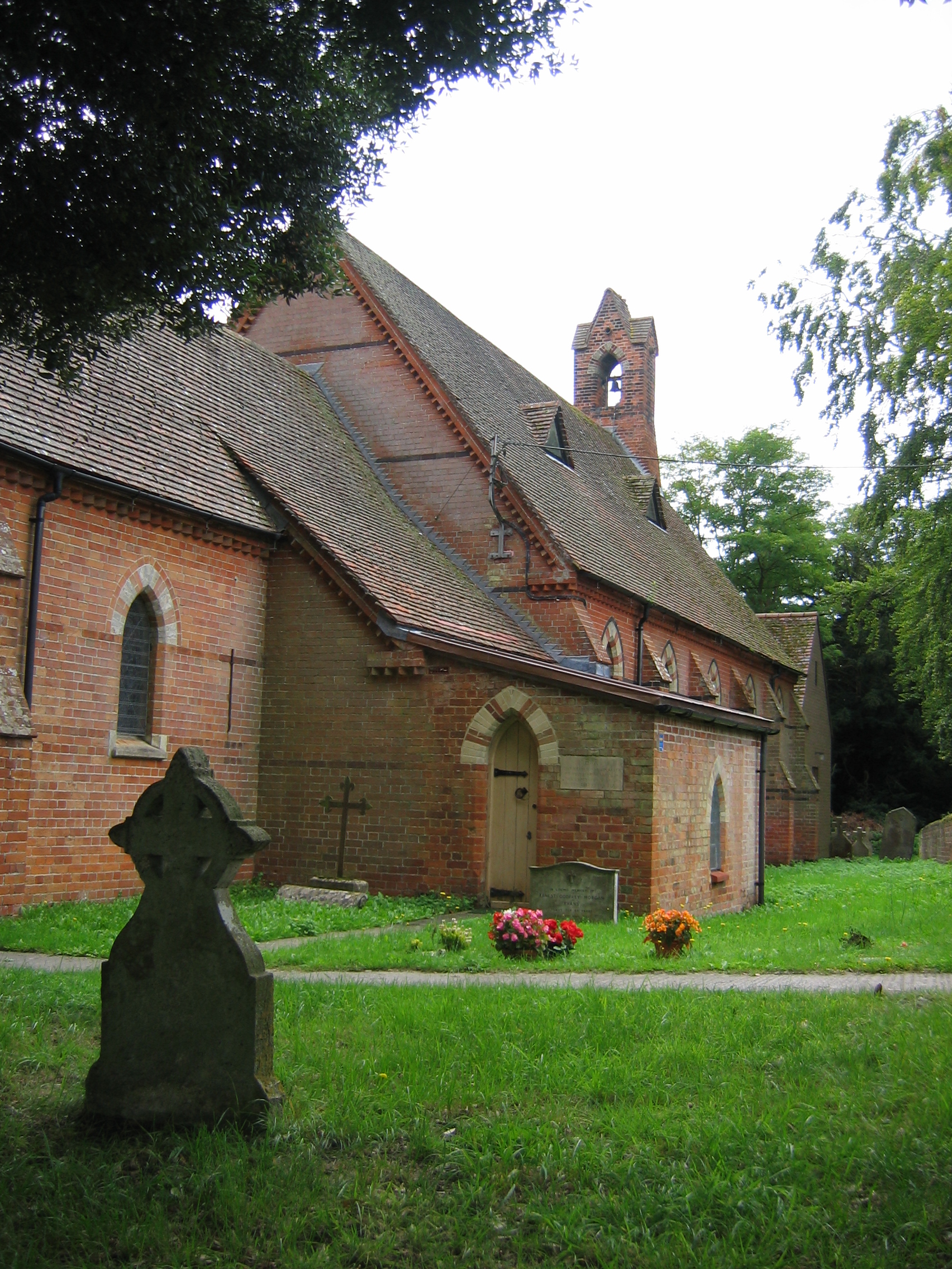
Warren Down Images

Images are sourced within 2km of 51.265292/-1.9327732 or Grid Reference SU0451. Thanks to Geograph Open Source API. All images are credited.

Candown Copse, Wiltshire Looking south over Westdown Artillery Range from the vicinity of Candown Copse.
Candown Copse, Wiltshire
Looking south over Westdown Artillery Range from the vicinity of Candown Copse.
Candown Copse, Wiltshire Warning signs controlling access to the Westdown Artillery range impact area, in the vicinity of Candown Copse.
Candown Copse, Wiltshire
Warning signs controlling access to the Westdown Artillery range impact area, in the vicinity of Candown Copse.
Byway across westdown Artillery Range Sensible advice, although somewhat limiting for geograph picture opportunities
Byway across westdown Artillery Range
Sensible advice, although somewhat limiting for geograph picture opportunities
View across Church Hill Grazing cattle can be seen in the distance
View across Church Hill
Grazing cattle can be seen in the distance
Hawthorn on Salisbury Plain Grass and hawthorn trees are pretty much standard for Salisbury Plain.  Indeed, in this area a casual inspection will find little else.
Hawthorn on Salisbury Plain
Grass and hawthorn trees are pretty much standard for Salisbury Plain. Indeed, in this area a casual inspection will find little else.
Byway and old warning sign This warning sign is looking in need of replacement.  However, it is identical to many others every half kilometre or so along the track and so it is unlikely that passers by will accidentally ignore it.  The sign contains the following message:

Danger. Do not leave this road.  Do not touch anything it may explode and kill you.
Byway and old warning sign
This warning sign is looking in need of replacement. However, it is identical to many others every half kilometre or so along the track and so it is unlikely that passers by will accidentally ignore it. The sign contains the following message: Danger. Do not leave this road. Do not touch anything it may explode and kill you.
Sheltered area on Salisbury Plain This section of land is protected by higher ground to the northwest and southeast.  This seems to allow rather more vigorous looking growth of trees.  On the whole, it is a very pleasant and secluded spot.
Sheltered area on Salisbury Plain
This section of land is protected by higher ground to the northwest and southeast. This seems to allow rather more vigorous looking growth of trees. On the whole, it is a very pleasant and secluded spot.
View across to grazing sheep In the distance, (probably just on the eastern edge of this grid square and just into the <a href="https://www.geograph.org.uk/gridref/SU0550">SU0550</a> ) a flock of sheep are grazing oblivious to the purported threat of unexploded ordnance.  The foreground again shows the scrubby vegetation typical in this area.
View across to grazing sheep
In the distance, (probably just on the eastern edge of this grid square and just into the SU0550 ) a flock of sheep are grazing oblivious to the purported threat of unexploded ordnance. The foreground again shows the scrubby vegetation typical in this area.
View beside byway on Westdown Artillery Range The right of access ends at the low ground beside the trees 300m away although the track continues on to join up to another byway.
View beside byway on Westdown Artillery Range
The right of access ends at the low ground beside the trees 300m away although the track continues on to join up to another byway.
Track towards Little Hill, Salisbury Plain Bleak but not entirely featureless, this part of the Plain is just a bit forbidding at this time of year. The track changes direction out of sight about 500 metres ahead.
Track towards Little Hill, Salisbury Plain
Bleak but not entirely featureless, this part of the Plain is just a bit forbidding at this time of year. The track changes direction out of sight about 500 metres ahead.
A view towards Little Hill, Salisbury Plain Little Hill is in the southern part of this square. This is a raw place in winter, even on a relatively dry day. The grass is coarse and tussocky but the land probably contains meadow plants that are lying dormant until warmer weather arrives.
A view towards Little Hill, Salisbury Plain
Little Hill is in the southern part of this square. This is a raw place in winter, even on a relatively dry day. The grass is coarse and tussocky but the land probably contains meadow plants that are lying dormant until warmer weather arrives.
Candown Copse, Wiltshire Looking over grassland in the vicinity of Candown Copse and Ball Down.
Candown Copse, Wiltshire
Looking over grassland in the vicinity of Candown Copse and Ball Down.
The Octagon, Wiltshire Looking east over grassland on Westdown Artillery Range, from the vicinity of The Octagon
The Octagon, Wiltshire
Looking east over grassland on Westdown Artillery Range, from the vicinity of The Octagon
Candown Copse, Wiltshire Looking southeast over the grassland of Westdown Artillery Range from the vicinity of Candown Copse.
Candown Copse, Wiltshire
Looking southeast over the grassland of Westdown Artillery Range from the vicinity of Candown Copse.
Candown Copse, Wiltshire A warning not to leave the bridleway within Westodwn Artillery Range, in the vicinity of Candown Copse.
Candown Copse, Wiltshire
A warning not to leave the bridleway within Westodwn Artillery Range, in the vicinity of Candown Copse.
Candown Copse, Wiltshire Rain threatening over Candown Copse on the Westdown Artillery Range.
Candown Copse, Wiltshire
Rain threatening over Candown Copse on the Westdown Artillery Range.
Observation point and view across Salisbury Plain Observation stations such as these are positioned around the firing range.  Patches of gorse can be found in various places across the plain and one such clump is shown here to the left and just beyond the observation point a patch or gorse
Observation point and view across Salisbury Plain
Observation stations such as these are positioned around the firing range. Patches of gorse can be found in various places across the plain and one such clump is shown here to the left and just beyond the observation point a patch or gorse
Track on Westdown Artillery range Track on Salisbury Plain training area (SPTA) - Westdown range; heading NW towards Market Lavington gate.
Track on Westdown Artillery range
Track on Salisbury Plain training area (SPTA) - Westdown range; heading NW towards Market Lavington gate.
Show me another place!

Warren Down is located at Grid Ref: SU0451 (Lat: 51.265292, Lng: -1.9327732)

Unitary Authority: Wiltshire

Police Authority: Wiltshire

What 3 Words

///caressed.fairway.highs. Near Market Lavington, Wiltshire

Nearby Locations

Ball Down Warren Down

Related Wikis

Market Lavington

Market Lavington is a civil parish and large village with a population of about 2,200 on the northern edge of Salisbury Plain in Wiltshire, England, 5...

Tilshead

Tilshead () is a village and civil parish in the county of Wiltshire in Southern England, about 9 miles (14 km) northwest of the town of Amesbury. It...

Easterton

Easterton is a village and civil parish in Wiltshire, England, 4 miles (6.4 km) south of Devizes. The parish includes the hamlets of Easterton Sands and...

Wiltshire

Wiltshire (; abbreviated to Wilts) is a ceremonial county in South West England. It borders Gloucestershire to the north, Oxfordshire and Berkshire to...

West Lavington, Wiltshire

West Lavington is a village and civil parish in Wiltshire, England, on the north edge of Salisbury Plain, on the A360 road between Devizes and Salisbury...
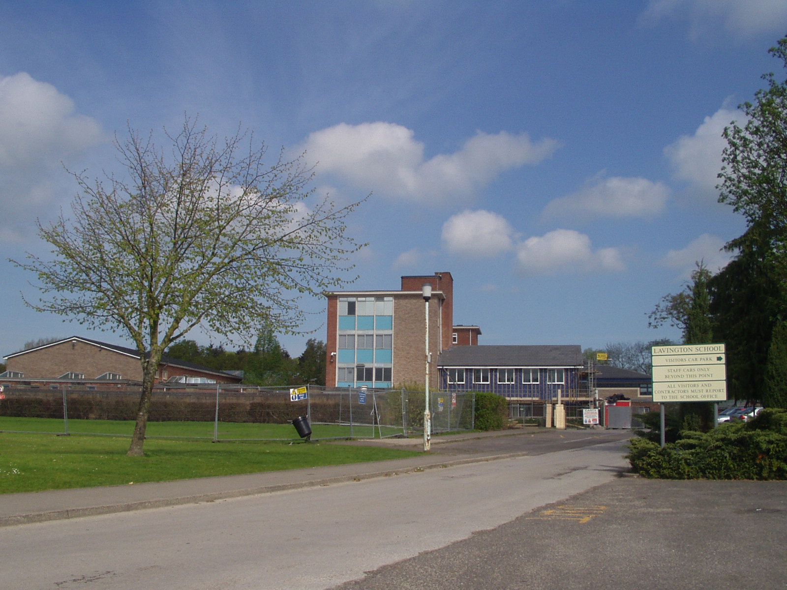
Lavington School

Lavington School is a secondary school in Market Lavington, Wiltshire, England, which became an academy in January 2011. From September 2018 the school...

Tilshead Lodge

Tilshead Lodge (now demolished) was a large 18th-century country house, southwest of Tilshead in Wiltshire, England, and about 13 miles (21 km) northwest...

Dauntsey's School

Dauntsey's School is a public school (fee-charging boarding and day school) for pupils aged 11–18 in the village of West Lavington, Wiltshire, England...

Nearby Amenities

Located within 500m of 51.265292,-1.9327732
Ele: 162
Source: NPE
Lat/Long: 51.2648292/-1.9365952
Archaeological Site: tumulus
Historic: archaeological_site
Lat/Long: 51.2648418/-1.9280071
The data included in this document is from www.openstreetmap.org. The data is made available under ODbL.

Have you been to Warren Down?

Leave your review of Warren Down below (or comments, questions and feedback).