Ball Down

Downs, Moorland in Wiltshire

England

Ball Down

Candown Copse, Wiltshire Looking south over Westdown Artillery Range from the vicinity of Candown Copse.
Candown Copse, Wiltshire Credit: Rebecca A Wills

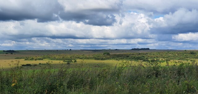
Ball Down is a prominent geographical feature located in Wiltshire, England. It is part of a larger expanse of land known as the Wiltshire Downs, which is characterized by its rolling hills, extensive grasslands, and wide-open spaces. Ball Down itself is situated within this beautiful landscape, offering breathtaking views of the surrounding countryside.

The area is predominantly covered by moorland, which consists of a mixture of heather, grasses, and low-growing shrubs. This unique habitat supports a diverse range of plant and animal species, making it an important conservation site. Visitors to Ball Down can expect to encounter various bird species, including skylarks and meadow pipits, as well as small mammals such as rabbits and hares.

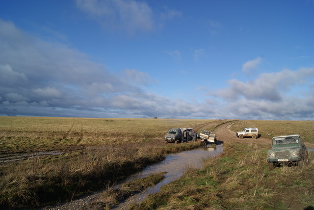
The accessibility of Ball Down makes it a popular destination for outdoor enthusiasts, nature lovers, and hikers. There are several well-maintained footpaths that crisscross the area, allowing visitors to explore its undulating terrain and discover its hidden treasures. The unspoiled beauty of Ball Down also makes it an ideal location for picnics, photography, and simply taking in the tranquil surroundings.

As part of the Wiltshire Downs, Ball Down is managed by local conservation organizations and landowners who strive to preserve its natural beauty and protect its wildlife. This ensures that future generations can continue to enjoy and appreciate this unique landscape. Whether you are seeking a peaceful escape or a chance to immerse yourself in nature, Ball Down is a captivating destination that offers a truly unforgettable experience.

If you have any feedback on the listing, please let us know in the comments section below.

Ball Down Images

Images are sourced within 2km of 51.258359/-1.9334138 or Grid Reference SU0451. Thanks to Geograph Open Source API. All images are credited.

Candown Copse, Wiltshire Looking south over Westdown Artillery Range from the vicinity of Candown Copse.
Candown Copse, Wiltshire
Looking south over Westdown Artillery Range from the vicinity of Candown Copse.
New Copse Down, Wiltshire Looking south along a bridleway that leads to Tilshead, from the vicinity of New Copse Down.
New Copse Down, Wiltshire
Looking south along a bridleway that leads to Tilshead, from the vicinity of New Copse Down.
Candown Copse, Wiltshire Warning signs controlling access to the Westdown Artillery range impact area, in the vicinity of Candown Copse.
Candown Copse, Wiltshire
Warning signs controlling access to the Westdown Artillery range impact area, in the vicinity of Candown Copse.
West Down Plantation, Wiltshire Looking north west from over the Westdown Artillery Range from West Down Plantation. This area is within the Westdown Artillery Range danger area, but is open to walkers on the bridleways when no red flags are displayed.
West Down Plantation, Wiltshire
Looking north west from over the Westdown Artillery Range from West Down Plantation. This area is within the Westdown Artillery Range danger area, but is open to walkers on the bridleways when no red flags are displayed.
East Down, Wiltshire Looking northeast along a bridleway on East Down. This area is within the Westdown Artillery Range danger area, but is open to walkers on the bridleways when no red flags are displayed.
East Down, Wiltshire
Looking northeast along a bridleway on East Down. This area is within the Westdown Artillery Range danger area, but is open to walkers on the bridleways when no red flags are displayed.
Westdown Camp - 4x4s Playing In The Mud A group of 4x4 vehicles playing in the mud.
Westdown Camp - 4x4s Playing In The Mud
A group of 4x4 vehicles playing in the mud.
Byway across westdown Artillery Range Sensible advice, although somewhat limiting for geograph picture opportunities
Byway across westdown Artillery Range
Sensible advice, although somewhat limiting for geograph picture opportunities
Hawthorn on Salisbury Plain Grass and hawthorn trees are pretty much standard for Salisbury Plain.  Indeed, in this area a casual inspection will find little else.
Hawthorn on Salisbury Plain
Grass and hawthorn trees are pretty much standard for Salisbury Plain. Indeed, in this area a casual inspection will find little else.
Byway and old warning sign This warning sign is looking in need of replacement.  However, it is identical to many others every half kilometre or so along the track and so it is unlikely that passers by will accidentally ignore it.  The sign contains the following message:

Danger. Do not leave this road.  Do not touch anything it may explode and kill you.
Byway and old warning sign
This warning sign is looking in need of replacement. However, it is identical to many others every half kilometre or so along the track and so it is unlikely that passers by will accidentally ignore it. The sign contains the following message: Danger. Do not leave this road. Do not touch anything it may explode and kill you.
Sheltered area on Salisbury Plain This section of land is protected by higher ground to the northwest and southeast.  This seems to allow rather more vigorous looking growth of trees.  On the whole, it is a very pleasant and secluded spot.
Sheltered area on Salisbury Plain
This section of land is protected by higher ground to the northwest and southeast. This seems to allow rather more vigorous looking growth of trees. On the whole, it is a very pleasant and secluded spot.
View across to grazing sheep In the distance, (probably just on the eastern edge of this grid square and just into the <a href="https://www.geograph.org.uk/gridref/SU0550">SU0550</a> ) a flock of sheep are grazing oblivious to the purported threat of unexploded ordnance.  The foreground again shows the scrubby vegetation typical in this area.
View across to grazing sheep
In the distance, (probably just on the eastern edge of this grid square and just into the SU0550 ) a flock of sheep are grazing oblivious to the purported threat of unexploded ordnance. The foreground again shows the scrubby vegetation typical in this area.
View beside byway on Westdown Artillery Range The right of access ends at the low ground beside the trees 300m away although the track continues on to join up to another byway.
View beside byway on Westdown Artillery Range
The right of access ends at the low ground beside the trees 300m away although the track continues on to join up to another byway.
View Northwest across Summer Down This is the eastern end of the Westdown Artillery Range.
View Northwest across Summer Down
This is the eastern end of the Westdown Artillery Range.
Downland and plantation, Tilshead Barrow Plantation is the one in the background.
Downland and plantation, Tilshead
Barrow Plantation is the one in the background.
Candown Copse, Wiltshire Looking over grassland in the vicinity of Candown Copse and Ball Down.
Candown Copse, Wiltshire
Looking over grassland in the vicinity of Candown Copse and Ball Down.
The Octagon, Wiltshire Looking east over grassland on Westdown Artillery Range, from the vicinity of The Octagon
The Octagon, Wiltshire
Looking east over grassland on Westdown Artillery Range, from the vicinity of The Octagon
Candown Copse, Wiltshire Looking southeast over the grassland of Westdown Artillery Range from the vicinity of Candown Copse.
Candown Copse, Wiltshire
Looking southeast over the grassland of Westdown Artillery Range from the vicinity of Candown Copse.
Candown Copse, Wiltshire A warning not to leave the bridleway within Westodwn Artillery Range, in the vicinity of Candown Copse.
Candown Copse, Wiltshire
A warning not to leave the bridleway within Westodwn Artillery Range, in the vicinity of Candown Copse.
Show me another place!

Ball Down is located at Grid Ref: SU0451 (Lat: 51.258359, Lng: -1.9334138)

Unitary Authority: Wiltshire

Police Authority: Wiltshire

What 3 Words

///cheeses.alongside.stars. Near Market Lavington, Wiltshire

Nearby Locations

Ball Down Warren Down

Related Wikis

Tilshead

Tilshead () is a village and civil parish in the county of Wiltshire in Southern England, about 9 miles (14 km) northwest of the town of Amesbury. It...

Tilshead Lodge

Tilshead Lodge (now demolished) was a large 18th-century country house, southwest of Tilshead in Wiltshire, England, and about 13 miles (21 km) northwest...

RAF Tilshead

Royal Air Force Tilshead or more simply RAF Tilshead is a former Royal Air Force station west of Tilshead, Wiltshire, England and 9 miles (14 km) east...

White Barrow

White Barrow is a large Neolithic long barrow just below the crest of Copehill Down on Salisbury Plain, just south of the village of Tilshead in Wiltshire...
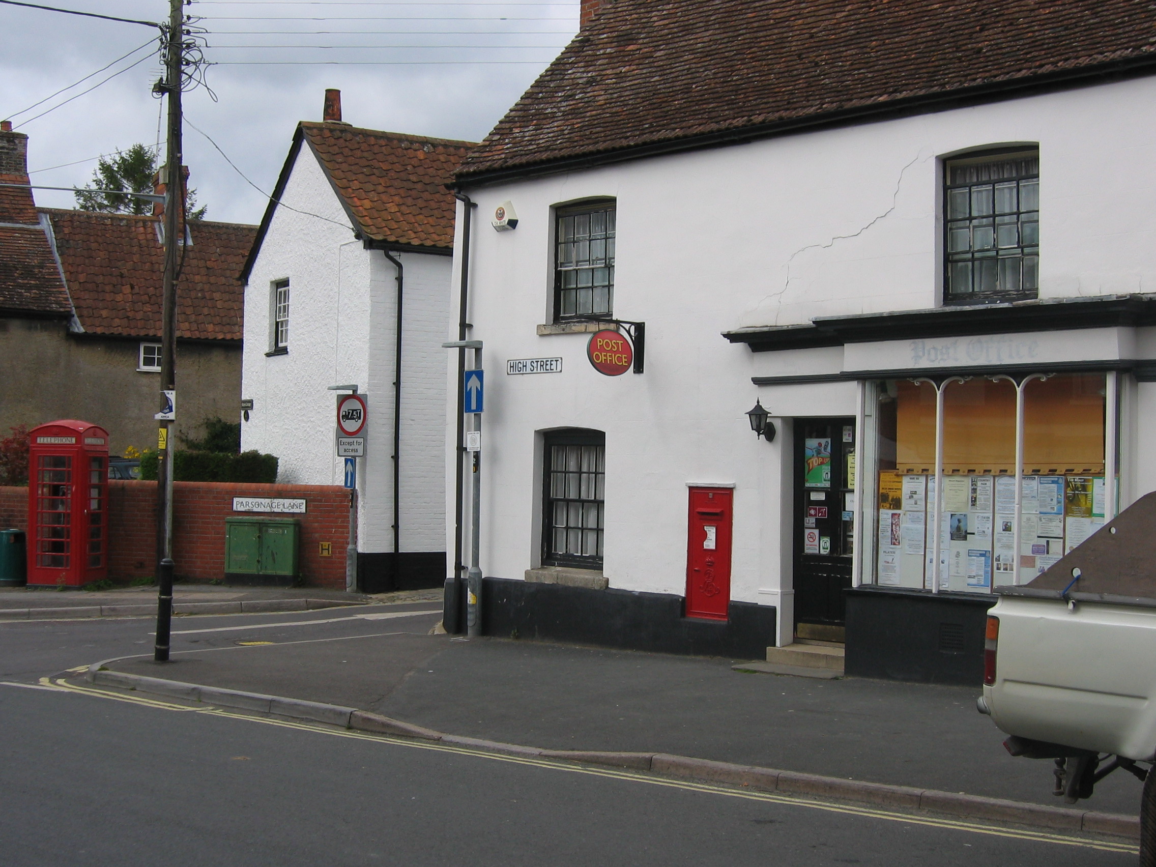
Market Lavington

Market Lavington is a civil parish and large village with a population of about 2,200 on the northern edge of Salisbury Plain in Wiltshire, England, 5...

Easterton

Easterton is a village and civil parish in Wiltshire, England, 4 miles (6.4 km) south of Devizes. The parish includes the hamlets of Easterton Sands and...

West Lavington, Wiltshire

West Lavington is a village and civil parish in Wiltshire, England, on the north edge of Salisbury Plain, on the A360 road between Devizes and Salisbury...
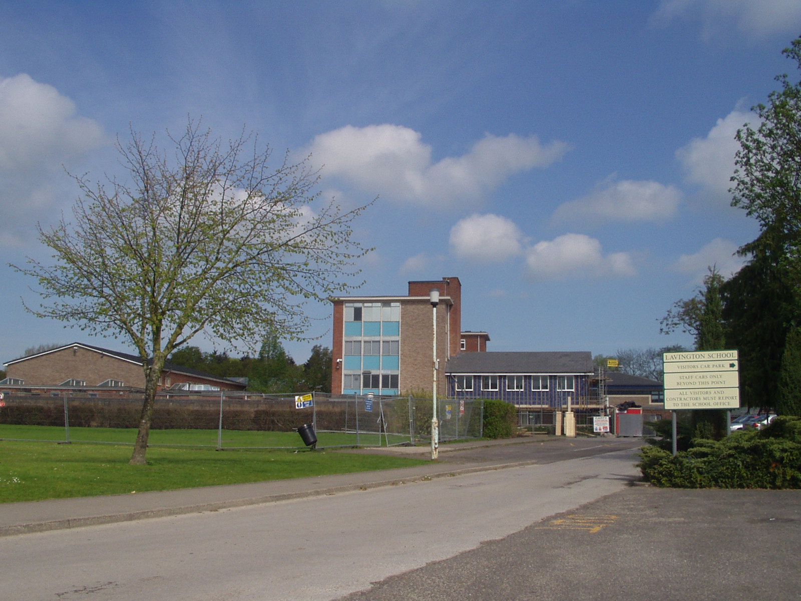
Lavington School

Lavington School is a secondary school in Market Lavington, Wiltshire, England, which became an academy in January 2011. From September 2018 the school...

Have you been to Ball Down?

Leave your review of Ball Down below (or comments, questions and feedback).