Low Pasture

Downs, Moorland in Yorkshire Richmondshire

England

Low Pasture

Ford and Footbridge at Braidley This ford is found on the River Cover at Braidley.
Ford and Footbridge at Braidley Credit: John Walton

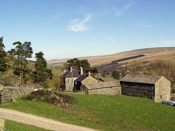
Low Pasture is a picturesque region located in Yorkshire, England, encompassing the stunning landscapes of the Downs and Moorland. Spanning over several square miles, this area is characterized by its rolling hills, expansive open spaces, and diverse flora and fauna.

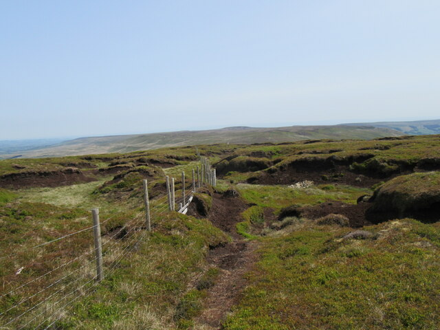
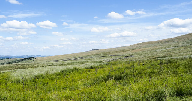
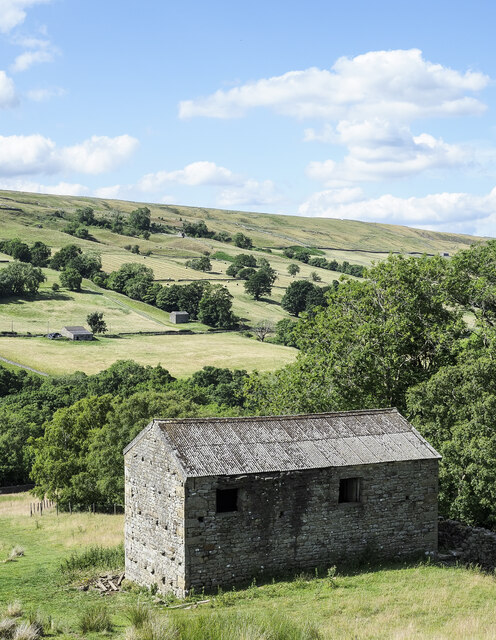
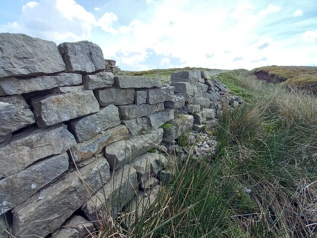
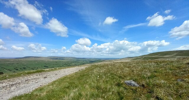
The Downs in Low Pasture are characterized by their gently sloping hills, covered in lush green grass. The landscape is dotted with small patches of woodland and scattered with grazing livestock, such as sheep and cattle. The Downs offer breathtaking views of the surrounding countryside and are a popular destination for hikers and nature enthusiasts.

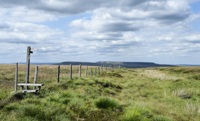
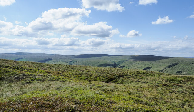
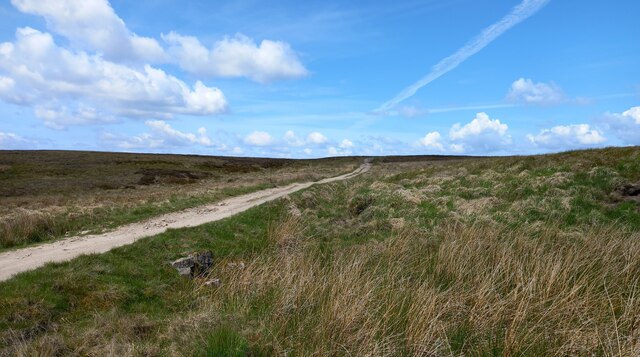
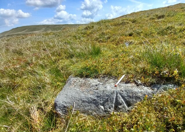
Moving onto the Moorland, the scenery changes dramatically, with vast stretches of open heather-covered hillsides dominating the landscape. The Moorland is home to numerous plant species, including heather, bracken, and gorse, creating a colorful tapestry of purples, greens, and yellows. This unique habitat supports a variety of wildlife, including birds like grouse and curlew, as well as small mammals like rabbits and hares.

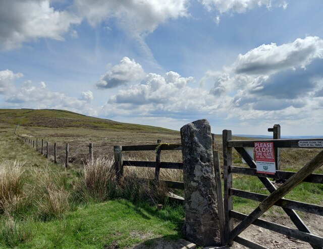
Low Pasture benefits from a temperate climate, with mild summers and cool winters, making it an ideal location for outdoor activities year-round. The area is crisscrossed by a network of footpaths and trails, allowing visitors to explore the stunning countryside at their own pace.

Whether it's enjoying the panoramic views from the Downs or immersing oneself in the tranquility of the Moorland, Low Pasture offers a captivating experience for nature lovers and those seeking an escape from the bustling city life.

If you have any feedback on the listing, please let us know in the comments section below.
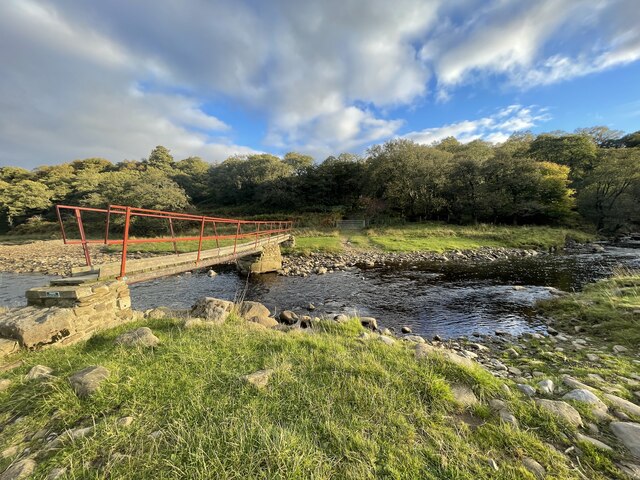
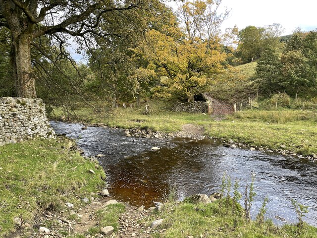
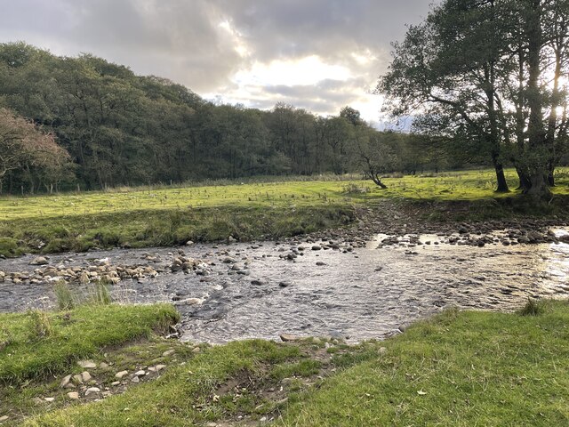
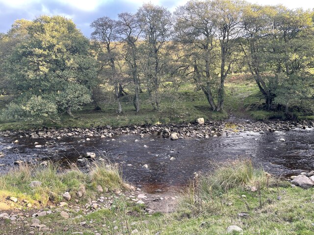
Low Pasture Images

Images are sourced within 2km of 54.211264/-1.9515746 or Grid Reference SE0379. Thanks to Geograph Open Source API. All images are credited.

Ford and Footbridge at Braidley This ford is found on the River Cover at Braidley.
Ford and Footbridge at Braidley
This ford is found on the River Cover at Braidley.
Ford on the River Cover This is a second ford on the River Cover at Braidley.
Ford on the River Cover
This is a second ford on the River Cover at Braidley.
River Cover Ford A third ford on the River Cover at this location.
River Cover Ford
A third ford on the River Cover at this location.
River Cover Ford This is another of the series of fords on the River Cover at this location.
River Cover Ford
This is another of the series of fords on the River Cover at this location.
River Cover Ford This is the final ford at this stretch of the River Cover.
River Cover Ford
This is the final ford at this stretch of the River Cover.
Sun and mist in Coverdale A similar view to one taken almost 3 years previously, but on this occasion the late November sun contrasted with lengthening shadows and mist that was creeping over the fell tops from Nidderdale.
Sun and mist in Coverdale
A similar view to one taken almost 3 years previously, but on this occasion the late November sun contrasted with lengthening shadows and mist that was creeping over the fell tops from Nidderdale.
Mist creeping into the dale The view up Coverdale towards Woodale on a late autumn afternoon when mist was creeping in over the felltops to eventually fill the valley.
Mist creeping into the dale
The view up Coverdale towards Woodale on a late autumn afternoon when mist was creeping in over the felltops to eventually fill the valley.
Little Whernside summit The summit of Little Whernside at 604m.
Little Whernside summit
The summit of Little Whernside at 604m.
Moorland with Arkleside Pasture Arkleside Pasture is an area of enclosed, marginal farmland on the south side of Coverdale above the small settlement of Arkleside; it lies beyond the rough vegetation in the foreground and the groove of Arkleside Gill which can just be discerned in the image.
Moorland with Arkleside Pasture
Arkleside Pasture is an area of enclosed, marginal farmland on the south side of Coverdale above the small settlement of Arkleside; it lies beyond the rough vegetation in the foreground and the groove of Arkleside Gill which can just be discerned in the image.
Fence with stile and footpath indicator The fence descends from the ridge between Little Whernside and Dead Man's Hill going down beside Harkera Gill. The route of the public footpath indicated by the finger post follows a similar route.
Pen Hill is the flat-topped feature in the distance.
Fence with stile and footpath indicator
The fence descends from the ridge between Little Whernside and Dead Man's Hill going down beside Harkera Gill. The route of the public footpath indicated by the finger post follows a similar route. Pen Hill is the flat-topped feature in the distance.
Rough moorland slope on Little Whernside The location is east-north-east of Little Whernside's summit where there's heather and grass moorland mingled with bilberry.
Buckden Pike is at the far left of the image with hill domes on the north side of Coverdale nearer and to the right.
Rough moorland slope on Little Whernside
The location is east-north-east of Little Whernside's summit where there's heather and grass moorland mingled with bilberry. Buckden Pike is at the far left of the image with hill domes on the north side of Coverdale nearer and to the right.
Large barn beside Harkera Gill The barn appears to be in good repair. Harkera Gill flows unseen within the trees as it descends to join the River Cover.
Large barn beside Harkera Gill
The barn appears to be in good repair. Harkera Gill flows unseen within the trees as it descends to join the River Cover.
Track leading from Scar House to Horsehouse, Nidderdale According to the 1910 map there was a benchmark cut at this location. No suitable features were found for a benchmark.
Track leading from Scar House to Horsehouse, Nidderdale
According to the 1910 map there was a benchmark cut at this location. No suitable features were found for a benchmark.
Benchmark cut into gatepost, Nidderdale The benchmark is cut into a stone gatepost on the track which leads from Scar House reservoir to Horsehouse in Coverdale. Wider view <a href="https://www.geograph.org.uk/photo/7557643">SE0478 : Boundary fence on moorland below Little Whernside</a>
Benchmark cut into gatepost, Nidderdale
The benchmark is cut into a stone gatepost on the track which leads from Scar House reservoir to Horsehouse in Coverdale. Wider view SE0478 : Boundary fence on moorland below Little Whernside
Boundary fence on moorland below Little Whernside There is a benchmark cut into the stone gatepost on the track which leads from Scar House reservoir to Horsehouse in Coverdale. Closer view <a href="https://www.geograph.org.uk/photo/7557642">SE0478 : Benchmark cut into gatepost, Nidderdale</a>
Boundary fence on moorland below Little Whernside
There is a benchmark cut into the stone gatepost on the track which leads from Scar House reservoir to Horsehouse in Coverdale. Closer view SE0478 : Benchmark cut into gatepost, Nidderdale
West parapet of bridge near Little Whernside According to the OS benchmark database there is a benchmark cut into the west face of the bridge, and on the north side of the stream. The bridge has gone through several repairs and refits, and nothing was found.
West parapet of bridge near Little Whernside
According to the OS benchmark database there is a benchmark cut into the west face of the bridge, and on the north side of the stream. The bridge has gone through several repairs and refits, and nothing was found.
Pivot benchmark cut into boulder on moorland, Nidderdale The pivot benchmark is cut into a large boulder on the east side of the track which leads from Scar House reservoir to Horsehouse in Coverdale. Wider view <a href="https://www.geograph.org.uk/photo/7557646">SE0478 : Views to Coverdale</a>
Pivot benchmark cut into boulder on moorland, Nidderdale
The pivot benchmark is cut into a large boulder on the east side of the track which leads from Scar House reservoir to Horsehouse in Coverdale. Wider view SE0478 : Views to Coverdale
Views to Coverdale There is a pivot benchmark cut into the large boulder on the east side of the track which leads from Scar House reservoir to Horsehouse in Coverdale. Closer view <a href="https://www.geograph.org.uk/photo/7557645">SE0478 : Pivot benchmark cut into boulder on moorland, Nidderdale</a>
Views to Coverdale
There is a pivot benchmark cut into the large boulder on the east side of the track which leads from Scar House reservoir to Horsehouse in Coverdale. Closer view SE0478 : Pivot benchmark cut into boulder on moorland, Nidderdale
Show me another place!

Low Pasture is located at Grid Ref: SE0379 (Lat: 54.211264, Lng: -1.9515746)

Division: North Riding

Administrative County: North Yorkshire

District: Richmondshire

Police Authority: North Yorkshire

What 3 Words

///whisker.parade.admires. Near Leyburn, North Yorkshire

Nearby Locations

Low Pasture

Related Wikis

Braidley

Braidley is a hamlet in Coverdale in the Yorkshire Dales, England. It lies in the civil parish of Carlton Highdale in the Richmondshire district of North...

Carlton Highdale

Carlton Highdale is a civil parish in Coverdale, North Yorkshire, England. According to the 2001 census it had a population of 95. The parish covers the...

Woodale

Woodale is a hamlet in Coverdale in the Yorkshire Dales in England. It lies in the civil parish of Carlton Highdale in the Richmondshire district of North...

Little Whernside

Little Whernside is a hill in the Yorkshire Dales, North Yorkshire, England, 2.82 miles (4.54 km) north east of Great Whernside. It is on the boundary...

Nearby Amenities

Located within 500m of 54.211264,-1.9515746
Post Box
Post Box Type: lamp
Royal Cypher: EIIR
Royal Cypher Wikidata: Q33102113
Lat/Long: 54.2155958/-1.9498706
Ford: yes
Lat/Long: 54.2139662/-1.9493577
Power: pole
Lat/Long: 54.210818/-1.9587348
Power: pole
Lat/Long: 54.2111876/-1.9575394
Power: pole
Lat/Long: 54.2115518/-1.9563213
Power: pole
Lat/Long: 54.2119199/-1.9551031
Power: pole
Lat/Long: 54.2122855/-1.9538188
Power: pole
Lat/Long: 54.2127244/-1.9523337
Power: pole
Lat/Long: 54.2131419/-1.9508487
Power: pole
Lat/Long: 54.2135688/-1.9493819
Power: pole
Lat/Long: 54.2139836/-1.9478991
Power: pole
Lat/Long: 54.2143478/-1.9469638
The data included in this document is from www.openstreetmap.org. The data is made available under ODbL.

Have you been to Low Pasture?

Leave your review of Low Pasture below (or comments, questions and feedback).