Stoneywoods Plain
Downs, Moorland in Yorkshire Richmondshire
England
Stoneywoods Plain

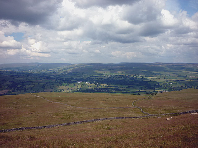
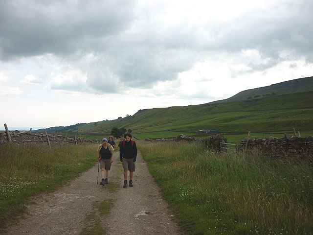
Stoneywoods Plain is a picturesque region located in Yorkshire, England, known for its breathtaking natural beauty and diverse landscape. Situated amidst the renowned Yorkshire Downs and Moorland, this area offers a stunning combination of rolling hills, vast open spaces, and rugged terrain.
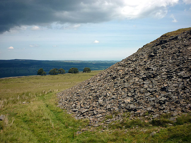
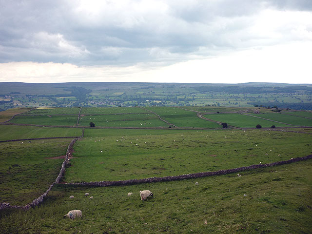
The region is characterized by its expansive moorland, which stretches as far as the eye can see. The moors are covered in heather, providing a vibrant purple hue during the summer months, while in winter, the landscape is transformed into a serene white wonderland. The moorland is also home to a variety of wildlife, including grouse, curlew, and the elusive red grouse.
Amidst the moors, there are pockets of woodland, affectionately known as Stoneywoods. These woodlands provide a stark contrast to the open moorland, offering shelter and a rich habitat for an array of flora and fauna. Ancient oak trees and birch forests dominate the area, creating a tranquil and enchanting atmosphere.
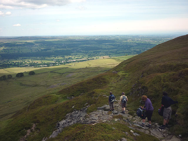
The Yorkshire Downs, which border Stoneywoods Plain, add to the region's charm. The rolling hills, covered in vibrant green grass, provide breathtaking panoramic views of the surrounding countryside. Walking trails meander through the downs, allowing visitors to explore the area on foot and take in the stunning vistas.
Stoneywoods Plain is a haven for outdoor enthusiasts, offering opportunities for hiking, birdwatching, and photography. The region's natural beauty, combined with its peaceful and remote location, make it a popular destination for those seeking a tranquil escape from the hustle and bustle of everyday life.
If you have any feedback on the listing, please let us know in the comments section below.
Stoneywoods Plain Images
Images are sourced within 2km of 54.280142/-1.9515096 or Grid Reference SE0387. Thanks to Geograph Open Source API. All images are credited.


Stoneywoods Plain is located at Grid Ref: SE0387 (Lat: 54.280142, Lng: -1.9515096)
Division: North Riding
Administrative County: North Yorkshire
District: Richmondshire
Police Authority: North Yorkshire
What 3 Words
///streamers.fabricate.delusions. Near Leyburn, North Yorkshire
Nearby Locations
Related Wikis

Penhill
Penhill (526 metres (1,726 ft) high at the trig point, 553 metres (1,814 ft) at Height of Hazely) is a prominent hill, 5.5 miles (9 km) south west of Leyburn...
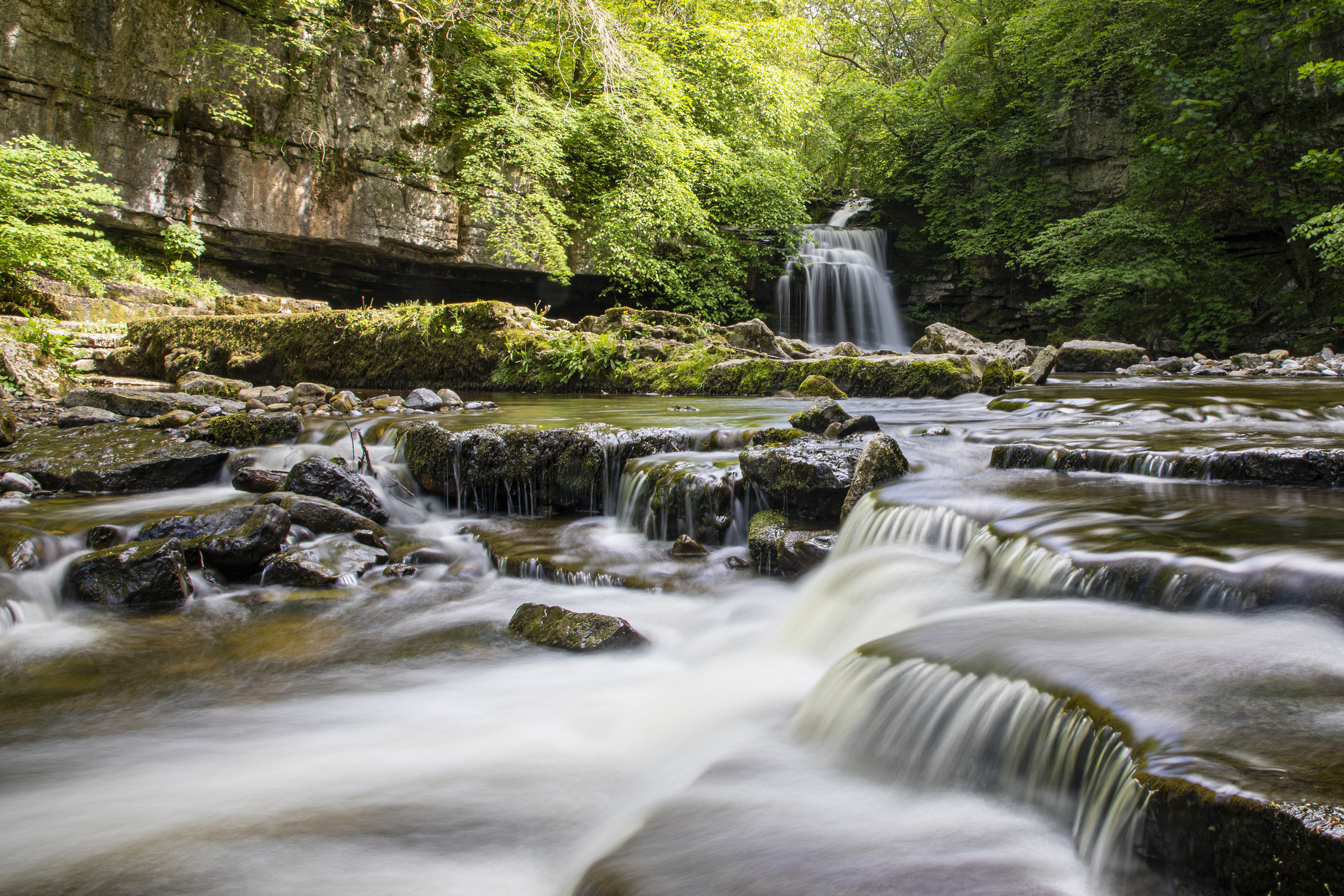
Cauldron Falls (North Yorkshire)
Cauldron Falls (also known as West Burton falls), is a series of waterfalls on Walden Beck in the village of West Burton, North Yorkshire, England. It...

West Burton, North Yorkshire
West Burton is a village in Bishopdale, a side valley of Wensleydale, in the Yorkshire Dales, North Yorkshire, England. It lies 6.2 miles (10 km) south...

Penhill Preceptory
Penhill Preceptory was a priory on the northern flanks of Penhill in Wensleydale, North Yorkshire, England, which functioned from about 1142 to 1308–12...

Bishopdale Beck
Bishopdale Beck is a major tributary of the River Ure in North Yorkshire, England. The beck flows down Bishopdale, a side valley of Wensleydale in the...

Swinithwaite
Swinithwaite is a hamlet in the Yorkshire Dales, North Yorkshire, England. It lies on the A684 road, 2 miles (3.2 km) miles east of Aysgarth.The hamlet...

St Andrew's Church, Aysgarth
St Andrew's Church, Aysgarth, is a Grade II* listed parish church in the Church of England: 66 in Aysgarth, North Yorkshire. It is located on the south...

Aysgarth Falls
Aysgarth Falls are a triple flight of waterfalls, surrounded by woodland and farmland, carved out by the River Ure over an almost one-mile (two-kilometre...
Related Videos

the Yorkshire dales #hiking
york #yorkshire #nationaltrust #nature #yorkshiredales.

"On the Run From The Penhill Giant" Series 2 (Episode 1) 20.11.23
Today we're on the hunt for the elusive Giant that lives on Penhill. Rumours has it, he likes to eat Sheep and children, so I'm going ...

A Winter's Day at Cauldron Falls - Photographing A Waterfall.
Cauldron Falls in West Burton near Leyburn on the Yorkshire Dales is my location for my first waterfall landscape photography ...

Exploring West Burton - Yorkshire Dales
We're in the Yorkshire Dale's on hoilday and its beautiful. Only been here two hours and this walk was stunning!!!
Nearby Amenities
Located within 500m of 54.280142,-1.9515096Have you been to Stoneywoods Plain?
Leave your review of Stoneywoods Plain below (or comments, questions and feedback).