Bear Park

Downs, Moorland in Yorkshire Richmondshire

England

Bear Park

Looking towards Ivy Scar Looking towards Ivy Scar from The Straights.
Looking towards Ivy Scar Credit: T Eyre

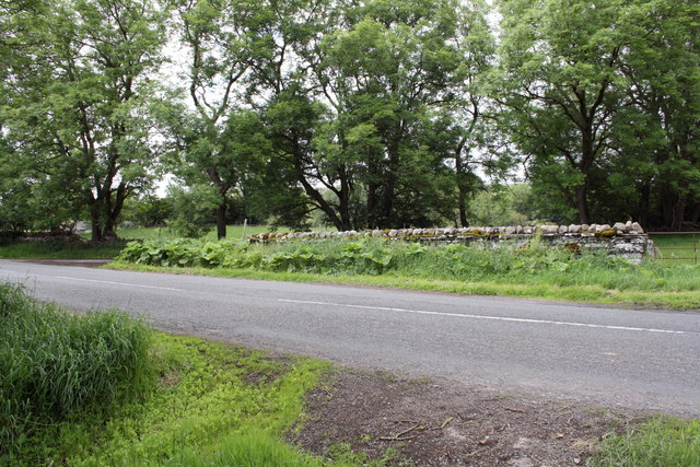
Bear Park is a picturesque area located in the heart of Yorkshire, encompassing both the Downs and Moorland regions. It is renowned for its breathtaking natural beauty, offering visitors a unique and diverse landscape to explore. Situated amidst rolling hills and vast expanses of open land, Bear Park is a haven for outdoor enthusiasts and nature lovers.

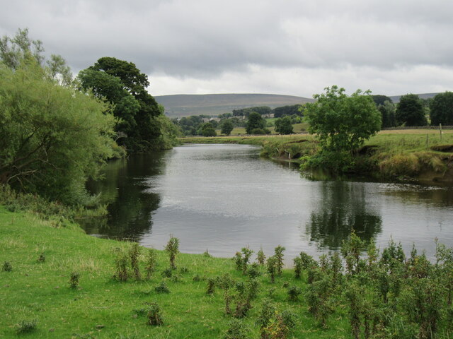
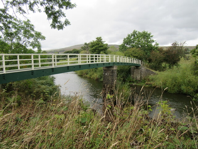
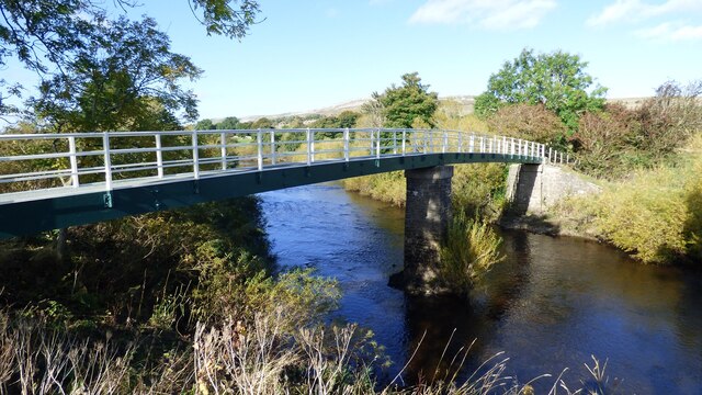
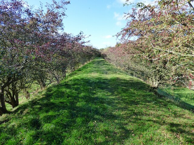
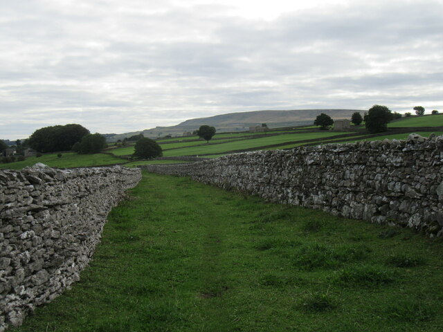
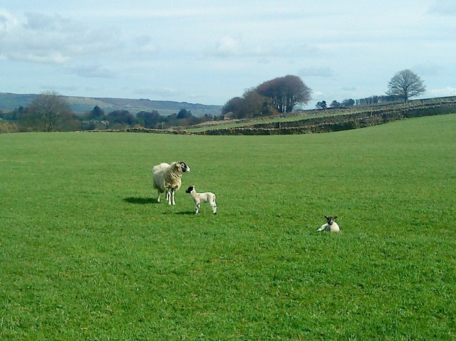
The Downs area of Bear Park is characterized by its lush green meadows, gentle slopes, and stunning panoramic views. It is a haven for hikers, cyclists, and horse riders, with an extensive network of well-maintained trails and paths that wind through the countryside. The Downs also provide a habitat for various wildlife species, including birds, rabbits, and foxes, making it a popular spot for birdwatching and wildlife enthusiasts.

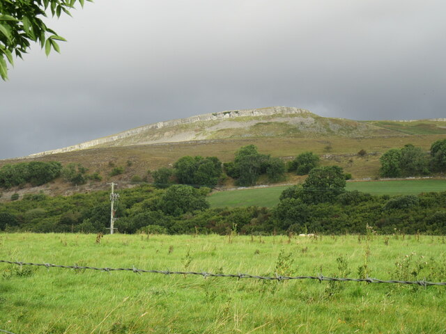
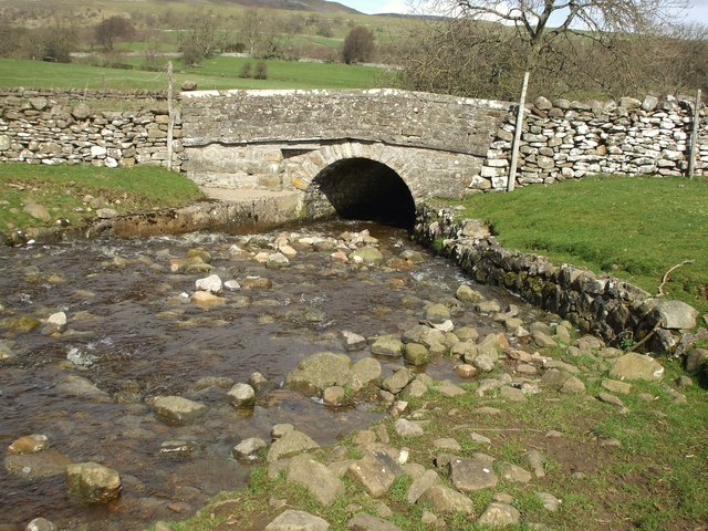
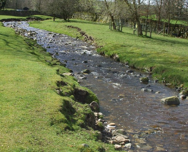
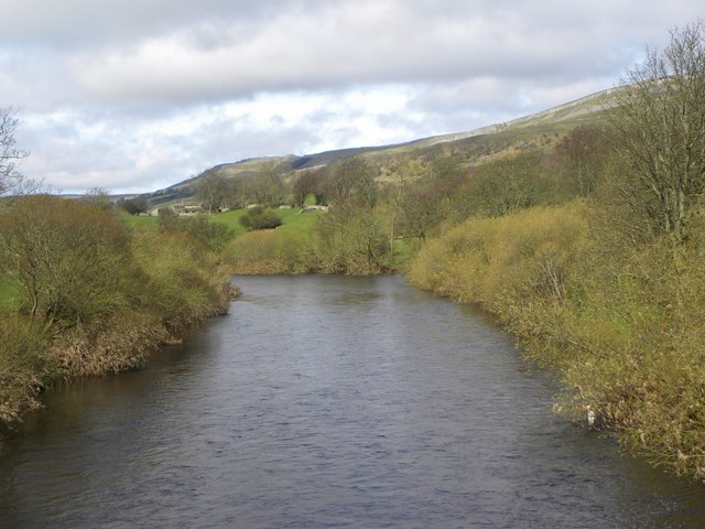
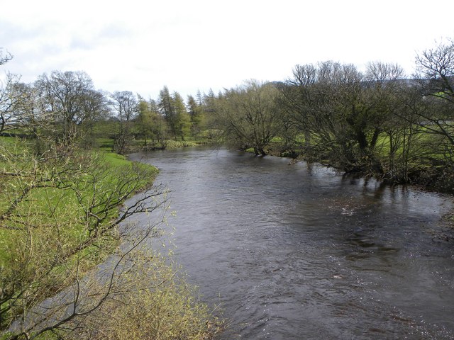
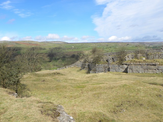
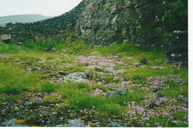
In contrast, the Moorland section of Bear Park offers a more rugged and wild experience. Here, visitors can explore vast stretches of heather-covered moors, interspersed with rocky outcrops and babbling brooks. The Moorland is home to an array of flora and fauna, including rare bird species such as the red grouse and the merlin falcon. It is also a designated Area of Outstanding Natural Beauty, attracting photographers and nature enthusiasts from far and wide.

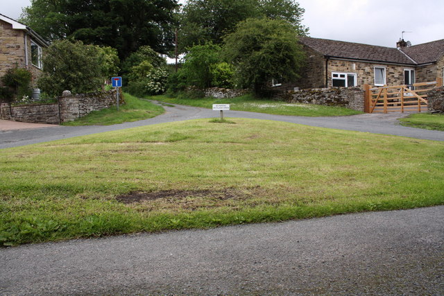
Bear Park is well-equipped to cater to the needs of visitors, with ample parking facilities, picnic areas, and visitor centers providing information on the local flora, fauna, and history of the area. Whether it's a leisurely stroll through the Downs or an adventurous hike across the Moorland, Bear Park offers a truly captivating experience for all.

If you have any feedback on the listing, please let us know in the comments section below.

Bear Park Images

Images are sourced within 2km of 54.29827/-1.9907927 or Grid Reference SE0089. Thanks to Geograph Open Source API. All images are credited.

Looking towards Ivy Scar Looking towards Ivy Scar from The Straights.
Looking towards Ivy Scar
Looking towards Ivy Scar from The Straights.
River Ure near Aysgarth Looking downstream with Penhill in the distance.
River Ure near Aysgarth
Looking downstream with Penhill in the distance.
Footbridge over the River Ure Footbridge over the River Ure near Aysgarth.
Footbridge over the River Ure
Footbridge over the River Ure near Aysgarth.
Footbridge over the River Ure
Disused Wensleydale railway embankment
Limekiln Lane A footpath enclosed by walls near Aysgarth.
Limekiln Lane
A footpath enclosed by walls near Aysgarth.
The Gatehouse, Aysgarth On "The Straights" near Ballowfield Bridge (across Eller Beck).
Due South of Mill Hill labelled "Gate House" 1910 and Ballowfield T.P. in 1858 (665 ft ASL). 
The property served the Richmond & Lancaster (Eastern District) Turnpike Trust in the 18ᵗʰ & 19ᵗʰ C.

Milestone Society National ID: YN.AYS
The Gatehouse, Aysgarth
On "The Straights" near Ballowfield Bridge (across Eller Beck). Due South of Mill Hill labelled "Gate House" 1910 and Ballowfield T.P. in 1858 (665 ft ASL). The property served the Richmond & Lancaster (Eastern District) Turnpike Trust in the 18ᵗʰ & 19ᵗʰ C. Milestone Society National ID: YN.AYS
Lowgill Bridge Small stone bridge that allows the A684 to cross over Gill Beck.
Lowgill Bridge
Small stone bridge that allows the A684 to cross over Gill Beck.
Gill Beck Flowing through the pastures at Seata.
Gill Beck
Flowing through the pastures at Seata.
The Ure at Ballowfield Looking upstream from the footbridge near Seata Farm.
The Ure at Ballowfield
Looking upstream from the footbridge near Seata Farm.
The Ure heading for Aysgarth Looking downstream along the Ure from the footbridge near Seata Farm.
The Ure heading for Aysgarth
Looking downstream along the Ure from the footbridge near Seata Farm.
Seata Quarry A general view across this old limestone quarry to the west of Aysgarth. Now a nature reserve with interesting plant species.
Seata Quarry
A general view across this old limestone quarry to the west of Aysgarth. Now a nature reserve with interesting plant species.
Lambs pose in the sunshine Lambs in the pastures above Seata Quarry.
Lambs pose in the sunshine
Lambs in the pastures above Seata Quarry.
Disused Seata Quarry floor with a good cover of Saxifrage in 2002
The small village green
Gatepost with benchmark beside road to Redmire The Ordnance Survey cut mark benchmark is described on the Bench Mark Database at <span class="nowrap"><a title="http://www.bench-marks.org.uk/bm38359" rel="nofollow ugc noopener" href="http://www.bench-marks.org.uk/bm38359">Link</a><img style="margin-left:2px;" alt="External link" title="External link - shift click to open in new window" src="https://s1.geograph.org.uk/img/external.png" width="10" height="10"/></span>
Gatepost with benchmark beside road to Redmire
The Ordnance Survey cut mark benchmark is described on the Bench Mark Database at LinkExternal link
Gateway and minor road junction on road to Redmire The gatepost on LHS of the gateway on RHS of photo has an OS benchmark <a href="https://www.geograph.org.uk/photo/2515931">SE0190 : Gatepost with benchmark beside road to Redmire</a>
Gateway and minor road junction on road to Redmire
The gatepost on LHS of the gateway on RHS of photo has an OS benchmark SE0190 : Gatepost with benchmark beside road to Redmire
Benchmark on gatepost of East End Farm Ordnance Survey cut mark benchmark described on the Bench Mark Database at <span class="nowrap"><a title="http://www.bench-marks.org.uk/bm38356" rel="nofollow ugc noopener" href="http://www.bench-marks.org.uk/bm38356">Link</a><img style="margin-left:2px;" alt="External link" title="External link - shift click to open in new window" src="https://s1.geograph.org.uk/img/external.png" width="10" height="10"/></span>
Benchmark on gatepost of East End Farm
Ordnance Survey cut mark benchmark described on the Bench Mark Database at LinkExternal link
Show me another place!

Bear Park is located at Grid Ref: SE0089 (Lat: 54.29827, Lng: -1.9907927)

Division: North Riding

Administrative County: North Yorkshire

District: Richmondshire

Police Authority: North Yorkshire

What 3 Words

///singing.cricket.walked. Near Leyburn, North Yorkshire

Nearby Locations

Carperby Bear Park

Related Wikis

Carperby

Carperby is a village in the Yorkshire Dales, North Yorkshire, England. It lies 7 miles (11 km) west of Leyburn. == Etymology == The derivation of the...

Aysgarth railway station

Aysgarth railway station is a disused railway station in North Yorkshire, England, near Aysgarth Falls. It was part of the Hawes Branch of the North Eastern...

Carperby-cum-Thoresby

Carperby-cum-Thoresby is a civil parish in the Richmondshire district of North Yorkshire, England. The parish contains the village of Carperby and the...

Aysgarth Falls

Aysgarth Falls are a triple flight of waterfalls, surrounded by woodland and farmland, carved out by the River Ure over an almost one-mile (two-kilometre...

St Andrew's Church, Aysgarth

St Andrew's Church, Aysgarth, is a Grade II* listed parish church in the Church of England: 66  in Aysgarth, North Yorkshire. It is located on the south...

Aysgarth

Aysgarth is a village and civil parish in Wensleydale, in North Yorkshire, England. The village is in the Yorkshire Dales National Park, about 16 miles...

A684 road

The A684 is an A road that runs through Cumbria and North Yorkshire, starting at Kendal, Cumbria and ending at Ellerbeck and the A19 road in North Yorkshire...

Bishopdale Beck

Bishopdale Beck is a major tributary of the River Ure in North Yorkshire, England. The beck flows down Bishopdale, a side valley of Wensleydale in the...

Nearby Amenities

Located within 500m of 54.29827,-1.9907927
Hazard Forward: blind_summits
Lat/Long: 54.3017037/-1.9941073
Barrier: stile
Foot: yes
Lat/Long: 54.2978991/-1.9836392
Barrier: stile
Foot: yes
Stile: squeezer
Lat/Long: 54.2986357/-1.9834615
Barrier: stile
Foot: yes
Lat/Long: 54.299377/-1.9835874
Barrier: stile
Source: survey;gps
Lat/Long: 54.2948447/-1.9940264
Access: yes
Barrier: entrance
Lat/Long: 54.2999075/-1.9931898
Access: yes
Barrier: entrance
Lat/Long: 54.3007808/-1.9910828
Barrier: stile
Lat/Long: 54.2962914/-1.9904306
Access: yes
Barrier: entrance
Lat/Long: 54.2978132/-1.9877837
Access: yes
Barrier: entrance
Lat/Long: 54.2995099/-1.9893555
Access: yes
Barrier: entrance
Lat/Long: 54.3003676/-1.9933895
Barrier: stile
Lat/Long: 54.2965234/-1.9910333
Barrier: stile
Lat/Long: 54.296046/-1.992538
Barrier: stile
Lat/Long: 54.2960053/-1.9926479
Power: pole
Lat/Long: 54.2959208/-1.9927391
Power: pole
Lat/Long: 54.2963293/-1.9942948
Power: pole
Lat/Long: 54.2967253/-1.9960088
Power: pole
Lat/Long: 54.2967684/-1.9973713
Barrier: entrance
Lat/Long: 54.2997572/-1.9842204
Barrier: entrance
Lat/Long: 54.2986553/-1.9833246
Barrier: entrance
Lat/Long: 54.2983877/-1.9855642
Barrier: entrance
Lat/Long: 54.2980386/-1.9867846
Barrier: entrance
Lat/Long: 54.2997455/-1.9878522
The data included in this document is from www.openstreetmap.org. The data is made available under ODbL.

Have you been to Bear Park?

Leave your review of Bear Park below (or comments, questions and feedback).