Tarn Moor

Downs, Moorland in Yorkshire Craven

England

Tarn Moor

Sheep with lambs at footpath from Brackenley Lane at west end of Embsay
Sheep with lambs at footpath from Brackenley Lane at west end of Embsay Credit: Roger Templeman

Tarn Moor is a picturesque area located in Yorkshire, England, characterized by its stunning Downs and Moorland landscapes. Covering a vast expanse, it is situated within the Yorkshire Dales National Park, renowned for its natural beauty and diverse ecosystems.

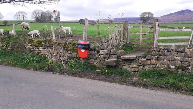
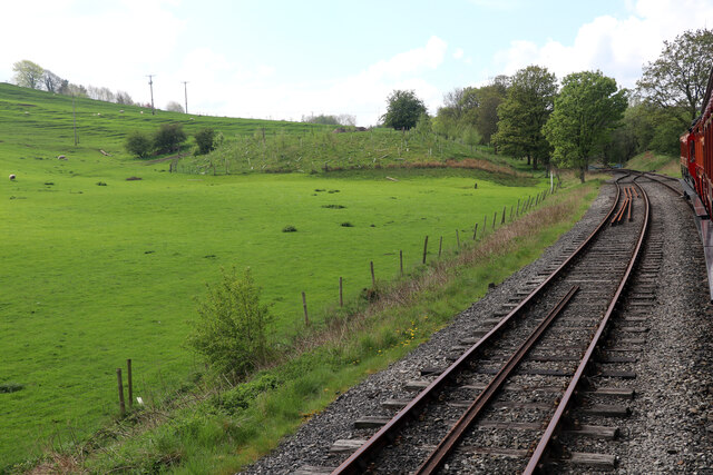
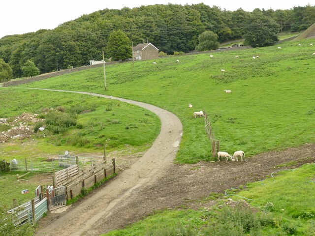
The moorland is a prominent feature of Tarn Moor, with its expansive stretches of open land, dominated by heather, grasses, and scattered shrubs. This rugged terrain provides a habitat for a range of wildlife, including birds such as curlews and lapwings, as well as numerous species of butterflies and moths. The moors are also home to a variety of grazing animals, including sheep and cattle, which play a crucial role in maintaining the unique ecosystem.

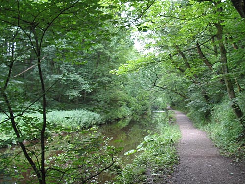
Tarn Moor is intersected by several streams and small rivers, which have carved out beautiful valleys over time. These watercourses provide a vital water source for the surrounding vegetation and wildlife, creating lush pockets of greenery amidst the moorland.

The area is also known for its ancient archaeological sites, with numerous Neolithic and Bronze Age remains scattered throughout the landscape. These include burial mounds, stone circles, and remnants of ancient settlements, offering a glimpse into the rich history of the area.

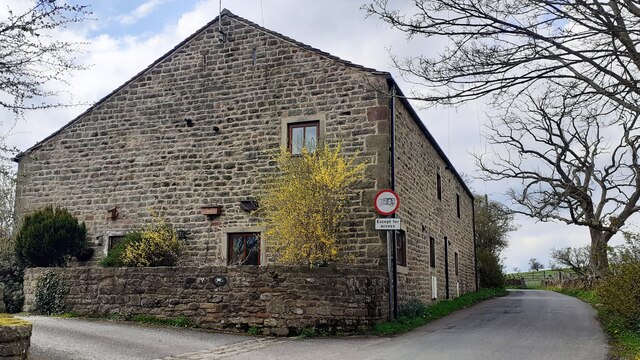
Tarn Moor attracts many visitors who come to enjoy the tranquility and natural beauty it offers. Hikers and walkers are particularly drawn to the area, as it provides numerous footpaths and trails that allow them to explore the diverse terrain and take in the breathtaking views.

In summary, Tarn Moor is a captivating region in Yorkshire, England, known for its expansive moorland, diverse wildlife, and ancient archaeological sites. It is a haven for nature enthusiasts and history buffs alike, offering a unique and captivating experience for all who visit.

If you have any feedback on the listing, please let us know in the comments section below.

Tarn Moor Images

Images are sourced within 2km of 53.977254/-2.0229715 or Grid Reference SD9853. Thanks to Geograph Open Source API. All images are credited.

Sheep with lambs at footpath from Brackenley Lane at west end of Embsay
Lind View Barn on south side of Brackenley Lane at west end of Embsay
Brackenley Grange on south side of Brackenley Lane There's a sign requesting motorists to drive slowly watching out for hedgehogs on the near corner of the building
Brackenley Grange on south side of Brackenley Lane
There's a sign requesting motorists to drive slowly watching out for hedgehogs on the near corner of the building
Brackenley Grange on south side of Brackenley Lane at Brackenley Crescent junction There is a Slow Hedgehog sign on the near corner of the house's boundary wall
Brackenley Grange on south side of Brackenley Lane at Brackenley Crescent junction
There is a Slow Hedgehog sign on the near corner of the house's boundary wall
Embsay & Bolton Abbey Steam Railway - Bow Bridge loop This is the limit of the preserved railway looking towards the former Embsay Junction. There is no station here so we all had to wait on board while the locomotive ran round on the loop.
Embsay & Bolton Abbey Steam Railway - Bow Bridge loop
This is the limit of the preserved railway looking towards the former Embsay Junction. There is no station here so we all had to wait on board while the locomotive ran round on the loop.
Waterworks below Embsay Reservoir Dam The Reservoir was opened by Skipton Urban District Council in 1910. The building with the chimney was the Engine House.
Waterworks below Embsay Reservoir Dam
The Reservoir was opened by Skipton Urban District Council in 1910. The building with the chimney was the Engine House.
Memorial bench overlooking the Embsay Reservoir This bench of somewhat unusual design stands beside the permissive path encircling the reservoir.
Memorial bench overlooking the Embsay Reservoir
This bench of somewhat unusual design stands beside the permissive path encircling the reservoir.
Drawdown tower on the Embsay Reservoir The Reservoir was opened by Skipton Urban District Council in 1910. Embsay Crag <a href="https://www.geograph.org.uk/gridref/SE0055">SE0055</a> on the skyline.
Drawdown tower on the Embsay Reservoir
The Reservoir was opened by Skipton Urban District Council in 1910. Embsay Crag SE0055 on the skyline.
Young plantation on the eastern shore of Embsay Reservoir A permissive path encircles Embsay Reservoir, passing this cluster of Tuley tubes.
Young plantation on the eastern shore of Embsay Reservoir
A permissive path encircles Embsay Reservoir, passing this cluster of Tuley tubes.
Spillway on the Embsay Reservoir Rather unusually for these times, water is actually flowing down the spillway.
Spillway on the Embsay Reservoir
Rather unusually for these times, water is actually flowing down the spillway.
Head of the spillway on the Embsay Reservoir Rather unusually for these times, water is actually flowing down the spillway.
Head of the spillway on the Embsay Reservoir
Rather unusually for these times, water is actually flowing down the spillway.
Blocked up hole in a wall On Brackenley Lane in Embsay; see <a href="https://www.geograph.org.uk/photo/7462465">SE0053 : Brackenley Grange on south side of Brackenley Lane at Brackenley Crescent junction</a> for context. This was the site of Brackenley Farm (the house in the linked photo may be the original farmhouse) so I suggest this may have been a niche for a milk churn.
Blocked up hole in a wall
On Brackenley Lane in Embsay; see SE0053 : Brackenley Grange on south side of Brackenley Lane at Brackenley Crescent junction for context. This was the site of Brackenley Farm (the house in the linked photo may be the original farmhouse) so I suggest this may have been a niche for a milk churn.
Brackenley Lane Wastewater Pumping Station There is no sign of a 'wet well', only a control cabinet above ground, so there may just be an inline pump below ground.
Brackenley Lane Wastewater Pumping Station
There is no sign of a 'wet well', only a control cabinet above ground, so there may just be an inline pump below ground.
Brackenley House The large house of 1870 is grade II listed (list entry 1131690). See <a href="https://www.geograph.org.uk/photo/4080689">SE0053 : House on Brackenley Lane, Embsay</a> for a different view.
Brackenley House
The large house of 1870 is grade II listed (list entry 1131690). See SE0053 : House on Brackenley Lane, Embsay for a different view.
Bus shelter, Skipton Road, Embsay Another contributor spotted what I didn't, that the shelter cunningly conceals an electrical substation <a href="https://www.geograph.org.uk/photo/5077966">SE0053 : Electricity Substation No 2647 & Bus Shelter - Skipton Road</a>. 

To the left is a stone marked with a cross, possibly a boundary stone, though it lacks any lettering. A local history page does mention that the village boundary was marked with cross stones in this way as it was a Priory estate, but this location doesn't match either the medieval or modern boundaries.
Bus shelter, Skipton Road, Embsay
Another contributor spotted what I didn't, that the shelter cunningly conceals an electrical substation SE0053 : Electricity Substation No 2647 & Bus Shelter - Skipton Road. To the left is a stone marked with a cross, possibly a boundary stone, though it lacks any lettering. A local history page does mention that the village boundary was marked with cross stones in this way as it was a Priory estate, but this location doesn't match either the medieval or modern boundaries.
Embsay Diesel Gala (6) The Embsay and Bolton Abbey Railway was holding a diesel gala over the August bank holiday, with a beer festival. Here, a shuttle train from Embsay station pauses at the far end of the line before reversing. Only seventy metres separates this point from the existing freight line into Skipton at Embsay Junction, but the contractual terms required for private railways to run trains on Network Rail lines mean it is often too expensive to have such a physical connection, meaning that any movement of locomotives or carriages  to and from the railway has to be by road.
Embsay Diesel Gala (6)
The Embsay and Bolton Abbey Railway was holding a diesel gala over the August bank holiday, with a beer festival. Here, a shuttle train from Embsay station pauses at the far end of the line before reversing. Only seventy metres separates this point from the existing freight line into Skipton at Embsay Junction, but the contractual terms required for private railways to run trains on Network Rail lines mean it is often too expensive to have such a physical connection, meaning that any movement of locomotives or carriages to and from the railway has to be by road.
Embsay Diesel Gala (7) The Embsay and Bolton Abbey Railway was holding a diesel gala over the August bank holiday, with a beer festival. Here, a shuttle train from Embsay station passes the ground frame (points levers) for the Embsay Junction run-round loop.
Embsay Diesel Gala (7)
The Embsay and Bolton Abbey Railway was holding a diesel gala over the August bank holiday, with a beer festival. Here, a shuttle train from Embsay station passes the ground frame (points levers) for the Embsay Junction run-round loop.
Track to Manby Castle House See <a href="https://www.geograph.org.uk/photo/4148871">SE0052 : Embsay:  Manby Castle House</a> for the house. I'm not aware the name has any historical significance.
Track to Manby Castle House
See SE0052 : Embsay: Manby Castle House for the house. I'm not aware the name has any historical significance.
Show me another place!

Tarn Moor is located at Grid Ref: SD9853 (Lat: 53.977254, Lng: -2.0229715)

Division: West Riding

Administrative County: North Yorkshire

District: Craven

Police Authority: North Yorkshire

What 3 Words

///remission.sectors.ventures. Near Skipton, North Yorkshire

Related Wikis

Nearby Amenities

Located within 500m of 53.977254,-2.0229715
Pub
Craven Heifer
Accommodation: yes
Addr City: Skipton
Addr County: North Yorkshire
Addr Postcode: BD23 3LA
Addr Street: Grassington Road
Fhrs Id: 292966
Food: yes
Source Addr: FHRS Open Data
Website: www.cravenheiferskipton.co.uk
Lat/Long: 53.9767539/-2.0274874
Stirton - Craven Heifer Inn
Bus: yes
Public Transport: stop_position
Lat/Long: 53.9763883/-2.0278625
Historic: memorial
Lat/Long: 53.9764321/-2.0261915
Historic: memorial
Lat/Long: 53.9764588/-2.0260293
Historic: memorial
Lat/Long: 53.9765321/-2.0260155
Barrier: stile
Lat/Long: 53.974621/-2.0200994
Barrier: stile
Source: survey
Lat/Long: 53.9777229/-2.028335
Bench
Backrest: yes
Lat/Long: 53.9779154/-2.0260589
Hiking: yes
Information: guidepost
Source: GPS survey
Tourism: information
Lat/Long: 53.9777276/-2.0283039
Hiking: yes
Information: guidepost
Source: GPS survey
Tourism: information
Lat/Long: 53.978441/-2.0210183
Bus Stop
Stirton - Craven Heifer Inn
Bus: yes
Naptan AtcoCode: 3200YNA01780
Naptan NaptanCode: 32001780
Public Transport: platform
Lat/Long: 53.9763895/-2.0279279
Bus Stop
Stirton - Craven Heifer Inn
Bus: yes
Naptan AtcoCode: 3200YNA01779
Naptan NaptanCode: 32001779
Public Transport: platform
Lat/Long: 53.9765165/-2.027803
Stirton - Craven Heifer Inn
Bus: yes
Public Transport: stop_position
Lat/Long: 53.9765185/-2.0278729
Power: pole
Lat/Long: 53.9798563/-2.0201245
Power: pole
Lat/Long: 53.9794099/-2.0191079
Power: pole
Lat/Long: 53.978932/-2.0179519
Power: pole
Lat/Long: 53.9784856/-2.0168978
Power: pole
Lat/Long: 53.9779193/-2.015605
The data included in this document is from www.openstreetmap.org. The data is made available under ODbL.

Have you been to Tarn Moor?

Leave your review of Tarn Moor below (or comments, questions and feedback).