Park Moor

Downs, Moorland in Cheshire

England

Park Moor

Looking up the valley of Gnathole Brook, west of Charles Head
Looking up the valley of Gnathole Brook, west of Charles Head Credit: Christopher Hilton

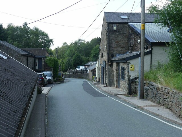
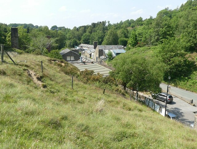
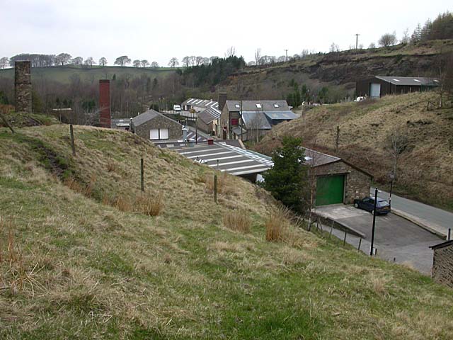
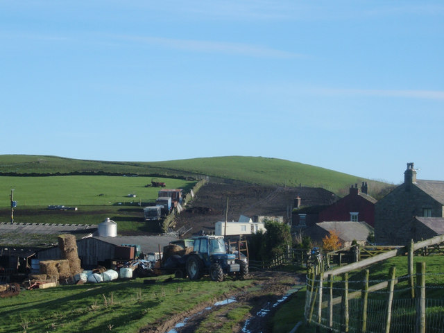
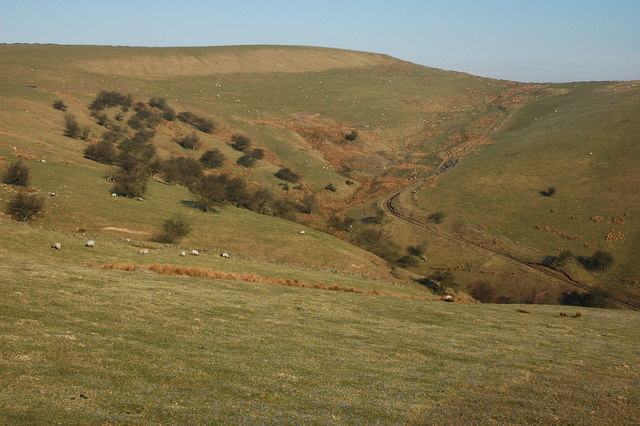
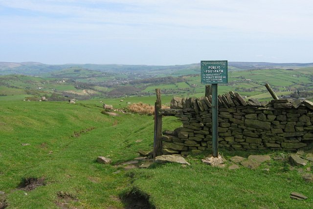
Park Moor is a picturesque area located in Cheshire, England. Spanning over a vast landscape, it is known for its scenic beauty and diverse natural habitats. The moorland is situated in close proximity to the village of Parkgate, offering visitors a tranquil escape from urban life.

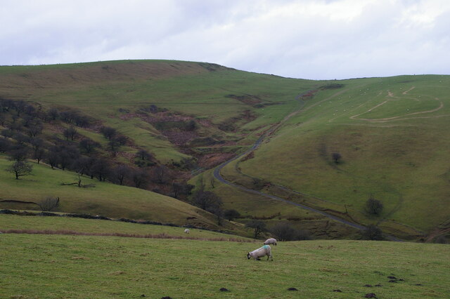
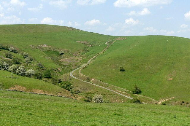
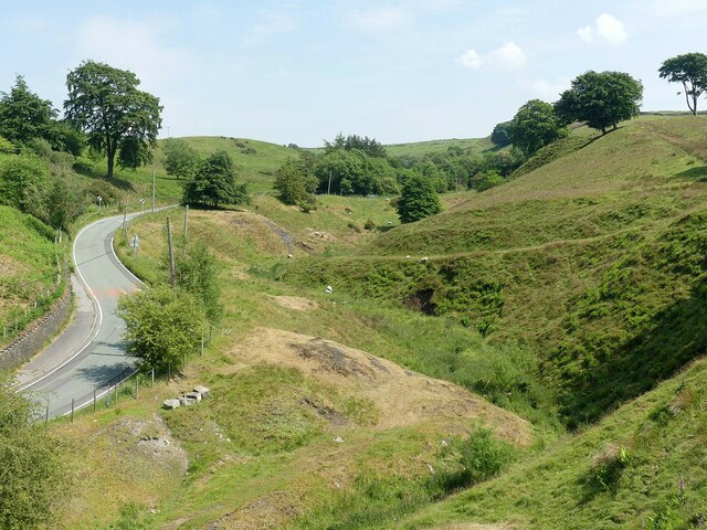
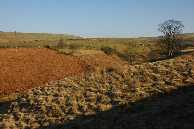
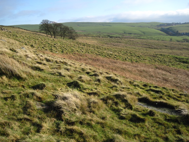
The area is characterized by rolling hills, vast expanses of open grassland, and heathland, creating a unique ecosystem that supports a wide array of plant and animal species. The moorland is covered in heather, gorse, and bracken, providing a vibrant display of colors throughout the year.

Park Moor is a haven for wildlife enthusiasts, as it is home to various bird species, including skylarks, lapwings, and kestrels. The moorland also provides a habitat for small mammals such as rabbits, hares, and voles. Additionally, visitors may spot the occasional deer or fox roaming freely.

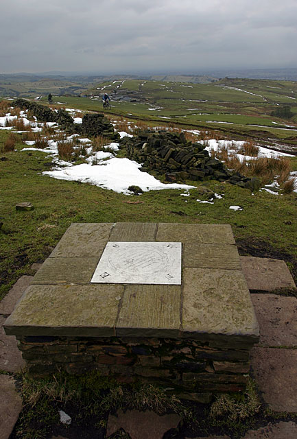
The area offers numerous walking trails and pathways, allowing visitors to explore the natural wonders at their own pace. One popular route is the Park Moor Circular Walk, which offers breathtaking views of the surrounding countryside and the nearby estuary. The diverse landscape also makes Park Moor an ideal location for outdoor activities, including picnicking, birdwatching, and photography.

With its natural beauty and peaceful atmosphere, Park Moor offers a serene escape for nature lovers and those seeking a break from the hustle and bustle of everyday life. Whether it's a leisurely stroll or an adventure-filled day, this charming moorland is sure to captivate visitors with its stunning vistas and rich biodiversity.

If you have any feedback on the listing, please let us know in the comments section below.

Park Moor Images

Images are sourced within 2km of 53.327695/-2.056024 or Grid Reference SJ9681. Thanks to Geograph Open Source API. All images are credited.

Looking up the valley of Gnathole Brook, west of Charles Head
The top of the Gnathole Brook valley Looking across from Bakestonedale Road. There is evidence for at least three of the small coal mines that were active in the area in the early-mid 19th century. The large site just left of centre is named on early maps as Black Sponds Pit.
The top of the Gnathole Brook valley
Looking across from Bakestonedale Road. There is evidence for at least three of the small coal mines that were active in the area in the early-mid 19th century. The large site just left of centre is named on early maps as Black Sponds Pit.
Bakestonedale Brickworks Brick-making started here in around 1820 due to readily accessible clay and coal. From the late 19th century the Hammond family were producing specialist firebricks. The brickworks extended either side of the road, and several kiln chimneys survive. Mining ceased in 1956 and brick-making in 1968 although Hammonds continued to make refractory materials until the 1990s. Since then the works have been developed into small business units and the area still an air of prosperity. For more of the history, see <span class="nowrap"><a title="https://www.williamhammondltd.com/history" rel="nofollow ugc noopener" href="https://www.williamhammondltd.com/history">Link</a><img style="margin-left:2px;" alt="External link" title="External link - shift click to open in new window" src="https://s1.geograph.org.uk/img/external.png" width="10" height="10"/></span> .
Bakestonedale Brickworks
Brick-making started here in around 1820 due to readily accessible clay and coal. From the late 19th century the Hammond family were producing specialist firebricks. The brickworks extended either side of the road, and several kiln chimneys survive. Mining ceased in 1956 and brick-making in 1968 although Hammonds continued to make refractory materials until the 1990s. Since then the works have been developed into small business units and the area still an air of prosperity. For more of the history, see LinkExternal link .
Bakestonedale Brickworks 'Cottage' entrance and drinking water supply. It's not clear whether this was in practice a dwelling or a small office.
Bakestonedale Brickworks
'Cottage' entrance and drinking water supply. It's not clear whether this was in practice a dwelling or a small office.
Bakestonedale Brickworks Brick-making started here in around 1820 due to readily accessible clay and coal. From the late 19th century the Hammond family were producing specialist firebricks. The brickworks extended either side of the road, and several kiln chimneys survive. Mining ceased in 1956 and brick-making in 1968 although Hammonds continued to make refractory materials until the 1990s. Since then the works have been developed into small business units and the area still an air of prosperity. For more of the history, see <span class="nowrap"><a title="https://www.williamhammondltd.com/history" rel="nofollow ugc noopener" href="https://www.williamhammondltd.com/history">Link</a><img style="margin-left:2px;" alt="External link" title="External link - shift click to open in new window" src="https://s1.geograph.org.uk/img/external.png" width="10" height="10"/></span> .
Bakestonedale Brickworks
Brick-making started here in around 1820 due to readily accessible clay and coal. From the late 19th century the Hammond family were producing specialist firebricks. The brickworks extended either side of the road, and several kiln chimneys survive. Mining ceased in 1956 and brick-making in 1968 although Hammonds continued to make refractory materials until the 1990s. Since then the works have been developed into small business units and the area still an air of prosperity. For more of the history, see LinkExternal link .
Old Brickworks Recreating this 'First' for the square <a title="https://www.geograph.org.uk/photo/61820" href="https://www.geograph.org.uk/photo/61820">Link</a> .

Brick-making started here in around 1820 due to readily accessible clay and coal. From the late 19th century the Hammond family were producing specialist firebricks. The brickworks extended either side of the road, and several kiln chimneys survive. Mining ceased in 1956 and brick-making in 1968 although Hammonds continued to make refractory materials until the 1990s. Since then the works have been developed into small business units and the area still an air of prosperity. For more of the history, see <span class="nowrap"><a title="https://www.williamhammondltd.com/history" rel="nofollow ugc noopener" href="https://www.williamhammondltd.com/history">Link</a><img style="margin-left:2px;" alt="External link" title="External link - shift click to open in new window" src="https://s1.geograph.org.uk/img/external.png" width="10" height="10"/></span> .
Old Brickworks
Recreating this 'First' for the square Link . Brick-making started here in around 1820 due to readily accessible clay and coal. From the late 19th century the Hammond family were producing specialist firebricks. The brickworks extended either side of the road, and several kiln chimneys survive. Mining ceased in 1956 and brick-making in 1968 although Hammonds continued to make refractory materials until the 1990s. Since then the works have been developed into small business units and the area still an air of prosperity. For more of the history, see LinkExternal link .
Bakestonedale Looking up the dale from the former brickworks. The spoil tips alongside the road are evidence of the working of coal in the area.
Bakestonedale
Looking up the dale from the former brickworks. The spoil tips alongside the road are evidence of the working of coal in the area.
Skeleton Sculpture, Old Brickworks This has clearly taken a few steps across the yard since 2020 <a title="https://www.geograph.org.uk/photo/6562702" href="https://www.geograph.org.uk/photo/6562702">Link</a> !
Skeleton Sculpture, Old Brickworks
This has clearly taken a few steps across the yard since 2020 Link !
Old Brickworks The old Hammond's firebrick works at Bakestonedale is now a small industrial estate.
Old Brickworks
The old Hammond's firebrick works at Bakestonedale is now a small industrial estate.
Hilltop Viewfinder On the unnamed summit south of Sponds hill: note the mountain bikes on the Gritstone Trail.
Hilltop Viewfinder
On the unnamed summit south of Sponds hill: note the mountain bikes on the Gritstone Trail.
Approaching Brink Farm Situated on Bakestonedale Road at its junction with the Gritstone Trail.
Approaching Brink Farm
Situated on Bakestonedale Road at its junction with the Gritstone Trail.
Bakestonedale Moor Bakestonedale Moor viewed from Bakestonedale Road to the east of Pott Shrigley.
Bakestonedale Moor
Bakestonedale Moor viewed from Bakestonedale Road to the east of Pott Shrigley.
Sponds Hill Sponds Hill viewed from Bakestonedale Moor Road.
Sponds Hill
Sponds Hill viewed from Bakestonedale Moor Road.
Bakestonedale Moor
Bakestonedale Moor
Lyme Hall House, Lyme Park, Disley National Trust house and gardens, most recently popularised after the BBC adaptation a few years ago of Pride and Prejudice.
Lyme Hall House, Lyme Park, Disley
National Trust house and gardens, most recently popularised after the BBC adaptation a few years ago of Pride and Prejudice.
The Cage in Lyme Park
Footpath sign on Sponds Hill Path descending from the ridge track on Sponds Hill. These old signs are a familiar sight in The Peak and are still maintained. When they were erected, access to land was bitterly resisted. Gritstone sheep graze  in front of a view to Whaley Bridge.
Footpath sign on Sponds Hill
Path descending from the ridge track on Sponds Hill. These old signs are a familiar sight in The Peak and are still maintained. When they were erected, access to land was bitterly resisted. Gritstone sheep graze in front of a view to Whaley Bridge.
Lyme Hall View of Lyme Hall - appeared as ‘Pemberley’ in the BBC’s adaptation of Jane Austen’s novel Pride and Prejudice.
Lyme Hall
View of Lyme Hall - appeared as ‘Pemberley’ in the BBC’s adaptation of Jane Austen’s novel Pride and Prejudice.
Show me another place!

Park Moor is located at Grid Ref: SJ9681 (Lat: 53.327695, Lng: -2.056024)

Unitary Authority: Cheshire East

Police Authority: Cheshire

What 3 Words

///emotional.replaying.irrigate. Near Pott Shrigley, Cheshire

Nearby Locations

Knightslow Wood Park Moor

Related Wikis

Bowstones

The Bowstones are a pair of Anglian cross shafts in Cheshire, England. Situated beside the old ridgeway between Disley and Macclesfield, overlooking Lyme...
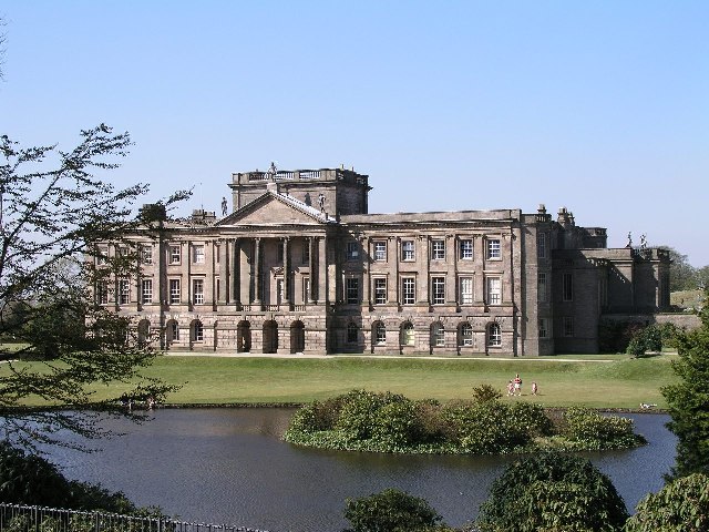
Lyme Park

Lyme Park is a large estate south of Disley, Cheshire, England, managed by the National Trust and consisting of a mansion house surrounded by formal gardens...

Lyme Handley

Lyme Handley, sometimes known as Lyme, is a former civil parish, now in the parish of Kettleshulme and Lyme Handley, in between Disley and Stockport, in...
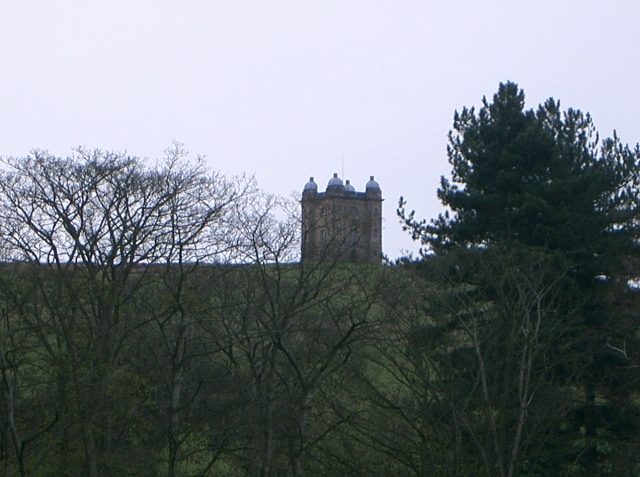
Shrigley Hall

Shrigley Hall is a former country house standing to the northwest of the village of Pott Shrigley, Cheshire, England. It has since been used as a school...

Nearby Amenities

Located within 500m of 53.327695,-2.056024
Barrier: stile
Foot: yes
Lat/Long: 53.3313824/-2.0596691
Barrier: stile
Lat/Long: 53.3295963/-2.0562163
Barrier: stile
Lat/Long: 53.3314192/-2.059884
Ford: stepping_stones
Lat/Long: 53.3314568/-2.0598459
Fixme: This must cross wall somehow
Lat/Long: 53.3298963/-2.0580527
Fixme: This must cross wall somehow
Lat/Long: 53.3273435/-2.0602705
Fixme: This must cross wall somehow
Lat/Long: 53.327365/-2.0602837
The data included in this document is from www.openstreetmap.org. The data is made available under ODbL.

Have you been to Park Moor?

Leave your review of Park Moor below (or comments, questions and feedback).