Slepe Moor
Downs, Moorland in Dorset
England
Slepe Moor
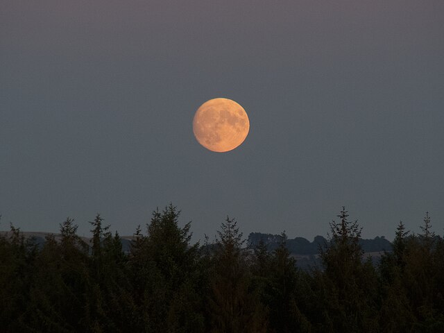
Slepe Moor is a unique and picturesque area located in the county of Dorset, England. It is nestled within the larger expanse of the Dorset Downs and is characterized by its vast stretches of untouched moorland. Covering an area of approximately 2 square miles, Slepe Moor offers visitors a tranquil escape from the hustle and bustle of modern life.
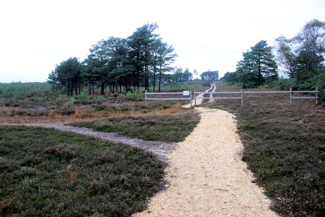
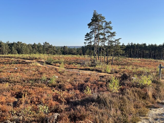
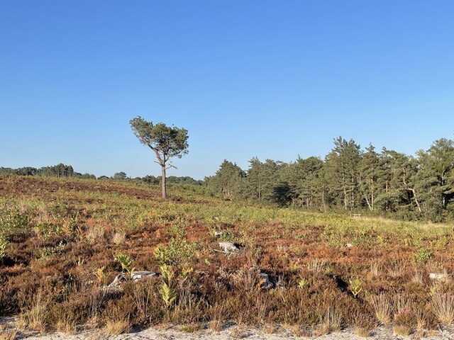
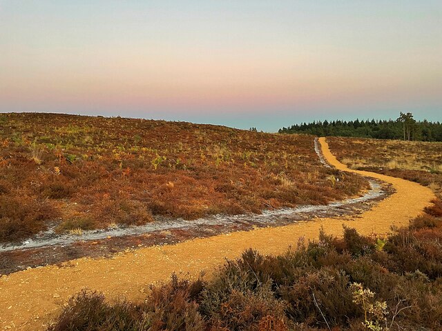
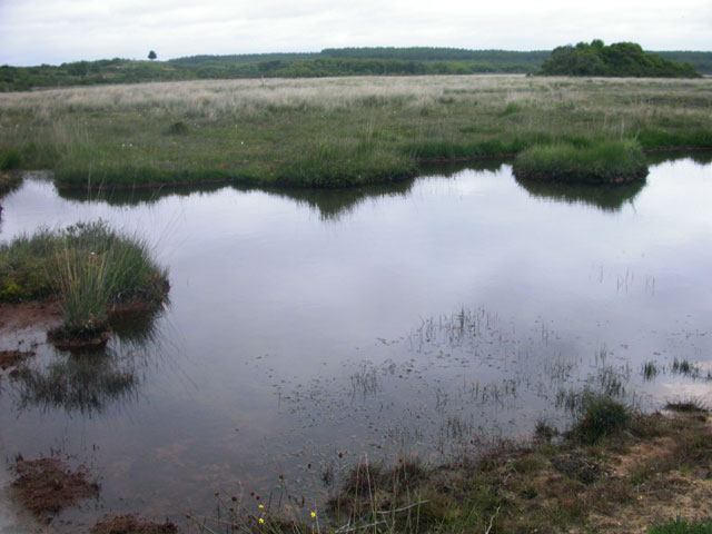
The moorland of Slepe Moor is made up of a variety of heathland and grassland habitats. It is known for its diverse range of plant species, including heather, gorse, and various types of grasses. These plants provide a rich and vibrant landscape, especially during the summer months when the moor is adorned with colorful blooms.
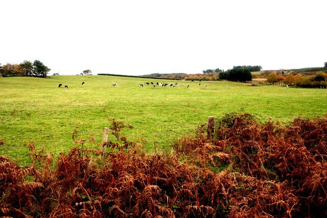
Wildlife enthusiasts will find Slepe Moor to be a haven for various animal species. The area is home to a variety of birdlife, including skylarks, stonechats, and meadow pipits. It is also known for its populations of small mammals such as rabbits and voles.
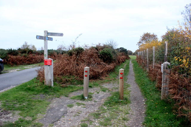
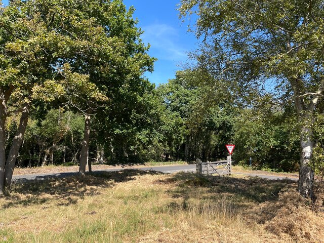
Slepe Moor is a popular destination for hikers and nature lovers. The area is crisscrossed with footpaths and bridleways, allowing visitors to explore its beauty on foot, bicycle, or horseback. The moor offers stunning panoramic views of the surrounding countryside, making it an ideal location for photography and picnicking.
With its untouched natural beauty and peaceful atmosphere, Slepe Moor is a hidden gem within the Dorset Downs. Whether you are a nature enthusiast, a keen hiker, or simply looking for a place to unwind and connect with the great outdoors, Slepe Moor is sure to captivate and inspire.
If you have any feedback on the listing, please let us know in the comments section below.
Slepe Moor Images
Images are sourced within 2km of 50.676637/-2.053855 or Grid Reference SY9686. Thanks to Geograph Open Source API. All images are credited.


Slepe Moor is located at Grid Ref: SY9686 (Lat: 50.676637, Lng: -2.053855)
Unitary Authority: Dorset
Police Authority: Dorset
What 3 Words
///afford.oils.skills. Near Corfe Castle, Dorset
Nearby Locations
Related Wikis

Arne RSPB reserve
Arne RSPB reserve is a 5.634-square-kilometre (1,392-acre) nature reserve and Site of Special Scientific Interest (SSSI) maintained by the RSPB and located...

Hartland Moor
Hartland Moor is a Site of Special Scientific Interest (SSSI) on the south side of Poole Harbour near the town of Wareham in Dorset, England. It consists...
Arne, Dorset
Arne is a village and civil parish in Dorset, England, situated 4 miles (6.4 km) east of Wareham. The local travel links are located at Wareham railway...

Gigger's Island
Gigger's Island is an island in Poole Harbour in the English county of Dorset. The island is situated near to the Frome and Piddle rivers, near to the...

Wytch Farm
Wytch Farm is an oil field and processing facility in the Purbeck district of Dorset, England. It is the largest onshore oil field in western Europe. The...

River Piddle
The River Piddle or Trent or North River is a small rural Dorset river which rises in the Dorset Downs and flows into Poole Harbour near Wareham. ��2...

Round Island (Dorset)
Round Island is an island in Poole Harbour in the English county of Dorset. It lies just off the shore of the Arne Peninsula in the south-west of the harbour...

Mid Dorset and North Poole (UK Parliament constituency)
Mid Dorset and North Poole is a constituency represented in the House of Commons of the UK Parliament since 2015 by Michael Tomlinson, a Conservative....
Related Videos

Arne Nature Reserve Dorset ~June Holiday 2018 Day #4
ArneNatureReserve #Dorset #caravanningUKcommunity #placestovisitindorset #holidaysindorset Today we visit Arne RSPB ...

BLUE LAGOON at DORSET UK / Walking Trail
Blue Pool is a flooded, disused clay pit where Purbeck ball clay was once extracted. It is now a lake within the Furzebrook Estate, ...

TWWS Ep03 || An adventure with Chloe to Arne! || Travel Dorset
Another weekend and another adventure! This time we headed to Arne to once again hunt for deer to photograph and film!
Visit to RSPB Arne Nature Reserve in Dorset UK
Welcome to my and Ellie's captivating journey through Arne Nature Reserve, (home of BBC Spring and Autumn Watch) a hidden ...
Nearby Amenities
Located within 500m of 50.676637,-2.053855Have you been to Slepe Moor?
Leave your review of Slepe Moor below (or comments, questions and feedback).