Hare Moss

Downs, Moorland in Yorkshire

England

Hare Moss

Heading South from West Stoney Keld This bridleway links two alternative versions of the Pennine Way - the main way  which crosses the A66 via an underpass at Pasture End, and the Bowes alternative which ascends to West Stoney Keld. This view is just after leaving the estate track west of West Stoney Keld heading towards the A66 and, in our case, a loop back round to Bowes over a mixture of public and permissive footpaths. I suspect it is not much used by walkers (nor cyclists or equestrians) but sees most traffic in its northern half, where it takes clients to a line of grouse butts half a kilometre to the SW of the point from which this shot was taken. It certainly gets fainter beyond them, though is still readily followed in good visibility.
Heading South from West Stoney Keld Credit: Andy Waddington

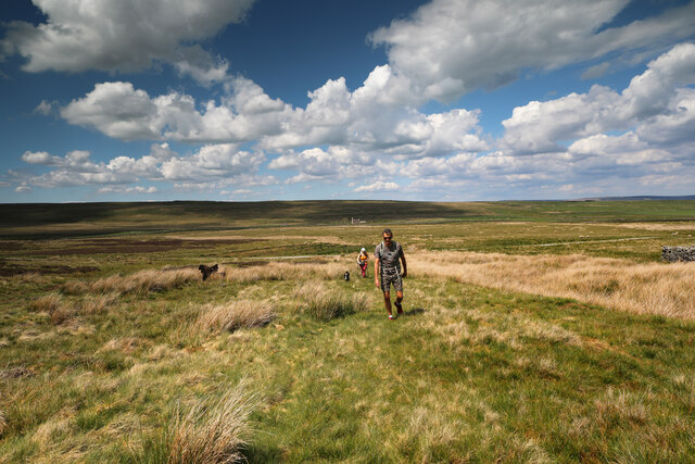
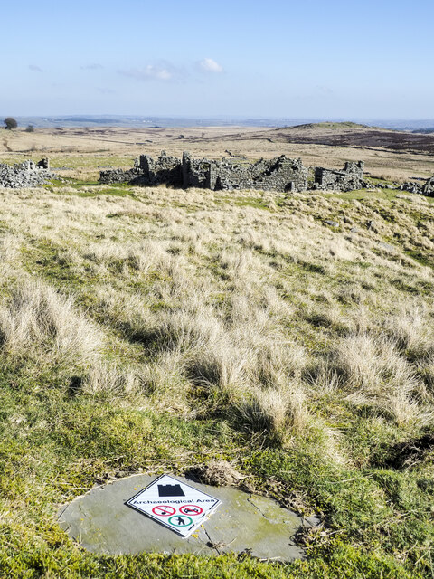
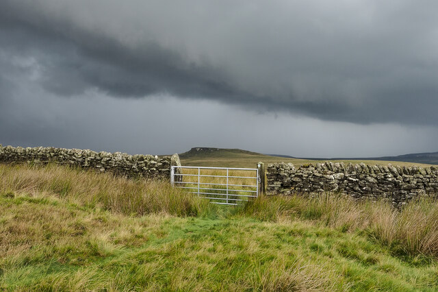
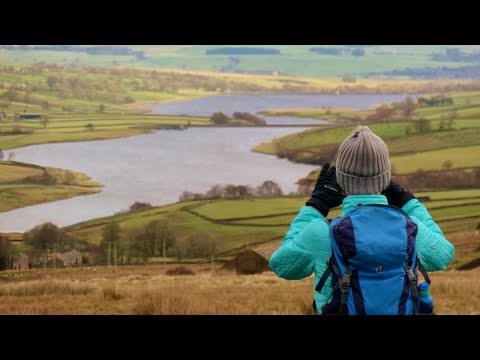
Hare Moss is a stunning expanse of land located in the region of Yorkshire, England. Situated amidst the picturesque Yorkshire Downs and Moorland, this area is known for its breathtaking beauty and tranquil atmosphere.

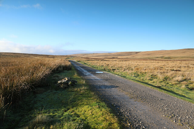
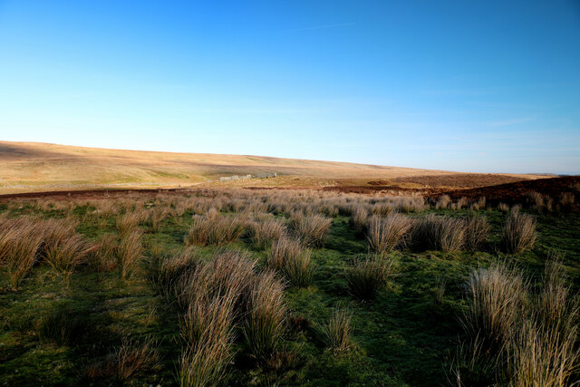
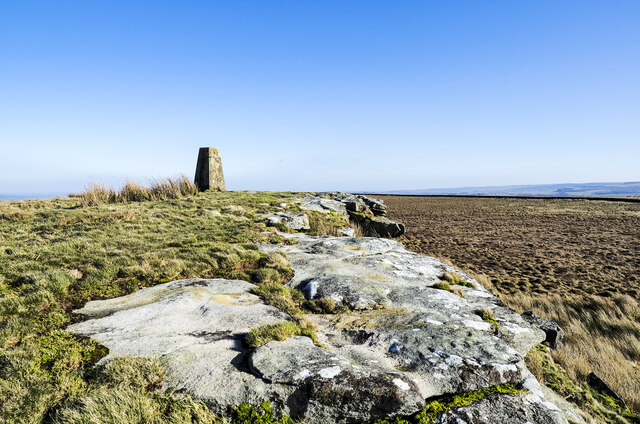
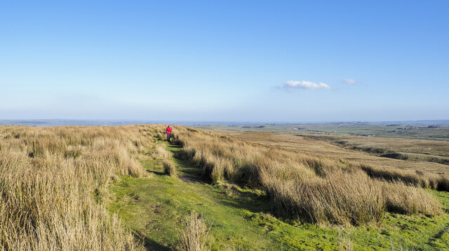
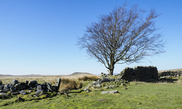
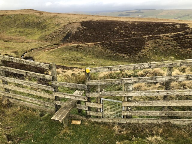
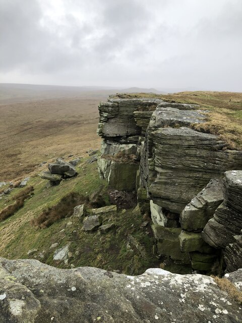
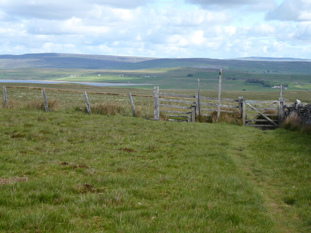
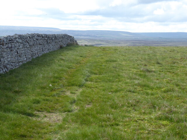
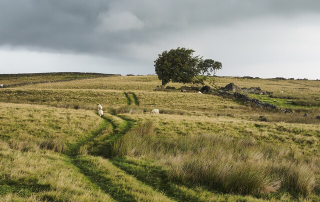
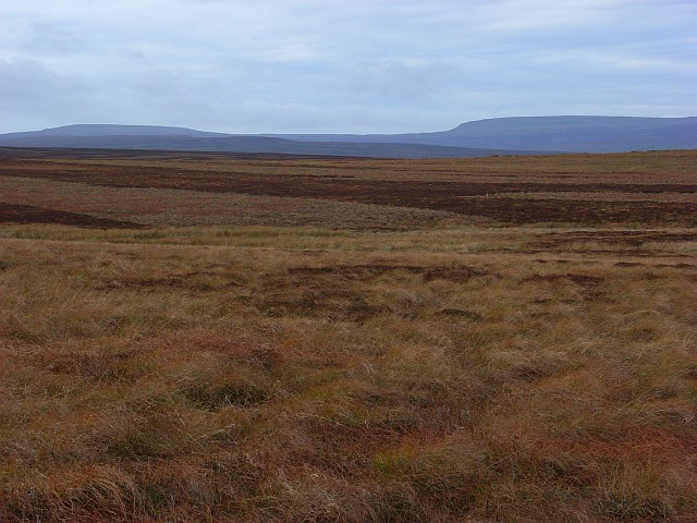
Covering a vast area, Hare Moss is characterized by its rolling hills, heather-clad moorlands, and diverse flora and fauna. The land is predominantly covered in a variety of grasses, mosses, and heather, creating a visually striking landscape that changes throughout the seasons. In spring, vibrant wildflowers bloom, adding splashes of color to the terrain.

The area is home to a rich array of wildlife, including numerous bird species such as red grouse, curlews, and lapwings. Visitors can often spot hares darting across the moors, which gives the location its name. The moorland also provides a habitat for smaller mammals such as rabbits and voles.

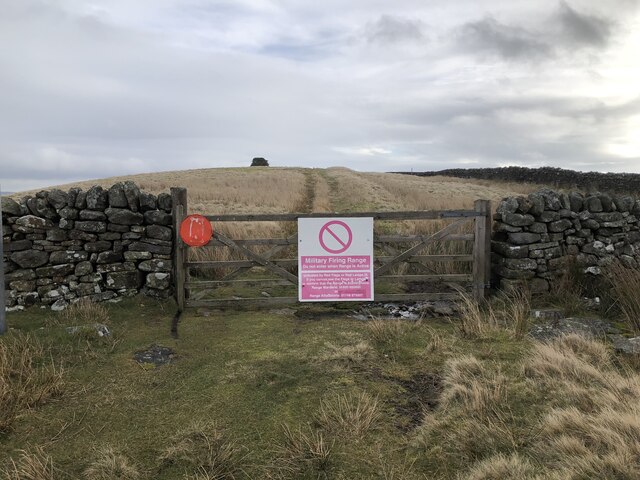
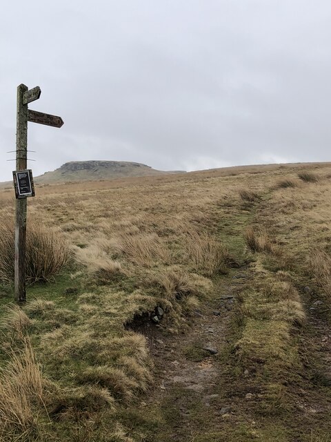
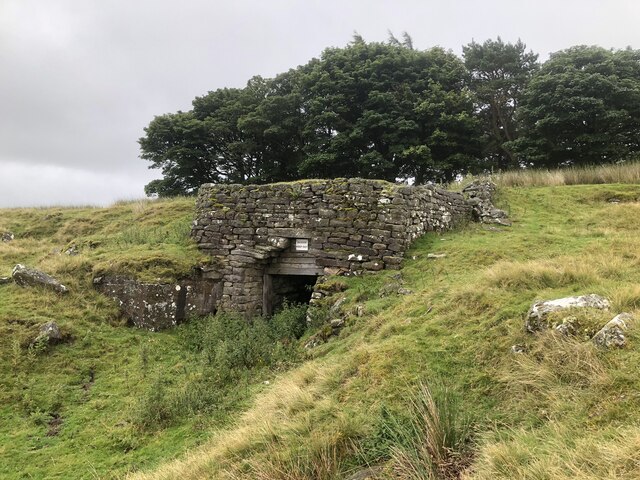
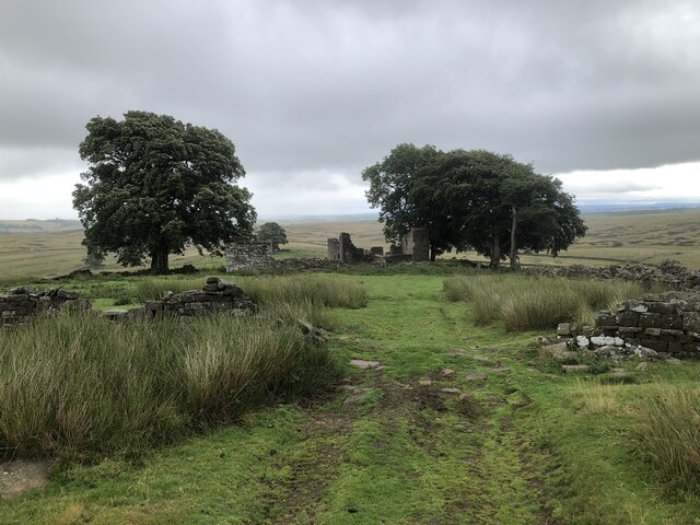
Hare Moss is a popular destination for nature enthusiasts, hikers, and photographers who are drawn to its unspoiled beauty. The rolling hills present an opportunity for scenic walks and hikes, allowing visitors to immerse themselves in the tranquility of the countryside. The moorland offers a sense of solitude and serenity, making it an ideal spot for those seeking a peaceful escape from the hustle and bustle of city life.

Overall, Hare Moss in Yorkshire is a captivating natural landscape that showcases the stunning beauty of the Yorkshire Downs and Moorland. It offers a haven for wildlife and a place for visitors to connect with nature and experience the raw magnificence of the English countryside.

If you have any feedback on the listing, please let us know in the comments section below.

Hare Moss Images

Images are sourced within 2km of 54.544651/-2.061906 or Grid Reference NY9616. Thanks to Geograph Open Source API. All images are credited.

Heading South from West Stoney Keld This bridleway links two alternative versions of the Pennine Way - the main way  which crosses the A66 via an underpass at Pasture End, and the Bowes alternative which ascends to West Stoney Keld. This view is just after leaving the estate track west of West Stoney Keld heading towards the A66 and, in our case, a loop back round to Bowes over a mixture of public and permissive footpaths. I suspect it is not much used by walkers (nor cyclists or equestrians) but sees most traffic in its northern half, where it takes clients to a line of grouse butts half a kilometre to the SW of the point from which this shot was taken. It certainly gets fainter beyond them, though is still readily followed in good visibility.
Heading South from West Stoney Keld
This bridleway links two alternative versions of the Pennine Way - the main way which crosses the A66 via an underpass at Pasture End, and the Bowes alternative which ascends to West Stoney Keld. This view is just after leaving the estate track west of West Stoney Keld heading towards the A66 and, in our case, a loop back round to Bowes over a mixture of public and permissive footpaths. I suspect it is not much used by walkers (nor cyclists or equestrians) but sees most traffic in its northern half, where it takes clients to a line of grouse butts half a kilometre to the SW of the point from which this shot was taken. It certainly gets fainter beyond them, though is still readily followed in good visibility.
Estate track north of Ravock From the end of the public road at West Stoney Keld, the estate track heads west at the base of the gentle northern slopes of Ravock, heading up to North Moor before taking a sharp left turn to head to the A66 opposite Old Spital. Here it is heading up Sled Dale (occupied by Deepdale Beck which will indeed soon flow into Deepdale, but here the valley is too shallow to use that name, apparently). In about a kilometre it will cross the main route of the Pennine Way (used by those who have not chosen the Bowes Loop alternative to get nearer some overnight accommodation, as I did when walking it in 1974). Although very near my home, this is the first time I've done this section of track without skis as it often makes an excellent loipe, following compressed snow in the Land Rover tracks before heading higher onto the moors.
Estate track north of Ravock
From the end of the public road at West Stoney Keld, the estate track heads west at the base of the gentle northern slopes of Ravock, heading up to North Moor before taking a sharp left turn to head to the A66 opposite Old Spital. Here it is heading up Sled Dale (occupied by Deepdale Beck which will indeed soon flow into Deepdale, but here the valley is too shallow to use that name, apparently). In about a kilometre it will cross the main route of the Pennine Way (used by those who have not chosen the Bowes Loop alternative to get nearer some overnight accommodation, as I did when walking it in 1974). Although very near my home, this is the first time I've done this section of track without skis as it often makes an excellent loipe, following compressed snow in the Land Rover tracks before heading higher onto the moors.
Sheepfold in Sled Dale The very large scale map calls this structure a livestock pen, whilst the 1:25000 map prefers Sheepfold (as do I). The moor is nowadays managed for grouse, and there are certainly no sheep up here in the winter months, but a few are to be found dotted around in the summer. The sunlit moorland beyond Deepdale Beck is the Great Allotment, but the shallow valley is not Deepdale - that lies lower down the course of the stream. Up here it is called Sled Dale - probably appropriate as most times I've been here before, I've been on skis rather than a sled, but certainly something to slide along the snow has been most useful !
Sheepfold in Sled Dale
The very large scale map calls this structure a livestock pen, whilst the 1:25000 map prefers Sheepfold (as do I). The moor is nowadays managed for grouse, and there are certainly no sheep up here in the winter months, but a few are to be found dotted around in the summer. The sunlit moorland beyond Deepdale Beck is the Great Allotment, but the shallow valley is not Deepdale - that lies lower down the course of the stream. Up here it is called Sled Dale - probably appropriate as most times I've been here before, I've been on skis rather than a sled, but certainly something to slide along the snow has been most useful !
Ruins at East Loups's The name Loups's, occurs several times within the MOD's Battle Hill range which, it's understood was created at the time of WWII for troop training. Both East and West Loups's are in ruins.
Ruins at East Loups's
The name Loups's, occurs several times within the MOD's Battle Hill range which, it's understood was created at the time of WWII for troop training. Both East and West Loups's are in ruins.
Ruins at West Loups's The extensive ruins lie within the MOD training area at Battle Hill which it's understood was taken for troop training during WWII. The unusual sign in the foreground declares the vicinity to be an 'Archaeological Area'. One of the symbols on the notice appears to ban digging: probably best avoided in a military area anyway!
Ruins at West Loups's
The extensive ruins lie within the MOD training area at Battle Hill which it's understood was taken for troop training during WWII. The unusual sign in the foreground declares the vicinity to be an 'Archaeological Area'. One of the symbols on the notice appears to ban digging: probably best avoided in a military area anyway!
Rock edge at West Hare Crag West Hare Crag is one of a number of low rock outcrops in this vicinity. The trig point is known to the OS as Brown Rigg. Brown Rigg is the name of the moorland ridge which is followed by the distant wall.
Rock edge at West Hare Crag
West Hare Crag is one of a number of low rock outcrops in this vicinity. The trig point is known to the OS as Brown Rigg. Brown Rigg is the name of the moorland ridge which is followed by the distant wall.
Bridleway passing through rushes The walker ahead in the image is on the short grass of a bridleway heading along or towards Ladyfold Rigg. In this area the word Rigg appears a number of times on maps and applies to ridges separated by shallow valleys running more or less parallel to one another.
Bridleway passing through rushes
The walker ahead in the image is on the short grass of a bridleway heading along or towards Ladyfold Rigg. In this area the word Rigg appears a number of times on maps and applies to ridges separated by shallow valleys running more or less parallel to one another.
Lone tree and dry stone walling A tree with various sections of dry stone walling at Long Rigg near Loups's Hill; Goldsborough is in the distance.
Lone tree and dry stone walling
A tree with various sections of dry stone walling at Long Rigg near Loups's Hill; Goldsborough is in the distance.
Footpath Across How Beck Gully
Battle Hill Firing Range The range is crossed by several public rights of way. The gate here guards the bridleway that crosses the range. Access is allowed unless red flags and lights indicate that the range is active.
Battle Hill Firing Range
The range is crossed by several public rights of way. The gate here guards the bridleway that crosses the range. Access is allowed unless red flags and lights indicate that the range is active.
Gritstone Crags On Goldsborough Goldsborough stands as an outcrop above the rather desolate Cotherstone Moor and is passed by the Pennine Way, albeit the less walked Bowes Loop.
Gritstone Crags On Goldsborough
Goldsborough stands as an outcrop above the rather desolate Cotherstone Moor and is passed by the Pennine Way, albeit the less walked Bowes Loop.
Pennine Way Signpost The Pennine Way Bowes Loop, heading up Cotherstone Moor to the outcrop of Goldsborough
Pennine Way Signpost
The Pennine Way Bowes Loop, heading up Cotherstone Moor to the outcrop of Goldsborough
The Pennine Way near Race Yate
Old kiln on Loups's Hill
Ruins of East Loups's farm
Approaching storm near West Loups's (sic) West Loups's is a farm location behind the camera position; it's now in ruins.
Rain is approaching. Some had already crossed but much more was to come from the threatening cloud over the moorland to the west.
The view beyond the wall and gate to the rock-girt feature of Goldsborough.
Approaching storm near West Loups's (sic)
West Loups's is a farm location behind the camera position; it's now in ruins. Rain is approaching. Some had already crossed but much more was to come from the threatening cloud over the moorland to the west. The view beyond the wall and gate to the rock-girt feature of Goldsborough.
Vehicle track winding north over moorland The track winds north from a location close to the ruins of a farm known as West Loups's (sic).
The moorland is within the MOD range at Battle Hill. It's doubtful that there's any military activity in this part of the range but there is a rifle range to the east which sees some use, including civilian.
Vehicle track winding north over moorland
The track winds north from a location close to the ruins of a farm known as West Loups's (sic). The moorland is within the MOD range at Battle Hill. It's doubtful that there's any military activity in this part of the range but there is a rifle range to the east which sees some use, including civilian.
Show me another place!

Hare Moss is located at Grid Ref: NY9616 (Lat: 54.544651, Lng: -2.061906)

Division: North Riding

Unitary Authority: County Durham

Police Authority: Durham

What 3 Words

///wager.pitchers.searches. Near Bowes, Co. Durham

Related Wikis

Cotherstone Moor

Cotherstone Moor is a Site of Special Scientific Interest in the Teesdale district in south-west County Durham, England. It is an extensive area of moorland...

Mere Beck Meadows

Mere Beck Meadows, formerly known as Willoughby Hall Meadows, is a Site of Special Scientific Interest in the Teesdale district of County Durham, England...

Blackton Reservoir

Blackton Reservoir is a reservoir in County Durham, England. It is situated in Baldersdale, about 4 miles (7 km) west of Cotherstone, where the River Balder...

Hury Reservoir

Hury Reservoir is a reservoir in County Durham, England situated in Baldersdale. The reservoir is located about four miles south of Middleton-in-Teesdale...

Related Videos

County Durham Running and Walking Routes: Goldsborough Rigg 9 miles / Hury Reservoir & Pennine Way

A great walk from the book “100 walks in County Durham” by Gary Richardson. Walk number 87. Start at Hury Reservoir car park ...

Goldsbrough via Hury - A Local Hike

Eyup everyone, welcome to a very windy walk! This is a fairly local hike to me, in an area, I am familiar with due to fishing grounds.

Goldsborough & Baldersdale, North Pennines - 22 August 2021

A 9.4 mile walk from Hury Reservoir. The route initially heads up to Goldsborough before heading west to the dam wall of ...

Shacklesborough with Hury, Blackton & Baldershead Reservoir, North Pennines - 23 November 2020

An 11 mile walk from the dam of Hury Reservoir. The route follows the northern edge of both Hury and Blackton Reservoir west ...

Nearby Amenities

Located within 500m of 54.544651,-2.061906
Hare Moss
Place: locality
Lat/Long: 54.544301/-2.0667638
Lancy Crag
Place: locality
Lat/Long: 54.5407161/-2.0582022
The data included in this document is from www.openstreetmap.org. The data is made available under ODbL.

Have you been to Hare Moss?

Leave your review of Hare Moss below (or comments, questions and feedback).