Acton Fell

Downs, Moorland in Northumberland

England

Acton Fell

Trig point at Warlaw Pike The trig point at Warlaw Pike at 402 m.; it lies to the north of the local high point on Bulbeck Common at 413 m.
The view beyond is to the west, across the valley of Devil's Water.
Trig point at Warlaw Pike Credit: Trevor Littlewood

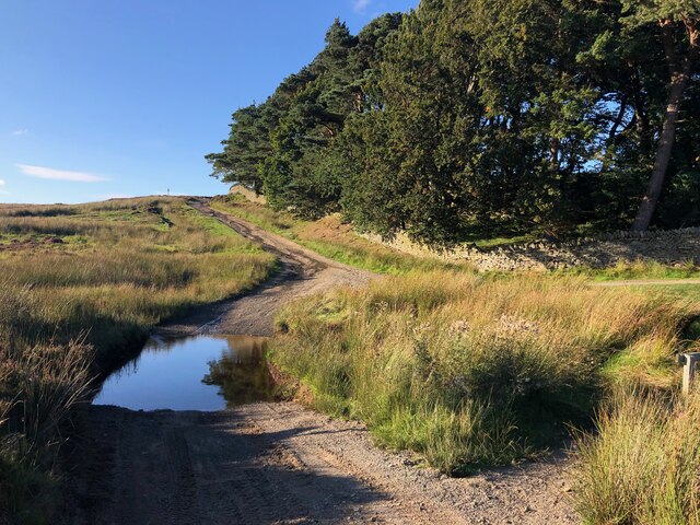
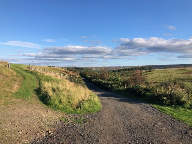
Acton Fell is a scenic area located in Northumberland, England. It is characterized by its rolling hills, expansive moorlands, and breathtaking views. The landscape of Acton Fell is mainly made up of downs and moorland, which provide a diverse and unique ecosystem.

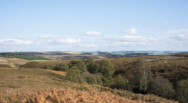
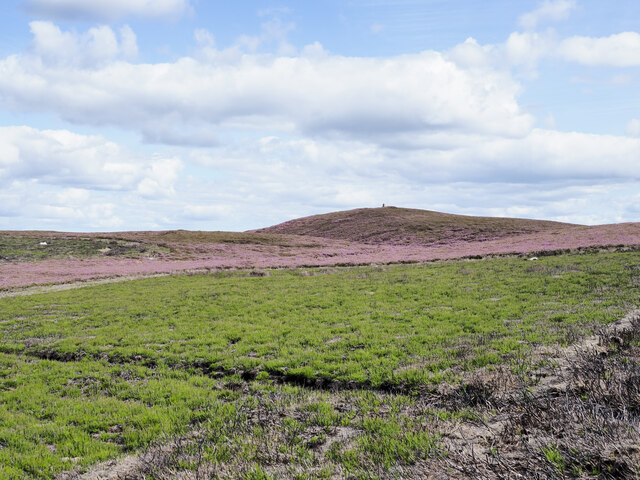
The downs of Acton Fell consist of gentle slopes and grassy plains that offer panoramic vistas of the surrounding countryside. These open spaces are often covered in colorful wildflowers during the warmer months, creating a picturesque scene. The downs are also home to a variety of wildlife, including birds such as skylarks and kestrels.

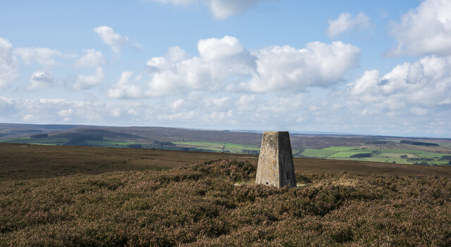
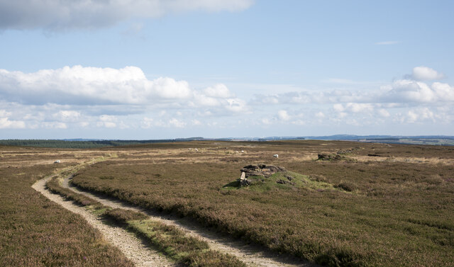
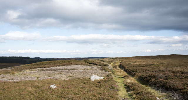
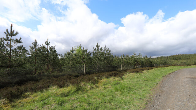
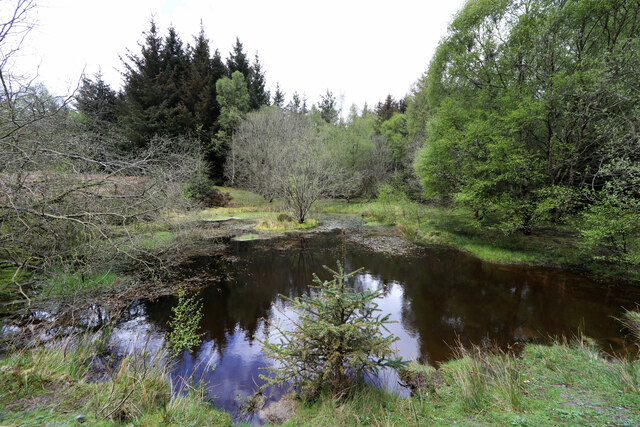
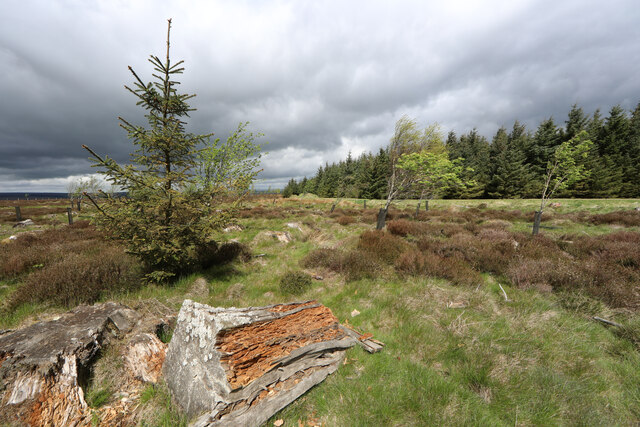
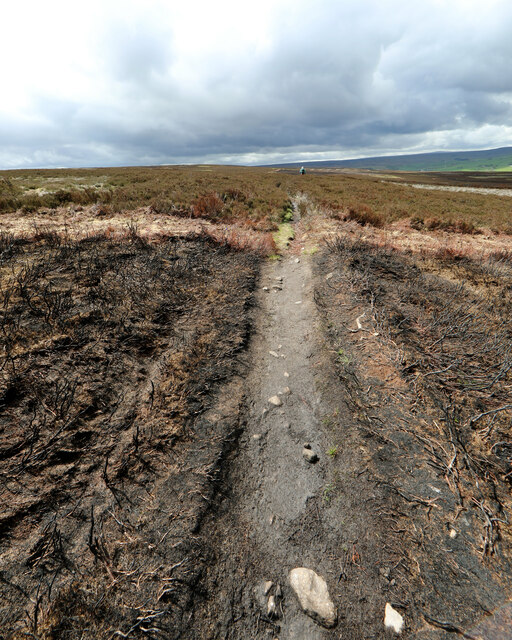
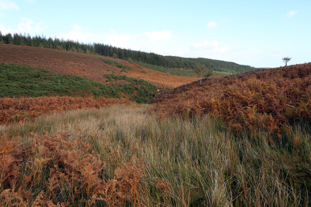
The moorland of Acton Fell is a more rugged and untamed environment. It is characterized by its heather-covered hills, peat bogs, and rocky outcrops. The moorland provides a habitat for a range of plant and animal species, including grouse, deer, and various species of moss and lichen. The moors also have a unique atmosphere, with their vast expanses and dramatic skies.

Visitors to Acton Fell can enjoy a range of outdoor activities. Hiking and walking trails crisscross the area, allowing visitors to explore its natural beauty up close. The hills and moors are also popular spots for birdwatching and wildlife spotting. Additionally, the area is dotted with ancient ruins and archaeological sites, adding an element of history and intrigue to the landscape.

Overall, Acton Fell in Northumberland offers visitors a chance to immerse themselves in the stunning natural beauty of downs and moorland. With its diverse ecosystem, breathtaking views, and opportunities for outdoor exploration, Acton Fell is a must-visit destination for nature enthusiasts and those seeking a peaceful retreat in the heart of Northumberland.

If you have any feedback on the listing, please let us know in the comments section below.

Acton Fell Images

Images are sourced within 2km of 54.875486/-2.0729489 or Grid Reference NY9553. Thanks to Geograph Open Source API. All images are credited.

Trig point at Warlaw Pike The trig point at Warlaw Pike at 402 m.; it lies to the north of the local high point on Bulbeck Common at 413 m.
The view beyond is to the west, across the valley of Devil's Water.
Trig point at Warlaw Pike
The trig point at Warlaw Pike at 402 m.; it lies to the north of the local high point on Bulbeck Common at 413 m. The view beyond is to the west, across the valley of Devil's Water.
Line of grouse butts on Blanchland Moor An estate road alongside the grouse butt line heading east over the flat heather moor.
Line of grouse butts on Blanchland Moor
An estate road alongside the grouse butt line heading east over the flat heather moor.
Tree tops showing in valley of Potter Burn Potter Burn is a stream of little note draining Blanchland Moor, but the short stretch in view where Ravens Crags are located is quite incised with the sides broken by rock exposures.
Tree tops showing in valley of Potter Burn
Potter Burn is a stream of little note draining Blanchland Moor, but the short stretch in view where Ravens Crags are located is quite incised with the sides broken by rock exposures.
Track crossing heather moor on Dean Rigg Dean Rigg is a minor ridge of ground on Cowbyers Moor to the south of Potter Burn; the estate road or track follows the ridge before moving to the north side of Acton Dean.
Track crossing heather moor on Dean Rigg
Dean Rigg is a minor ridge of ground on Cowbyers Moor to the south of Potter Burn; the estate road or track follows the ridge before moving to the north side of Acton Dean.
Ford on Byway near Pennypie House The Byway crosses the Shildon Burn at this point before joining another Byway (which is part of "A Pennine Journey")
Ford on Byway near Pennypie House
The Byway crosses the Shildon Burn at this point before joining another Byway (which is part of "A Pennine Journey")
Byway near Pennypie House This track connects Pennypie House to Blanchland and follows the valley containing the Shildon Burn. It forms part of the "A Pennine Journey" LDP
Byway near Pennypie House
This track connects Pennypie House to Blanchland and follows the valley containing the Shildon Burn. It forms part of the "A Pennine Journey" LDP
Regenerating Slaley Forest Areas of the forest have been harvested on a cycle, and this patch seems to have been cut some years ago. Whilst much of the mature plantation is Sitka Spruce, this area has been repopulated with pine. Forestry does not feel obliged to stick with native species, and the trees aren't big enough yet that I could identify whether they are Scots Pine (which are native), Austrian/Corsican Pine (which have been widely used for shelter in the UK) or an American species like Lodgepole Pine (the coast range subspecies of which, Shore Pine, is used in forestry). They certainly aren't that widely planted and very fast-growing species much used for timber or woodpulp in somewhat warmer climes, Pinus radiata (Monterrey Pine).
Regenerating Slaley Forest
Areas of the forest have been harvested on a cycle, and this patch seems to have been cut some years ago. Whilst much of the mature plantation is Sitka Spruce, this area has been repopulated with pine. Forestry does not feel obliged to stick with native species, and the trees aren't big enough yet that I could identify whether they are Scots Pine (which are native), Austrian/Corsican Pine (which have been widely used for shelter in the UK) or an American species like Lodgepole Pine (the coast range subspecies of which, Shore Pine, is used in forestry). They certainly aren't that widely planted and very fast-growing species much used for timber or woodpulp in somewhat warmer climes, Pinus radiata (Monterrey Pine).
Slaley Forest pond A pool in a clearing surrounded by a greater diversity of tree species than found elsewhere in the forest, with a small island which no doubt provides a safer nesting spot for someone. However, this view is strictly time-limited as the diminutive conifer directly in front of the photographer is a volunteer seedling Sitka Spruce which, given considerably more light than the ones planted so densely in the plantation, will rapidly grow to occupy the foreground.
Slaley Forest pond
A pool in a clearing surrounded by a greater diversity of tree species than found elsewhere in the forest, with a small island which no doubt provides a safer nesting spot for someone. However, this view is strictly time-limited as the diminutive conifer directly in front of the photographer is a volunteer seedling Sitka Spruce which, given considerably more light than the ones planted so densely in the plantation, will rapidly grow to occupy the foreground.
Rogue spruce, Slaley Forest This area on the edge of Slaley Forest has been clear cut and not replanted, so the remaining stumps are rotting away nicely, providing habitat for numerous invertebrates and the birds which feed on them. The proximity of serried ranks of alien Sitka Spruce provides a much bigger input of seeds than do sparser and more distant natives, so this Sitka Spruce has taken advantage of the ungrazed space and daylight to establish itself.
Rogue spruce, Slaley Forest
This area on the edge of Slaley Forest has been clear cut and not replanted, so the remaining stumps are rotting away nicely, providing habitat for numerous invertebrates and the birds which feed on them. The proximity of serried ranks of alien Sitka Spruce provides a much bigger input of seeds than do sparser and more distant natives, so this Sitka Spruce has taken advantage of the ungrazed space and daylight to establish itself.
Leaving a burn, Embley Fell Slaley forest and the surrounding moors seem to be home to an unusual density of both bridleways and byways. This one is the former, a short stretch linking two of the latter across the grouse moor which has been burned quite recently - there's still a strong smell of smoke and ash. The land managers have defined areas to burn using what is, in effect, a giant lawnmower to form firebreaks. The path is just crossing one of these from the burnt area to middle-aged heather ahead.
Leaving a burn, Embley Fell
Slaley forest and the surrounding moors seem to be home to an unusual density of both bridleways and byways. This one is the former, a short stretch linking two of the latter across the grouse moor which has been burned quite recently - there's still a strong smell of smoke and ash. The land managers have defined areas to burn using what is, in effect, a giant lawnmower to form firebreaks. The path is just crossing one of these from the burnt area to middle-aged heather ahead.
Off-road vehicles near Pennypie House The eroded road being used by a number of 4X4 vehicles is a byway but restricted in the time of year that the public may motor over it. At this location and elsewhere there's serious erosion to the ground along the route.
Off-road vehicles near Pennypie House
The eroded road being used by a number of 4X4 vehicles is a byway but restricted in the time of year that the public may motor over it. At this location and elsewhere there's serious erosion to the ground along the route.
Demarcation lines on heather moorland The different states of heather cover on this slope of Warlaw Pike are a result of its management for grouse shooting, basically the periodic burning of it. In earlier times the burnt areas would be far more random in size and shape with the burn area controlled by estate workers. Now, lanes are mown as firebreaks resulting in more regular, geometric shapes.
Demarcation lines on heather moorland
The different states of heather cover on this slope of Warlaw Pike are a result of its management for grouse shooting, basically the periodic burning of it. In earlier times the burnt areas would be far more random in size and shape with the burn area controlled by estate workers. Now, lanes are mown as firebreaks resulting in more regular, geometric shapes.
Course of aqueduct, Acton Fell
Acton Cleugh The steep valley of Acton Burn.
Acton Cleugh
The steep valley of Acton Burn.
Archers Fold A sheep fold on Acton Fell, South of Acton Burn.
OS Namebook (c1860): <span class="nowrap"><a title="http://namebooks.org.uk/browse/main/?OSref=411&Page=19.0" rel="nofollow ugc noopener" href="http://namebooks.org.uk/browse/main/?OSref=411&Page=19.0">Link</a><img style="margin-left:2px;" alt="External link" title="External link - shift click to open in new window" src="https://s1.geograph.org.uk/img/external.png" width="10" height="10"/></span> <span class="nowrap"><a title="https://web.archive.org/web/20221010200331/http://namebooks.org.uk/browse/main/?OSref=411&Page=19.0" rel="nofollow ugc noopener" href="https://web.archive.org/web/20221010200331/http://namebooks.org.uk/browse/main/?OSref=411&Page=19.0">Archive Link</a><img style="margin-left:2px;" alt="External link" title="External link - shift click to open in new window" src="https://s1.geograph.org.uk/img/external.png" width="10" height="10"/></span>
Archers Fold
A sheep fold on Acton Fell, South of Acton Burn. OS Namebook (c1860): LinkExternal link Archive LinkExternal link
Pit Sikes Three small streams flowing into Acton Burn which derive their name from their proximity to some old coal workings.
OS Namebook (c1860): <span class="nowrap"><a title="http://namebooks.org.uk/browse/main/?OSref=411&Page=19.0" rel="nofollow ugc noopener" href="http://namebooks.org.uk/browse/main/?OSref=411&Page=19.0">Link</a><img style="margin-left:2px;" alt="External link" title="External link - shift click to open in new window" src="https://s1.geograph.org.uk/img/external.png" width="10" height="10"/></span> <span class="nowrap"><a title="https://web.archive.org/web/20221010200331/http://namebooks.org.uk/browse/main/?OSref=411&Page=19.0" rel="nofollow ugc noopener" href="https://web.archive.org/web/20221010200331/http://namebooks.org.uk/browse/main/?OSref=411&Page=19.0">Archive Link</a><img style="margin-left:2px;" alt="External link" title="External link - shift click to open in new window" src="https://s1.geograph.org.uk/img/external.png" width="10" height="10"/></span>
Pit Sikes
Three small streams flowing into Acton Burn which derive their name from their proximity to some old coal workings. OS Namebook (c1860): LinkExternal link Archive LinkExternal link
Old boundary bank, Acton Fell The old field on the left of the bank shows signs of ploughing on aerial photos and LIDAR.
Old boundary bank, Acton Fell
The old field on the left of the bank shows signs of ploughing on aerial photos and LIDAR.
Old boundary bank, Acton Fell
Show me another place!

Acton Fell is located at Grid Ref: NY9553 (Lat: 54.875486, Lng: -2.0729489)

Unitary Authority: Northumberland

Police Authority: Northumbria

What 3 Words

///static.encoded.furniture. Near Slaley, Northumberland

Nearby Locations

Acton Fell

Related Wikis

Nearby Amenities

Located within 500m of 54.875486,-2.0729489
Blanchland Moor
Natural: heath
Lat/Long: 54.8726597/-2.0787029
Hunting Stand
Hunting Stand: grouse_butt
Source: Bing imagery
Lat/Long: 54.8772671/-2.0665401
Hunting Stand
Hunting Stand: grouse_butt
Source: Bing imagery
Lat/Long: 54.8773103/-2.0675433
Hunting Stand
Hunting Stand: grouse_butt
Source: Bing imagery
Lat/Long: 54.8773597/-2.0683962
Hunting Stand
Hunting Stand: grouse_butt
Source: Bing imagery
Lat/Long: 54.8774029/-2.0692438
Hunting Stand
Hunting Stand: grouse_butt
Source: Bing imagery
Lat/Long: 54.87744/-2.0700592
Hunting Stand
Hunting Stand: grouse_butt
Source: Bing imagery
Lat/Long: 54.8774863/-2.0709175
Hunting Stand
Hunting Stand: grouse_butt
Source: Bing imagery
Lat/Long: 54.877514/-2.0717704
Hunting Stand
Hunting Stand: grouse_butt
Source: Bing imagery
Lat/Long: 54.8775511/-2.0725375
Hunting Stand
Hunting Stand: grouse_butt
Source: Bing imagery
Lat/Long: 54.8775881/-2.0732778
Hunting Stand
Hunting Stand: grouse_butt
Source: Bing imagery
Lat/Long: 54.8776221/-2.0740449
The data included in this document is from www.openstreetmap.org. The data is made available under ODbL.

Have you been to Acton Fell?

Leave your review of Acton Fell below (or comments, questions and feedback).