Middlebere Heath

Downs, Moorland in Dorset

England

Middlebere Heath

National Cycle Track This is where the track to Studland leaves the minor road that runs between Corfe and Arne.
National Cycle Track Credit: Nigel Mykura

Middlebere Heath is a picturesque area located in the county of Dorset, England. Situated on the outskirts of Wareham, it is encompassed by the breathtaking landscapes of the Dorset Downs and Moorland. Spanning approximately 200 hectares, Middlebere Heath is renowned for its unspoiled natural beauty and diverse wildlife.

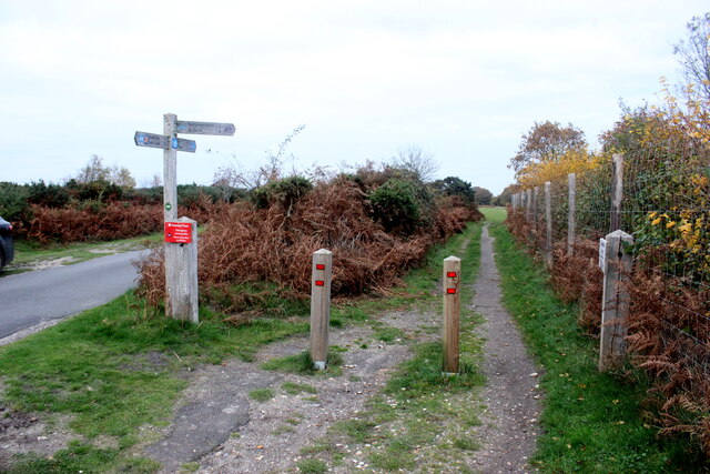
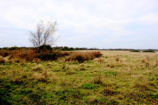
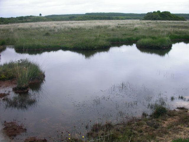
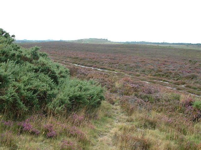
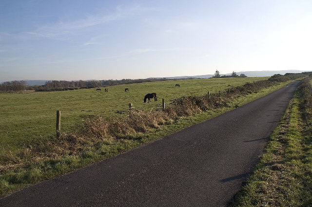
The heathland is characterized by its wide expanses of open space, covered with heather, gorse, and bracken. This unique habitat supports a rich variety of flora and fauna, including rare species such as the Dartford warbler, nightjar, and silver-studded blue butterfly. The area is also home to a number of reptiles, including adders and common lizards.

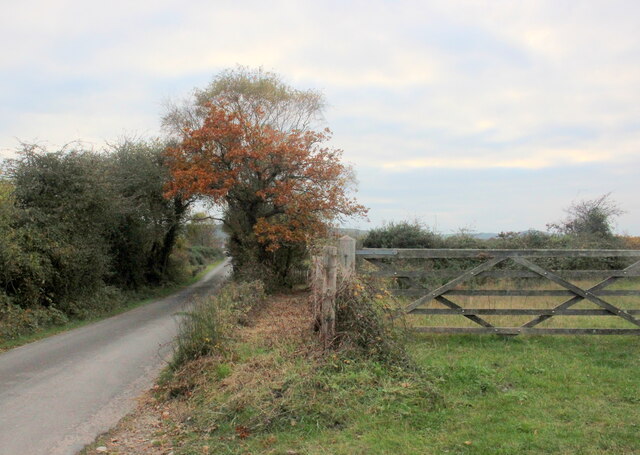
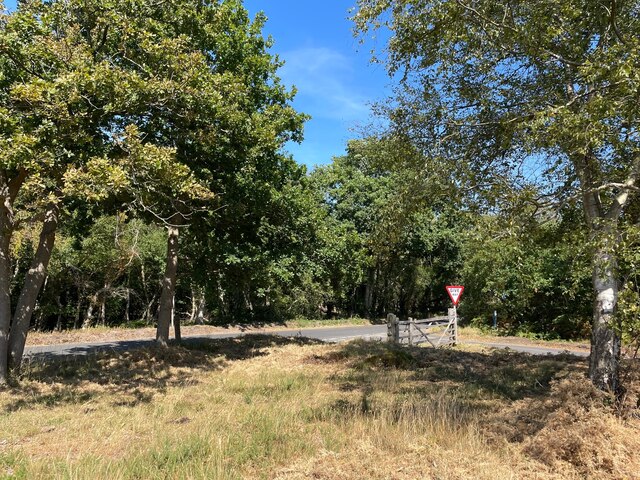
Middlebere Heath offers visitors a tranquil escape from the hustle and bustle of urban life. Its rolling hills and panoramic views make it an ideal spot for hiking and birdwatching. Numerous footpaths and trails crisscross the heath, allowing visitors to explore its natural wonders at their own pace.

In addition to its natural beauty, Middlebere Heath holds historical significance. The area was once used for military training during World War II, and remnants of this era can still be found, including ammunition storage bunkers and practice trenches.

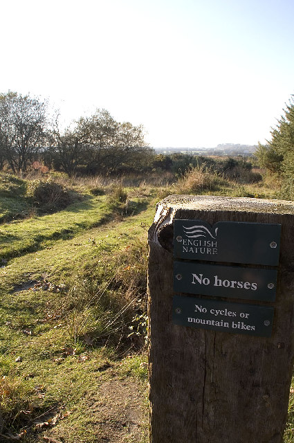
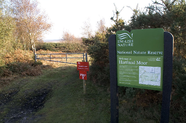
Managed by the National Trust, Middlebere Heath is carefully preserved to maintain its unique ecosystem. The conservation efforts ensure that future generations can continue to enjoy the beauty and tranquility of this remarkable heathland in Dorset.

If you have any feedback on the listing, please let us know in the comments section below.

Middlebere Heath Images

Images are sourced within 2km of 50.664823/-2.0660945 or Grid Reference SY9585. Thanks to Geograph Open Source API. All images are credited.

National Cycle Track This is where the track to Studland leaves the minor road that runs between Corfe and Arne.
National Cycle Track
This is where the track to Studland leaves the minor road that runs between Corfe and Arne.
New Mills Heath Quite rough pasture land with few bushes or trees
New Mills Heath
Quite rough pasture land with few bushes or trees
Bridleway on New Mills Heath In between the road and the gate there is a narrow bridle path which does not appear to be used much but leads to New Line Farm
Bridleway on New Mills Heath
In between the road and the gate there is a narrow bridle path which does not appear to be used much but leads to New Line Farm
Bank Gate Cottages On Arne Road on the Arne peninsula
Bank Gate Cottages
On Arne Road on the Arne peninsula
Minor road junction on the Arne Peninsula  Where Soldiers Road meets Arne Road
Minor road junction on the Arne Peninsula
Where Soldiers Road meets Arne Road
Wild horse on Soldier’s Road A minor road crossing Slepe Heath
Wild horse on Soldier’s Road
A minor road crossing Slepe Heath
Halfway Inn Public house and restaurant on the A531. Located approximately halfway between Wareham and Corfe Castle.
Halfway Inn
Public house and restaurant on the A531. Located approximately halfway between Wareham and Corfe Castle.
Old Milestone by the A351, south of Stoborough Green Carved stone post by the A351, in parish of ARNE (PURBECK District), by bus stop and path to Blue Pool, opposite sign 'RVP No 5' at entrance to Hartland Nature reserve, on West side of road. Dorset 2 (limestone), erected by the Wareham (North, South & West Branches) turnpike trust in the 19th century.

Inscription reads:-
II
MILES FROM
WAREHAM
Carved benchmark bottom centre of front face. 

Grade II Listed. List Entry Number:1120342 <span class="nowrap"><a title="https://historicengland.org.uk/listing/the-list/list-entry/1120342" rel="nofollow ugc noopener" href="https://historicengland.org.uk/listing/the-list/list-entry/1120342">Link</a><img style="margin-left:2px;" alt="External link" title="External link - shift click to open in new window" src="https://s1.geograph.org.uk/img/external.png" width="10" height="10"/></span>

Milestone Society National ID: DO_WASW02
Old Milestone by the A351, south of Stoborough Green
Carved stone post by the A351, in parish of ARNE (PURBECK District), by bus stop and path to Blue Pool, opposite sign 'RVP No 5' at entrance to Hartland Nature reserve, on West side of road. Dorset 2 (limestone), erected by the Wareham (North, South & West Branches) turnpike trust in the 19th century. Inscription reads:- II MILES FROM WAREHAM Carved benchmark bottom centre of front face. Grade II Listed. List Entry Number:1120342 LinkExternal link Milestone Society National ID: DO_WASW02
Old Milestone by the A351, Norden Heath Carved stone post by the A351, in parish of CORFE CASTLE (PURBECK District), 150m South of Cats Eye Cottage Camp Site, on grass verge beside road, on West side of road. Dorset 2 (limestone), erected by the Wareham (North, South & West Branches) turnpike trust in the 19th century. 

Inscription reads:-
III
MILES FROM
WAREHAM 
Carved benchmark bottom centre of front face.

Grade II Listed. List Entry Number:1278601
<span class="nowrap"><a title="https://historicengland.org.uk/listing/the-list/list-entry/1278601" rel="nofollow ugc noopener" href="https://historicengland.org.uk/listing/the-list/list-entry/1278601">Link</a><img style="margin-left:2px;" alt="External link" title="External link - shift click to open in new window" src="https://s1.geograph.org.uk/img/external.png" width="10" height="10"/></span>

Milestone Society National ID: DO_WASW03
Old Milestone by the A351, Norden Heath
Carved stone post by the A351, in parish of CORFE CASTLE (PURBECK District), 150m South of Cats Eye Cottage Camp Site, on grass verge beside road, on West side of road. Dorset 2 (limestone), erected by the Wareham (North, South & West Branches) turnpike trust in the 19th century. Inscription reads:- III MILES FROM WAREHAM Carved benchmark bottom centre of front face. Grade II Listed. List Entry Number:1278601 LinkExternal link Milestone Society National ID: DO_WASW03
Slepe Heath A sunset across Slepe Heath
Slepe Heath
A sunset across Slepe Heath
Pond at Hartland Moor
Hartland Moor National Nature Reserve View looking east towards Middlebere Heath
Hartland Moor National Nature Reserve
View looking east towards Middlebere Heath
Stoborough Heath NNR, Dorset Stoborough Heath NNR (National Nature Reserve) is a heathland reserve adjacent to Hartland Moor NNR. The habitat is made up of dry heath, mire and acid grassland reverting to heath. The grassland was heath until the 1950s when it started to be used for agriculture. The area was declared a NNR in 1985 to reinstate the heathland. The photograph is taken from the eastern edge of the Reserve, looking towards Stoborough.
<span class="nowrap"><a title="http://www.english-nature.org.uk/about/teams/team_photo/StoboroughHeathmap.pdf" rel="nofollow ugc noopener" href="http://www.english-nature.org.uk/about/teams/team_photo/StoboroughHeathmap.pdf">Link</a><img style="margin-left:2px;" alt="External link" title="External link - shift click to open in new window" src="https://s1.geograph.org.uk/img/external.png" width="10" height="10"/></span>
Stoborough Heath NNR, Dorset
Stoborough Heath NNR (National Nature Reserve) is a heathland reserve adjacent to Hartland Moor NNR. The habitat is made up of dry heath, mire and acid grassland reverting to heath. The grassland was heath until the 1950s when it started to be used for agriculture. The area was declared a NNR in 1985 to reinstate the heathland. The photograph is taken from the eastern edge of the Reserve, looking towards Stoborough. LinkExternal link
Hartland Moor NNR, Dorset Hartland Moor NNR (National Nature Reserve) is a superb example of an extensive heathland site. The NNR covers an entire drainage basin and is unique in having a Y-shaped bog system which includes both acid and alkaline drainage systems. Heathland is a rare and threatened habitat, and many of the species of plants and animals found on Hartland are equally rare.
<span class="nowrap"><a title="http://www.english-nature.org.uk/special/nnr/nnr_details.asp?nnr_name=&C=0&Habitat=0&natural_area=&local_team=0&spotlight_reserve=0&X=&NNR_ID=79" rel="nofollow ugc noopener" href="http://www.english-nature.org.uk/special/nnr/nnr_details.asp?nnr_name=&C=0&Habitat=0&natural_area=&local_team=0&spotlight_reserve=0&X=&NNR_ID=79">Link</a><img style="margin-left:2px;" alt="External link" title="External link - shift click to open in new window" src="https://s1.geograph.org.uk/img/external.png" width="10" height="10"/></span>
Hartland Moor NNR, Dorset
Hartland Moor NNR (National Nature Reserve) is a superb example of an extensive heathland site. The NNR covers an entire drainage basin and is unique in having a Y-shaped bog system which includes both acid and alkaline drainage systems. Heathland is a rare and threatened habitat, and many of the species of plants and animals found on Hartland are equally rare. LinkExternal link
Hartland Moor NNR, Dorset Hartland Moor NNR (National Nature Reserve) is on the left and the Purbeck Hills can be seen in the distance.
Hartland Moor NNR, Dorset
Hartland Moor NNR (National Nature Reserve) is on the left and the Purbeck Hills can be seen in the distance.
The Halfway Inn, Norden, Dorset The inn is halfway between Wareham and Corfe Castle.
The Halfway Inn, Norden, Dorset
The inn is halfway between Wareham and Corfe Castle.
Slepe Moor This field at the edge of Saltern's Copse lies next to marshland that, in turn, drains into Middlebere Lake which is one of the very shallow western arms of Poole Harbour.
Slepe Moor
This field at the edge of Saltern's Copse lies next to marshland that, in turn, drains into Middlebere Lake which is one of the very shallow western arms of Poole Harbour.
Slepe Copse Field and woodland near the edge of Slepe Moor.
Slepe Copse
Field and woodland near the edge of Slepe Moor.
Show me another place!

Middlebere Heath is located at Grid Ref: SY9585 (Lat: 50.664823, Lng: -2.0660945)

Unitary Authority: Dorset

Police Authority: Dorset

What 3 Words

///entitles.snowboard.rail. Near Corfe Castle, Dorset

Nearby Locations

Middlebere Heath

Related Wikis

Nearby Amenities

Located within 500m of 50.664823,-2.0660945
Tourism: viewpoint
Lat/Long: 50.6623322/-2.0641687
Path
Bicycle: no
Foot: yes
Horse: no
Motor Vehicle: private
Lat/Long: 50.6622377/-2.0643231
The data included in this document is from www.openstreetmap.org. The data is made available under ODbL.

Have you been to Middlebere Heath?

Leave your review of Middlebere Heath below (or comments, questions and feedback).