Flats

Downs, Moorland in Yorkshire Craven

England

Flats

Path along Old Cote Moor Top A reasonable path runs along the whole ridge parallel with the wall on the north eastern side. This is not shown on Ordnance Survey Maps.
Path along Old Cote Moor Top Credit: Colin Park

Flats, Yorkshire is a picturesque region located in the northern part of England. Known for its stunning landscapes and natural beauty, Flats is divided into two distinct areas: the Yorkshire Downs and the Yorkshire Moorland.

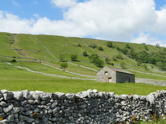
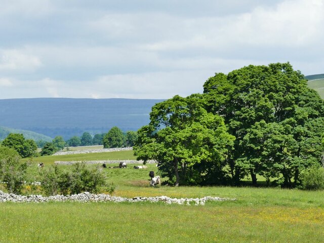
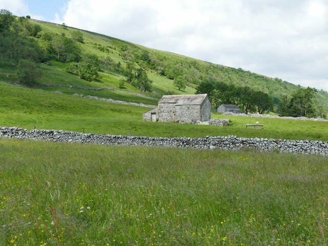
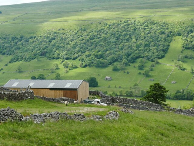
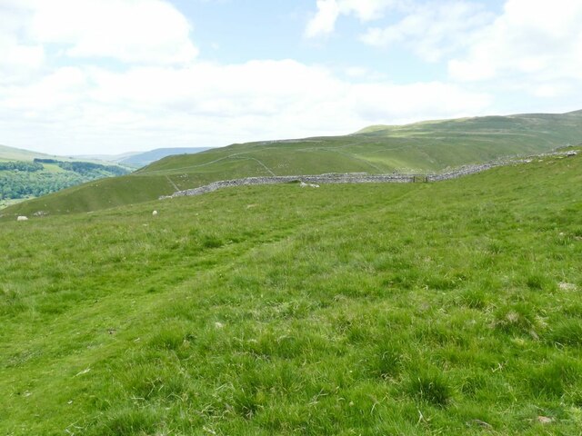
The Yorkshire Downs are characterized by rolling hills and vast open spaces. The land is mainly used for agriculture, with farmers cultivating crops such as wheat, barley, and oats. The Downs offer breathtaking views, particularly in the spring when the fields are adorned with colorful wildflowers. The region is also home to numerous species of birds, making it a popular spot for birdwatching enthusiasts.

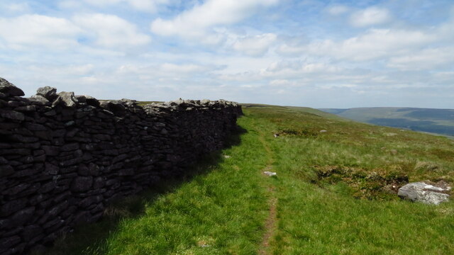
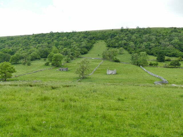
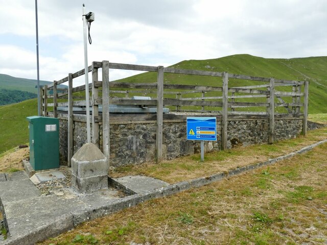
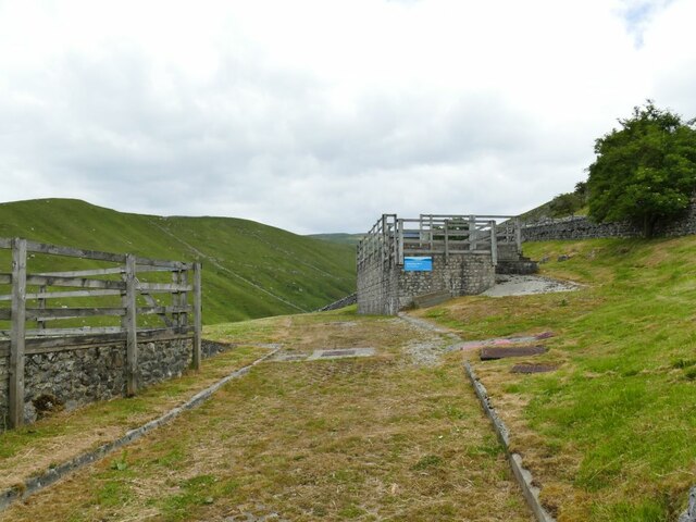
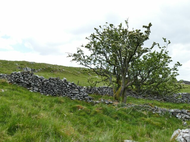
On the other hand, the Yorkshire Moorland is a rugged and wild area, featuring expansive heather-covered hills and deep valleys. This part of Flats is known for its dramatic scenery and is a favorite destination for hikers and nature enthusiasts. The Moorland is also home to a variety of wildlife, including grouse, foxes, and deer.

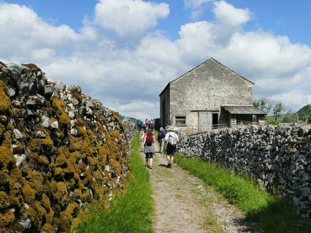
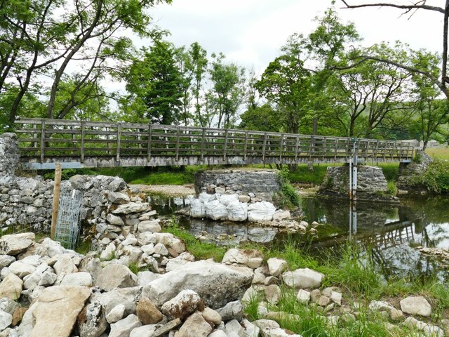
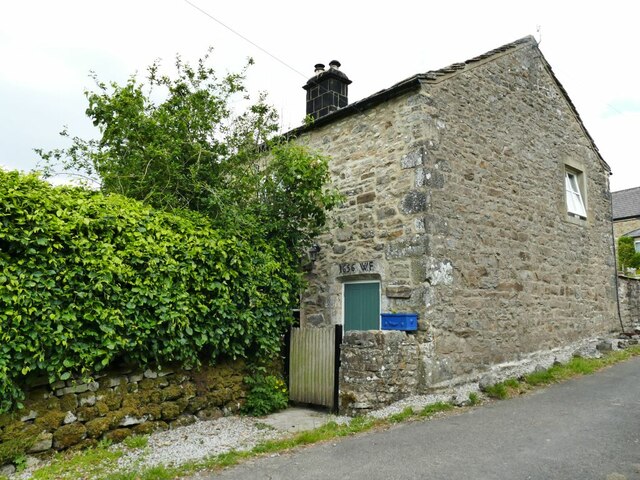
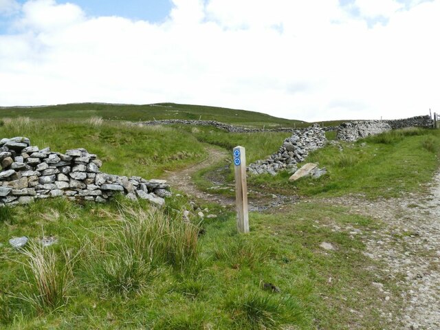
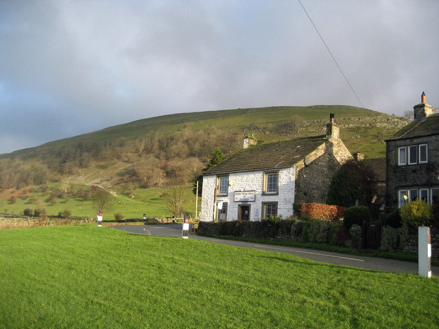
Flats, Yorkshire is a haven for outdoor activities, with numerous walking and cycling trails crisscrossing the region. The area also boasts several quaint villages and historic landmarks, such as old stone churches and traditional pubs. Visitors can immerse themselves in the rich history and culture of the region by exploring its charming towns and engaging with the friendly locals.

Overall, Flats, Yorkshire offers a unique blend of natural beauty, tranquility, and cultural experiences. Whether you are seeking adventure in the rugged Moorland or relaxation in the peaceful Downs, this region is sure to captivate you with its charm and allure.

If you have any feedback on the listing, please let us know in the comments section below.

Flats Images

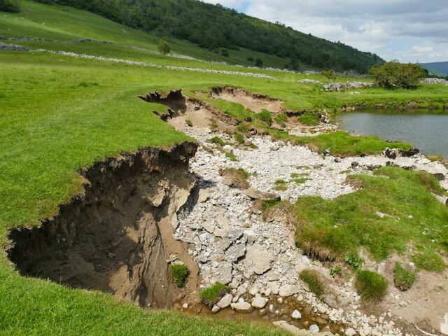
Images are sourced within 2km of 54.16547/-2.0724403 or Grid Reference SD9574. Thanks to Geograph Open Source API. All images are credited.

Path along Old Cote Moor Top A reasonable path runs along the whole ridge parallel with the wall on the north eastern side. This is not shown on Ordnance Survey Maps.
Path along Old Cote Moor Top
A reasonable path runs along the whole ridge parallel with the wall on the north eastern side. This is not shown on Ordnance Survey Maps.
Descending southeast from Old Cote Moor Top A reasonable path runs along the ridge on the north eastern side of the wall. It is not shown on Ordnance Survey Maps.
Descending southeast from Old Cote Moor Top
A reasonable path runs along the ridge on the north eastern side of the wall. It is not shown on Ordnance Survey Maps.
Path & wall descending southeast from Old Cote Moor Top A reasonable path runs along the ridge on the north eastern side of the wall. It is not shown on Ordnance Survey Maps.
Path & wall descending southeast from Old Cote Moor Top
A reasonable path runs along the ridge on the north eastern side of the wall. It is not shown on Ordnance Survey Maps.
Stone laithe by the Dales Way One of many such structures in Upper Wharfedale, where there is still a network of small fields.  This laithe appears still to be in active use.
Stone laithe by the Dales Way
One of many such structures in Upper Wharfedale, where there is still a network of small fields. This laithe appears still to be in active use.
Haw Fields Laithe  One of many such structures in Upper Wharfedale, where there is still a network of small fields.  This laithe is one of the few to be shown on maps with a name.
Haw Fields Laithe
One of many such structures in Upper Wharfedale, where there is still a network of small fields. This laithe is one of the few to be shown on maps with a name.
Cows by the river Wharfe The cows are on the far side of the river from the photographer, the nearest one being at a point where they come down to the river to drink.
Cows by the river Wharfe
The cows are on the far side of the river from the photographer, the nearest one being at a point where they come down to the river to drink.
Stone laithe below Moor End One of many such structures in Upper Wharfedale, where there is still a network of small fields.
Stone laithe below Moor End
One of many such structures in Upper Wharfedale, where there is still a network of small fields.
Continuing erosion of the riverbank  Roughly the same location as <a href="https://www.geograph.org.uk/photo/4254500">SD9573 : Another landslip on the Wharfe</a> taken seven years earlier, looking in the opposite direction.
Continuing erosion of the riverbank
Roughly the same location as SD9573 : Another landslip on the Wharfe taken seven years earlier, looking in the opposite direction.
Bounty Barns, Starbotton Two of many such structures in Upper Wharfedale, where there is still a network of small fields; the name is given on old maps.
Bounty Barns, Starbotton
Two of many such structures in Upper Wharfedale, where there is still a network of small fields; the name is given on old maps.
Starbotton footbridge The bridge on a bridleway is the only crossing point of the river between Kettlewell and Buckden. One of the pillars had recently been given temporary protection following flood damage the previous winter (see <a href="https://www.geograph.org.uk/photo/3193993">SD9574 : The Dales Way</a> for a 'before' view).  See also <a href="https://www.geograph.org.uk/photo/249353">SD9574 : Bridge over the Wharfe, Starbotton</a>.
Starbotton footbridge
The bridge on a bridleway is the only crossing point of the river between Kettlewell and Buckden. One of the pillars had recently been given temporary protection following flood damage the previous winter (see SD9574 : The Dales Way for a 'before' view). See also SD9574 : Bridge over the Wharfe, Starbotton.
Lilac Cottage, Starbotton  One of the oldest properties in the village, dated 1656. Listed grade II (list entry 1295854).
Lilac Cottage, Starbotton
One of the oldest properties in the village, dated 1656. Listed grade II (list entry 1295854).
Starbotton waterworks (1) The installation alongside Starbotton Cam Road is shown on one online map as a 'sewage pumping station' which given its location high above the village seems most unlikely. Rather, it's a reservoir and treatment works for the village water supply.
Starbotton waterworks (1)
The installation alongside Starbotton Cam Road is shown on one online map as a 'sewage pumping station' which given its location high above the village seems most unlikely. Rather, it's a reservoir and treatment works for the village water supply.
Starbotton waterworks (2) The installation alongside Starbotton Cam Road is shown on one online map as a 'sewage pumping station' which given its location high above the village seems most unlikely. Rather, it's a reservoir and treatment works for the village water supply.
Starbotton waterworks (2)
The installation alongside Starbotton Cam Road is shown on one online map as a 'sewage pumping station' which given its location high above the village seems most unlikely. Rather, it's a reservoir and treatment works for the village water supply.
Modern barn by Starbotton Cam Road Maps show a sheepfold here, but the wooden-clad barn looks quite a recent addition.
Modern barn by Starbotton Cam Road
Maps show a sheepfold here, but the wooden-clad barn looks quite a recent addition.
Hawthorn alongside Starbotton Cam Road A solitary tree by this steep stone track high on the hillside.
Hawthorn alongside Starbotton Cam Road
A solitary tree by this steep stone track high on the hillside.
Grass track across Starbotton Cam Pasture A track not shown on online maps, probably made by quad bikes.
Grass track across Starbotton Cam Pasture
A track not shown on online maps, probably made by quad bikes.
Bridleway junction at Sandy Gate Left for Buckden Pike, straight on for Nidderdale or down to Kettlewell.
Bridleway junction at Sandy Gate
Left for Buckden Pike, straight on for Nidderdale or down to Kettlewell.
Lambs at Cam Head
Lambs at Cam Head
Show me another place!

Flats is located at Grid Ref: SD9574 (Lat: 54.16547, Lng: -2.0724403)

Division: West Riding

Administrative County: North Yorkshire

District: Craven

Police Authority: North Yorkshire

What 3 Words

///nest.votes.novelists. Near Grassington, North Yorkshire

Related Wikis

Nearby Amenities

Located within 500m of 54.16547,-2.0724403
Starbotton
Is In: UK, England, Yorkshire, North Yorkshire, Wharfedale, Yorkshire Dales
Is In County: North Yorkshire
Is In Municipality: Craven
Place: village
Wikidata: Q7601482
Lat/Long: 54.1688923/-2.0733872
Barrier: stile
Lat/Long: 54.1649899/-2.0749038
Barrier: stile
Lat/Long: 54.1650861/-2.074947
Post Box
Post Box Type: lamp
Source: survey
Lat/Long: 54.1687519/-2.0735572
Telephone
Booth: K6
Covered: booth
Listed Status: Grade II
Source: survey
Lat/Long: 54.1687131/-2.0735505
Bench
Lat/Long: 54.1687374/-2.0735539
Defibrillator
Defibrillator Location: next to red phone box at the end of Coates Lane in Starbottom
Emergency: defibrillator
Indoor: no
Lat/Long: 54.1687252/-2.0735525
Bench
Lat/Long: 54.1682874/-2.0722929
Generator Method: photovoltaic
Generator Output Electricity: yes
Generator Source: solar
Generator Type: solar_photovoltaic_panel
Location: roof
Power: generator
Lat/Long: 54.1694415/-2.0748146
Bus Stop
Starbotton - Fox And Hounds
Bus: yes
Naptan AtcoCode: 3200YNE04679
Naptan NaptanCode: 32004679
Public Transport: platform
Lat/Long: 54.1690943/-2.0736223
Bus Stop
Starbotton - Fox And Hounds
Bus: yes
Departures Board: timetable
Naptan AtcoCode: 3200YNA01853
Naptan NaptanCode: 32001853
Public Transport: platform
Shelter: no
Lat/Long: 54.1691509/-2.0735125
Starbotton - Fox And Hounds
Bus: yes
Public Transport: stop_position
Lat/Long: 54.1691557/-2.0735587
Starbotton - Fox And Hounds
Bus: yes
Public Transport: stop_position
Lat/Long: 54.1690967/-2.0735569
Power: pole
Lat/Long: 54.1695693/-2.0714888
Power: pole
Lat/Long: 54.1687968/-2.0705044
Power: pole
Lat/Long: 54.1680431/-2.0698124
Power: pole
Lat/Long: 54.1673051/-2.0691338
Power: pole
Lat/Long: 54.1659343/-2.0678437
Power: pole
Lat/Long: 54.165237/-2.0672563
Power: pole
Lat/Long: 54.1644378/-2.0665589
Power: pole
Lat/Long: 54.1636243/-2.0658588
Toilets
Portable: yes
Lat/Long: 54.1690029/-2.0732797
The data included in this document is from www.openstreetmap.org. The data is made available under ODbL.

Have you been to Flats?

Leave your review of Flats below (or comments, questions and feedback).