Hutton's Kilnsey Moor

Downs, Moorland in Yorkshire Craven

England

Hutton's Kilnsey Moor

Mastiles Lane dropping towards Kilnsey Mastiles Lane was the subject of some controversy when the number of off-road vehicles using it was starting to have an adverse impact. Although it is still marked as a Byway Open to All Traffic on the map, it doesn't seem to remain so for its full length, and even where it is so marked, further west, there is a definite "all motor vehicles prohibited sign", so I was unsurprised not to meet the sort of continuous procession of trail bikes and four-wheel-drive enthusiasts that one meets on a number of other BOATs in the National Park. Indeed, on an eight mile walk on a breezy day in January, there was one mountain biker and two walkers, apart from myself (and dog). The lane itself continues towards Kilnsey, but the small gate on the right gives onto a public footpath down towards the road junction leading to Coniston bridge - a better parking spot than a village in these times of infectious disease.
Mastiles Lane dropping towards Kilnsey Credit: Andy Waddington

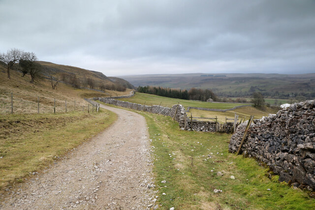
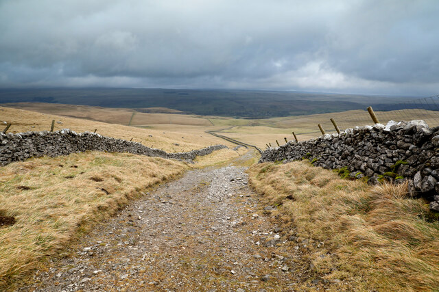
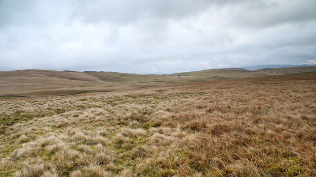
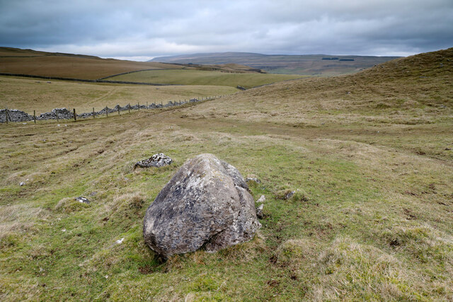
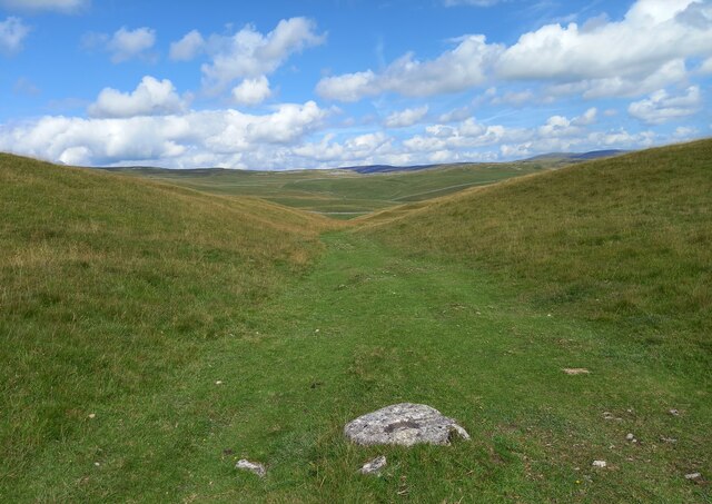
Hutton's Kilnsey Moor is a vast expanse of moorland located in the Yorkshire Dales National Park, in the county of Yorkshire, England. This area is renowned for its picturesque landscapes, rugged beauty, and rich history. Covering an area of approximately 2,500 acres, Kilnsey Moor is a haven for nature enthusiasts and offers breathtaking views of the surrounding countryside.

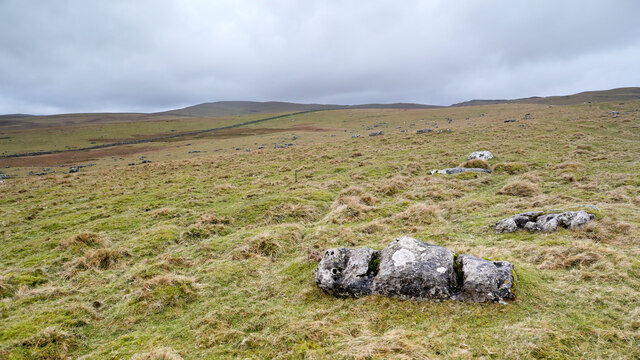
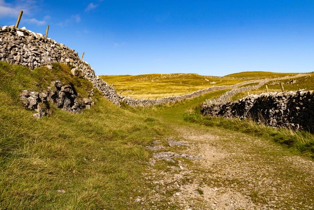
The moorland is characterized by its rolling hills, heather-covered slopes, and scattered rocky outcrops. It is home to a diverse range of flora and fauna, including heath bedstraw, bilberry, and cotton grass, as well as numerous bird species such as curlews, lapwings, and red grouse. The area is also known for its sheep farming, with flocks of hardy Swaledale and Dalesbred sheep dotting the landscape.

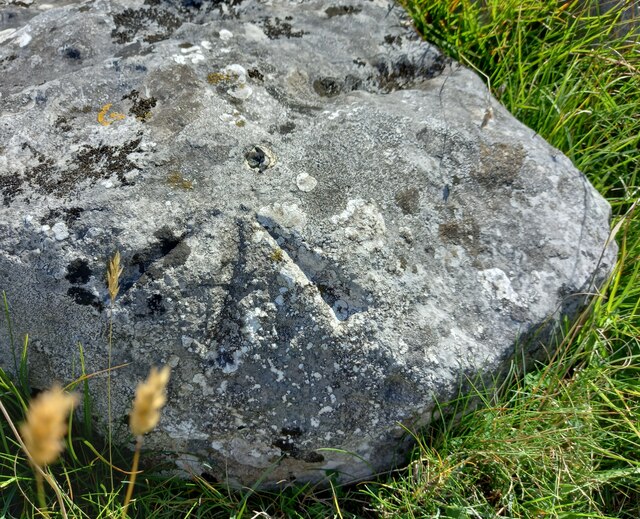
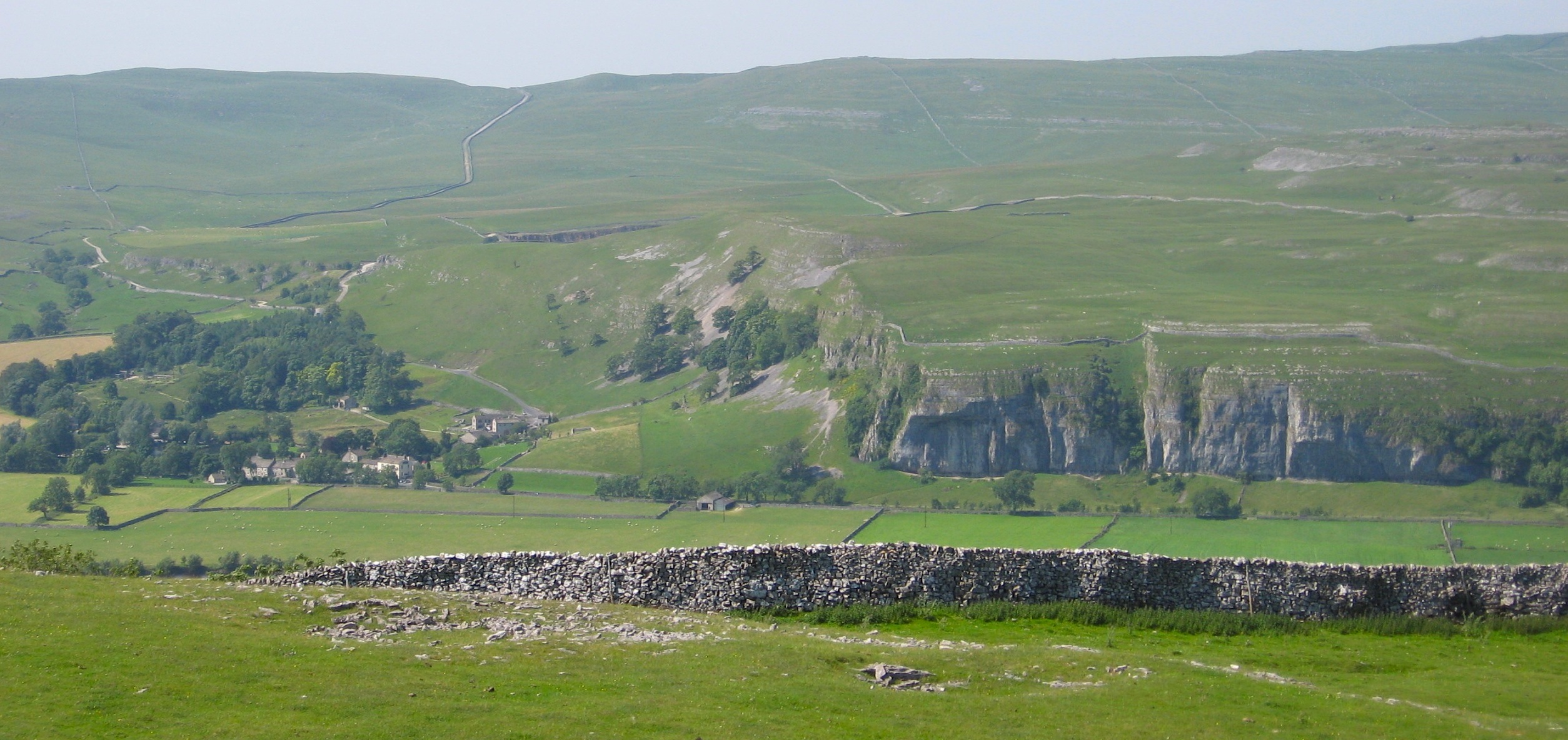
Kilnsey Moor holds historical significance, with evidence of human activity dating back to the Neolithic period. The remains of ancient settlements, stone circles, and burial sites can still be found scattered across the moor. Additionally, the area is famous for its limestone cliffs, including the iconic Kilnsey Crag, which is a popular spot for rock climbers.

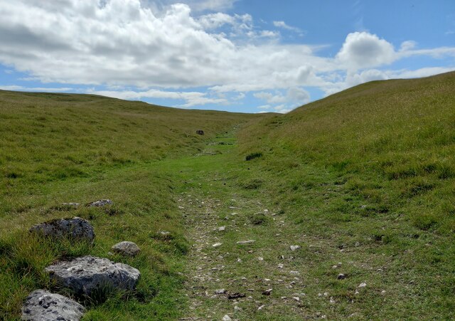
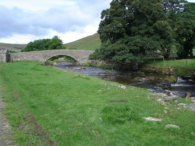
Visitors to Hutton's Kilnsey Moor can enjoy a variety of outdoor activities, such as hiking, birdwatching, and photography. There are several well-marked trails that allow visitors to explore the moorland and soak in its natural beauty. The area also offers opportunities for fishing in the nearby River Wharfe, which is renowned for its trout and grayling population.

Overall, Hutton's Kilnsey Moor is a captivating destination that showcases the beauty of the Yorkshire Dales, offering visitors a chance to immerse themselves in its wild and rugged charm.

If you have any feedback on the listing, please let us know in the comments section below.

Hutton's Kilnsey Moor Images

Images are sourced within 2km of 54.104028/-2.0778996 or Grid Reference SD9567. Thanks to Geograph Open Source API. All images are credited.

Mastiles Lane dropping towards Kilnsey Mastiles Lane was the subject of some controversy when the number of off-road vehicles using it was starting to have an adverse impact. Although it is still marked as a Byway Open to All Traffic on the map, it doesn't seem to remain so for its full length, and even where it is so marked, further west, there is a definite "all motor vehicles prohibited sign", so I was unsurprised not to meet the sort of continuous procession of trail bikes and four-wheel-drive enthusiasts that one meets on a number of other BOATs in the National Park. Indeed, on an eight mile walk on a breezy day in January, there was one mountain biker and two walkers, apart from myself (and dog). The lane itself continues towards Kilnsey, but the small gate on the right gives onto a public footpath down towards the road junction leading to Coniston bridge - a better parking spot than a village in these times of infectious disease.
Mastiles Lane dropping towards Kilnsey
Mastiles Lane was the subject of some controversy when the number of off-road vehicles using it was starting to have an adverse impact. Although it is still marked as a Byway Open to All Traffic on the map, it doesn't seem to remain so for its full length, and even where it is so marked, further west, there is a definite "all motor vehicles prohibited sign", so I was unsurprised not to meet the sort of continuous procession of trail bikes and four-wheel-drive enthusiasts that one meets on a number of other BOATs in the National Park. Indeed, on an eight mile walk on a breezy day in January, there was one mountain biker and two walkers, apart from myself (and dog). The lane itself continues towards Kilnsey, but the small gate on the right gives onto a public footpath down towards the road junction leading to Coniston bridge - a better parking spot than a village in these times of infectious disease.
Mastiles Lane heading for Wharfedale From the great publicity that once attended the supposed degradation of this "green lane" by overusage of motor vehicles, I had expected something a great deal softer and grassier underfoot than this well-compacted hard track. I was already beginning to feel that wellies had been an unnecessary choice for such a route march with barely enough puddles to keep the dog hydrated. The edge of the grid square is just shy of the 423m high point of the lane as it passes over a col on Holgates Kilnsey Moor, so the view looks back on almost the sum total of the ascent.
Mastiles Lane heading for Wharfedale
From the great publicity that once attended the supposed degradation of this "green lane" by overusage of motor vehicles, I had expected something a great deal softer and grassier underfoot than this well-compacted hard track. I was already beginning to feel that wellies had been an unnecessary choice for such a route march with barely enough puddles to keep the dog hydrated. The edge of the grid square is just shy of the 423m high point of the lane as it passes over a col on Holgates Kilnsey Moor, so the view looks back on almost the sum total of the ascent.
Mastiles Lane dropping towards Mastiles Gate Walled lanes make for an extra degree of freedom for the dog, not available when the fell is open and occupied by grazers, but beyond Mastiles gate at the junction of walls seen ahead, the lead will be back on and the walk will get slower. Most of the sheep on the fell ahead are in a large group (just out of view on the right) where a load of hay has just been dropped for them, but south of the track they are more randomly dotted about. The gate is at a slight low point in the lane (about 380m) before it climbs back 20m to the next rise.
Mastiles Lane dropping towards Mastiles Gate
Walled lanes make for an extra degree of freedom for the dog, not available when the fell is open and occupied by grazers, but beyond Mastiles gate at the junction of walls seen ahead, the lead will be back on and the walk will get slower. Most of the sheep on the fell ahead are in a large group (just out of view on the right) where a load of hay has just been dropped for them, but south of the track they are more randomly dotted about. The gate is at a slight low point in the lane (about 380m) before it climbs back 20m to the next rise.
High Long Ridge This gently sloping broad pasture is neither high, nor long, and hardly qualifies as a ridge, but drops gently towards the dry valley above Bordley Beck which, after the odd identity change, drains into the River Aire just east of Gargrave. The hill to the right of the photo on Malham Moor has the faint remains of a settlement and field system long predating the modern walls and farms. Being on limestone, the grassland is greener as the soil is noticeably more fertile than in the immediate foreground which provides only a scant living for sheep.
High Long Ridge
This gently sloping broad pasture is neither high, nor long, and hardly qualifies as a ridge, but drops gently towards the dry valley above Bordley Beck which, after the odd identity change, drains into the River Aire just east of Gargrave. The hill to the right of the photo on Malham Moor has the faint remains of a settlement and field system long predating the modern walls and farms. Being on limestone, the grassland is greener as the soil is noticeably more fertile than in the immediate foreground which provides only a scant living for sheep.
Limestone boulders on Tommy High Pasture Although the bedrock is concealed by a layer of drift, there are plenty of boulders lying about to indicate that a lot of the local geology is limestone. The one in the immediate foreground has smoothed surfaces and characteristic grooves eroded by humic acids whilst partially buried in the soil. Now exposed, lichen finds it a congenial home. In the distance are Clapham High Mark and Parson's Pulpit, where the underlying limestone is much closer to the surface and forms numerous small outcrops.
Limestone boulders on Tommy High Pasture
Although the bedrock is concealed by a layer of drift, there are plenty of boulders lying about to indicate that a lot of the local geology is limestone. The one in the immediate foreground has smoothed surfaces and characteristic grooves eroded by humic acids whilst partially buried in the soil. Now exposed, lichen finds it a congenial home. In the distance are Clapham High Mark and Parson's Pulpit, where the underlying limestone is much closer to the surface and forms numerous small outcrops.
Descending from Green Haw Hill From Malham Moor Lane, the bridleway passes west of Green Haw Hill and descends to the shallow valley followed by Mastiles lane on its way to Kilnsey. A fence replaces the disintegrating drystone wall on the left but will no doubt prove to be a much more ephemeral presence on the fellside, both rotting and rusting unlike the limestone which fits much better into the landscape.
Descending from Green Haw Hill
From Malham Moor Lane, the bridleway passes west of Green Haw Hill and descends to the shallow valley followed by Mastiles lane on its way to Kilnsey. A fence replaces the disintegrating drystone wall on the left but will no doubt prove to be a much more ephemeral presence on the fellside, both rotting and rusting unlike the limestone which fits much better into the landscape.
Kilnsey, Green Haw Hill The rivet benchmark is cut into a rock on the east side of the bridleway.
Kilnsey, Green Haw Hill
The rivet benchmark is cut into a rock on the east side of the bridleway.
Kilnsey, Green Haw Hill There is a rivet benchmark cut into a rock on the east side of the bridleway.
Kilnsey, Green Haw Hill
There is a rivet benchmark cut into a rock on the east side of the bridleway.
Kilnsey, Green Haw Hill The rivet benchmark cut into a large rock is in the centre of the bridleway track.
Kilnsey, Green Haw Hill
The rivet benchmark cut into a large rock is in the centre of the bridleway track.
Kilnsey, Green Haw Hill There is a rivet benchmark cut into the large rock in the centre of the bridleway track.
Kilnsey, Green Haw Hill
There is a rivet benchmark cut into the large rock in the centre of the bridleway track.
Kilnsey Moor
Kilnsey Moor
Kilnsey Moor
Kilnsey Moor
Kilnsey Horse riders near Kilnsey.
Kilnsey
Horse riders near Kilnsey.
Mastile Lane Restricted byway on Kilnsey Moor.
Mastile Lane
Restricted byway on Kilnsey Moor.
Kilnsey Moor Mastiles Lane, a restricted byway, crossing Kilnsey Moor.
Kilnsey Moor
Mastiles Lane, a restricted byway, crossing Kilnsey Moor.
Mastiles Lane Mastiles Lane, a restricted byway crossing Kilnsey Moor.
Mastiles Lane
Mastiles Lane, a restricted byway crossing Kilnsey Moor.
Green Haw Hill View from Mastiles Lane looking across the northern flank of Green Haw Hill.
Green Haw Hill
View from Mastiles Lane looking across the northern flank of Green Haw Hill.
Cool Scar Quarry The tops of the quarry faces at Cool Scar Quarry, above Kilnsey.
Cool Scar Quarry
The tops of the quarry faces at Cool Scar Quarry, above Kilnsey.
Show me another place!

Hutton's Kilnsey Moor is located at Grid Ref: SD9567 (Lat: 54.104028, Lng: -2.0778996)

Division: West Riding

Administrative County: North Yorkshire

District: Craven

Police Authority: North Yorkshire

What 3 Words

///basics.gentle.public. Near Grassington, North Yorkshire

Related Wikis

Kilnsey

Kilnsey is a small village in Wharfedale, North Yorkshire, England. It lies on the B6160 road, between the villages of Grassington and Kettlewell, near...

Bordley

Bordley is a village in the civil parish of Hetton-cum-Bordley, in North Yorkshire, England, within the Yorkshire Dales National Park and 12 miles (19...

Hawkswick

Hawkswick is a hamlet and civil parish in the Craven district of North Yorkshire, England. Situated in the Yorkshire Dales, it lies in Littondale on the...

Conistone

Conistone is a small village in the Craven district of North Yorkshire, England. It lies 3 miles (5 km) north of Grassington, 3 miles (5 km) south of Kettlewell...

Conistone with Kilnsey

Conistone with Kilnsey is a civil parish in Wharfedale in the district of Craven, North Yorkshire, England. It contains the villages of Kilnsey and Conistone...

St Mary's Church, Conistone

St Mary's Church is in the village of Conistone, North Yorkshire, England. It is an active Anglican parish church in the deanery of Skipton, the archdeaconry...

River Skirfare

River Skirfare is a small river in North Yorkshire, England, that flows through Littondale and ends where it joins the larger River Wharfe. The source...

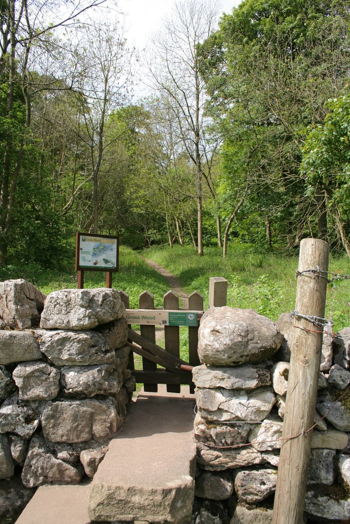
Grass Wood, Wharfedale

Grass Wood is an ancient woodland of 88 hectares (220 acres) in Wharfedale, North Yorkshire, England, that has an exceptional ground flora of woodland...

Nearby Amenities

Located within 500m of 54.104028,-2.0778996
Natural: spring
Source: OS 1851
Lat/Long: 54.1072335/-2.0798131
Historic: mine_shaft
Source: Bing
Lat/Long: 54.1035054/-2.0839668
The data included in this document is from www.openstreetmap.org. The data is made available under ODbL.

Have you been to Hutton's Kilnsey Moor?

Leave your review of Hutton's Kilnsey Moor below (or comments, questions and feedback).