Corton Down

Downs, Moorland in Wiltshire

England

Corton Down

Beech trees, Wylye Valley The steep slope they are growing on is probably where harder chalk overlies the chalk marl of the valley floor. There once was a small quarry a bit further to the right along the slope.
Beech trees, Wylye Valley Credit: Robin Webster

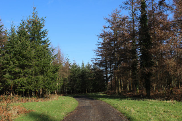
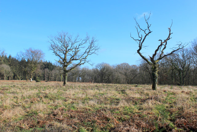
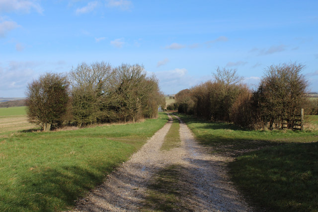
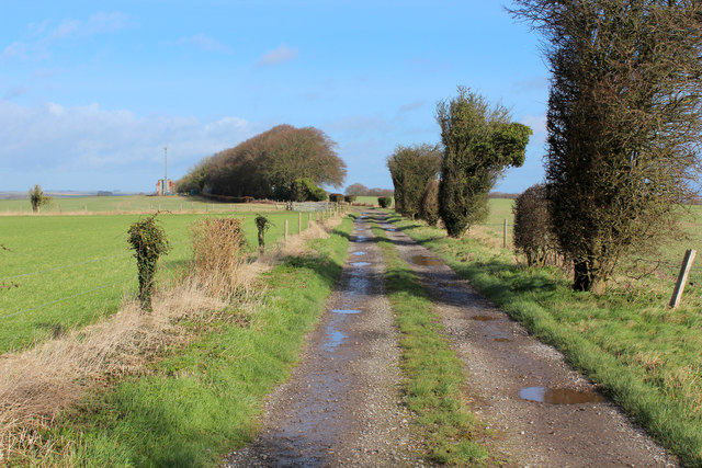
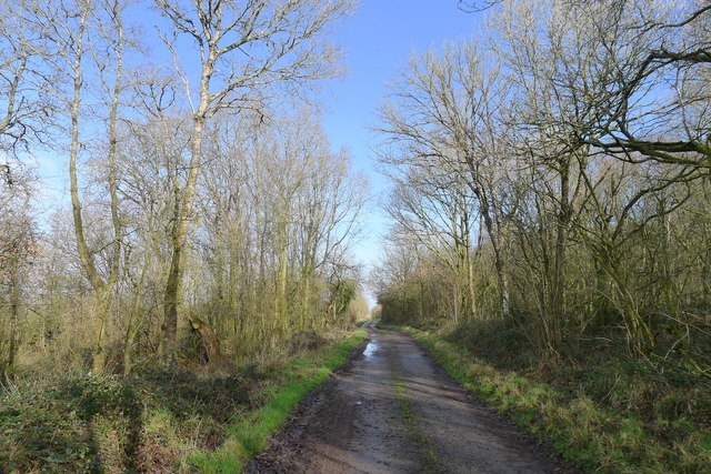
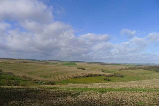
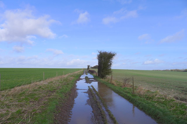
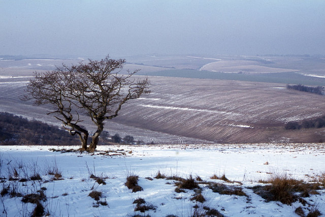
Corton Down is a prominent geographical feature located in Wiltshire, England. It is part of the larger expanse of the North Wessex Downs Area of Outstanding Natural Beauty. The area is characterized by rolling hills, vast grasslands, and patches of dense woodland.

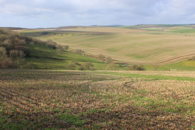
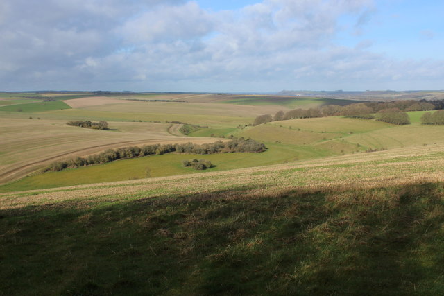
Situated near the village of Corton, Corton Down covers an extensive area, stretching for several miles. The downland is primarily composed of chalk, which gives the landscape a distinct white appearance. This chalky soil supports a diverse range of plant species, including grasses, wildflowers, and rare orchids.

The site is a haven for wildlife, with numerous species inhabiting the area. Visitors may spot a variety of birds, such as skylarks, kestrels, and buzzards soaring above the downs. Additionally, the downland is home to various mammals, including hares, rabbits, and foxes.

Corton Down offers breathtaking panoramic views of the surrounding countryside and is a popular destination for outdoor enthusiasts. The area provides ample opportunities for activities such as walking, hiking, and picnicking. There are several well-marked footpaths and trails that traverse the downland, providing visitors with a chance to explore the diverse ecosystems and enjoy the tranquil beauty of the landscape.

Corton Down is also of historical significance, with various archaeological remains dating back to the Neolithic and Bronze Age periods. The area is dotted with ancient burial mounds, known as barrows, and other prehistoric features, which serve as a testament to the rich history and cultural heritage of the region.

Overall, Corton Down in Wiltshire is a stunning natural landscape that offers a range of recreational opportunities and a glimpse into the area's fascinating past.

If you have any feedback on the listing, please let us know in the comments section below.

Corton Down Images

Images are sourced within 2km of 51.144679/-2.0984442 or Grid Reference ST9338. Thanks to Geograph Open Source API. All images are credited.

Beech trees, Wylye Valley The steep slope they are growing on is probably where harder chalk overlies the chalk marl of the valley floor. There once was a small quarry a bit further to the right along the slope.
Beech trees, Wylye Valley
The steep slope they are growing on is probably where harder chalk overlies the chalk marl of the valley floor. There once was a small quarry a bit further to the right along the slope.
Wessex Ridgeway heading North through Great Ridge Wood The long distance footpath following a good wide track between conifers
Wessex Ridgeway heading North through Great Ridge Wood
The long distance footpath following a good wide track between conifers
Clearing in Great Ridge Wood
View over Well Bottom View from the Wessex Ridgeway as it emerges from the clutches of Great Ridge Wood.
It shows the sweeping chalk landscape of the West Wiltshire Downs.
View over Well Bottom
View from the Wessex Ridgeway as it emerges from the clutches of Great Ridge Wood. It shows the sweeping chalk landscape of the West Wiltshire Downs.
View over Corton Down Sweeping view over the West Wiltshire Downs from the Wessex Ridgeway as it emerges from the Great Ridge Wood.
View over Corton Down
Sweeping view over the West Wiltshire Downs from the Wessex Ridgeway as it emerges from the Great Ridge Wood.
Wessex Ridgeway on Corton Down A good firm track helps make good progress as the long distance footpath heads northwards.
Wessex Ridgeway on Corton Down
A good firm track helps make good progress as the long distance footpath heads northwards.
Corrugated Metal Barn on Corton Down Barn passed by on the Wessex Ridgeway between Great Ridge Wood and the village of Corton
Corrugated Metal Barn on Corton Down
Barn passed by on the Wessex Ridgeway between Great Ridge Wood and the village of Corton
Following the Wessex Ridgeway over Corton Down The Wessex Ridgeway is a 136-mile long-distance footpath which runs from Marlborough in Wiltshire to Lyme Regis in Dorset. It was opened in 1994. 

Wikipedia entry: <span class="nowrap"><a title="https://en.wikipedia.org/wiki/Wessex_Ridgeway" rel="nofollow ugc noopener" href="https://en.wikipedia.org/wiki/Wessex_Ridgeway">Link</a><img style="margin-left:2px;" alt="External link" title="External link - shift click to open in new window" src="https://s1.geograph.org.uk/img/external.png" width="10" height="10"/></span>
Following the Wessex Ridgeway over Corton Down
The Wessex Ridgeway is a 136-mile long-distance footpath which runs from Marlborough in Wiltshire to Lyme Regis in Dorset. It was opened in 1994. Wikipedia entry: LinkExternal link
Pasture beside Corton Field Barn As seen from the Wessex Ridgeway long distance footpath
Pasture beside Corton Field Barn
As seen from the Wessex Ridgeway long distance footpath
Farm Buildings, Corton Field Barn
Wessex Ridgeway on Corton Hill The long distance footpath between the village of Corton and Great Ridge Wood
Wessex Ridgeway on Corton Hill
The long distance footpath between the village of Corton and Great Ridge Wood
Solitary oak, Great Ridge woods A clearing in predominantly coniferous planting
Solitary oak, Great Ridge woods
A clearing in predominantly coniferous planting
The Wessex Ridgeway path about to leave the northern edge of the Great Ridge woodlands
The West Wiltshire Downs viewed from Great Ridge A chalk downland Area of Outstanding Natural Beauty
The West Wiltshire Downs viewed from Great Ridge
A chalk downland Area of Outstanding Natural Beauty
Track along the ridge of Corton Down Puddles on easily drained chalk downs testify to what would become the wettest February on record.
Track along the ridge of Corton Down
Puddles on easily drained chalk downs testify to what would become the wettest February on record.
Airwave communications mast, Corton Down
The Wessex Ridgeway path on the north flank of Corton Hill We will follow the path down the slope to the right for a pub lunch in Corton
The Wessex Ridgeway path on the north flank of Corton Hill
We will follow the path down the slope to the right for a pub lunch in Corton
Downland and lone hawthron tree near Rowdean Hill
Show me another place!

Corton Down is located at Grid Ref: ST9338 (Lat: 51.144679, Lng: -2.0984442)

Unitary Authority: Wiltshire

Police Authority: Wiltshire

What 3 Words

///soonest.saturate.shuffles. Near Boyton, Wiltshire

Related Wikis

Great Ridge Wood

Great Ridge Wood, formerly also known as Chicklade Wood, is one of the largest woodlands in southern Wiltshire, England. Mostly within the parishes of...

Tytherington Down

Tytherington Down (grid reference ST912385) is a 5.9 hectares (15 acres) biological Site of Special Scientific Interest in Wiltshire, England, notified...
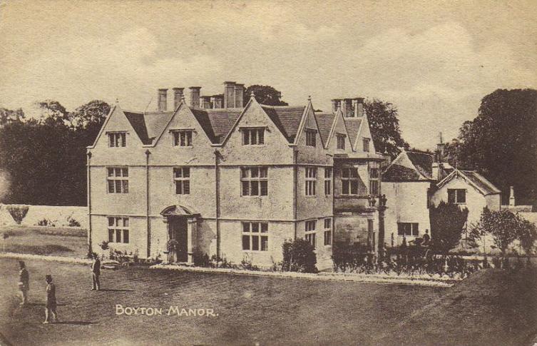
Boyton, Wiltshire

Boyton is a village and civil parish in Wiltshire, England. It lies in the Wylye Valley within Salisbury Plain, about 6 miles (10 km) south-east of Warminster...

Upton Lovell

Upton Lovell is a village and civil parish in Wiltshire, England. It lies on the A36, in the Wylye valley about 5 miles (8.0 km) southeast of Warminster...

Nearby Amenities

Located within 500m of 51.144679,-2.0984442
Corton Down
Place: locality
Lat/Long: 51.1450289/-2.0971227
The data included in this document is from www.openstreetmap.org. The data is made available under ODbL.

Have you been to Corton Down?

Leave your review of Corton Down below (or comments, questions and feedback).