The Rush Beds

Downs, Moorland in Yorkshire

England

The Rush Beds

Reaps Cross The cross has been vandalized in the past but still has a presence on Reaps Edge high on  Heptonstall Moor.
Reaps Cross Credit: Stephen Shaw

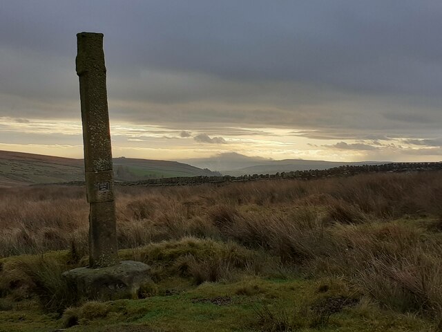
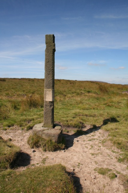
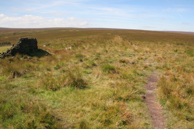
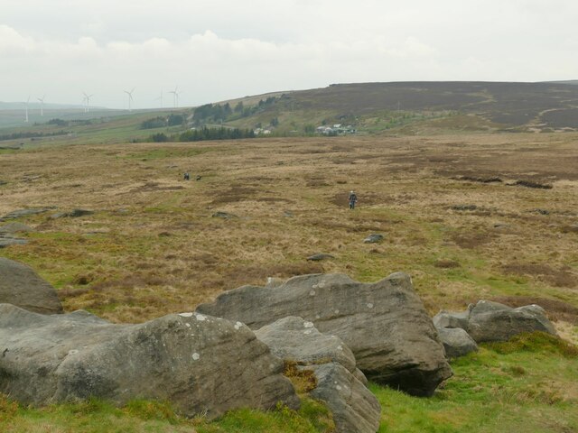
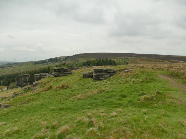
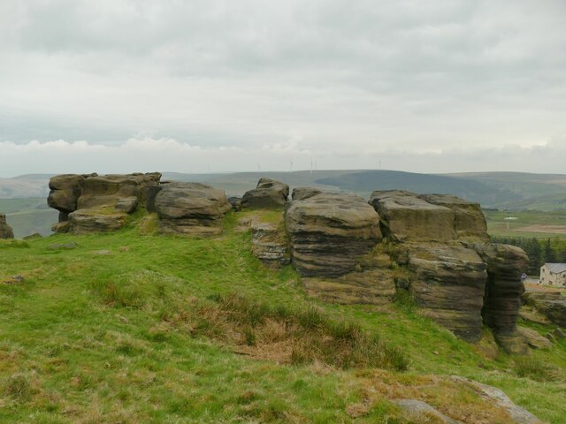
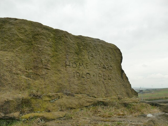
The Rush Beds in Yorkshire is a captivating and picturesque area that encompasses both downs and moorland landscapes. Located in the northern region of England, it is known for its stunning natural beauty and diverse ecosystem.

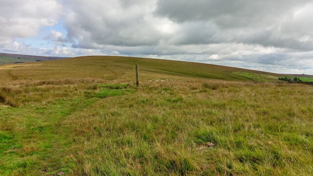
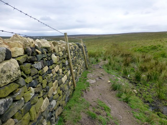
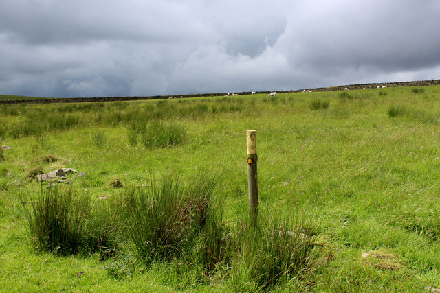
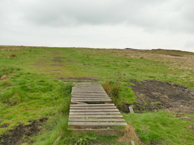
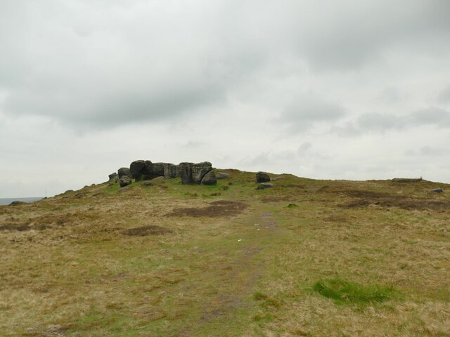
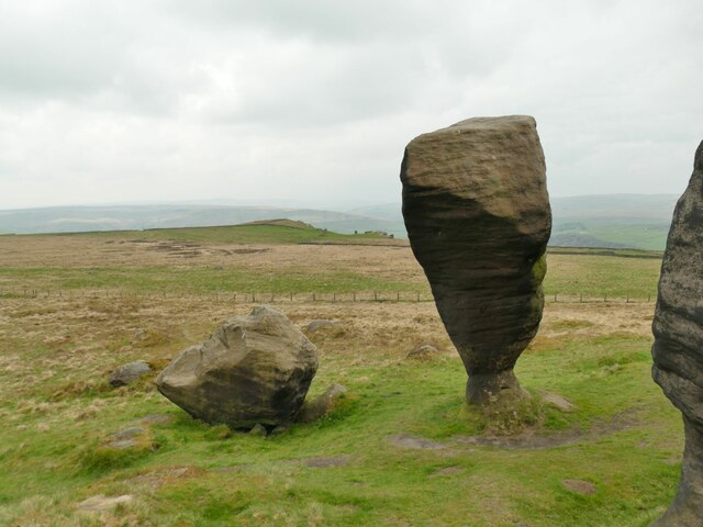
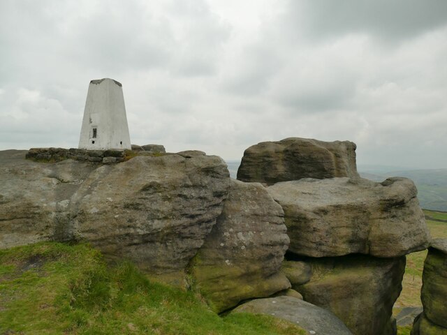
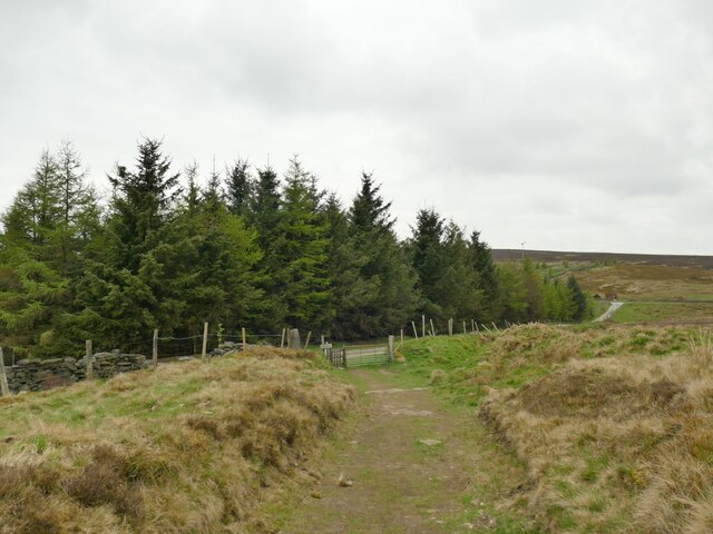
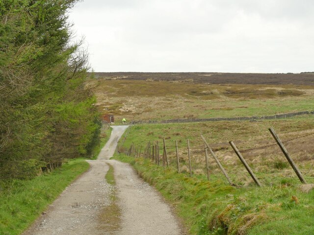
The downs of The Rush Beds offer vast open spaces with gently rolling hills covered in lush green grass. These areas provide a perfect setting for leisurely walks or picnics, offering breathtaking panoramic views of the surrounding countryside. The downs are also home to a variety of plant and animal species, including wildflowers and grazing sheep, contributing to the area's rich biodiversity.

In contrast, the moorland of The Rush Beds presents a more rugged and untamed environment. The heather-covered hills stretch as far as the eye can see, creating a stunning purple landscape during the blooming season. This area is known for its unique wildlife, including grouse and curlews, which thrive in the harsh conditions of the moors.

The Rush Beds is a popular destination for outdoor enthusiasts, offering a range of activities such as hiking, birdwatching, and photography. The area's extensive network of trails allows visitors to explore the downs and moorland, providing opportunities to discover hidden gems and enjoy the tranquility of nature.

Overall, The Rush Beds in Yorkshire is a remarkable and diverse landscape that showcases the natural beauty of the region. Whether you seek peaceful walks, wildlife encounters, or simply a chance to immerse yourself in nature, this area offers a memorable experience for all who visit.

If you have any feedback on the listing, please let us know in the comments section below.

The Rush Beds Images

Images are sourced within 2km of 53.754213/-2.1045171 or Grid Reference SD9328. Thanks to Geograph Open Source API. All images are credited.

Reaps Cross The cross has been vandalized in the past but still has a presence on Reaps Edge high on  Heptonstall Moor.
Reaps Cross
The cross has been vandalized in the past but still has a presence on Reaps Edge high on Heptonstall Moor.
Reaps Edge A recently repaired dry stone wall and fence at Reaps Edge.
Reaps Edge
A recently repaired dry stone wall and fence at Reaps Edge.
Public Footpath on Rough Pasture, Heptonstall Moor Not evident on the ground, but posts lead the way for the footpath between the ruins of Rough Hey to the ruins of Raistrick Greave.
Public Footpath on Rough Pasture, Heptonstall Moor
Not evident on the ground, but posts lead the way for the footpath between the ruins of Rough Hey to the ruins of Raistrick Greave.
Old Wayside Cross on Reaps Edge, Heptonstall Moor, Heptonstall Parish Reaps Cross, old head, shaft and base, by the wayside, in parish of Heptonstall (Calderdale District), Hepstonstall Moor; Reaps Edge, on moorland overlooking Gorple Lower Reservoir, at junction of paths, re-erected 2002.

Grade II Listed. List Entry Number: 1226173
<span class="nowrap"><a title="https://historicengland.org.uk/listing/the-list/list-entry/1226173" rel="nofollow ugc noopener" href="https://historicengland.org.uk/listing/the-list/list-entry/1226173">Link</a><img style="margin-left:2px;" alt="External link" title="External link - shift click to open in new window" src="https://s1.geograph.org.uk/img/external.png" width="10" height="10"/></span>
Scheduled Monument. List Entry Number: 1013830
<span class="nowrap"><a title="https://historicengland.org.uk/listing/the-list/list-entry/1013830" rel="nofollow ugc noopener" href="https://historicengland.org.uk/listing/the-list/list-entry/1013830">Link</a><img style="margin-left:2px;" alt="External link" title="External link - shift click to open in new window" src="https://s1.geograph.org.uk/img/external.png" width="10" height="10"/></span>

To be surveyed

Milestone Society National ID: YWCA_HEP01
Old Wayside Cross on Reaps Edge, Heptonstall Moor, Heptonstall Parish
Reaps Cross, old head, shaft and base, by the wayside, in parish of Heptonstall (Calderdale District), Hepstonstall Moor; Reaps Edge, on moorland overlooking Gorple Lower Reservoir, at junction of paths, re-erected 2002. Grade II Listed. List Entry Number: 1226173 LinkExternal link Scheduled Monument. List Entry Number: 1013830 LinkExternal link To be surveyed Milestone Society National ID: YWCA_HEP01
Old cross The remains of Reaps Cross on Heptonstall Moor.  To the north is Gorple Lower Reservoir.   The small plaque says it was reerected in 2002.
Old cross
The remains of Reaps Cross on Heptonstall Moor. To the north is Gorple Lower Reservoir. The small plaque says it was reerected in 2002.
Reap Cross, Heptonstall Moor Looking W at the remains of Reap Cross.
Reap Cross, Heptonstall Moor
Looking W at the remains of Reap Cross.
Footpath, Heptonstall Moor Looking SW along the footpath at the corner of the wall SD 938 302. Raistrick Greave Hill is directly ahead.
Footpath, Heptonstall Moor
Looking SW along the footpath at the corner of the wall SD 938 302. Raistrick Greave Hill is directly ahead.
OS Bench Mark OS cut bench mark from the first, 19th century, levelling, on flat rock close to the trig point. There is no sign of a pivot or rivet. The BM is shown on the 1853 6" OS map but not on subsequent editions, nor on any 25" maps. Marked as 1434.7 feet above old datum
OS Bench Mark
OS cut bench mark from the first, 19th century, levelling, on flat rock close to the trig point. There is no sign of a pivot or rivet. The BM is shown on the 1853 6" OS map but not on subsequent editions, nor on any 25" maps. Marked as 1434.7 feet above old datum
Start of a footpath off Eastwood Road The boardwalk over a sometimes boggy patch within metres of leaving the road was not a good sign, but it had been a fairly dry winter and spring, and the going was good across Bridestones Moor.
Start of a footpath off Eastwood Road
The boardwalk over a sometimes boggy patch within metres of leaving the road was not a good sign, but it had been a fairly dry winter and spring, and the going was good across Bridestones Moor.
Approaching the Bridestones The moor contains several gritstone outcrops generically known as the Bridestones, some of them having individual names. This is the first significant outcrop approaching from the east.
Approaching the Bridestones
The moor contains several gritstone outcrops generically known as the Bridestones, some of them having individual names. This is the first significant outcrop approaching from the east.
The Bottleneck on Bridestones Moor The moor contains several gritstone outcrops generically known as the Bridestones, some of them having individual names. This is perhaps the most distinctive individual rock. <a href="https://www.geograph.org.uk/photo/5350930">SD9326 : The Bride Stone, Todmorden</a> shows the other side and another contributor gives us the geological detail at <a href="https://www.geograph.org.uk/photo/4105934">SD9326 : The Bride Stone</a>.
The Bottleneck on Bridestones Moor
The moor contains several gritstone outcrops generically known as the Bridestones, some of them having individual names. This is perhaps the most distinctive individual rock. SD9326 : The Bride Stone, Todmorden shows the other side and another contributor gives us the geological detail at SD9326 : The Bride Stone.
Bridestones triangulation pillar Given a height of 437 or 438 metres on modern maps, though these trig points were more important for their location on plan than the precise elevation.  The 1907 1:2500 map shows it 20 metres further west, a big enough  discrepancy at that scale to suggest it was in fact relocated at some time.
Bridestones triangulation pillar
Given a height of 437 or 438 metres on modern maps, though these trig points were more important for their location on plan than the precise elevation. The 1907 1:2500 map shows it 20 metres further west, a big enough discrepancy at that scale to suggest it was in fact relocated at some time.
West from the Great Bridestones
Outcrop above Bridestones Farm The moor contains several gritstone outcrops generically known as the Bridestones, some of them having individual names. This one doesn't seem to have a name, but the farm below has taken the name of the wider group.
Outcrop above Bridestones Farm
The moor contains several gritstone outcrops generically known as the Bridestones, some of them having individual names. This one doesn't seem to have a name, but the farm below has taken the name of the wider group.
Rock outcrop above Bridestones Farm The moor contains several gritstone outcrops generically known as the Bridestones, some of them having individual names. This one doesn't seem to have a name, but the farm below (right of photo) has taken the name of the wider group.
Rock outcrop above Bridestones Farm
The moor contains several gritstone outcrops generically known as the Bridestones, some of them having individual names. This one doesn't seem to have a name, but the farm below (right of photo) has taken the name of the wider group.
Graffito on rock outcrop above Bridestones Farm The text is "A Coy 21st WY Br Home Guard 1940-1944".  The lettering looks surprisingly sharp for an 80-year-old carving in an exposed location.  Maybe the gritstone is hard enough, or perhaps it's been re-cut more recently?

For context, it is on one of the rocks to the right of the group in <a href="https://www.geograph.org.uk/photo/7170447">SD9226 : Rock outcrop above Bridestones Farm</a>.
Graffito on rock outcrop above Bridestones Farm
The text is "A Coy 21st WY Br Home Guard 1940-1944". The lettering looks surprisingly sharp for an 80-year-old carving in an exposed location. Maybe the gritstone is hard enough, or perhaps it's been re-cut more recently? For context, it is on one of the rocks to the right of the group in SD9226 : Rock outcrop above Bridestones Farm.
Approaching Eleanor's Wood A conifer wood above Todmorden.
Approaching Eleanor's Wood
A conifer wood above Todmorden.
Track above Eleanor's Wood The track is a public footpath and in the other direction gives access to Hudson Clough Farm.
Track above Eleanor's Wood
The track is a public footpath and in the other direction gives access to Hudson Clough Farm.
Show me another place!

The Rush Beds is located at Grid Ref: SD9328 (Lat: 53.754213, Lng: -2.1045171)

Division: West Riding

Unitary Authority: Calderdale

Police Authority: West Yorkshire

What 3 Words

///windy.impose.countries. Near Cornholme, West Yorkshire

Nearby Locations

Cross Clough The Rush Beds

Related Wikis

Blackshaw

Blackshaw is a civil parish in the Calderdale metropolitan borough of West Yorkshire, England. It contains the village of Blackshaw Head. According to...

Cornholme railway station

Cornholme railway station served the village of Cornholme in West Yorkshire, England on the Copy Pit line. The station was opened by the Lancashire and...

Colden, West Yorkshire

Colden is a hamlet in the civil parish of Heptonstall in Calderdale, West Yorkshire, England. Historically part of the West Riding of Yorkshire, the hamlet...

Pudsey, Calderdale

Pudsey is a neighbourhood in the village of Cornholme, Calderdale, West Yorkshire, England. It is near the town of Todmorden and the A646 Burnley Road...

Related Videos

AirBnB #todmorden #tourism

Visit #todmorden #airbnb.

Cliviger Valley Gorge, Todmorden, Calderdale, Yorkshire

A walk from Todmorden leading up past Dobroyd Castle, (a Victorian mock-gothic pile) then across to the edge of Cliviger Gorge ...

Gaddings Dam Todmorden Tourism How to get to #GADDINGSDAM #todmorden #UKSTALLESTBEACH

Gaddings Dam is the place for you! Todmorden Tourism paid for by your tax money. Music by @thefamousclive.

Have you been to The Rush Beds?

Leave your review of The Rush Beds below (or comments, questions and feedback).