Black Brae

Downs, Moorland in Yorkshire Richmondshire

England

Black Brae

Old limekiln at Middle Bank
Old limekiln at Middle Bank Credit: Chris Holifield

Black Brae is a picturesque village nestled in the heart of Yorkshire, located in the northern region of England. Situated amidst the stunning landscapes of the Yorkshire Downs and Moorland, this idyllic village offers a tranquil and serene getaway for nature enthusiasts and those seeking respite from the bustling city life.

The village of Black Brae is characterized by its charming stone cottages, which exude a rustic and traditional charm. The surrounding rolling hills and lush green meadows provide a delightful backdrop to the village, making it an ideal destination for hikers, walkers, and nature lovers. The Yorkshire Downs offer breathtaking panoramic views and a multitude of walking trails, allowing visitors to explore the area's natural beauty at their own pace.

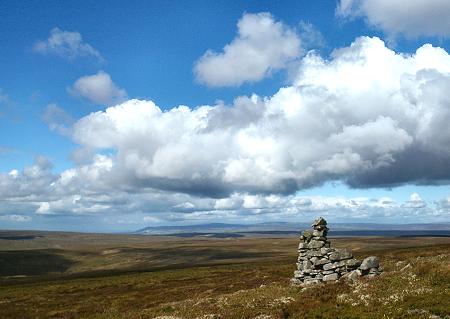
The nearby moorlands of Black Brae are renowned for their rugged beauty and unique wildlife. With vast expanses of heather-covered hills and scattered ancient stone formations, the moorlands provide a captivating experience for visitors. Keen birdwatchers can spot a variety of species, including grouse, curlews, and peregrine falcons, while the moorland is also home to wild deer and sheep.

The village itself boasts a friendly and welcoming community, with a traditional village pub serving local ales and hearty Yorkshire cuisine. Visitors can immerse themselves in the local culture by attending the various events and festivals held throughout the year, showcasing traditional music, arts, and crafts.

In summary, Black Brae offers a serene and picturesque retreat, where visitors can unwind amidst the stunning landscapes of the Yorkshire Downs and Moorland. With its charming village atmosphere and natural beauty, it is an ideal destination for those seeking an escape into the tranquility of the English countryside.

If you have any feedback on the listing, please let us know in the comments section below.
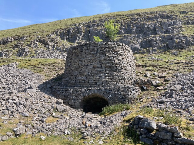
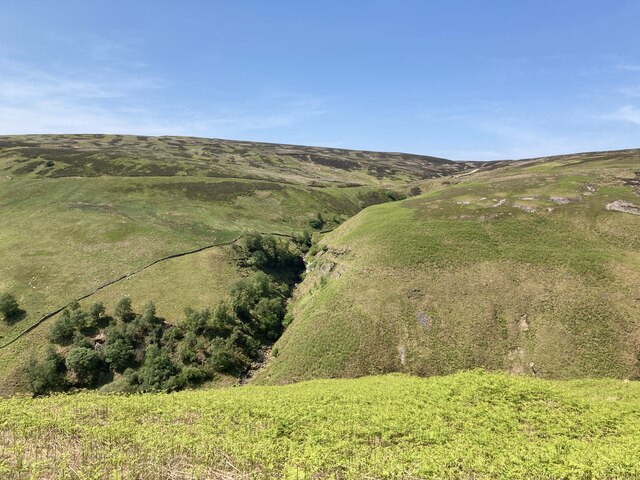
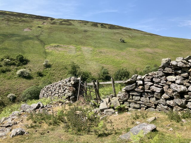
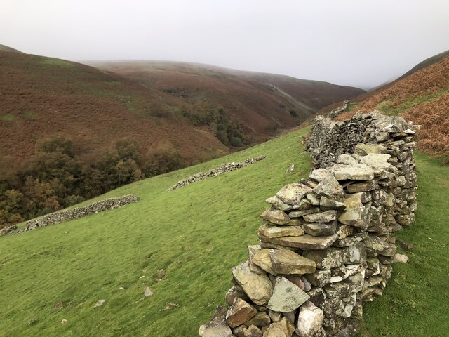
Black Brae Images

Images are sourced within 2km of 54.399122/-2.105738 or Grid Reference NY9300. Thanks to Geograph Open Source API. All images are credited.

Old limekiln at Middle Bank
Looking up Gunnerside Gill Showing the remains of old lead mine workings on both sides
Looking up Gunnerside Gill
Showing the remains of old lead mine workings on both sides
The path up Gunnerside Gill at Swina Bank
Botcher Gill
Botcher Gill
Entrance to Bunton Level lead mine
Ruined buildings at Bunton Level lead mine
Old lead mining area in Gunnerside Gill The North Hush and Lownathwaite Lead Mine
Old lead mining area in Gunnerside Gill
The North Hush and Lownathwaite Lead Mine
Drystone wall at Middle Bank
Formerly enclosed pasture at Middle Bank
Dolly Lead Level The stone entrance to the Dolly Lead Level can be seen sitting above the mining waste tumbling into the Gunnerside valley as if spewed from the mouth of the level.
Dolly Lead Level
The stone entrance to the Dolly Lead Level can be seen sitting above the mining waste tumbling into the Gunnerside valley as if spewed from the mouth of the level.
Bunton Level and Bunton Hush Bunton level is one of many levels and shafts associated with Friarfold Lead Mine. There are also three hushes in close proximity around the mine site. Hushes were created by the damming and releasing of water to sweep away the upper layers of vegetation and expose the veins of ore.
Bunton Level and Bunton Hush
Bunton level is one of many levels and shafts associated with Friarfold Lead Mine. There are also three hushes in close proximity around the mine site. Hushes were created by the damming and releasing of water to sweep away the upper layers of vegetation and expose the veins of ore.
Mine Buildings, Bunton Level, and Bunton Hush Buildings, level, and hush associated with the Friarfold lead mine.
Mine Buildings, Bunton Level, and Bunton Hush
Buildings, level, and hush associated with the Friarfold lead mine.
Waterfall and old mine workings, Blakethwaite Gill
Ruins of Blakethwaite Smelting Mill Lead ore was smelted here from 1821. The closure date is disputed, with 1878 being the most often quoted year. The lead was smelted using peat with a little coal. The arched building in the foreground was probably for peat storage, the furnace was part of the ruin seen at the base of the hill, with the route of the flue traceable up the hillside to a now demolished chimney. Just behind and above the furnace ruin is a lime kiln, most likely built to provide the mortar for constructing  the rest of the buildings on the site.
Ruins of Blakethwaite Smelting Mill
Lead ore was smelted here from 1821. The closure date is disputed, with 1878 being the most often quoted year. The lead was smelted using peat with a little coal. The arched building in the foreground was probably for peat storage, the furnace was part of the ruin seen at the base of the hill, with the route of the flue traceable up the hillside to a now demolished chimney. Just behind and above the furnace ruin is a lime kiln, most likely built to provide the mortar for constructing the rest of the buildings on the site.
Entrance to Bunton Level I've taken the 8-figure grid reference for this by comparison with Andy Waddington's photo <a href="https://www.geograph.org.uk/photo/4702388">NY9401 : Bunton Hush above the entrance to Bunton Level</a> slightly adjusted from looking at aerial mapping.
Entrance to Bunton Level
I've taken the 8-figure grid reference for this by comparison with Andy Waddington's photo NY9401 : Bunton Hush above the entrance to Bunton Level slightly adjusted from looking at aerial mapping.
Fingerpost, Gunnerside Gill Marooned in a sea of waste from the old lead workings. Surrender Bridge lies across the moor, the next objective for Coast-to-Coast walkers.
Fingerpost, Gunnerside Gill
Marooned in a sea of waste from the old lead workings. Surrender Bridge lies across the moor, the next objective for Coast-to-Coast walkers.
Wheel pit, Bunton Crushing Mill, Gunnerside Gill A large water-powered wheel once sat in deep pit here, supported on the timbers still visible. Its purpose was to crush the lead ore obtained from the nearby Bunting Level.
Wheel pit, Bunton Crushing Mill, Gunnerside Gill
A large water-powered wheel once sat in deep pit here, supported on the timbers still visible. Its purpose was to crush the lead ore obtained from the nearby Bunting Level.
Show me another place!

Black Brae is located at Grid Ref: NY9300 (Lat: 54.399122, Lng: -2.105738)

Division: North Riding

Administrative County: North Yorkshire

District: Richmondshire

Police Authority: North Yorkshire

What 3 Words

///charmingly.steepest.steers. Near Bowes, Co. Durham

Nearby Locations

Silver Hill Black Brae

Related Wikis

Gunnerside Gill

Gunnerside Gill (or Ghyll) is a small valley in the Yorkshire Dales, England, which branches off Swaledale into moorland to the north of Gunnerside. The...

Melbecks

Melbecks is a civil parish in North Yorkshire, England. It is located in upper Swaledale and covers the settlements of Gunnerside, Low Row, Feetham and...

Ivelet

Ivelet is a hamlet in the Yorkshire Dales, North Yorkshire, England about a mile west of Gunnerside in Swaledale. Ivelet Bridge crosses the River Swale...

Arn Gill (North Yorkshire)

Arn Gill is a ravine or gully containing a beck of the same name, near the village of Muker in Swaledale, North Yorkshire, England. The ravine and beck...

Satron

Satron is a hamlet in Swaledale, North Yorkshire, England. It lies 0.6 miles (1 km) south west of Gunnerside on the opposite bank of the River Swale. It...

Gunnerside

Gunnerside is a village in North Yorkshire, England. It is situated in Swaledale, on the B6270 road, 3 miles (5 km) east of Muker and 6 miles (10 km) west...

Rogan's Seat

Rogan's Seat is a remote hill located near East Stonesdale and Gunnerside Gill, in the Yorkshire Dales in England. It is a high expanse of moorland that...

Kisdon Force

Kisdon Force is a series of waterfalls on the River Swale in Swaledale, England. The falls are situated within the Yorkshire Dales National Park in the...

Nearby Amenities

Located within 500m of 54.399122,-2.105738
Black Hill
Ele: 569
Natural: peak
Lat/Long: 54.3968082/-2.1113808
Waterway: waterfall
Lat/Long: 54.4006418/-2.1011741
Hunting Stand
Hunting Stand: grouse_butt
Lat/Long: 54.4023931/-2.1054214
Hunting Stand
Hunting Stand: grouse_butt
Lat/Long: 54.4024623/-2.1060586
Hunting Stand
Hunting Stand: grouse_butt
Lat/Long: 54.4025282/-2.1066657
Hunting Stand
Hunting Stand: grouse_butt
Lat/Long: 54.4025939/-2.1072708
Hunting Stand
Hunting Stand: grouse_butt
Lat/Long: 54.4026577/-2.1078581
Hunting Stand
Hunting Stand: grouse_butt
Lat/Long: 54.4027242/-2.1084704
Hunting Stand
Hunting Stand: grouse_butt
Lat/Long: 54.4027894/-2.1090703
Hunting Stand
Hunting Stand: grouse_butt
Lat/Long: 54.4028469/-2.1096
The data included in this document is from www.openstreetmap.org. The data is made available under ODbL.

Have you been to Black Brae?

Leave your review of Black Brae below (or comments, questions and feedback).