Crown Point Flat

Downs, Moorland in Yorkshire

England

Crown Point Flat

Higher House With Widdop Reservoir beyond
Higher House Credit: Kevin Waterhouse

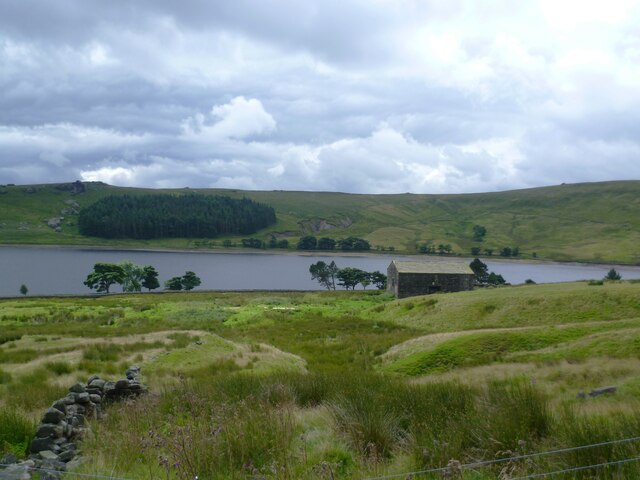
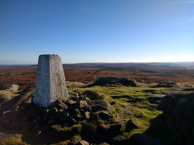
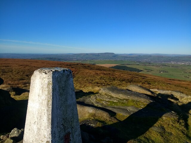
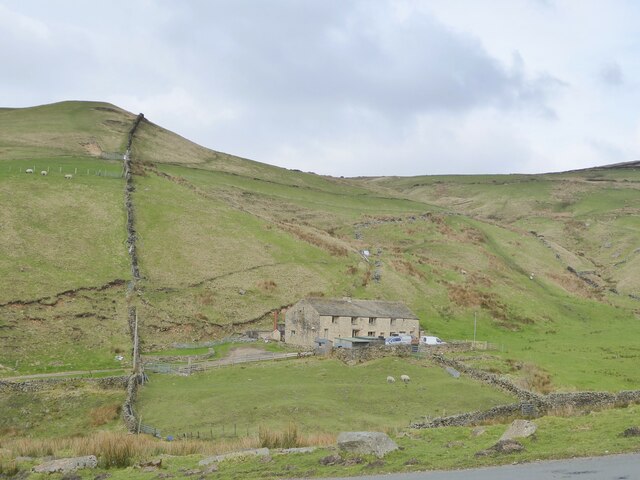
Crown Point Flat is a picturesque area located in Yorkshire, England. This region is known for its stunning landscapes, encompassing downs, moorland, and rolling hills. The flat itself is a vast expanse of open grassland, offering visitors and locals alike a serene and tranquil environment.

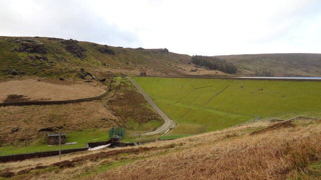
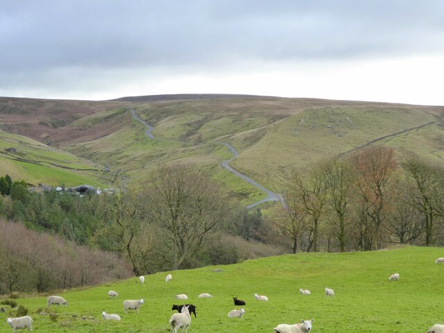
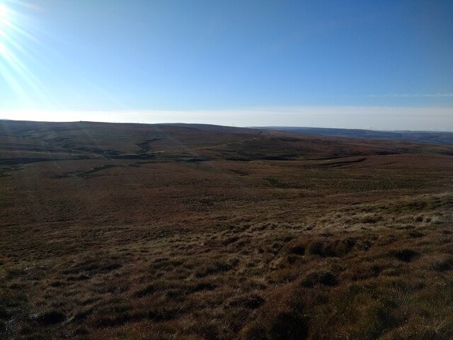
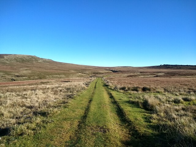
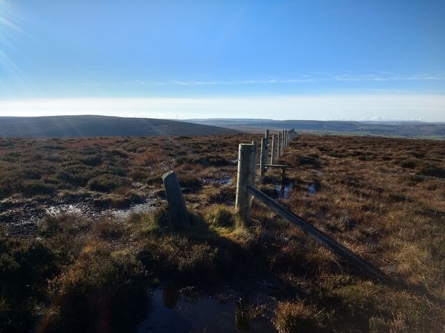
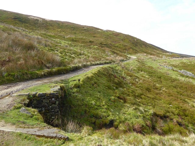
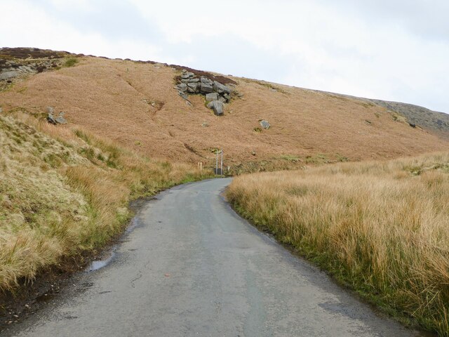
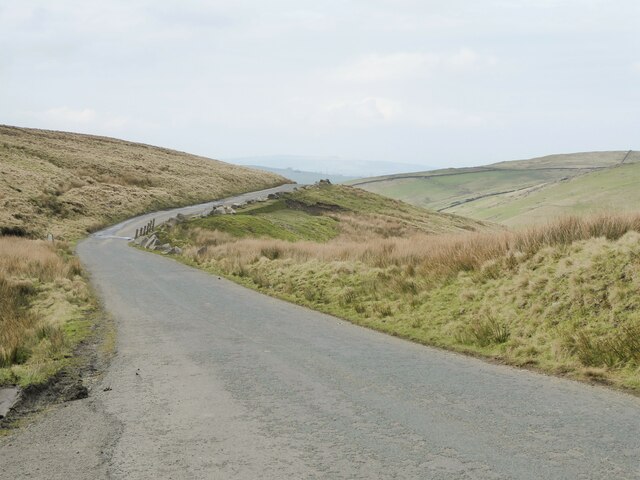
The flat is located at an elevation, providing breathtaking panoramic views of the surrounding countryside. With its vast open spaces and unobstructed views, Crown Point Flat is an ideal location for outdoor activities such as walking, hiking, and picnicking. The flat's gentle slopes make it accessible to people of all ages and fitness levels.

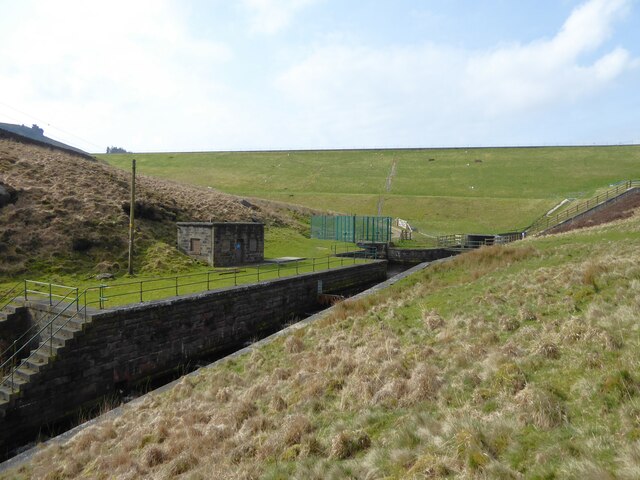
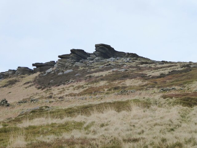
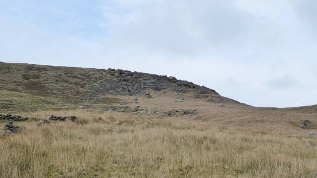
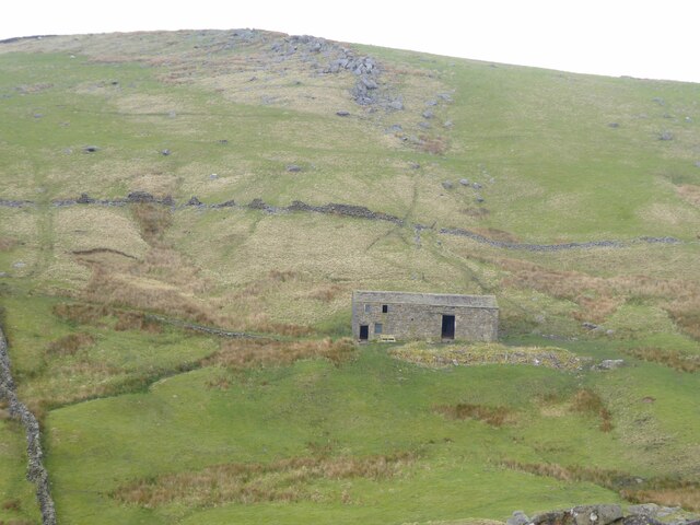
The Yorkshire Downs, which surround the flat, are characterized by their undulating hills and lush greenery. These downs are home to a variety of flora and fauna, making it a haven for nature enthusiasts. The moorland in the area is also notable, with its distinctive heather-covered terrain and scattered rock formations.

Crown Point Flat is easily accessible, with well-maintained footpaths and trails. The area is also popular among birdwatchers, as it attracts a diverse range of bird species throughout the year. Visitors can often spot kestrels, buzzards, and pheasants, among many others.

Overall, Crown Point Flat offers a serene and peaceful escape from the hustle and bustle of daily life. With its stunning natural beauty and abundance of outdoor activities, it is a must-visit destination for nature lovers and those seeking tranquility in the heart of Yorkshire.

If you have any feedback on the listing, please let us know in the comments section below.

Crown Point Flat Images

Images are sourced within 2km of 53.803146/-2.1122917 or Grid Reference SD9234. Thanks to Geograph Open Source API. All images are credited.

Higher House With Widdop Reservoir beyond
Higher House
With Widdop Reservoir beyond
Widdop Reservoir Dam View from the car park
Widdop Reservoir Dam
View from the car park
Valve House With its interesting Egyptian style build and presumably control rods going into the waters of Widdop Reservoir
Valve House
With its interesting Egyptian style build and presumably control rods going into the waters of Widdop Reservoir
Road to Widdop A minor road climbs out of the Thursden Valley towards Widdop in Yorkshire
Road to Widdop
A minor road climbs out of the Thursden Valley towards Widdop in Yorkshire
Looking south across the trig point on Lad Law
Looking northwest across the trig point on Lad Law towards Pendle Hill
Looking south across the valley from just south of the top of Lad Law
Looking down the track between Lad Law and Grey Stone Hill
Fence corner and stile on the top of the nameless hill north of Black Hameldon
Widdop Reservoir Dam Contractors' work on the reservoir has required a diversion to the public footpath down into Graining Water, below the dam, rather than the route across the top of the dam.
Widdop Reservoir Dam
Contractors' work on the reservoir has required a diversion to the public footpath down into Graining Water, below the dam, rather than the route across the top of the dam.
Pennine Bridleway rounding an hairpin bend Climbing away from Widdop Reservoir to Clough Head, with two more pronounced bends to go.
Pennine Bridleway rounding an hairpin bend
Climbing away from Widdop Reservoir to Clough Head, with two more pronounced bends to go.
Raven Stones A rocky outcrop north of Widdop Reservoir
Raven Stones
A rocky outcrop north of Widdop Reservoir
Round Hill A rocky outcrop, north of Widdop Reservoir
Round Hill
A rocky outcrop, north of Widdop Reservoir
Approaching the county boundary Yorkshire ahead at the bend on the Colne to Slack road. The metal poles no longer have the Calderdale sign.
Approaching the county boundary
Yorkshire ahead at the bend on the Colne to Slack road. The metal poles no longer have the Calderdale sign.
Road crossing Rapes Clough The Slack to Colne road is about to start the long descent to Thursden. After the bend at the clough crossing there appears to be a land slip and the road supported by what appear to be sandbags.
Road crossing Rapes Clough
The Slack to Colne road is about to start the long descent to Thursden. After the bend at the clough crossing there appears to be a land slip and the road supported by what appear to be sandbags.
Cockridge Copy Seen across the valley of Thursden Brook from the Slack to Colne road
Cockridge Copy
Seen across the valley of Thursden Brook from the Slack to Colne road
New Bridge End At Thursden seen from the Slack to Colne road
New Bridge End
At Thursden seen from the Slack to Colne road
Bridge across the spillway at Widdop Reservoir A new gate had recently been added.
Bridge across the spillway at Widdop Reservoir
A new gate had recently been added.
Show me another place!

Crown Point Flat is located at Grid Ref: SD9234 (Lat: 53.803146, Lng: -2.1122917)

Division: West Riding

Unitary Authority: Calderdale

Police Authority: West Yorkshire

What 3 Words

///nets.feuds.factories. Near Nelson, Lancashire

Related Wikis

Boulsworth Hill

Boulsworth Hill is a large expanse of moorland, the highest point of the South Pennines of south-eastern Lancashire, England, separating the Borough of...

Trawden Brook

Trawden Brook is a minor river in Lancashire, England. It is 3.48 miles (5.6 km) long and has a catchment area of 4.40 square miles (11.4 km2). Rising...

Walshaw Dean Reservoirs

Walshaw Dean Reservoirs are three reservoirs situated above Hebden Bridge, West Yorkshire, England. They are between Hebden Bridge and Top Withins, a ruined...

Blake Dean Railway

The Blake Dean Railway was an approximately 5.5 miles (9 km) long 3 ft (914 mm) gauge narrow gauge railway on the edge of Hardcastle Crags Valley in West...

Nearby Amenities

Located within 500m of 53.803146,-2.1122917
Grey Stone Hill
Ele: 462
Natural: peak
Lat/Long: 53.8010379/-2.1139173
The data included in this document is from www.openstreetmap.org. The data is made available under ODbL.

Have you been to Crown Point Flat?

Leave your review of Crown Point Flat below (or comments, questions and feedback).