Lee Gate High Pasture

Downs, Moorland in Yorkshire Craven

England

Lee Gate High Pasture

High Long Ridge This gently sloping broad pasture is neither high, nor long, and hardly qualifies as a ridge, but drops gently towards the dry valley above Bordley Beck which, after the odd identity change, drains into the River Aire just east of Gargrave. The hill to the right of the photo on Malham Moor has the faint remains of a settlement and field system long predating the modern walls and farms. Being on limestone, the grassland is greener as the soil is noticeably more fertile than in the immediate foreground which provides only a scant living for sheep.
High Long Ridge Credit: Andy Waddington

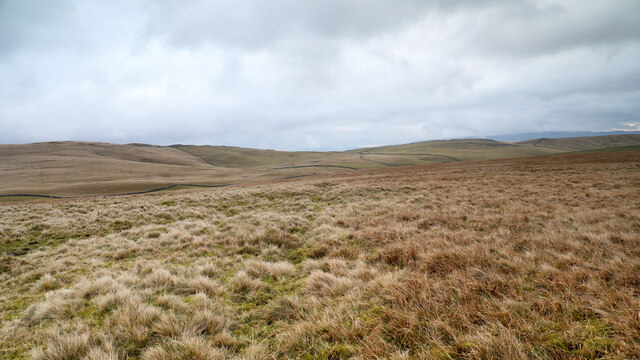
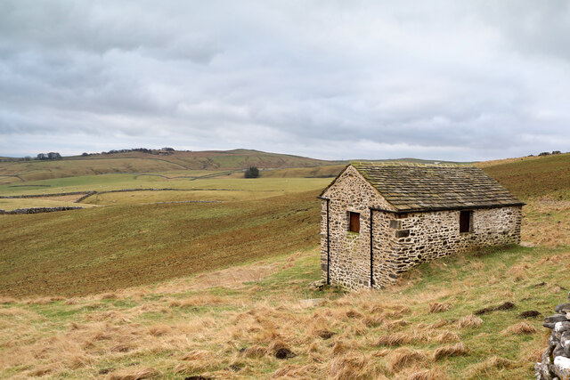
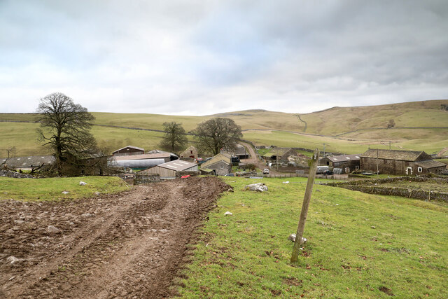
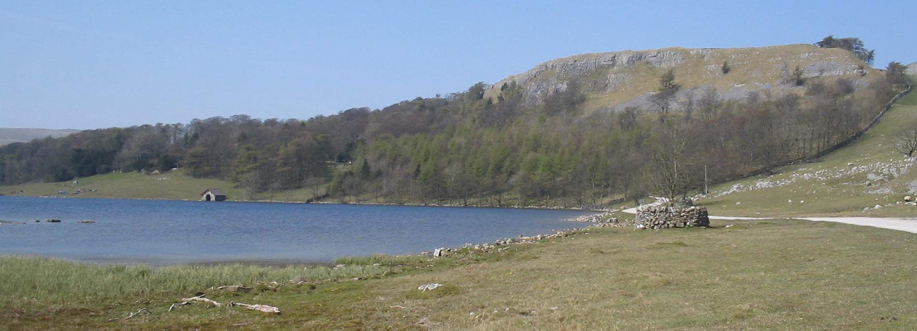
Lee Gate High Pasture is a picturesque area located in the heart of Yorkshire, encompassing both downs and moorland landscapes. Situated in the northern part of England, this region is renowned for its natural beauty and breathtaking vistas. The area is characterized by rolling hills, expansive meadows, and rugged terrain, creating a diverse and enchanting landscape for visitors to explore.

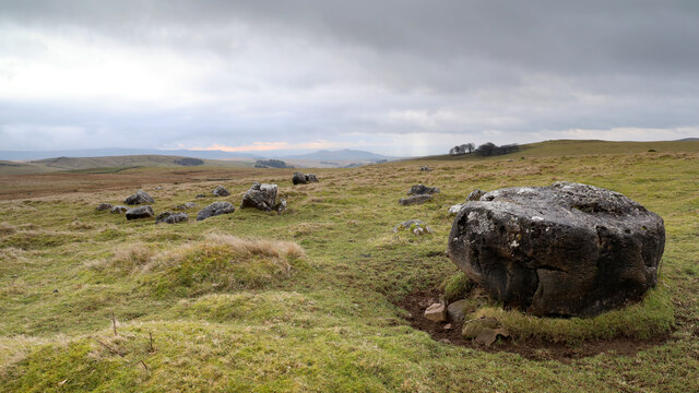
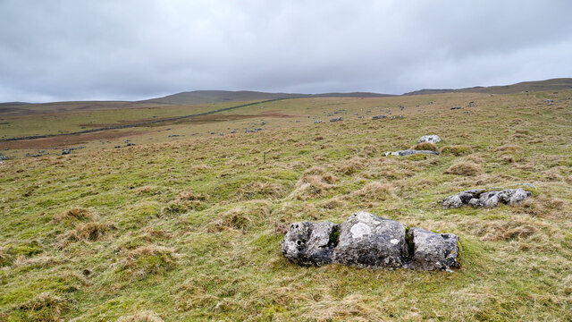
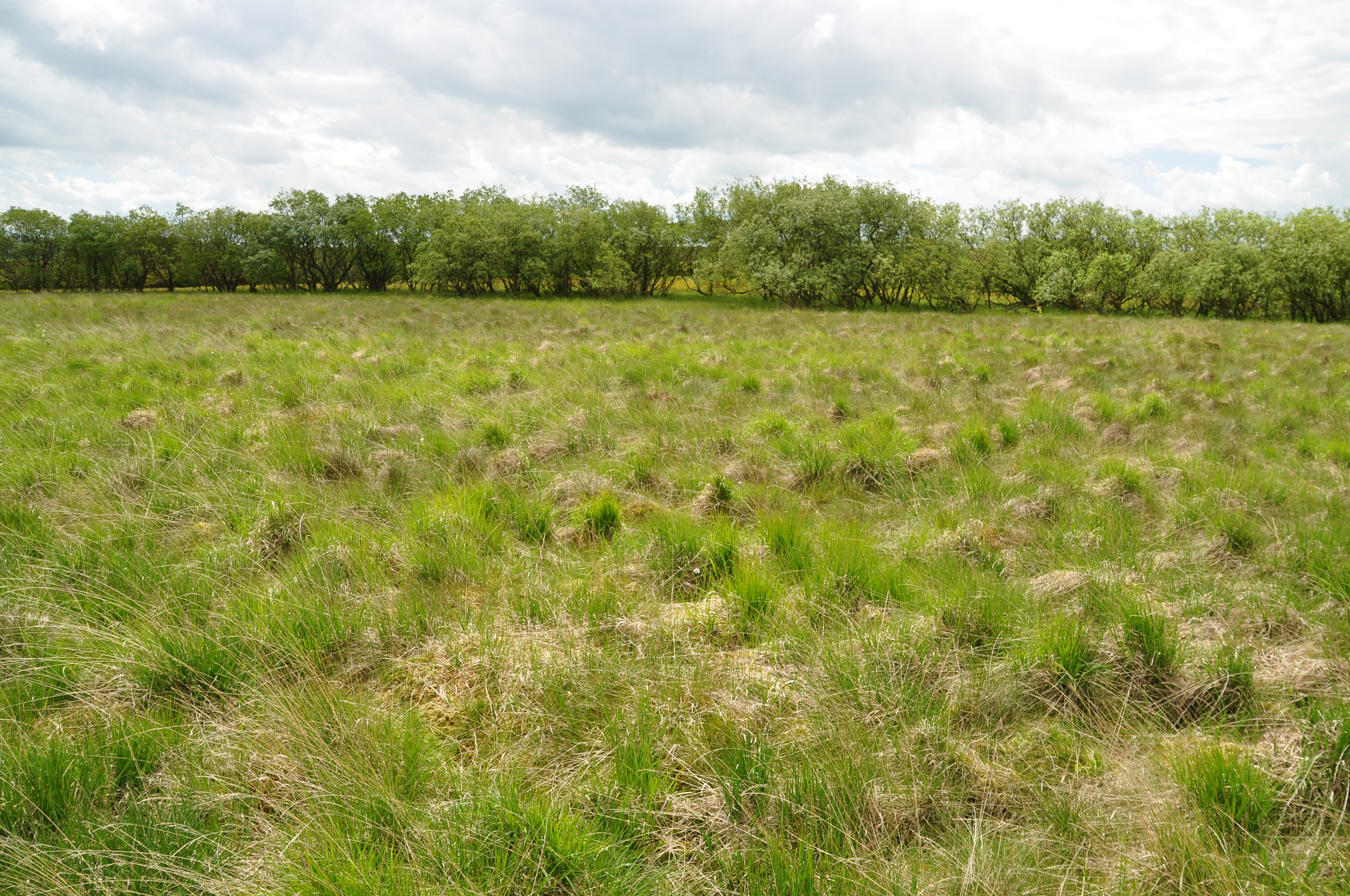
The downs of Lee Gate High Pasture offer wide-open spaces and panoramic views, with gentle slopes and lush greenery stretching as far as the eye can see. These downs are ideal for leisurely walks, picnics, and enjoying the tranquility of the surrounding countryside. The moorland, on the other hand, presents a more rugged and untamed environment, with heather-covered hills, rocky outcrops, and winding pathways. This part of Lee Gate High Pasture is perfect for hikers and nature enthusiasts, who can revel in the peacefulness of the moors while spotting native wildlife and bird species.

Lee Gate High Pasture is also home to an array of flora and fauna, including wildflowers, ferns, and various species of birds. The area's diverse habitats provide a sanctuary for unique and rare species, making it a haven for nature lovers and conservationists alike. Additionally, the rich history of the region is evident in the presence of ancient burial mounds and stone circles, adding an element of intrigue and mystique to the landscape.

Overall, Lee Gate High Pasture in Yorkshire offers visitors an idyllic retreat where they can immerse themselves in the beauty of nature, explore diverse landscapes, and discover the rich cultural heritage of the area.

If you have any feedback on the listing, please let us know in the comments section below.

Lee Gate High Pasture Images

Images are sourced within 2km of 54.090942/-2.1128245 or Grid Reference SD9266. Thanks to Geograph Open Source API. All images are credited.

High Long Ridge This gently sloping broad pasture is neither high, nor long, and hardly qualifies as a ridge, but drops gently towards the dry valley above Bordley Beck which, after the odd identity change, drains into the River Aire just east of Gargrave. The hill to the right of the photo on Malham Moor has the faint remains of a settlement and field system long predating the modern walls and farms. Being on limestone, the grassland is greener as the soil is noticeably more fertile than in the immediate foreground which provides only a scant living for sheep.
High Long Ridge
This gently sloping broad pasture is neither high, nor long, and hardly qualifies as a ridge, but drops gently towards the dry valley above Bordley Beck which, after the odd identity change, drains into the River Aire just east of Gargrave. The hill to the right of the photo on Malham Moor has the faint remains of a settlement and field system long predating the modern walls and farms. Being on limestone, the grassland is greener as the soil is noticeably more fertile than in the immediate foreground which provides only a scant living for sheep.
Limestone boulders on Tommy Low Pasture Although there is no bedrock in evidence, the short green grass is indicative that limestone lies close to the surface here, and there are lots of limestone bouders dotted about. The nearest has clearly been used by sheep as shelter from the wind, leading to a "moat" of eroded aoil around it and showing that the soil also contains rocks other than limestone in its matrix. In the middle distance, the group of trees are Kealcup plantation on the NE side of Kealcup Hill.
Limestone boulders on Tommy Low Pasture
Although there is no bedrock in evidence, the short green grass is indicative that limestone lies close to the surface here, and there are lots of limestone bouders dotted about. The nearest has clearly been used by sheep as shelter from the wind, leading to a "moat" of eroded aoil around it and showing that the soil also contains rocks other than limestone in its matrix. In the middle distance, the group of trees are Kealcup plantation on the NE side of Kealcup Hill.
Limestone boulders on Tommy High Pasture Although the bedrock is concealed by a layer of drift, there are plenty of boulders lying about to indicate that a lot of the local geology is limestone. The one in the immediate foreground has smoothed surfaces and characteristic grooves eroded by humic acids whilst partially buried in the soil. Now exposed, lichen finds it a congenial home. In the distance are Clapham High Mark and Parson's Pulpit, where the underlying limestone is much closer to the surface and forms numerous small outcrops.
Limestone boulders on Tommy High Pasture
Although the bedrock is concealed by a layer of drift, there are plenty of boulders lying about to indicate that a lot of the local geology is limestone. The one in the immediate foreground has smoothed surfaces and characteristic grooves eroded by humic acids whilst partially buried in the soil. Now exposed, lichen finds it a congenial home. In the distance are Clapham High Mark and Parson's Pulpit, where the underlying limestone is much closer to the surface and forms numerous small outcrops.
Mastiles Lane heading west Having endured a brief spell as a mere bridleway behind the photographer, Mastiles Lane here resumes its status as a byway open to all traffic as it heads for a Roman camp and on towards the public road system near Malham Tarn.
Mastiles Lane heading west
Having endured a brief spell as a mere bridleway behind the photographer, Mastiles Lane here resumes its status as a byway open to all traffic as it heads for a Roman camp and on towards the public road system near Malham Tarn.
Kealcup Laithe The building has been very well looked after with all mod cons - guttering is not common on such buildings well away from its farm. It looks out across rough grazing below the public bridleway from Smearbottoms Lane to Bordley on the southern slopes of Kealcup Hill. The lone tree in the centre of the view is above  Heber Beck within New House Farm National Nature Reserve.
Kealcup Laithe
The building has been very well looked after with all mod cons - guttering is not common on such buildings well away from its farm. It looks out across rough grazing below the public bridleway from Smearbottoms Lane to Bordley on the southern slopes of Kealcup Hill. The lone tree in the centre of the view is above Heber Beck within New House Farm National Nature Reserve.
Bordley Farms The hamlet of Bordley consists mainly of two farms, Bordley Green farm (on the left) and Bordley House Farm (on the right). From the perspective of a walker passing by, the farms seem to exist to house two sets of dogs who each compete to drown out the other during one's approach and passage between the buildings. Chickens and a cockerel have no hesitation in joining the fray, so I'm sure none of the human occupants would have heard my own dog's attempts to compete. The muddy approach is by a public bridleway, which can be seen continuing between walls beyond the farms. These are by no means the only rights of way which converge here, there being another bridleway and four separate public footpaths, walkers thereupon no doubt offering many opportunities for canine choir practice.
Bordley Farms
The hamlet of Bordley consists mainly of two farms, Bordley Green farm (on the left) and Bordley House Farm (on the right). From the perspective of a walker passing by, the farms seem to exist to house two sets of dogs who each compete to drown out the other during one's approach and passage between the buildings. Chickens and a cockerel have no hesitation in joining the fray, so I'm sure none of the human occupants would have heard my own dog's attempts to compete. The muddy approach is by a public bridleway, which can be seen continuing between walls beyond the farms. These are by no means the only rights of way which converge here, there being another bridleway and four separate public footpaths, walkers thereupon no doubt offering many opportunities for canine choir practice.
Track leading E to Bordley House Farm, Bordley
Old Wayside Cross beside Mastiles Lane Mastiles Lane Cross 3, the base of a wayside cross. Set within boundaries of Roman marching camp on the north side Mastiles Lane, east of Street Gate in Malham parish. Scheduled Monument <span class="nowrap"><a title="https://historicengland.org.uk/listing/the-list/list-entry/1008777" rel="nofollow ugc noopener" href="https://historicengland.org.uk/listing/the-list/list-entry/1008777">Link</a><img style="margin-left:2px;" alt="External link" title="External link - shift click to open in new window" src="https://s1.geograph.org.uk/img/external.png" width="10" height="10"/></span>. 

Milestone Society National ID: YNCR_MAL03
Old Wayside Cross beside Mastiles Lane
Mastiles Lane Cross 3, the base of a wayside cross. Set within boundaries of Roman marching camp on the north side Mastiles Lane, east of Street Gate in Malham parish. Scheduled Monument LinkExternal link. Milestone Society National ID: YNCR_MAL03
Mastiles Lane Gate on Mastiles Lane, a restricted byway.
Mastiles Lane
Gate on Mastiles Lane, a restricted byway.
Gordale Beck View looking down Gordale Beck.
Gordale Beck
View looking down Gordale Beck.
Kilnsey Moor
Kilnsey Moor
Mastiles Lane A restricted byway across Kilnsey Moor.
Mastiles Lane
A restricted byway across Kilnsey Moor.
Gordale Beck View looking up Gordale Beck.
Gordale Beck
View looking up Gordale Beck.
Cow Gill View looking down Cow Gill.
Cow Gill
View looking down Cow Gill.
High Stony Bank High Stony Bank seen from Mastiles Lane.
High Stony Bank
High Stony Bank seen from Mastiles Lane.
High Long Ridge View from Mastiles Lane looking across High Long Ridge.
High Long Ridge
View from Mastiles Lane looking across High Long Ridge.
Gordale Scar at Low Stony Bank
Empty pasture near Mastiles
Show me another place!

Lee Gate High Pasture is located at Grid Ref: SD9266 (Lat: 54.090942, Lng: -2.1128245)

Division: West Riding

Administrative County: North Yorkshire

District: Craven

Police Authority: North Yorkshire

What 3 Words

///weary.mondays.friends. Near Grassington, North Yorkshire

Related Wikis

Bordley

Bordley is a village in the civil parish of Hetton-cum-Bordley, in North Yorkshire, England, within the Yorkshire Dales National Park and 12 miles (19...
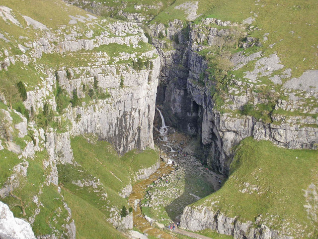
Gordale Scar

Gordale Scar is a limestone ravine 1 mile (1.6 km) north-east of Malham, North Yorkshire, England. It contains two waterfalls and has overhanging limestone...

Malham Tarn Estate

Malham Tarn Estate is a National Trust property in North Yorkshire, England. The estate is located in the Pennines and lies between Wharfedale and Ribblesdale...

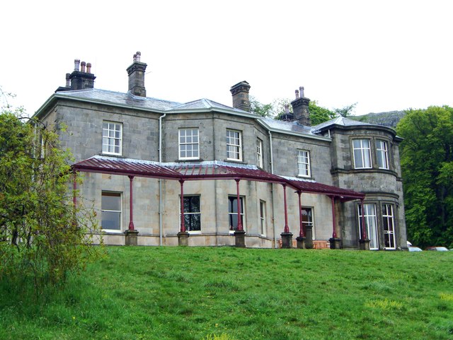
Malham Tarn Field Studies Centre

FSC Malham Tarn, situated near Malham Tarn in the Yorkshire Dales National Park, North Yorkshire, England, occupies a large Georgian country house, leased...

Malham Tarn

Malham Tarn is a glacial lake near the village of Malham in the Yorkshire Dales, England. The lake is one of only eight upland alkaline lakes in Europe...

Malham Cove

Malham Cove is a large curved limestone formation 0.6 miles (1 km) north of the village of Malham, North Yorkshire, England. It was formed by a waterfall...

Friar Garth Farmhouse

Friar Garth Farmhouse is a Grade II listed building in Malham, North Yorkshire, England. It was listed as an historic site by English Heritage on 13 September...

Malham

Malham is a village and civil parish in the Craven district of North Yorkshire, England. Before 20th century boundary changes, the village was part of...

Nearby Amenities

Located within 500m of 54.090942,-2.1128245
Mastiles
Natural: moor
Source: NPE
Lat/Long: 54.0909068/-2.1093443
The data included in this document is from www.openstreetmap.org. The data is made available under ODbL.

Have you been to Lee Gate High Pasture?

Leave your review of Lee Gate High Pasture below (or comments, questions and feedback).