Thringarth Pasture

Downs, Moorland in Yorkshire

England

Thringarth Pasture

Former Chapel Looks like under conversion to a dwelling
Former Chapel Credit: Anthony Parkes

Thringarth Pasture is a picturesque area located in Yorkshire, England. Situated amidst the stunning Yorkshire Downs and Moorland, this expansive pasture offers a captivating landscape that attracts visitors from far and wide.

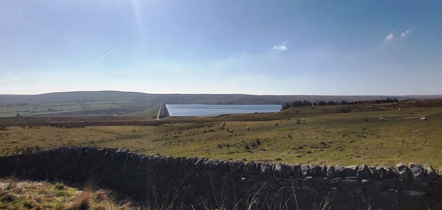
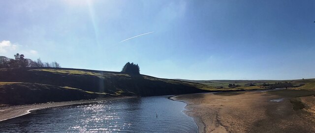
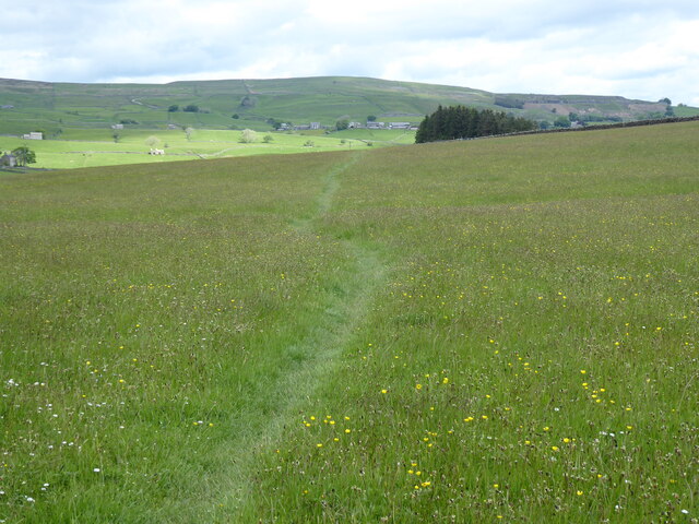
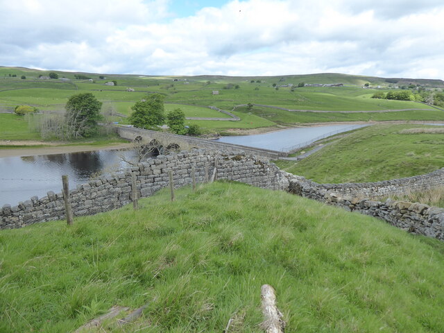
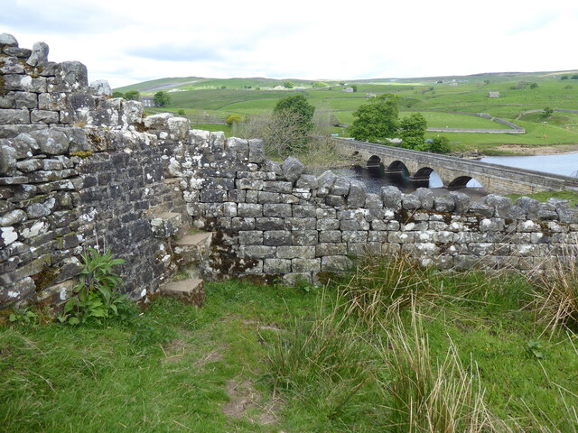
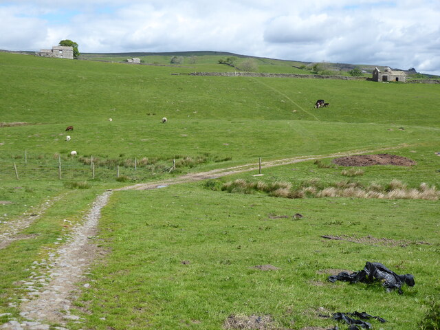
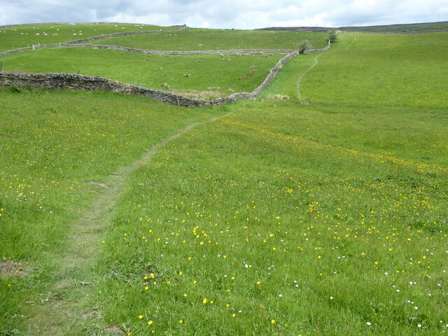
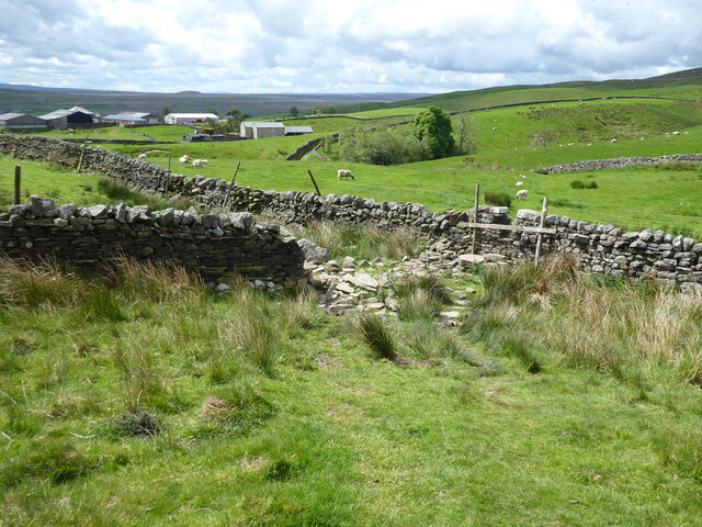
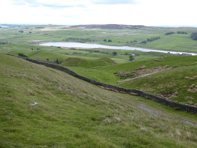
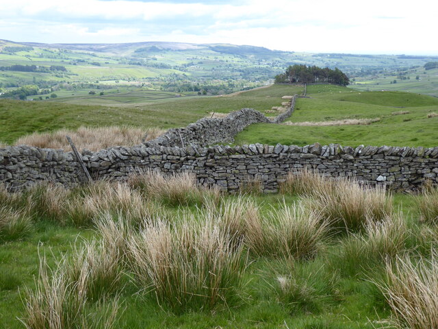
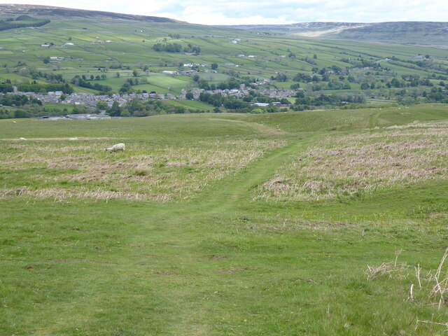
Covering a vast area of rolling hills and meadows, Thringarth Pasture is renowned for its natural beauty and tranquility. The undulating terrain is adorned with a patchwork of vibrant green fields, dotted with grazing sheep and cattle. The peaceful atmosphere and breathtaking views make it an ideal destination for nature enthusiasts and hikers.

The flora and fauna in Thringarth Pasture are diverse and abundant. The lush grasses and wildflowers that blanket the landscape provide a haven for a variety of wildlife species, including birds, butterflies, and small mammals. It is not uncommon to spot kestrels hovering above or hear the delightful songs of skylarks echoing through the air.

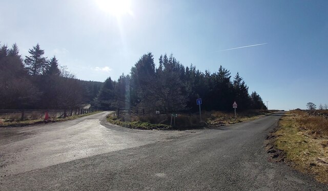
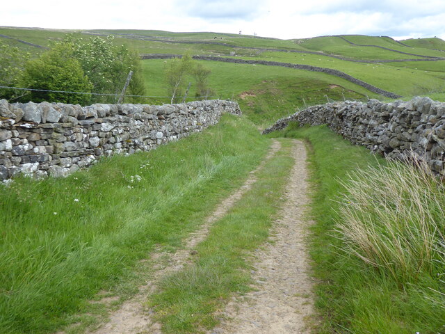
For those seeking outdoor activities, Thringarth Pasture offers a multitude of opportunities. The network of well-maintained footpaths and trails allows visitors to explore the area at their own pace. From leisurely walks to more challenging hikes, there is something for everyone. The breathtaking panoramic views from the higher vantage points are particularly rewarding.

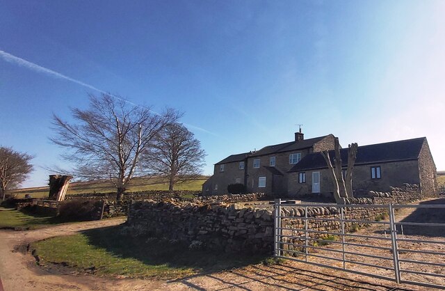
Thringarth Pasture is also steeped in history and culture. The remnants of ancient stone walls and boundary markers serve as a reminder of the area's rich heritage. Exploring these historical features can provide a glimpse into the past and a deeper understanding of the land's significance.

Overall, Thringarth Pasture is a captivating destination that combines natural beauty, tranquility, and a touch of history. Whether it is for a leisurely stroll, a challenging hike, or simply to immerse oneself in the serenity of the countryside, this Yorkshire gem offers an unforgettable experience for all who visit.

If you have any feedback on the listing, please let us know in the comments section below.

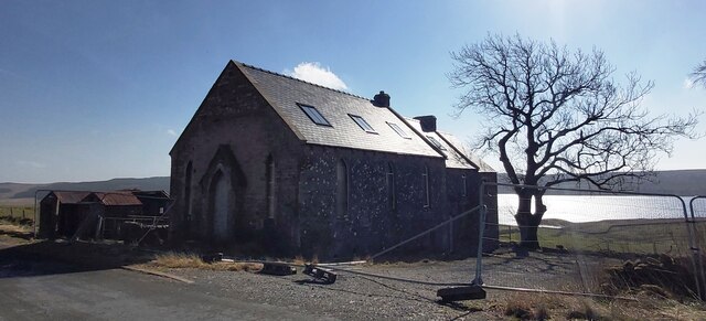
Thringarth Pasture Images

Images are sourced within 2km of 54.599447/-2.1181761 or Grid Reference NY9222. Thanks to Geograph Open Source API. All images are credited.

Former Chapel Looks like under conversion to a dwelling
Former Chapel
Looks like under conversion to a dwelling
Dry Stone Wall at Selset Reservoir from Lane Head Cottages
Grassholme Reservoir
Fork in the road near Grassholme
West Pasture Farm
West Pasture Farm
The Pennine Way near Beck Head
The Pennine Way near Grassholme Reservoir
The Pennine Way near Grassholme Farm
The Pennine Way near Collin Hill
The Pennine Way near Hawkser Spring
View from the Pennine Way near Pin Gate
The Pennine Way near Crossthwaite Common
View towards Kirkcarrion from the Pennine Way
The Pennine Way near Crossthwaite Common
Wall rising towards Kirkcarrion The wall is rising to the south-west, towards Kirkcarrion, a location west of the confluence of the Rivers Lune and Tees where there's a circular walled enclosure with a number of trees within.
Harter Fell is to the right side of the image.
Wall rising towards Kirkcarrion
The wall is rising to the south-west, towards Kirkcarrion, a location west of the confluence of the Rivers Lune and Tees where there's a circular walled enclosure with a number of trees within. Harter Fell is to the right side of the image.
Barn on slope below Kirkcarrion Kirkcarrion is a prominent group of coniferous trees enclosed in ring of dry stone walling which is built into the ridge wall along the watershed between Teesdale and Lunedale. The barn, seen through the trees of Kirkcarrion, stands on the slope to the south-west
Barn on slope below Kirkcarrion
Kirkcarrion is a prominent group of coniferous trees enclosed in ring of dry stone walling which is built into the ridge wall along the watershed between Teesdale and Lunedale. The barn, seen through the trees of Kirkcarrion, stands on the slope to the south-west
Show me another place!

Thringarth Pasture is located at Grid Ref: NY9222 (Lat: 54.599447, Lng: -2.1181761)

Division: North Riding

Unitary Authority: County Durham

Police Authority: Durham

What 3 Words

///decays.mixing.breezes. Near Mickleton, Co. Durham

Related Wikis

Thringarth

Thringarth is a hamlet in Lunedale, in the Pennines of England. It is traditionally located in the North Riding of Yorkshire but along with the rest of...

Rigg Farm and Stake Hill Meadows

Rigg Farm and Stake Hill Meadows is a Site of Special Scientific Interest in the Teesdale district of County Durham, England. It is situated in Lunedale...

Grassholme

Grassholme is a village in County Durham, England.For centuries it lay within the historic county boundaries of the North Riding of Yorkshire, but, along...

Harter Fell, Lunedale

Harter Fell is an area of upland heath in west County Durham, England. It lies on the watershed between the River Tees to the north-east and the River...

Related Videos

Air the Feather Victoria Brailsford - Breathtaking Views - Travel with Cubs

The cast iron feather is sited on a stone plinth, in keeping with the stone-walled fields in the Teesdale landscape. Inspired by a ...

High Force - Teesdale

A walk and talk at High Force. A lovely day out despite the rain. A lovely walk but you do need to be able to navigate slippery ...

Duke of Edinburgh Gold: EXPEDITION

Back in May, we had our DofE Gold training expedition I look a lot less tired and in pain in this video than I actually was.

Nearby Amenities

Located within 500m of 54.599447,-2.1181761
Wythes Hill
Natural: peak
Lat/Long: 54.599634/-2.1197272
Ford: yes
Lat/Long: 54.6021574/-2.118639
Source: NLS-OS-NatGrid-110k-1940-60
Waterway: waterfall
Lat/Long: 54.6017449/-2.1186554
Barrier: stile
Stile: stepover
Lat/Long: 54.6025514/-2.1206735
Access: yes
Barrier: cattle_grid
Lat/Long: 54.5988324/-2.1123681
Barrier: stile
Lat/Long: 54.5972466/-2.1189962
Post Box
Ref: DL12 174
Lat/Long: 54.6005243/-2.1124363
Collin Hill
Natural: peak
Source: NLS-OS-NatGrid-110k-1940-60
Lat/Long: 54.5992673/-2.1241821
Natural: shake_hole
Source: NLS-OS-NatGrid-110k-1940-60
Lat/Long: 54.5954647/-2.1205987
Natural: shake_hole
Source: NLS-OS-NatGrid-110k-1940-60
Lat/Long: 54.5952782/-2.1210922
Barrier: entrance
Lat/Long: 54.6031626/-2.1152299
Power: pole
Lat/Long: 54.5971347/-2.1245804
Power: pole
Lat/Long: 54.5974572/-2.1230167
Power: pole
Switch: mechanical
Lat/Long: 54.597712/-2.1217829
Power: pole
Lat/Long: 54.5979443/-2.1206631
Power: pole
Lat/Long: 54.5982752/-2.1190457
Power: pole
Lat/Long: 54.5985114/-2.1176697
Power: pole
Lat/Long: 54.5987934/-2.1160604
Power: pole
Lat/Long: 54.5990071/-2.1148065
Power: pole
Lat/Long: 54.5992471/-2.1134265
Power: pole
Lat/Long: 54.5995494/-2.1120197
Power: pole
Lat/Long: 54.5998081/-2.1108623
Bicycle Parking
Image: https://www.geograph.org.uk/photo/2510379
Lat/Long: 54.600141/-2.1135277
Generator Method: wind_turbine
Generator Source: wind
Image: https://www.geograph.org.uk/photo/2510379
Power: generator
Lat/Long: 54.6002311/-2.1133494
Parking
Lat/Long: 54.6001654/-2.1133567
Hiking: yes
Image: https://www.geograph.org.uk/photo/4858930
Information: guidepost
Tourism: information
Lat/Long: 54.5972451/-2.1190175
Barrier: entrance
Lat/Long: 54.6026596/-2.1222877
Ford: stepping_stones
Image: https://www.geograph.org.uk/photo/6814012
Lat/Long: 54.60147/-2.1214233
North Wythes Hill
Place: isolated_dwelling
Source Name: OS_OpenData_StreetView
Lat/Long: 54.6005609/-2.1218339
Power: pole
Lat/Long: 54.5987639/-2.1181646
Power: pole
Lat/Long: 54.5994056/-2.1194896
Power: pole
Transformer: distribution
Lat/Long: 54.5997513/-2.1201883
The data included in this document is from www.openstreetmap.org. The data is made available under ODbL.

Have you been to Thringarth Pasture?

Leave your review of Thringarth Pasture below (or comments, questions and feedback).