Bainbridge Low Pasture

Downs, Moorland in Yorkshire Richmondshire

England

Bainbridge Low Pasture

Countersett, Holly House barn The barn is on the east side of the road. The benchmark is cut into a left hand cornerstone and remains as crisp as the day it was cut.
Countersett, Holly House barn Credit: Mel Towler

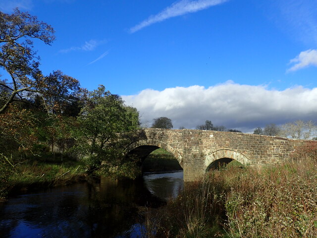
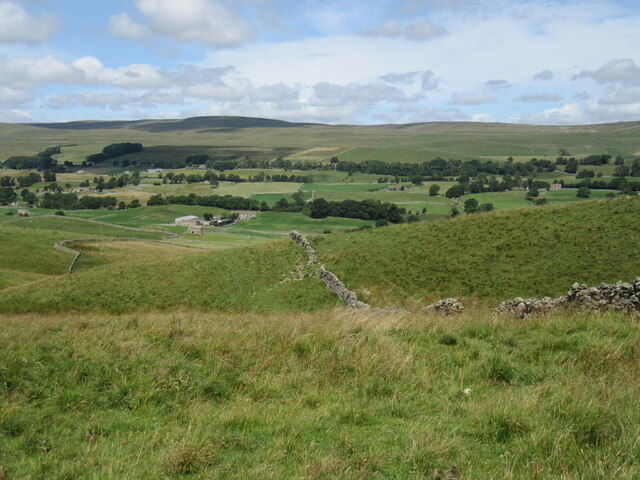
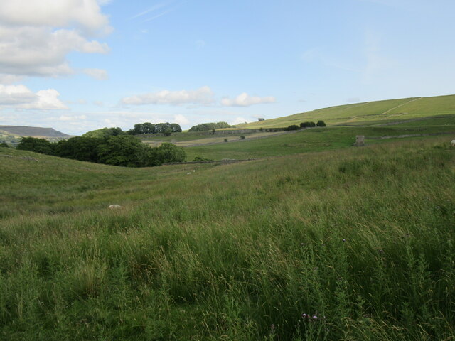
Bainbridge Low Pasture is a picturesque area located in the county of Yorkshire, England. Situated amidst the beautiful Yorkshire Downs and Moorland, it offers breathtaking views of the surrounding landscape.

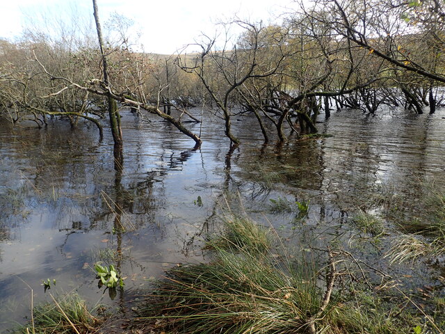
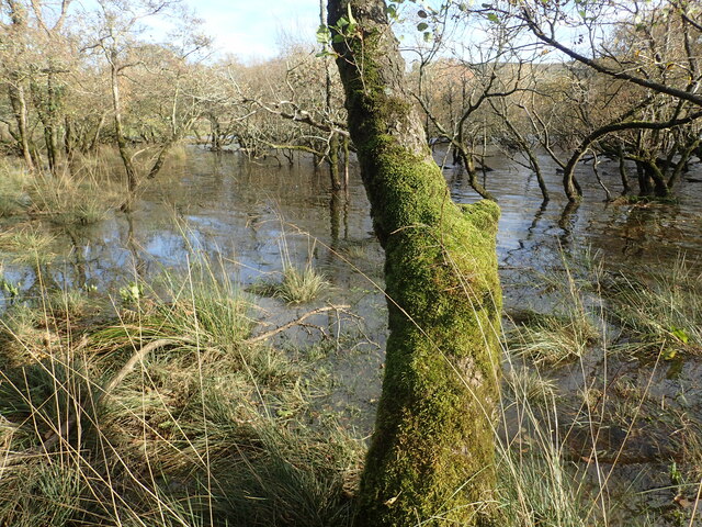
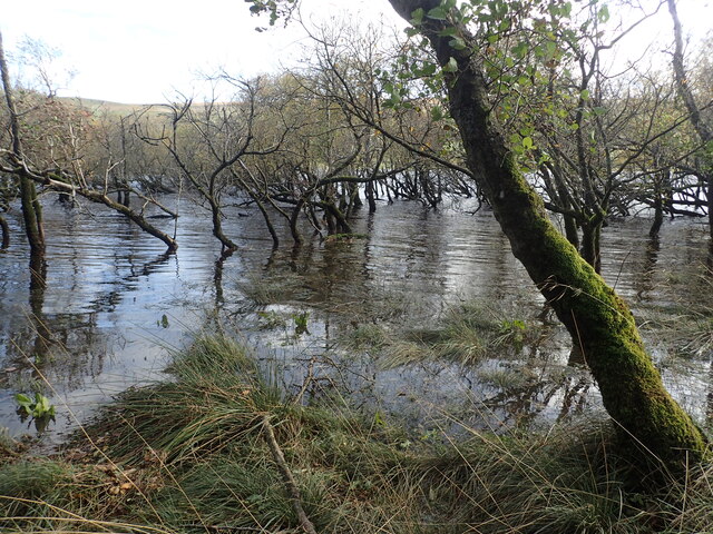
Covering an extensive area, Bainbridge Low Pasture is characterized by its rolling hills, lush green meadows, and scattered patches of woodland. These features make it an ideal location for various outdoor activities such as hiking, birdwatching, and picnicking. The diverse terrain also attracts wildlife enthusiasts, as the area is home to a wide range of flora and fauna.

The pastures in this region are predominantly used for livestock grazing, with sheep being the most common sight. The sheep graze peacefully, adding to the charm and tranquility of the area. The farmers who own these pastures have a long-standing tradition of maintaining the land and preserving its natural beauty.

Visitors to Bainbridge Low Pasture can enjoy leisurely walks along the well-maintained footpaths that crisscross the area. These paths offer stunning views of the rolling hills and expansive moorland, providing ample opportunities for photographers and nature lovers to capture the beauty of the landscape.

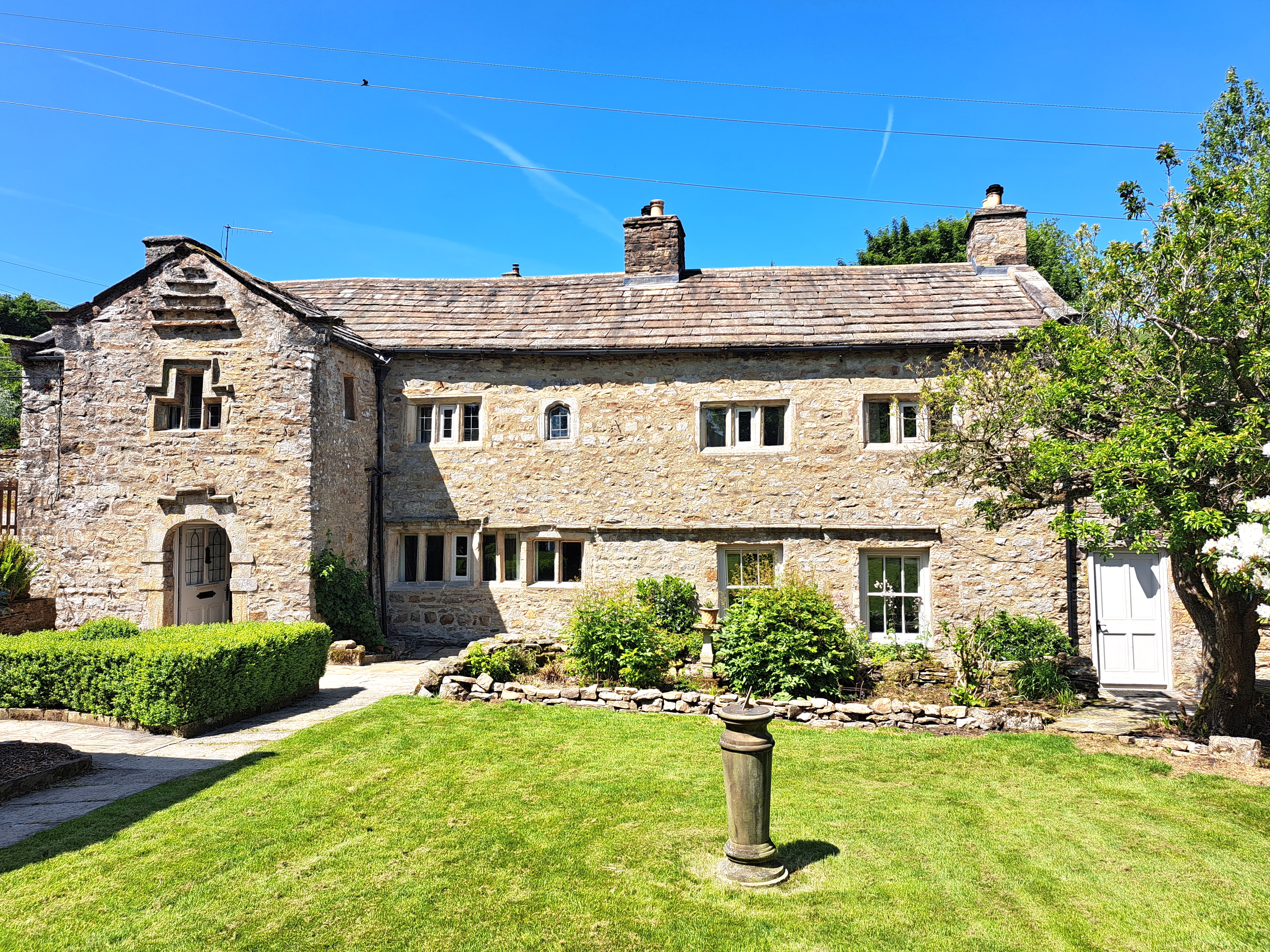
The nearby village of Bainbridge, which lends its name to the area, offers amenities such as pubs, cafes, and accommodation options for those looking to extend their stay. With its unspoiled natural beauty and peaceful ambiance, Bainbridge Low Pasture is a must-visit destination for those seeking a serene escape amidst the stunning Yorkshire countryside.

If you have any feedback on the listing, please let us know in the comments section below.

Bainbridge Low Pasture Images

Images are sourced within 2km of 54.29963/-2.137274 or Grid Reference SD9189. Thanks to Geograph Open Source API. All images are credited.

Countersett, Holly House barn The barn is on the east side of the road. The benchmark is cut into a left hand cornerstone and remains as crisp as the day it was cut.
Countersett, Holly House barn
The barn is on the east side of the road. The benchmark is cut into a left hand cornerstone and remains as crisp as the day it was cut.
Countersett, Holly House barn The barn is on the east side of the road. There is a benchmark cut into a left hand cornerstone and remains as crisp as the day it was cut.
Countersett, Holly House barn
The barn is on the east side of the road. There is a benchmark cut into a left hand cornerstone and remains as crisp as the day it was cut.
Crag Side Road Crag Side Road leads from Countersett up on to the moors above Wensleydale. The Roman Cam High Road is just a short distance ahead.
Crag Side Road
Crag Side Road leads from Countersett up on to the moors above Wensleydale. The Roman Cam High Road is just a short distance ahead.
Footpath from Crag Side Road Crag Side Road leads from Countersett up on to the moors above Wensleydale. The Roman Cam High Road is just a short distance to the left see also <a title="https://www.geograph.org.uk/photo/7327706" href="https://www.geograph.org.uk/photo/7327706">Link</a>
Footpath from Crag Side Road
Crag Side Road leads from Countersett up on to the moors above Wensleydale. The Roman Cam High Road is just a short distance to the left see also Link
Semer Water Bridge The River Bain flows from Semer Water under the bridge here. As a tributary of the River Ure, it is one of the shortest, named rivers in England.
Semer Water Bridge
The River Bain flows from Semer Water under the bridge here. As a tributary of the River Ure, it is one of the shortest, named rivers in England.
Part of Semer water There are only two lakes in the Yorkshire Dales, Malham Tarn and Semer Water. This is Semer Water in Wensleydale. It was clearly fuller than normal making this look like a mangrove swamp. Legend has it that there is a drowned village under the water.
Part of Semer water
There are only two lakes in the Yorkshire Dales, Malham Tarn and Semer Water. This is Semer Water in Wensleydale. It was clearly fuller than normal making this look like a mangrove swamp. Legend has it that there is a drowned village under the water.
Semer Water There are only two lakes in the Yorkshire Dales, Malham Tarn and Semer Water. This is Semer Water in Wensleydale. It was clearly fuller than normal making this look like a mangrove swamp. Legend has it that there is a drowned village under the water.
Semer Water
There are only two lakes in the Yorkshire Dales, Malham Tarn and Semer Water. This is Semer Water in Wensleydale. It was clearly fuller than normal making this look like a mangrove swamp. Legend has it that there is a drowned village under the water.
Above Greensley Bank Greensley Bank is the farm ahead.
Above Greensley Bank
Greensley Bank is the farm ahead.
Bainbridge High Pasture Looking NW from Cam High Road.
Bainbridge High Pasture
Looking NW from Cam High Road.
Cam High Road Looking uphill.
Cam High Road
Looking uphill.
Cam High Road 2 Looking down towards Bainbridge.
Cam High Road 2
Looking down towards Bainbridge.
Near Bainbridge Looking east from Cam High Road.
Near Bainbridge
Looking east from Cam High Road.
Crag Side Road Descending towards Countersett. Semerwater is hidden, but the view extends across Raydale to the fells beyond.
Crag Side Road
Descending towards Countersett. Semerwater is hidden, but the view extends across Raydale to the fells beyond.
Road at  Hawes End The road is from Countersett towards Burtersett and at this point appears to be heading straight towards the limestone capped bluff of Yorburgh, a twin of Addlebrough a few miles to the east.
Road at Hawes End
The road is from Countersett towards Burtersett and at this point appears to be heading straight towards the limestone capped bluff of Yorburgh, a twin of Addlebrough a few miles to the east.
Rural Wensleydale Wensleydale is generally wider and more lush than other valleys in the Yorkshire Dales. Here are flocks of sheep, but the accent here is more on cattle, particularly dairy herds which provide the raw material for the Hawes Creamery, home of authentic Wensleydale cheese.
Rural Wensleydale
Wensleydale is generally wider and more lush than other valleys in the Yorkshire Dales. Here are flocks of sheep, but the accent here is more on cattle, particularly dairy herds which provide the raw material for the Hawes Creamery, home of authentic Wensleydale cheese.
Semer Water Bridge This bridge over the River Bain was built in the late 17C or early 18C, and is listed, Grade II.
Semer Water Bridge
This bridge over the River Bain was built in the late 17C or early 18C, and is listed, Grade II.
Near Countersett Looking towards Semer Water.
Near Countersett
Looking towards Semer Water.
Show me another place!

Bainbridge Low Pasture is located at Grid Ref: SD9189 (Lat: 54.29963, Lng: -2.137274)

Division: North Riding

Administrative County: North Yorkshire

District: Richmondshire

Police Authority: North Yorkshire

What 3 Words

///imagined.older.inversely. Near Leyburn, North Yorkshire

Related Wikis

Countersett Quaker Meeting House

Countersett Quaker Meeting House is a historic building in Countersett, a village in North Yorkshire, in England. Quakers met in Countersett Hall from...

Countersett Hall

Countersett Hall is a Grade II* listed historic building in Countersett, a hamlet in North Yorkshire, in England. The house dates back to the twelfth century...

Countersett

Countersett is the largest of the three settlements in Raydale, around Semerwater in the Richmondshire district of North Yorkshire, England. It is in the...

Wensleydale

Wensleydale is a valley in North Yorkshire, England. It is one of the Yorkshire Dales, which are part of the Pennines. The dale is named after the village...

Nearby Amenities

Located within 500m of 54.29963,-2.137274
Bainbridge Low Pasture
Is In Country Code: GB
Is In County: North Yorkshire
Is In Municipality: Richmondshire
Natural: fell
Source: NPE
Lat/Long: 54.3005319/-2.1326126
Borwins Pasture
Is In Country Code: GB
Is In County: North Yorkshire
Is In Municipality: Richmondshire
Natural: fell
Source: NPE
Lat/Long: 54.2983631/-2.1345797
Natural: spring
Lat/Long: 54.302828/-2.1352369
Natural: spring
Lat/Long: 54.3020647/-2.1335435
Natural: spring
Source: OS_OpenData_Streetview
Lat/Long: 54.2982267/-2.1314061
Natural: sinkhole
Source: OS_OpenData_Streetview
Lat/Long: 54.2978197/-2.1316207
Historic: lime_kiln
Mineral: lime
Source: OS 1856 sheet 66
Lat/Long: 54.3029625/-2.135409
Historic: lime_kiln
Mineral: lime
Source: OS 1856 sheet 66
Lat/Long: 54.2986707/-2.1377694
Power: pole
Lat/Long: 54.3014914/-2.1442866
Power: pole
Lat/Long: 54.3015853/-2.1428329
Power: pole
Lat/Long: 54.3016667/-2.1413684
Power: pole
Lat/Long: 54.3017794/-2.1399146
Power: pole
Lat/Long: 54.3018577/-2.138418
Power: pole
Lat/Long: 54.3023319/-2.1311277
Power: pole
Lat/Long: 54.3021433/-2.1340366
Power: pole
Lat/Long: 54.302047/-2.1355104
Power: pole
Lat/Long: 54.3019633/-2.136983
Power: pole
Lat/Long: 54.3022442/-2.1326754
Power: pole
Lat/Long: 54.302997/-2.1333486
The data included in this document is from www.openstreetmap.org. The data is made available under ODbL.

Have you been to Bainbridge Low Pasture?

Leave your review of Bainbridge Low Pasture below (or comments, questions and feedback).