Borwins Pasture

Downs, Moorland in Yorkshire Richmondshire

England

Borwins Pasture

Countersett, Holly House barn The barn is on the east side of the road. The benchmark is cut into a left hand cornerstone and remains as crisp as the day it was cut.
Countersett, Holly House barn Credit: Mel Towler

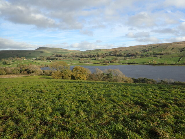
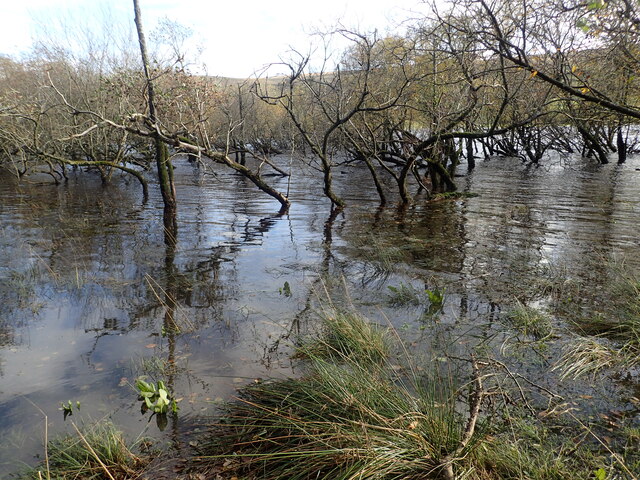
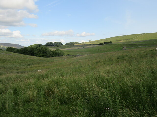
Borwins Pasture is a picturesque area located in the region of Yorkshire, England. Nestled amidst the stunning landscape of the Yorkshire Downs and Moorland, it offers visitors a truly unique and captivating experience.

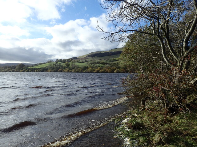
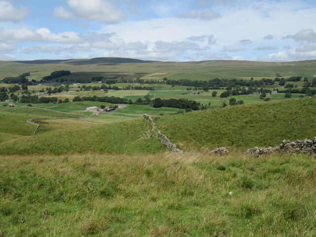
The pasture is characterized by its vast open spaces, rolling hills, and lush green meadows. It is a haven for nature enthusiasts and outdoor lovers, providing ample opportunities for walking, hiking, and exploring the surrounding countryside. The panoramic views from the pasture are simply breathtaking, with the undulating terrain stretching as far as the eye can see.

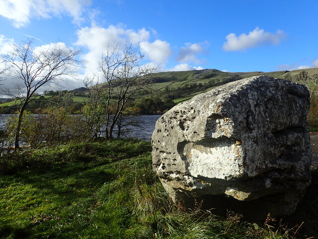
The area is rich in flora and fauna, with a diverse range of plant species, including wildflowers, heather, and grasses that carpet the landscape. This abundance of plant life attracts a variety of wildlife, such as rabbits, hares, and numerous bird species, making it a popular spot for birdwatching.

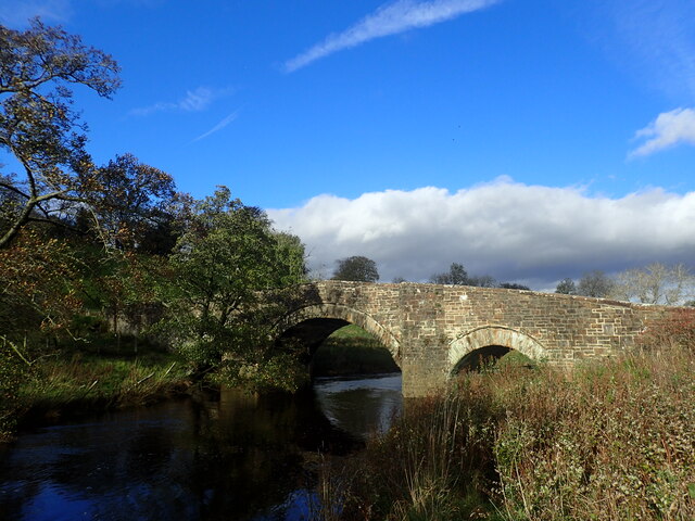
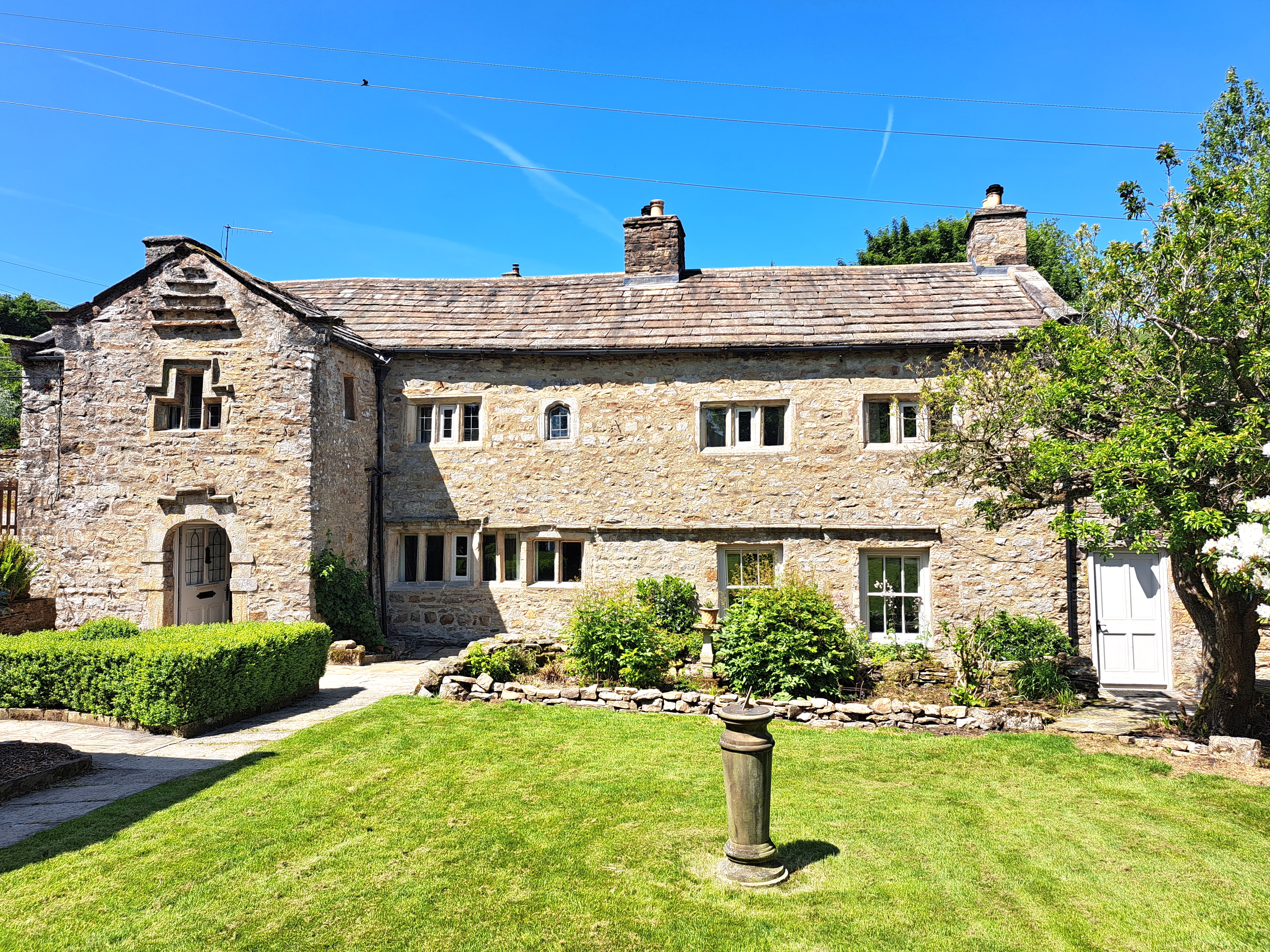
Borwins Pasture also boasts a rich historical and cultural heritage. Ruins of ancient settlements and burial mounds can be found scattered throughout the area, providing glimpses into the past. The pasture has been used for grazing livestock for centuries, and traditional farming practices can still be observed today.

For those seeking tranquility and a break from the hustle and bustle of city life, Borwins Pasture offers a serene and idyllic retreat. Whether it's exploring the untouched natural beauty, immersing oneself in history, or simply enjoying the tranquility of the countryside, this hidden gem of Yorkshire provides an unforgettable experience for all who visit.

If you have any feedback on the listing, please let us know in the comments section below.

Borwins Pasture Images

Images are sourced within 2km of 54.299249/-2.1323865 or Grid Reference SD9189. Thanks to Geograph Open Source API. All images are credited.

Countersett, Holly House barn The barn is on the east side of the road. The benchmark is cut into a left hand cornerstone and remains as crisp as the day it was cut.
Countersett, Holly House barn
The barn is on the east side of the road. The benchmark is cut into a left hand cornerstone and remains as crisp as the day it was cut.
Countersett, Holly House barn The barn is on the east side of the road. There is a benchmark cut into a left hand cornerstone and remains as crisp as the day it was cut.
Countersett, Holly House barn
The barn is on the east side of the road. There is a benchmark cut into a left hand cornerstone and remains as crisp as the day it was cut.
Crag Side Road Crag Side Road leads from Countersett up on to the moors above Wensleydale. The Roman Cam High Road is just a short distance ahead.
Crag Side Road
Crag Side Road leads from Countersett up on to the moors above Wensleydale. The Roman Cam High Road is just a short distance ahead.
View from a footpath above Semer Water There are only two lakes in the Yorkshire Dales, Malham Tarn and Semer Water. Semer Water was formed during the last Ice Age by a moraine which effectively dammed the valley. The lake today is a shadow of its former self but is still three miles in circumference and 45 feet deep. Legend has it that there is a drowned village under the water. The hill in the distance is Addlebrough.
View from a footpath above Semer Water
There are only two lakes in the Yorkshire Dales, Malham Tarn and Semer Water. Semer Water was formed during the last Ice Age by a moraine which effectively dammed the valley. The lake today is a shadow of its former self but is still three miles in circumference and 45 feet deep. Legend has it that there is a drowned village under the water. The hill in the distance is Addlebrough.
Semer Water There are only two lakes in the Yorkshire Dales, Malham Tarn and Semer Water. Semer Water was formed during the last Ice Age by a moraine which effectively dammed the valley. The lake today is a shadow of its former self but is still three miles in circumference and 45 feet deep. Legend has it that there is a drowned village under the water. The River Bain, which flows out of Semer Water, at two and half miles is the shortest river in England.
Semer Water
There are only two lakes in the Yorkshire Dales, Malham Tarn and Semer Water. Semer Water was formed during the last Ice Age by a moraine which effectively dammed the valley. The lake today is a shadow of its former self but is still three miles in circumference and 45 feet deep. Legend has it that there is a drowned village under the water. The River Bain, which flows out of Semer Water, at two and half miles is the shortest river in England.
Footpath from Crag Side Road Crag Side Road leads from Countersett up on to the moors above Wensleydale. The Roman Cam High Road is just a short distance to the left see also <a title="https://www.geograph.org.uk/photo/7327706" href="https://www.geograph.org.uk/photo/7327706">Link</a>
Footpath from Crag Side Road
Crag Side Road leads from Countersett up on to the moors above Wensleydale. The Roman Cam High Road is just a short distance to the left see also Link
Erratic at Semer Water Semer Water was formed during the last Ice Age by a moraine which effectively dammed the valley and leaving erratic boulders like this one behind. The lake today is a shadow of its former self but is still three miles in circumference and 45 feet deep.
Erratic at Semer Water
Semer Water was formed during the last Ice Age by a moraine which effectively dammed the valley and leaving erratic boulders like this one behind. The lake today is a shadow of its former self but is still three miles in circumference and 45 feet deep.
Semer Water Bridge The River Bain flows from Semer Water under the bridge here. As a tributary of the River Ure, it is one of the shortest, named rivers in England.
Semer Water Bridge
The River Bain flows from Semer Water under the bridge here. As a tributary of the River Ure, it is one of the shortest, named rivers in England.
Part of Semer water There are only two lakes in the Yorkshire Dales, Malham Tarn and Semer Water. This is Semer Water in Wensleydale. It was clearly fuller than normal making this look like a mangrove swamp. Legend has it that there is a drowned village under the water.
Part of Semer water
There are only two lakes in the Yorkshire Dales, Malham Tarn and Semer Water. This is Semer Water in Wensleydale. It was clearly fuller than normal making this look like a mangrove swamp. Legend has it that there is a drowned village under the water.
Semer Water There are only two lakes in the Yorkshire Dales, Malham Tarn and Semer Water. This is Semer Water in Wensleydale. It was clearly fuller than normal making this look like a mangrove swamp. Legend has it that there is a drowned village under the water.
Semer Water
There are only two lakes in the Yorkshire Dales, Malham Tarn and Semer Water. This is Semer Water in Wensleydale. It was clearly fuller than normal making this look like a mangrove swamp. Legend has it that there is a drowned village under the water.
Above Greensley Bank Greensley Bank is the farm ahead.
Above Greensley Bank
Greensley Bank is the farm ahead.
Bainbridge High Pasture Looking NW from Cam High Road.
Bainbridge High Pasture
Looking NW from Cam High Road.
Cam High Road Looking uphill.
Cam High Road
Looking uphill.
Cam High Road 2 Looking down towards Bainbridge.
Cam High Road 2
Looking down towards Bainbridge.
Near Bainbridge Looking east from Cam High Road.
Near Bainbridge
Looking east from Cam High Road.
Field barn above the River Bain The little River Bain is hidden in the fold of the hills, whilst the barn, although typical of Dales barns, is slightly unusual in that it sits in the middle of a field rather than at a junction of two or three.
Field barn above the River Bain
The little River Bain is hidden in the fold of the hills, whilst the barn, although typical of Dales barns, is slightly unusual in that it sits in the middle of a field rather than at a junction of two or three.
Crag Side Road Descending towards Countersett. Semerwater is hidden, but the view extends across Raydale to the fells beyond.
Crag Side Road
Descending towards Countersett. Semerwater is hidden, but the view extends across Raydale to the fells beyond.
Show me another place!

Borwins Pasture is located at Grid Ref: SD9189 (Lat: 54.299249, Lng: -2.1323865)

Division: North Riding

Administrative County: North Yorkshire

District: Richmondshire

Police Authority: North Yorkshire

What 3 Words

///firming.tolerates.whistle. Near Leyburn, North Yorkshire

Related Wikis

Countersett Quaker Meeting House

Countersett Quaker Meeting House is a historic building in Countersett, a village in North Yorkshire, in England. Quakers met in Countersett Hall from...

Countersett Hall

Countersett Hall is a Grade II* listed historic building in Countersett, a hamlet in North Yorkshire, in England. The house dates back to the twelfth century...

Countersett

Countersett is the largest of the three settlements in Raydale, around Semerwater in the Richmondshire district of North Yorkshire, England. It is in the...

Bainbridge, North Yorkshire

Bainbridge is a village and civil parish in North Yorkshire, England. The population of the civil parish at the 2011 census was 480. The village is situated...

Nearby Amenities

Located within 500m of 54.299249,-2.1323865
Bainbridge Low Pasture
Is In Country Code: GB
Is In County: North Yorkshire
Is In Municipality: Richmondshire
Natural: fell
Source: NPE
Lat/Long: 54.3005319/-2.1326126
Borwins Pasture
Is In Country Code: GB
Is In County: North Yorkshire
Is In Municipality: Richmondshire
Natural: fell
Source: NPE
Lat/Long: 54.2983631/-2.1345797
Natural: spring
Lat/Long: 54.302828/-2.1352369
Natural: spring
Lat/Long: 54.3020647/-2.1335435
Natural: spring
Source: OS_OpenData_Streetview
Lat/Long: 54.2982267/-2.1314061
Natural: sinkhole
Source: OS_OpenData_Streetview
Lat/Long: 54.2978197/-2.1316207
Historic: lime_kiln
Mineral: lime
Source: OS 1856 sheet 66
Lat/Long: 54.3029625/-2.135409
Archaeological Site: limekiln
Historic: archaeological_site
Mineral: lime
Source: OS 1856 sheet 66
Lat/Long: 54.2993721/-2.1294223
Historic: lime_kiln
Mineral: lime
Source: OS 1856 sheet 66
Lat/Long: 54.2986707/-2.1377694
Power: pole
Lat/Long: 54.3018577/-2.138418
Power: pole
Lat/Long: 54.3027388/-2.128247
Power: pole
Lat/Long: 54.3025275/-2.1296766
Power: pole
Lat/Long: 54.3023319/-2.1311277
Power: pole
Lat/Long: 54.3021433/-2.1340366
Power: pole
Lat/Long: 54.302047/-2.1355104
Power: pole
Lat/Long: 54.3019633/-2.136983
Power: pole
Lat/Long: 54.3022442/-2.1326754
Power: pole
Lat/Long: 54.302997/-2.1333486
The data included in this document is from www.openstreetmap.org. The data is made available under ODbL.

Have you been to Borwins Pasture?

Leave your review of Borwins Pasture below (or comments, questions and feedback).