Middle Ridge Down

Downs, Moorland in Wiltshire

England

Middle Ridge Down

Boreham Down, Wiltshire Looking southwest along Boreham Down. This area is within the Imber Range on the Salisbury Plain Training Area.
Boreham Down, Wiltshire Credit: Rebecca A Wills

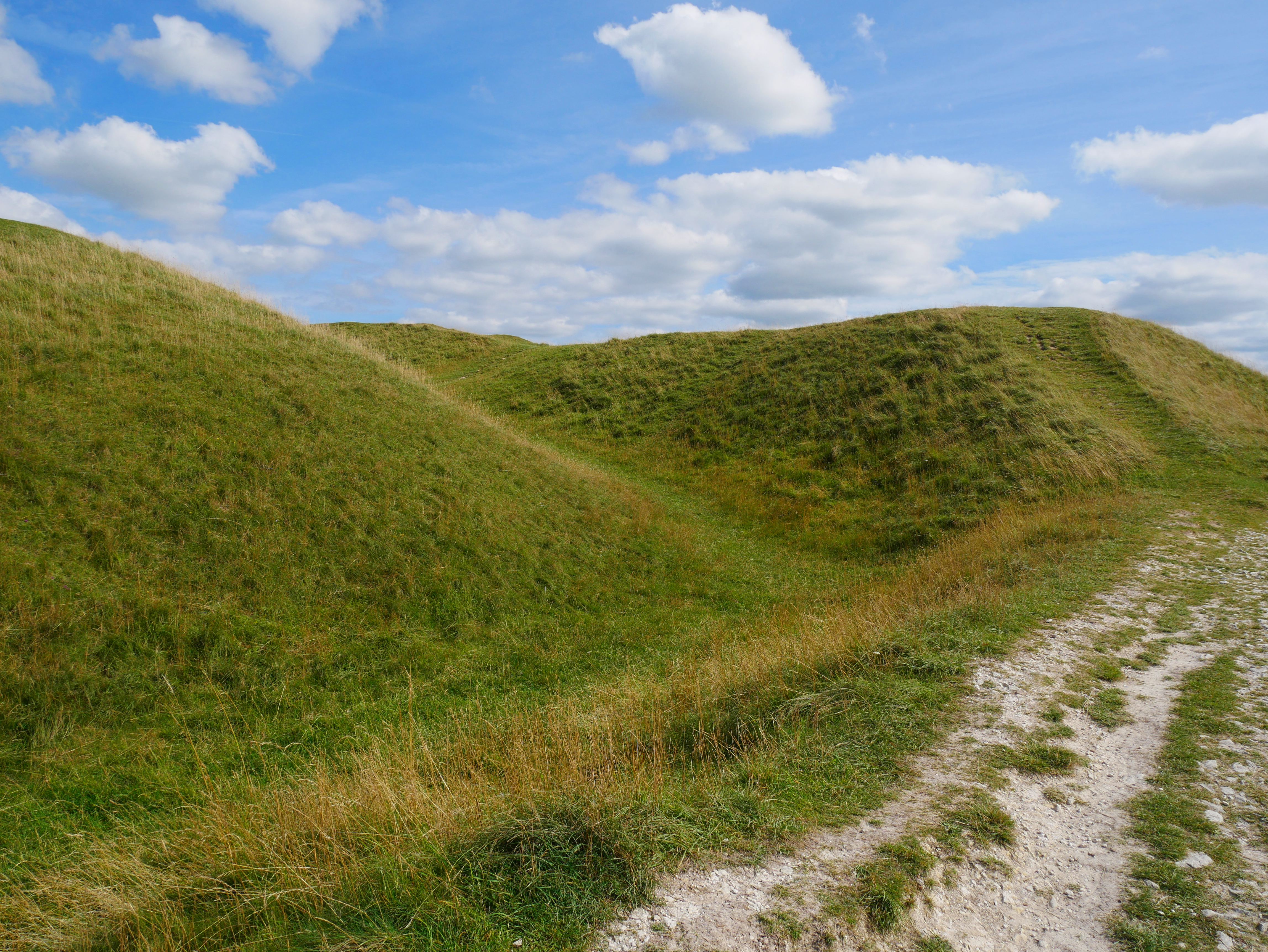
Middle Ridge Down is a picturesque area located in Wiltshire, England. Situated within the expansive Downs and Moorland region, it offers breathtaking natural beauty and a tranquil atmosphere. Covering a vast expanse of approximately 500 hectares, Middle Ridge Down is characterized by rolling hills, expansive grasslands, and heather-clad moorlands.

The area boasts a rich diversity of flora and fauna, making it a haven for nature enthusiasts and wildlife lovers. Visitors can expect to encounter a wide range of species, including rare and protected birds such as skylarks, stonechats, and meadow pipits. The vibrant colors of wildflowers, including orchids and cowslips, add to the area's allure during the warmer months.

Middle Ridge Down is a popular destination for outdoor activities and offers numerous walking trails and pathways that provide stunning panoramic views of the surrounding countryside. Hiking, birdwatching, and photography are among the favored pastimes for visitors. The area is known for its peace and tranquility, providing an ideal escape from the hustle and bustle of city life.

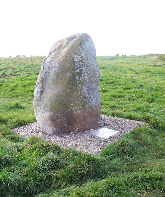
Historically, Middle Ridge Down has been used for grazing livestock, and evidence of ancient farming practices can still be found today. The area is also home to several archaeological sites, including Bronze Age burial mounds and Iron Age hillforts, which add a layer of cultural significance to the landscape.

Overall, Middle Ridge Down in Wiltshire is a captivating destination for nature enthusiasts, offering a unique blend of natural beauty, wildlife, and historical significance.

If you have any feedback on the listing, please let us know in the comments section below.

Middle Ridge Down Images

Images are sourced within 2km of 51.241016/-2.1284895 or Grid Reference ST9149. Thanks to Geograph Open Source API. All images are credited.

Boreham Down, Wiltshire Looking southwest along Boreham Down. This area is within the Imber Range on the Salisbury Plain Training Area.
Boreham Down, Wiltshire
Looking southwest along Boreham Down. This area is within the Imber Range on the Salisbury Plain Training Area.
Road across Imber Range
Derelict tank on Imber Range Just to the north of the <a href="https://www.geograph.org.uk/photo/7681154">ST9248 : Road across Imber Range</a>.
Derelict tank on Imber Range
Just to the north of the ST9248 : Road across Imber Range.
Fire power demonstration area, Imber Range
Line of posts, Imber Range Not exactly a fence, but clearly demarcating a line across the landscape.
Line of posts, Imber Range
Not exactly a fence, but clearly demarcating a line across the landscape.
Road across Imber Range Looking towards Warminster.
Road across Imber Range
Looking towards Warminster.
Track across the landscape, Imber Range
2011 : MOD road heading to Sack Hill and Warminster This is Imber Road, about three miles west of Imber.
Roads on the MOD Range were open for the Easter weekend.
2011 : MOD road heading to Sack Hill and Warminster
This is Imber Road, about three miles west of Imber. Roads on the MOD Range were open for the Easter weekend.
2011 : East on Imber Road, MOD range A private car heads toward Imber, taking advantage of the open roads over Easter.
The two roads seen to the right over the brow of the hill point to Imber which is hidden in the valley.
2011 : East on Imber Road, MOD range
A private car heads toward Imber, taking advantage of the open roads over Easter. The two roads seen to the right over the brow of the hill point to Imber which is hidden in the valley.
2011 : MOD Imber Range All of what you see here is in the MOD range. From here it is six miles to the A360 through Tilshead, then it continues for another six miles almost to Upavon.
2011 : MOD Imber Range
All of what you see here is in the MOD range. From here it is six miles to the A360 through Tilshead, then it continues for another six miles almost to Upavon.
2011 : Heading east to Imber One of the few roads open to the public this Easter weekend.
2011 : Heading east to Imber
One of the few roads open to the public this Easter weekend.
2011 : Blooming gorse on Summer Down On the MOD range near Imber.
2011 : Blooming gorse on Summer Down
On the MOD range near Imber.
2011 : Imber Road crossing Summer Down on MOD land Imber village is hidden in the valley two and a half miles straight ahead.
The gorse is in bloom.
2011 : Imber Road crossing Summer Down on MOD land
Imber village is hidden in the valley two and a half miles straight ahead. The gorse is in bloom.
2011 : Looking south from the road to Imber The MOD range on an open day. Most of these roads are not open to the public.
2011 : Looking south from the road to Imber
The MOD range on an open day. Most of these roads are not open to the public.
2011 : Tank on Imber Range, a little older The fun our gang could have had with this!
Derelict but not disused.
2011 : Tank on Imber Range, a little older
The fun our gang could have had with this! Derelict but not disused.
2011 : North east from Imber Road On the MOD range.
With gorse, of course.
2011 : North east from Imber Road
On the MOD range. With gorse, of course.
Ready Steady Go! Buses pause at Tinkers Track on the 1748 journey from Brazen Bottom to Warminster having had a busy day transporting passengers across the Plain.
Ready Steady Go!
Buses pause at Tinkers Track on the 1748 journey from Brazen Bottom to Warminster having had a busy day transporting passengers across the Plain.
Chieftain tank near Imber The biter bit - or perhaps the hitter hit... A redundant tank sees out its days as a target for more modern tanks on Salisbury Plain. This one, which may have been here for 20-30 years, seems reasonably well preserved, though others are clearly mouldering.
Chieftain tank near Imber
The biter bit - or perhaps the hitter hit... A redundant tank sees out its days as a target for more modern tanks on Salisbury Plain. This one, which may have been here for 20-30 years, seems reasonably well preserved, though others are clearly mouldering.
Show me another place!

Middle Ridge Down is located at Grid Ref: ST9149 (Lat: 51.241016, Lng: -2.1284895)

Unitary Authority: Wiltshire

Police Authority: Wiltshire

What 3 Words

///nibbles.overhear.shudders. Near Bratton, Wiltshire

Related Wikis

Bratton Castle

Bratton Castle (also known as Bratton Camp) is a bivallate (two ramparts) Iron Age built hill fort on Bratton Down, at the western edge of the Salisbury...

Battle of Edington

At the Battle of Edington, an army of the kingdom of Wessex under Alfred the Great defeated the Great Heathen Army led by the Dane Guthrum on a date between...

Westbury White Horse

Westbury White Horse or Bratton White Horse is a hill figure on the escarpment of Salisbury Plain, approximately 1.5 mi (2.4 km) east of Westbury in Wiltshire...

Bratton, Wiltshire

Bratton is a village and civil parish in the English county of Wiltshire, about 2.5 miles (4 km) east of Westbury. The village lies under the northern...

Nearby Amenities

Located within 500m of 51.241016,-2.1284895
Archaeological Site: tumulus
Historic: archaeological_site
Lat/Long: 51.2405985/-2.1214606
Knapp Down
Place: locality
Lat/Long: 51.2421073/-2.1321174
Middle Ridge Down
Place: locality
Lat/Long: 51.2437572/-2.1245811
Summer Down
Place: locality
Lat/Long: 51.2394989/-2.1224139
The data included in this document is from www.openstreetmap.org. The data is made available under ODbL.

Have you been to Middle Ridge Down?

Leave your review of Middle Ridge Down below (or comments, questions and feedback).