Flaight Moss

Downs, Moorland in Yorkshire Richmondshire

England

Flaight Moss

Barn between the trees Close to Raydale Lodge.
Barn between the trees Credit: James Allan

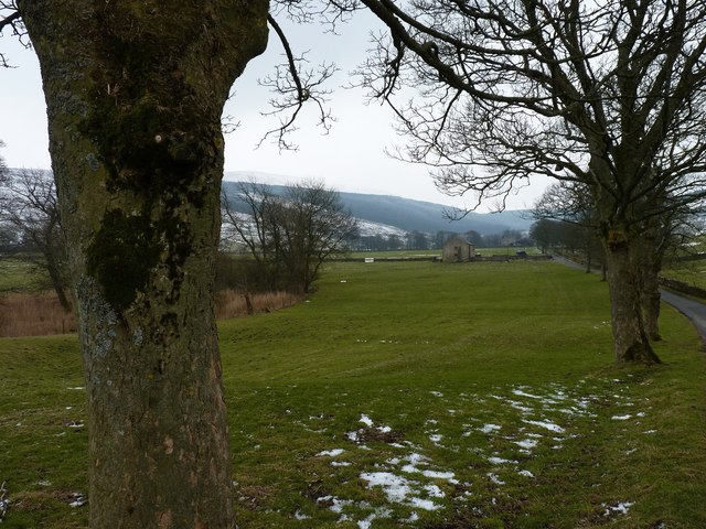
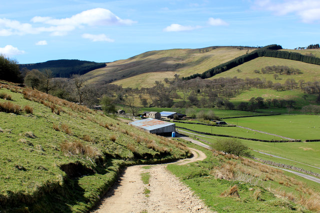
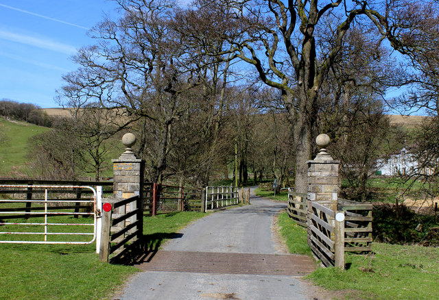
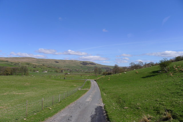
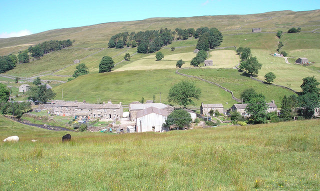
Flaight Moss is a picturesque area located in the county of Yorkshire, England. Situated within the Yorkshire Downs and Moorland region, it is renowned for its stunning natural beauty and diverse wildlife.

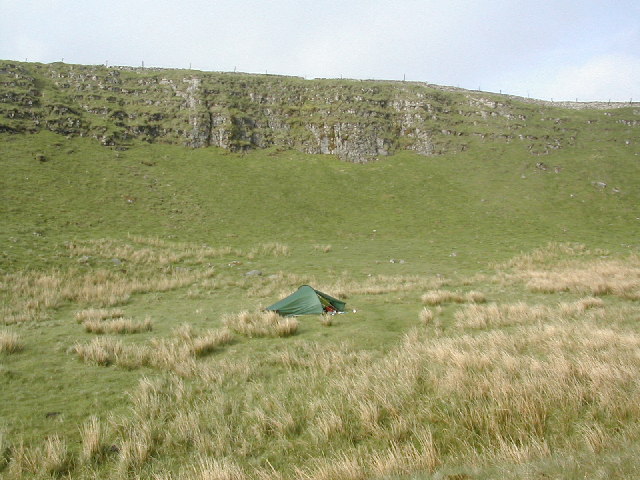
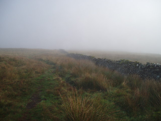
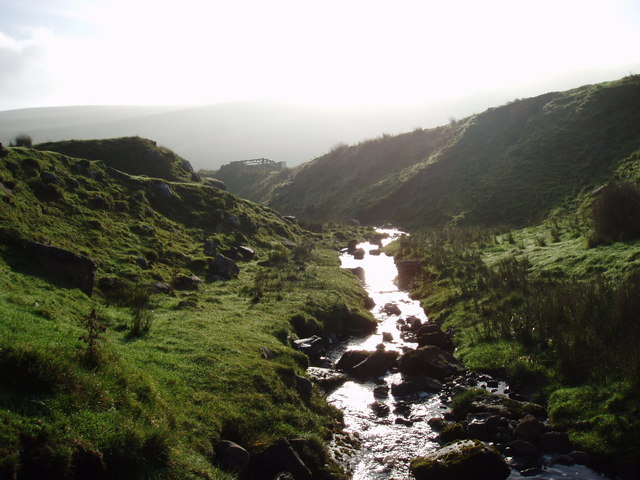
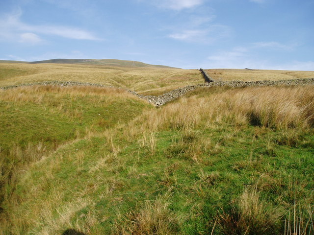
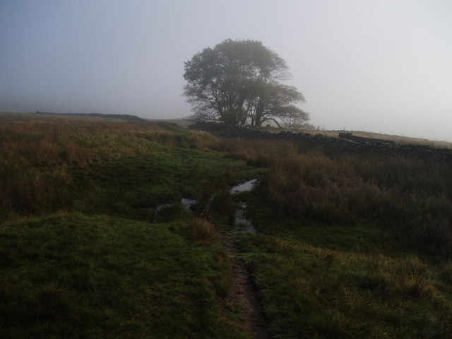
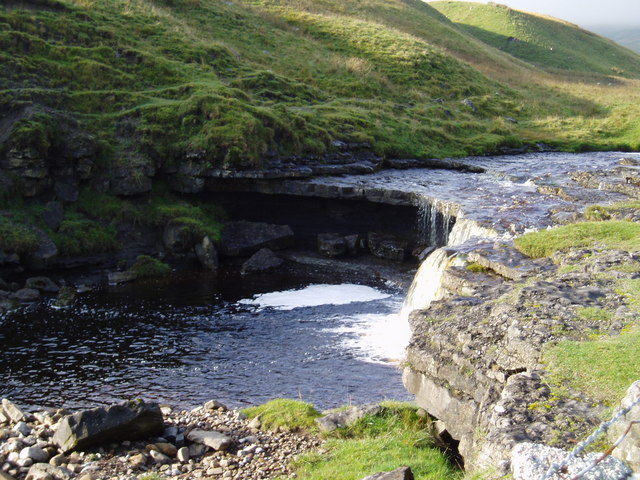
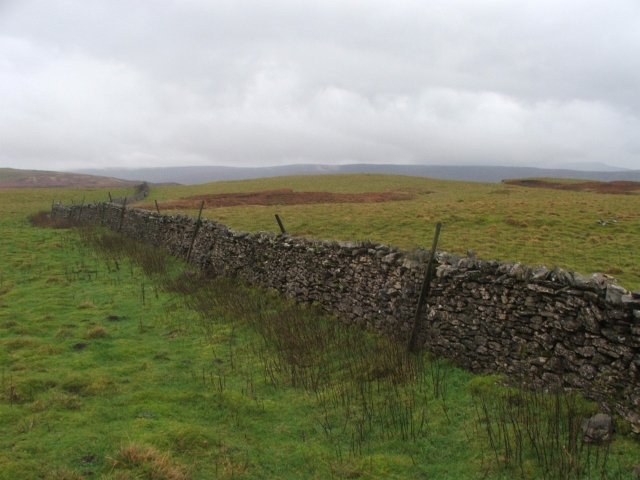
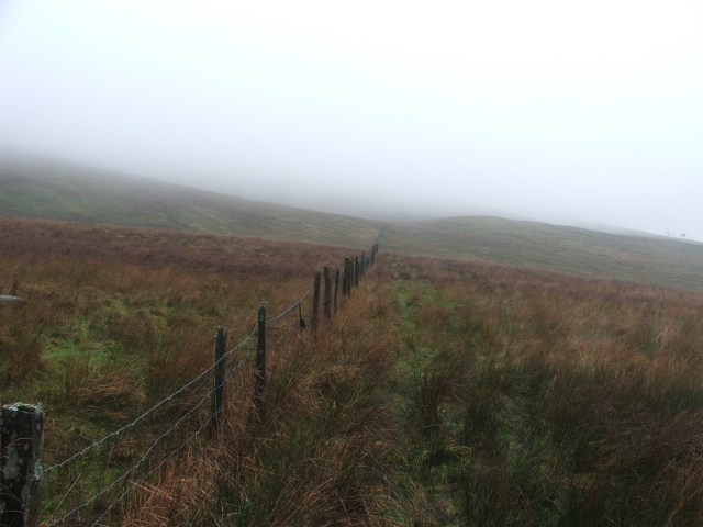
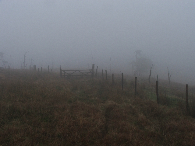
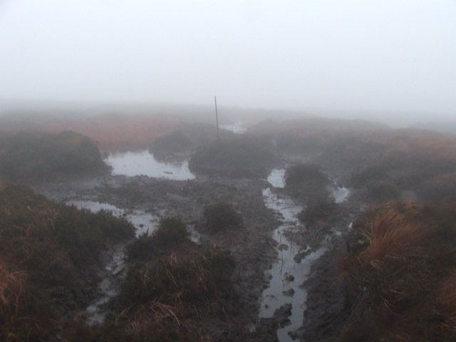
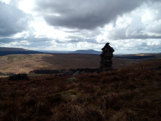
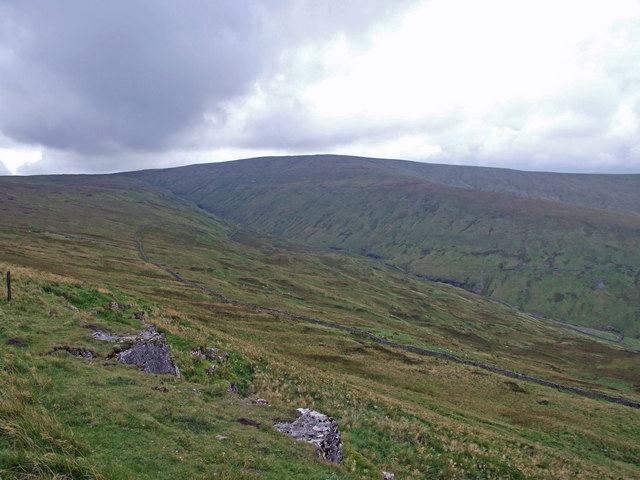
Covering an expansive area of heathland and peat bog, Flaight Moss is characterized by its unique landscape. The region is dominated by wide, open spaces, rolling hills, and vast stretches of greenery. The moss itself is a wetland habitat, with marshy areas and pools of water scattered throughout.

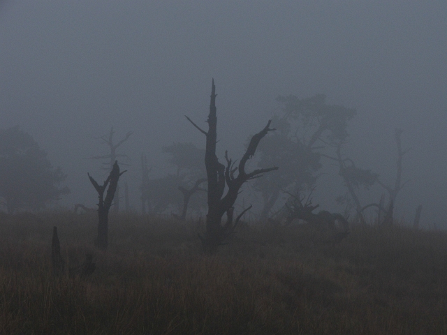
Flaight Moss is home to a rich variety of flora and fauna. The mossland is carpeted with heather, cotton grass, and sphagnum moss, creating a vibrant and colorful tapestry. Rare plant species, such as the sundew and bog rosemary, can also be found in this area.

The wildlife in Flaight Moss is equally diverse. Visitors may catch a glimpse of various bird species, including curlews, lapwings, and red grouse. The region is also known for its populations of reptiles, such as adders and common lizards, as well as mammals like hares and rabbits.

The area is a popular destination for nature enthusiasts and hikers, who can explore the numerous walking trails that meander through the mossland. The tranquil and serene atmosphere of Flaight Moss provides an ideal setting for outdoor activities, birdwatching, and photography.

In summary, Flaight Moss in Yorkshire is a stunning natural habitat, boasting a breathtaking landscape, diverse flora and fauna, and a peaceful environment. It offers visitors an opportunity to immerse themselves in the beauty of the Yorkshire Downs and Moorland region.

If you have any feedback on the listing, please let us know in the comments section below.

Flaight Moss Images

Images are sourced within 2km of 54.255993/-2.1807829 or Grid Reference SD8884. Thanks to Geograph Open Source API. All images are credited.

Barn between the trees Close to Raydale Lodge.
Barn between the trees
Close to Raydale Lodge.
Raydale House Now a country house with holiday accommodation, Raydale House is not only reputed to be haunted by "Auld 'opper" but was also the scene of the Raydale Riot, when in 1617 Sir Thomas Metcalfe of Nappa Hall besieged the house with 60 armed men in a dispute with his tenant, William Robinson of Worton.
Raydale House
Now a country house with holiday accommodation, Raydale House is not only reputed to be haunted by "Auld 'opper" but was also the scene of the Raydale Riot, when in 1617 Sir Thomas Metcalfe of Nappa Hall besieged the house with 60 armed men in a dispute with his tenant, William Robinson of Worton.
Descending into Raydale Shooting track dropping down towards Raydale House
Descending into Raydale
Shooting track dropping down towards Raydale House
Cattle Grid above Raydale Beck The elaborate gateposts announce the entrance to Raydale House - although the map marks the road as part of the Queen's Highway.
Cattle Grid above Raydale Beck
The elaborate gateposts announce the entrance to Raydale House - although the map marks the road as part of the Queen's Highway.
Raydale From close to Raydale House, at the head of the dale
Raydale
From close to Raydale House, at the head of the dale
Jefferey Pot Scar Looking up at Jeffery Pot Scar from a remote camp.
Jefferey Pot Scar
Looking up at Jeffery Pot Scar from a remote camp.
Moorland scene A bleak autumnal scene in Bardale that runs down from the Oughtershaw - Gayle road towards Semerwater.
Moorland scene
A bleak autumnal scene in Bardale that runs down from the Oughtershaw - Gayle road towards Semerwater.
Blind Beck One of the many becks that run down the northern slopes of Bardale to join Bardale Beck, then to join Raydale Beck before flowing into Semerwater as Crook Beck.
Blind Beck
One of the many becks that run down the northern slopes of Bardale to join Bardale Beck, then to join Raydale Beck before flowing into Semerwater as Crook Beck.
A moorland beck in Bardale Cow Stand Gill running down from the northern slopes of Bardale to join Bardale Beck.
A moorland beck in Bardale
Cow Stand Gill running down from the northern slopes of Bardale to join Bardale Beck.
Bardale A typical view of lower Bardale with rough grassland and dry stone walls. The hill in the distance is the intriguingly named Drumaldrace, the highest point on Wether fell.
Bardale
A typical view of lower Bardale with rough grassland and dry stone walls. The hill in the distance is the intriguingly named Drumaldrace, the highest point on Wether fell.
Bleak Moorland Scene This lone tree stands by a gate on the track down Bardale
Bleak Moorland Scene
This lone tree stands by a gate on the track down Bardale
Waterfall on Bardale Beck As the beck approaches the lower end of its course it drops down over a number of natural stone steps and through a very narrow gorge like a mini version of the Strid near Bolton Abbey.
Waterfall on Bardale Beck
As the beck approaches the lower end of its course it drops down over a number of natural stone steps and through a very narrow gorge like a mini version of the Strid near Bolton Abbey.
Drystone Wall on Wolside. Just S of Jeffery Pot Scar.
Drystone Wall on Wolside.
Just S of Jeffery Pot Scar.
Forest Track in Raydale. Looking ESE from Long Lock Gill.
Forest Track in Raydale.
Looking ESE from Long Lock Gill.
Fence across the Hillside. This fence runs from the forestry near Oughtershaw Gill to what's left of Wolside Plantation.
Fence across the Hillside.
This fence runs from the forestry near Oughtershaw Gill to what's left of Wolside Plantation.
Wolside plantation. Or what's left of it.  Still marked on the map, but long since harvested.
Wolside plantation.
Or what's left of it. Still marked on the map, but long since harvested.
Dead Trees in the Mist. The remnants of Wolside Plantation.
Dead Trees in the Mist.
The remnants of Wolside Plantation.
Crossing Fleet Moss. There is line of old fenceposts that crosses Fleet Moss, some of them still vertical, very handy on a day like this.  The last mile or so of my walk looked like this.
Crossing Fleet Moss.
There is line of old fenceposts that crosses Fleet Moss, some of them still vertical, very handy on a day like this. The last mile or so of my walk looked like this.
Show me another place!

Flaight Moss is located at Grid Ref: SD8884 (Lat: 54.255993, Lng: -2.1807829)

Division: North Riding

Administrative County: North Yorkshire

District: Richmondshire

Police Authority: North Yorkshire

What 3 Words

///trinkets.porridge.dives. Near Settle, North Yorkshire

Related Wikis

Fleet Moss

Fleet Moss is a upland area separating Wharfedale from Wensleydale in North Yorkshire, England. The area is 1,850 ft (560 m) above sea level (although...

Yorkshire Dales National Park

The Yorkshire Dales National Park is a 2,178 km2 (841 sq mi) national park in England covering most of the Yorkshire Dales, with the notable exception...

Wether Fell

Wether Fell (archaically Wetherfell), also known as Drumaldrace (the name of its summit), is a mountain in the Yorkshire Dales National Park, in North...

Marsett

Marsett is one of three settlements in around Semer Water in Raydale, a small side dale off Wensleydale in North Yorkshire, England. Marsett is only a...

Oughtershaw

Oughtershaw is a hamlet in the Yorkshire Dales, North Yorkshire, England. It lies on a road it shares with other small villages; Deepdale, Yockenthwaite...

St Matthew's Church, Stalling Busk

St Matthew's Church, Stalling Busk is a Grade II listed parish church in the Church of England in Stalling Busk, North Yorkshire. == History == The church...

Stalling Busk

Stalling Busk is one of three settlements around Semer Water in the Richmondshire district of North Yorkshire in the small dale of Raydale just off...

Dodd Fell Hill

Dodd Fell Hill is a hill in the Yorkshire Dales, in North Yorkshire, England. It is classed as a Marilyn (a hill with topographic prominence of at least...

Nearby Amenities

Located within 500m of 54.255993,-2.1807829
Cock Lake Side
Is In Country Code: GB
Is In County: North Yorkshire
Is In Municipality: Richmondshire
Natural: fell
Source: NPE
Lat/Long: 54.2589403/-2.1771587
New Close
Is In Country Code: GB
Is In County: North Yorkshire
Is In Municipality: Richmondshire
Natural: fell
Source: NPE
Lat/Long: 54.2549292/-2.1763004
The data included in this document is from www.openstreetmap.org. The data is made available under ODbL.

Have you been to Flaight Moss?

Leave your review of Flaight Moss below (or comments, questions and feedback).