Smithmoor Common

Downs, Moorland in Worcestershire Malvern Hills

England

Smithmoor Common

Earl's Croome church Earl's Croome church is dedicated to St Nicholas.  The church is Grade II* listed, see: <span class="nowrap"><a title="https://historicengland.org.uk/listing/the-list/list-entry/1302545?section=comments-and-photos" rel="nofollow ugc noopener" href="https://historicengland.org.uk/listing/the-list/list-entry/1302545?section=comments-and-photos">Link</a><img style="margin-left:2px;" alt="External link" title="External link - shift click to open in new window" src="https://s1.geograph.org.uk/img/external.png" width="10" height="10"/></span>
Earl's Croome church Credit: Philip Halling

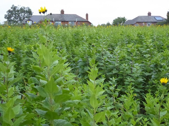
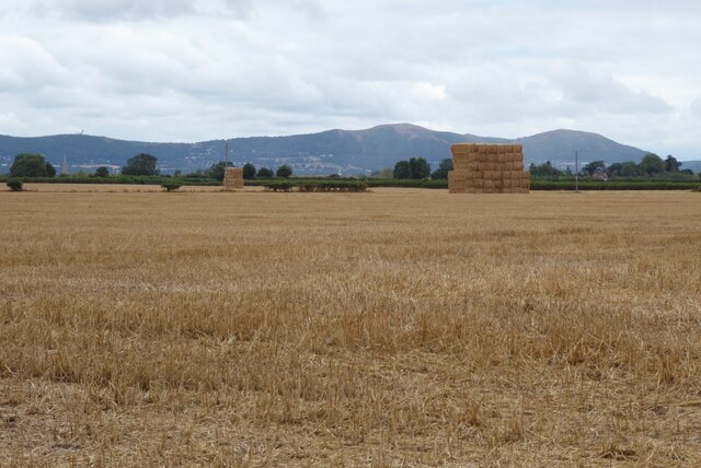
Smithmoor Common is a picturesque expanse of land located in Worcestershire, England. Spread across the Downs and Moorland regions, this natural treasure covers an area of approximately 300 acres. The common is a beautiful blend of rolling hills, vast open spaces, and diverse flora and fauna.

The landscape of Smithmoor Common is characterized by sweeping meadows, heather-covered moorlands, and patches of dense woodland. The undulating terrain provides stunning panoramic views of the surrounding countryside, making it a popular spot for nature enthusiasts and hikers alike.

The common is home to a rich variety of plant and animal species. Wildflowers such as foxgloves, bluebells, and primroses adorn the meadows in the spring, creating a vibrant and colorful tapestry. Many species of birds, including skylarks and peregrine falcons, can be spotted soaring above the moorlands.

In addition to its natural beauty, Smithmoor Common also holds historical significance. The remains of ancient settlements and burial mounds can be found scattered across the common, offering a glimpse into the area's past. Archaeologists have discovered artifacts dating back to the Bronze Age, further adding to its historical value.

Smithmoor Common is a haven for outdoor activities such as walking, horse riding, and birdwatching. Several well-maintained footpaths and bridleways crisscross the area, allowing visitors to explore its diverse landscapes and soak in its tranquil ambiance.

Overall, Smithmoor Common is a cherished natural gem in Worcestershire, offering a unique combination of stunning scenery, biodiversity, and historical significance.

If you have any feedback on the listing, please let us know in the comments section below.

Smithmoor Common Images

Images are sourced within 2km of 52.067908/-2.1857056 or Grid Reference SO8741. Thanks to Geograph Open Source API. All images are credited.

Earl's Croome church Earl's Croome church is dedicated to St Nicholas.  The church is Grade II* listed, see: <span class="nowrap"><a title="https://historicengland.org.uk/listing/the-list/list-entry/1302545?section=comments-and-photos" rel="nofollow ugc noopener" href="https://historicengland.org.uk/listing/the-list/list-entry/1302545?section=comments-and-photos">Link</a><img style="margin-left:2px;" alt="External link" title="External link - shift click to open in new window" src="https://s1.geograph.org.uk/img/external.png" width="10" height="10"/></span>
Earl's Croome church
Earl's Croome church is dedicated to St Nicholas. The church is Grade II* listed, see: LinkExternal link
Road approaching Earl's Croome The large house in the background is Earl's Croome Court which until 2002 was home to the late Earl of Coventry.
Road approaching Earl's Croome
The large house in the background is Earl's Croome Court which until 2002 was home to the late Earl of Coventry.
Bus shelter at Naunton Bus shelter just off the A38 on a country road at Naunton.  A similar view to this picture of the same bus shelter in 2010 <a href="https://www.geograph.org.uk/photo/1762707">SO8739 : Naunton bus shelter</a>.
Bus shelter at Naunton
Bus shelter just off the A38 on a country road at Naunton. A similar view to this picture of the same bus shelter in 2010 SO8739 : Naunton bus shelter.
A field of potatoes A field of potatoes at Naunton, with the Malvern Hills in the distance.
A field of potatoes
A field of potatoes at Naunton, with the Malvern Hills in the distance.
Harvesting potatoes Harvesting potatoes in Naunton.
Harvesting potatoes
Harvesting potatoes in Naunton.
Harvesting potatoes Harvesting potatoes in Naunton.
Harvesting potatoes
Harvesting potatoes in Naunton.
Harvesting potatoes Harvesting potatoes in Naunton.
Harvesting potatoes
Harvesting potatoes in Naunton.
Jerusalem artichoke A crop of Jerusalem artichoke growing in a field beside a road in Ripple.
Jerusalem artichoke
A crop of Jerusalem artichoke growing in a field beside a road in Ripple.
Jerusalem artichoke A crop of Jerusalem artichoke growing in a field beside a road in Ripple.
Jerusalem artichoke
A crop of Jerusalem artichoke growing in a field beside a road in Ripple.
View across farmland to the Malvern Hills View across farmland near Naunton in the broad Severn vale with the Malvern Hills in the background.
View across farmland to the Malvern Hills
View across farmland near Naunton in the broad Severn vale with the Malvern Hills in the background.
A June sunset It is one week before the longest day and the sun is setting to the north of the Malvern Hills.  Here it is viewed from approximately one mile north of the village of Ripple.
A June sunset
It is one week before the longest day and the sun is setting to the north of the Malvern Hills. Here it is viewed from approximately one mile north of the village of Ripple.
Sundown The sunset viewed from about one mile north of the village of Ripple.  It is 7 days before the longest days and from this location the sun is setting to the north of the Malvern Hills <a href="https://www.geograph.org.uk/photo/7206212">SO8739 : A June sunset</a>.
Sundown
The sunset viewed from about one mile north of the village of Ripple. It is 7 days before the longest days and from this location the sun is setting to the north of the Malvern Hills SO8739 : A June sunset.
Shepherd's delight The sunset viewed from about one mile north of the village of Ripple.  It is 7 days before the longest days and from this location the sun is setting to the north of the Malvern Hills <a href="https://www.geograph.org.uk/photo/7206212">SO8739 : A June sunset</a>.
Shepherd's delight
The sunset viewed from about one mile north of the village of Ripple. It is 7 days before the longest days and from this location the sun is setting to the north of the Malvern Hills SO8739 : A June sunset.
A red sky at night A red sky at night, usually a reliable indication of a fine day to follow.  This sky after the sunset is viewed from about one mile north of the village of Ripple.  It is 7 days before the longest days and from this location the sun is setting to the north of the Malvern Hills <a href="https://www.geograph.org.uk/photo/7206212">SO8739 : A June sunset</a>.
A red sky at night
A red sky at night, usually a reliable indication of a fine day to follow. This sky after the sunset is viewed from about one mile north of the village of Ripple. It is 7 days before the longest days and from this location the sun is setting to the north of the Malvern Hills SO8739 : A June sunset.
Straw in a stubble field Straw bales stacked in a stubble field with the Malvern Hills in the distance.
Straw in a stubble field
Straw bales stacked in a stubble field with the Malvern Hills in the distance.
Trenches dug in a field near Ripple
Show me another place!

Smithmoor Common is located at Grid Ref: SO8741 (Lat: 52.067908, Lng: -2.1857056)

Administrative County: Worcestershire

District: Malvern Hills

Police Authority: West Mercia

What 3 Words

///earphones.loaf.quieter. Near Upton upon Severn, Worcestershire

Nearby Locations

Smithmoor Common Baughton

Related Wikis

Ryall, Worcestershire

Ryall is a village in the south of Worcestershire, England, on the east bank of the River Severn, near Upton-upon-Severn on the opposite bank. The village...

Baughton

Baughton is a hamlet in Worcestershire, England. The Population of Baughton is 193. The population as a whole is older than the national average and the...

Earls Croome

Earl's Croome is a village and civil parish in the Malvern Hills District in the county of Worcestershire, England. It had a population of 243 in 2021...

Hill Croome

Hill Croome is a village, and a civil parish which covers 1000 acres, in the Malvern Hills District in the county of Worcestershire, England. Historically...

Naunton, Worcestershire

Naunton is a village in the parish of Ripple, near Upton-upon-Severn in Worcestershire, England. Records for Naunton date back to the 12th Century, where...

Upton-upon-Severn

Upton-upon-Severn (or Upton on Severn, etc. and locally simply Upton) is a town and civil parish in the Malvern Hills District of Worcestershire, England...

Dunstall Common

Dunstall Common is a village in Worcestershire, England.

Battle of Upton

The Battle of Upton was fought on 28 August 1651 when a New Model Army detachment under the command of Colonel John Lambert made a surprise attack on Royalists...

Nearby Amenities

Located within 500m of 52.067908,-2.1857056
Power: pole
Lat/Long: 52.0693013/-2.1866493
Power: pole
Lat/Long: 52.06942/-2.1807511
Power: pole
Lat/Long: 52.0690655/-2.1899364
Power: pole
Lat/Long: 52.0693977/-2.1850481
Power: pole
Lat/Long: 52.0695395/-2.183015
Withy Beds
Power: pole
Transformer: distribution
Voltage Primary: 11000
Lat/Long: 52.0659599/-2.1900639
Power: pole
Lat/Long: 52.0658519/-2.1911247
Power: pole
Lat/Long: 52.0654924/-2.1917094
Power: pole
Lat/Long: 52.0691776/-2.1881354
Power: pole
Lat/Long: 52.068927/-2.1918985
The data included in this document is from www.openstreetmap.org. The data is made available under ODbL.

Have you been to Smithmoor Common?

Leave your review of Smithmoor Common below (or comments, questions and feedback).