Percy's Moss

Downs, Moorland in Northumberland

England

Percy's Moss

Sandy Sike View looking across Sandy Sike towards Hareshaw House.
Sandy Sike Credit: Peter McDermott

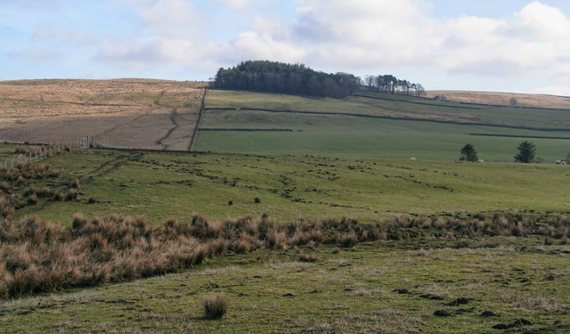
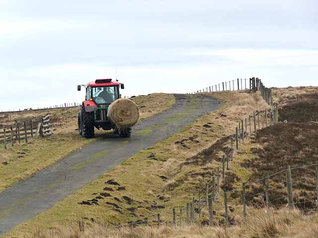
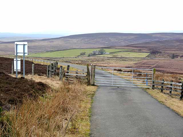
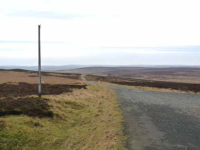
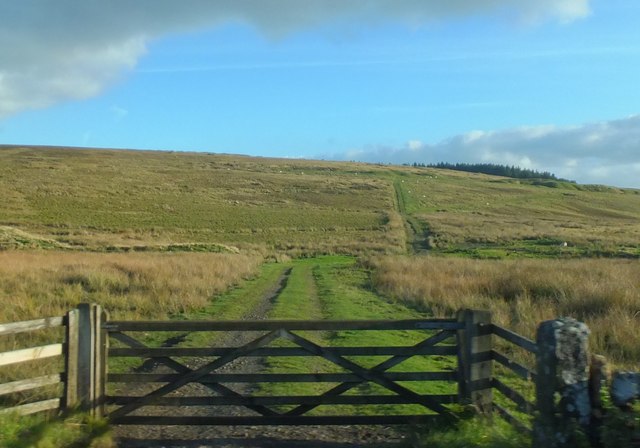
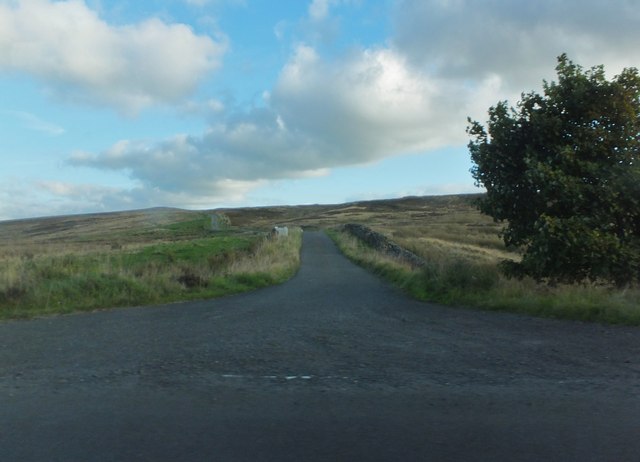
Percy's Moss is a picturesque area situated in the county of Northumberland, England. This stunning landscape is renowned for its diverse natural beauty, encompassing both downs and moorland. It spans an expansive area, covering several miles of rolling hills, meadows, and marshes.

The downs of Percy's Moss are characterized by their gentle slopes and lush grasslands. These open spaces offer breathtaking panoramic views of the surrounding countryside, providing visitors with a sense of tranquility and connection to nature. The downs are home to a variety of plant species, including wildflowers, heather, and grasses, which create a vibrant tapestry of colors throughout the seasons.

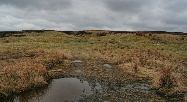
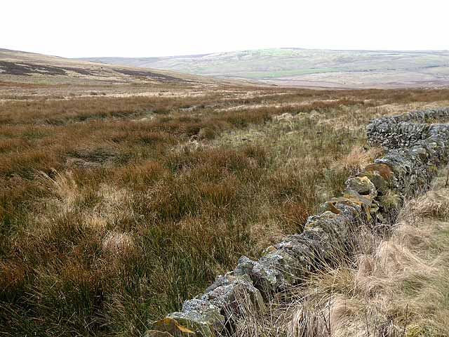
In contrast, the moorland areas of Percy's Moss offer a rugged and wild ambiance. Here, visitors can immerse themselves in the untamed beauty of Northumberland's ancient heaths and bogs. The moorland is dotted with scattered rock formations and peat bogs, providing a unique habitat for a range of wildlife, such as birds, reptiles, and small mammals.

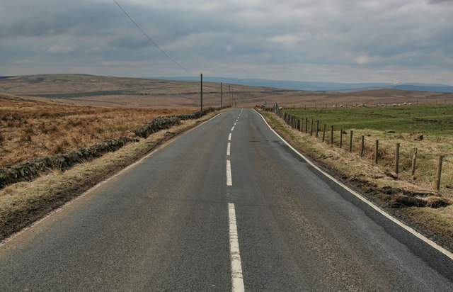
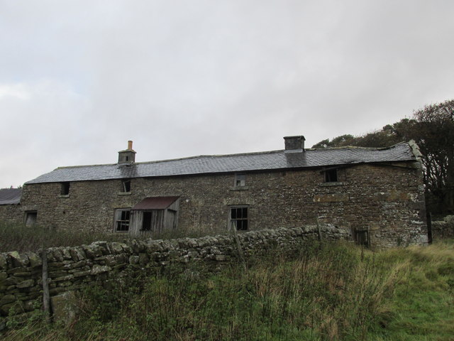
Percy's Moss attracts outdoor enthusiasts of all kinds, from hikers and cyclists to birdwatchers and nature photographers. The area features a network of well-maintained trails, allowing visitors to explore its diverse landscapes at their own pace. Additionally, the surrounding villages and towns offer charming accommodations and amenities for those wishing to extend their stay.

Overall, Percy's Moss in Northumberland is a captivating destination that showcases the natural beauty and rich biodiversity of the region. Its downs and moorland provide a harmonious balance between tranquility and adventure, making it a must-visit location for nature lovers and outdoor enthusiasts alike.

If you have any feedback on the listing, please let us know in the comments section below.

Percy's Moss Images

Images are sourced within 2km of 55.178814/-2.2258147 or Grid Reference NY8587. Thanks to Geograph Open Source API. All images are credited.

Sandy Sike View looking across Sandy Sike towards Hareshaw House.
Sandy Sike
View looking across Sandy Sike towards Hareshaw House.
Corsenside Common Road on Corsenside Common.
Corsenside Common
Road on Corsenside Common.
Corsenside Common Disused quarry on Corsenside Common.
Corsenside Common
Disused quarry on Corsenside Common.
Hareshaw Head The B6320 beneath Hareshaw Head.
Hareshaw Head
The B6320 beneath Hareshaw Head.
Low Leam Burn Plantation on Low Leam Burn.
Low Leam Burn
Plantation on Low Leam Burn.
Moorland below Hareshaw Head In the distance are the moors on the far side of North Tynedale.
Moorland below Hareshaw Head
In the distance are the moors on the far side of North Tynedale.
Tractor at Hareshaw Head Off to feed the sheep on the minor road over Corsenside Common to West Woodburn.
Tractor at Hareshaw Head
Off to feed the sheep on the minor road over Corsenside Common to West Woodburn.
Hareshaw Head On the minor road over Corsenside Common from West Woodburn. The road passes through a small outlier of the Otterburn Ranges; this gate marks the boundary at the western end. The farm of Hareshaw Head down on the B6320 can be seen in the middle distance.
Hareshaw Head
On the minor road over Corsenside Common from West Woodburn. The road passes through a small outlier of the Otterburn Ranges; this gate marks the boundary at the western end. The farm of Hareshaw Head down on the B6320 can be seen in the middle distance.
Slopes of Corsenside Common Sheep creep through a wall beside the road over Corsenside Common. The valley of Redesdale can be dimly seen in the distance to the left.
Slopes of Corsenside Common
Sheep creep through a wall beside the road over Corsenside Common. The valley of Redesdale can be dimly seen in the distance to the left.
Summit of Corsenside Common This very minor country road from West Woodburn to Bellingham passes through a small outlier of the Otterburn Ranges. The flagpole in the foreground flies the red flag when access to the area is unsafe.
Summit of Corsenside Common
This very minor country road from West Woodburn to Bellingham passes through a small outlier of the Otterburn Ranges. The flagpole in the foreground flies the red flag when access to the area is unsafe.
View over Redesdale Looking from the minor road over Corsenside Common.
View over Redesdale
Looking from the minor road over Corsenside Common.
The Pennine Way Leading southward from the B6320.
The Pennine Way
Leading southward from the B6320.
Minor road over Corsenside Common From the junction with the B6320 at Hareshaw Head.
Minor road over Corsenside Common
From the junction with the B6320 at Hareshaw Head.
Derelict farm buildings near Hareshaw House Along the Pennine Way.
Derelict farm buildings near Hareshaw House
Along the Pennine Way.
Pennine Way off the B6320 Heading north.
Pennine Way off the B6320
Heading north.
Layby at Hareshaw Head Beside the B6320.
Layby at Hareshaw Head
Beside the B6320.
Moorland at White Rigg Patterns of heather clearing can be seen on Great Moor beyond.
Moorland at White Rigg
Patterns of heather clearing can be seen on Great Moor beyond.
Riders on Bridleway Bridge over the Hazel Burn
Show me another place!

Percy's Moss is located at Grid Ref: NY8587 (Lat: 55.178814, Lng: -2.2258147)

Unitary Authority: Northumberland

Police Authority: Northumbria

What 3 Words

///dugouts.puns.ramming. Near Corsenside, Northumberland

Nearby Locations

Percy's Moss

Related Wikis

Corsenside

Corsenside is one of the largest parishes in Northumberland, however the area is mainly a vast expanse of rolling hills and farmland, with three tiny villages...

West Woodburn

West Woodburn is a village in north-western Northumberland, England. The 2001 census recorded a population of 492 in the parish of Corsenside, of which...

Bellingham, Northumberland

Bellingham ( BEL-in-jəm) is a village and civil parish in Northumberland, to the north-west of Newcastle upon Tyne and is situated on the Hareshaw Burn...

Bellingham North Tyne railway station

Bellingham railway station served the village of Bellingham, Northumberland, England from 1861 to 1963 on the Border Counties Railway. == History == The...

Nearby Amenities

Located within 500m of 55.178814,-2.2258147
Percy's Moss
Place: locality
Lat/Long: 55.1782832/-2.2250295
The data included in this document is from www.openstreetmap.org. The data is made available under ODbL.

Have you been to Percy's Moss?

Leave your review of Percy's Moss below (or comments, questions and feedback).