Towneley Park

Downs, Moorland in Lancashire Burnley

England

Towneley Park

WWII Lancashire: Ghost Signs of the Home Front  (22) -
Emergency Water Supply, Hand Bridge, Todmorden Road, Burnley

"EWS Hatch"

A rare EWS sign of metal on the bridge over the River Calder. "EWS Hatch" may refer to a facility to obtain an emergency supply of water from the river (below the bridge).

<a href="https://www.geograph.org.uk/photo/6945367">SD8432 : WWII Lancashire: Ghost Signs of the Home Front  (23)</a>
WWII Lancashire: Ghost Signs of the Home Front (22) Credit: Mike Searle

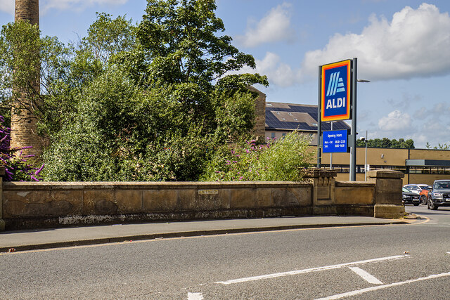
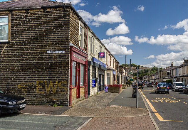
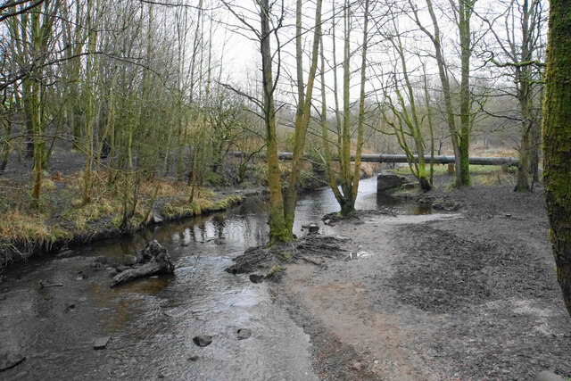
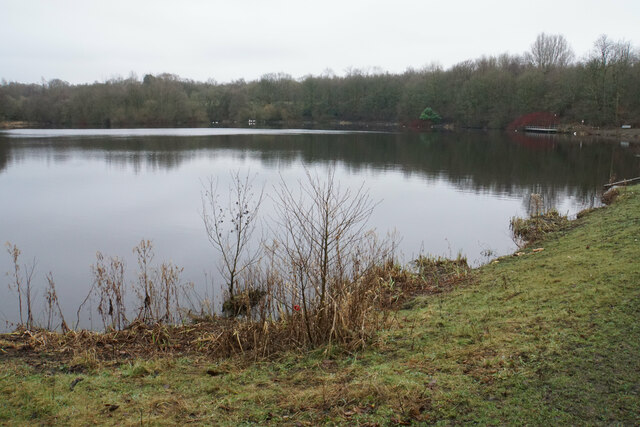
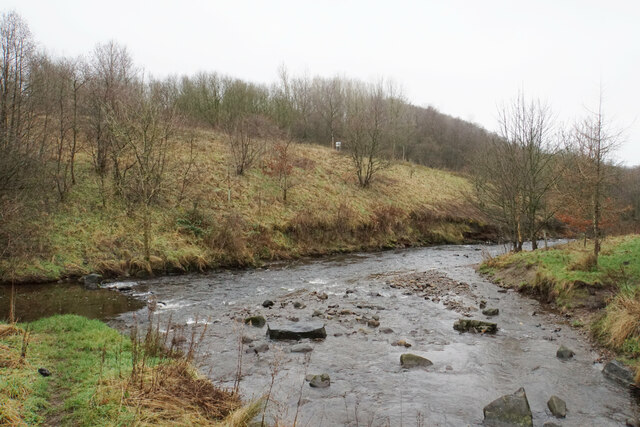
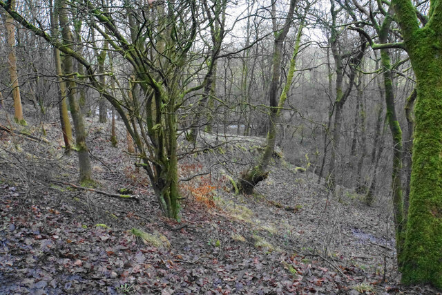
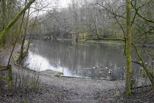
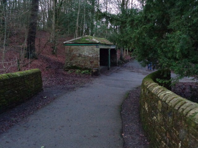
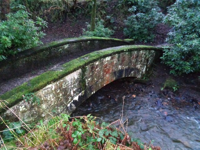
Towneley Park is a picturesque park located in Burnley, Lancashire, England. Spanning over 180 acres, it offers a wide range of natural landscapes, including rolling downs, captivating moorland, and lush woodlands. The park is a popular destination for both locals and tourists, providing ample opportunities for recreational activities and leisurely walks.

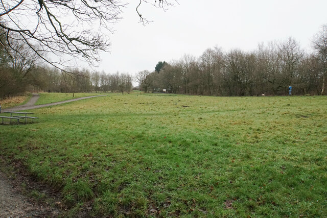
The park's downs showcase vast open spaces adorned with neatly manicured lawns and vibrant flower beds, creating a tranquil setting for picnics, sports, and family gatherings. Visitors can enjoy breathtaking views of the surrounding countryside from the downs, making it an ideal spot for relaxation and unwinding.

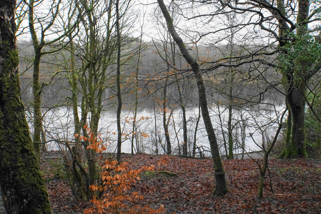
The moorland area of Towneley Park is a haven for wildlife enthusiasts and nature lovers. With its heather-covered expanses and diverse flora and fauna, it provides a perfect habitat for various species of birds, insects, and small mammals. Walking along the moorland trails, visitors can immerse themselves in the serenity of nature and appreciate the beauty of the Lancashire countryside.

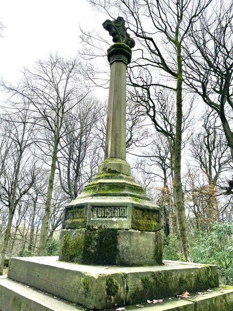
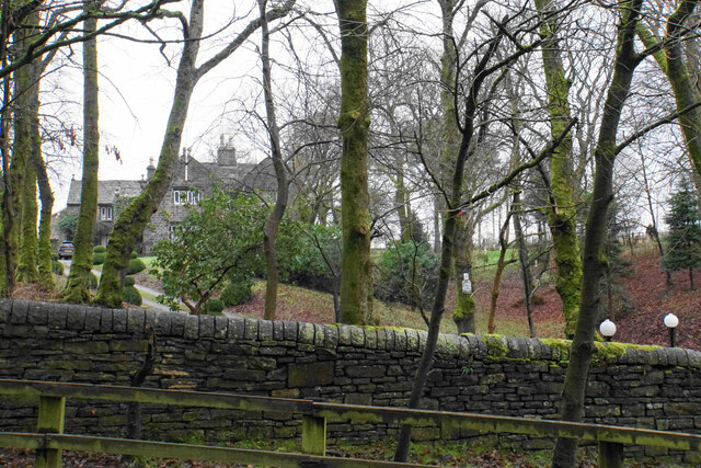
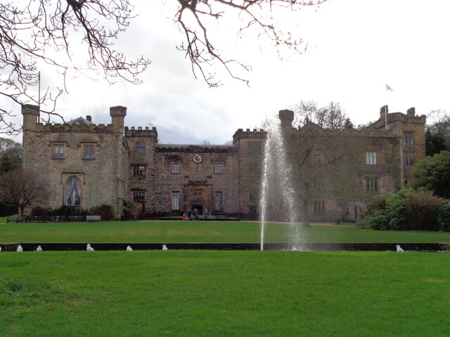
In addition to its natural beauty, Towneley Park boasts historical significance. It is home to the magnificent Towneley Hall, a Grade I listed building that dates back to the 14th century. The hall houses a museum and art gallery, showcasing an impressive collection of art, artifacts, and historical memorabilia.

Overall, Towneley Park offers a delightful blend of natural wonders, historical charm, and recreational amenities. Whether one seeks tranquility amidst nature, a spot for a family outing, or an opportunity to explore Lancashire's rich heritage, this park is a must-visit destination.

If you have any feedback on the listing, please let us know in the comments section below.

Towneley Park Images

Images are sourced within 2km of 53.781015/-2.2184469 or Grid Reference SD8531. Thanks to Geograph Open Source API. All images are credited.

WWII Lancashire: Ghost Signs of the Home Front  (22) -
Emergency Water Supply, Hand Bridge, Todmorden Road, Burnley

"EWS Hatch"

A rare EWS sign of metal on the bridge over the River Calder. "EWS Hatch" may refer to a facility to obtain an emergency supply of water from the river (below the bridge).

<a href="https://www.geograph.org.uk/photo/6945367">SD8432 : WWII Lancashire: Ghost Signs of the Home Front  (23)</a>
WWII Lancashire: Ghost Signs of the Home Front (22)
- Emergency Water Supply, Hand Bridge, Todmorden Road, Burnley "EWS Hatch" A rare EWS sign of metal on the bridge over the River Calder. "EWS Hatch" may refer to a facility to obtain an emergency supply of water from the river (below the bridge). SD8432 : WWII Lancashire: Ghost Signs of the Home Front (23)
WWII Lancashire: Ghost Signs of the Home Front  (24) -
Emergency Water Supply, Holmsley Street, at junction with Lyndhurst Road, Burnley

"EWS 100 yds"

<a href="https://www.geograph.org.uk/photo/6945363">SD8432 : WWII Lancashire: Ghost Signs of the Home Front  (25)</a>
WWII Lancashire: Ghost Signs of the Home Front (24)
- Emergency Water Supply, Holmsley Street, at junction with Lyndhurst Road, Burnley "EWS 100 yds" SD8432 : WWII Lancashire: Ghost Signs of the Home Front (25)
WWII Lancashire: Ghost Signs of the Home Front  (25) -
Emergency Water Supply, Holmsley Street, at junction with Lyndhurst Road, Burnley

"EWS 100 yds"

                              *********
START: <a href="https://www.geograph.org.uk/photo/6944970">SJ8498 : WWII Lancashire: Ghost Signs of the Home Front  (1)</a>
WWII Lancashire: Ghost Signs of the Home Front (25)
- Emergency Water Supply, Holmsley Street, at junction with Lyndhurst Road, Burnley "EWS 100 yds" ********* START: SJ8498 : WWII Lancashire: Ghost Signs of the Home Front (1)
WWII Lancashire: Ghost Signs of the Home Front  (23) -
Emergency Water Supply,  Hand Bridge, Todmorden Road, Burnley

"EWS Hatch"

<a href="https://www.geograph.org.uk/photo/6945359">SD8432 : WWII Lancashire: Ghost Signs of the Home Front  (24)</a>
WWII Lancashire: Ghost Signs of the Home Front (23)
- Emergency Water Supply, Hand Bridge, Todmorden Road, Burnley "EWS Hatch" SD8432 : WWII Lancashire: Ghost Signs of the Home Front (24)
Old Wayside Cross in Tiwneley Park, Burnley Foldys' Cross, an old market cross base in a new cross. Moved to the intersection of footpaths leading towards Todmorden road in Towneley Park, 300 metres southwest of Towneley Hall in Burnley. Grade II Listed <span class="nowrap"><a title="https://historicengland.org.uk/listing/the-list/list-entry/1247301" rel="nofollow ugc noopener" href="https://historicengland.org.uk/listing/the-list/list-entry/1247301">Link</a><img style="margin-left:2px;" alt="External link" title="External link - shift click to open in new window" src="https://s1.geograph.org.uk/img/external.png" width="10" height="10"/></span>. See also <a title="https://www.geograph.org.uk/photo/3569776" href="https://www.geograph.org.uk/photo/3569776">Link</a> and <a title="https://www.geograph.org.uk/photo/1133733" href="https://www.geograph.org.uk/photo/1133733">Link</a>.

Milestone Society National ID: LABU_BUR03
Old Wayside Cross in Tiwneley Park, Burnley
Foldys' Cross, an old market cross base in a new cross. Moved to the intersection of footpaths leading towards Todmorden road in Towneley Park, 300 metres southwest of Towneley Hall in Burnley. Grade II Listed LinkExternal link. See also Link and Link. Milestone Society National ID: LABU_BUR03
Rowley Lake Viewed through woodland on the south western side, from the path which circumvents the whole lake.
Rowley Lake
Viewed through woodland on the south western side, from the path which circumvents the whole lake.
Footpaths at Pike Hill Open space attached to Rowley Lake which has been developed by Burnley Borough Council as an attractive woodland leisure area.
Footpaths at Pike Hill
Open space attached to Rowley Lake which has been developed by Burnley Borough Council as an attractive woodland leisure area.
River Brun above Rowley Lake Looking upstream from the circular path around the lake.
River Brun above Rowley Lake
Looking upstream from the circular path around the lake.
Rowley Lake An artificial lake created on the River Brun, seen here with sombre January colouring.
Rowley Lake
An artificial lake created on the River Brun, seen here with sombre January colouring.
Rowley Hall A lot of farm buildings are behind the grand house, as seen from Rowley Lane.
Rowley Hall
A lot of farm buildings are behind the grand house, as seen from Rowley Lane.
Heckenhurst Farm Viewed from Rowley Lane on a slightly misty day. Wasnop Edge is in the background, the beginning of the higher Pennines.
Heckenhurst Farm
Viewed from Rowley Lane on a slightly misty day. Wasnop Edge is in the background, the beginning of the higher Pennines.
Track up to Netherwood Farm The section up the slope has been reinforced with concrete to make it more durable, though the concrete has a good coating of mud.
Track up to Netherwood Farm
The section up the slope has been reinforced with concrete to make it more durable, though the concrete has a good coating of mud.
Confluence of the Rivers Don and Brun The rivers meet in the Brun Valley Forest Park.
Confluence of the Rivers Don and Brun
The rivers meet in the Brun Valley Forest Park.
Woodland in Scrogg's Wood Part of the Brun Valley Forest Park. The land slopes down to the River Don, which is just about seen ahead.
Woodland in Scrogg's Wood
Part of the Brun Valley Forest Park. The land slopes down to the River Don, which is just about seen ahead.
Pond in the Brun valley An artificial pond from the time when this was an industrial valley. It is showing some January bleakness here.
Pond in the Brun valley
An artificial pond from the time when this was an industrial valley. It is showing some January bleakness here.
Towneley Hall The north east frontage
Towneley Hall
The north east frontage
Park Shelters At Boggart Bridge in Towneley Park Wilderness
Park Shelters
At Boggart Bridge in Towneley Park Wilderness
Ornamental Footbridge In the Wilderness of Towneley Park over Copy Clough
Ornamental Footbridge
In the Wilderness of Towneley Park over Copy Clough
Show me another place!

Towneley Park is located at Grid Ref: SD8531 (Lat: 53.781015, Lng: -2.2184469)

Administrative County: Lancashire

District: Burnley

Police Authority: Lancashire

What 3 Words

///fields.mostly.change. Near Burnley, Lancashire

Nearby Locations

Towneley Park

Related Wikis

Unity College, Burnley

Unity College is a mixed 11-16 comprehensive school in Burnley, Lancashire, England. == History == === Former school === Towneley High School originally...

Towneley Park

Towneley Park is owned and managed by Burnley Borough Council and is the largest and most popular park in Burnley, Lancashire, England. The main entrance...

Burnley Wood

Burnley Wood is a district and former electoral ward of Burnley, Lancashire. In broad terms the area lies between Parliament Street in the north and Hufling...

Towneley Colliery

Towneley Colliery or Towneley Desmesne was a coal mine on the Burnley Coalfield in Burnley, Lancashire, England. Sunk in the late 1860s, it was linked...
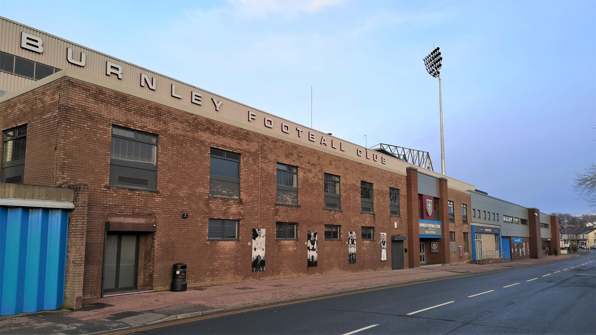
Turf Moor

Turf Moor is an association football stadium in Burnley, Lancashire, England, which has been the home of Burnley Football Club since 1883. This unbroken...

Towneley railway station

Towneley railway station was a station in Lancashire which served Burnley Wood and the nearby Towneley Hall on the eastern edge of Burnley. Opened on 12...

Church of St Mary of the Assumption, Burnley

The Church of St Mary of the Assumption is in Yorkshire Street, Burnley, Lancashire, England. It is an active Roman Catholic parish church in the diocese...

Burnley power station

Burnley power station supplied electricity to the town of Burnley, Lancashire from 1893 to 1958. The electricity station was owned and operated by Burnley...

Nearby Amenities

Located within 500m of 53.781015,-2.2184469
Barrier: entrance
Lat/Long: 53.7820897/-2.2243536
Entrance: yes
Lat/Long: 53.7772006/-2.2147112
Bus Stop
Slaidburn Avenue
Bus: yes
Naptan AtcoCode: 2500DCL604
Naptan NaptanCode: landmtpd
Public Transport: platform
Lat/Long: 53.7851901/-2.215728
The data included in this document is from www.openstreetmap.org. The data is made available under ODbL.

Have you been to Towneley Park?

Leave your review of Towneley Park below (or comments, questions and feedback).