Ged Beck Moor

Downs, Moorland in Yorkshire Ribble Valley

England

Ged Beck Moor

Ordnance Survey Cut Mark This mark can be found on the gatepost at the entrance to Long Bank Farm.
The benchmark has a recorded height of 155.9753 metres above sea level.
For more detail see : <span class="nowrap"><a title="https://www.bench-marks.org.uk/bm152156" rel="nofollow ugc noopener" href="https://www.bench-marks.org.uk/bm152156">Link</a><img style="margin-left:2px;" alt="External link" title="External link - shift click to open in new window" src="https://s1.geograph.org.uk/img/external.png" width="10" height="10"/></span>
Ordnance Survey Cut Mark Credit: Peter Wood

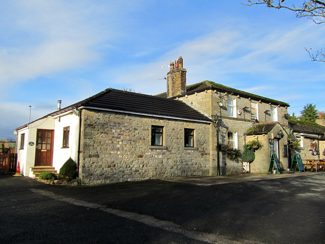
Ged Beck Moor is a picturesque area located in the county of Yorkshire, England. Situated amidst the beautiful Yorkshire Downs, this moorland provides a unique and captivating landscape for nature enthusiasts and hikers alike.

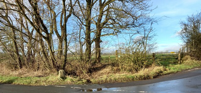
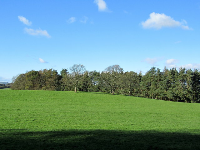
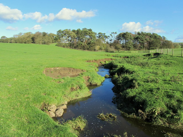
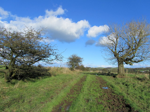
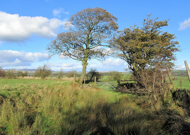
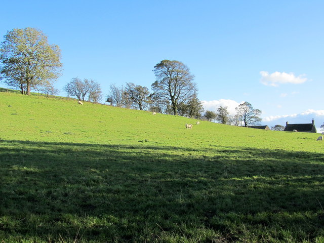
Covering an expansive area, Ged Beck Moor is characterized by its rolling hills, vast stretches of heather, and scattered pockets of woodland. The moorland offers a diverse range of flora and fauna, including rare bird species, such as curlews and lapwings, which can be observed nesting amidst the heather.

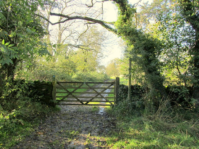
The undulating terrain of Ged Beck Moor makes it an ideal destination for outdoor activities such as walking, hiking, and cycling. There are a number of well-maintained trails that wind through the moorland, offering breathtaking views of the surrounding countryside. These trails cater to various levels of difficulty, making it accessible for both beginners and experienced adventurers.

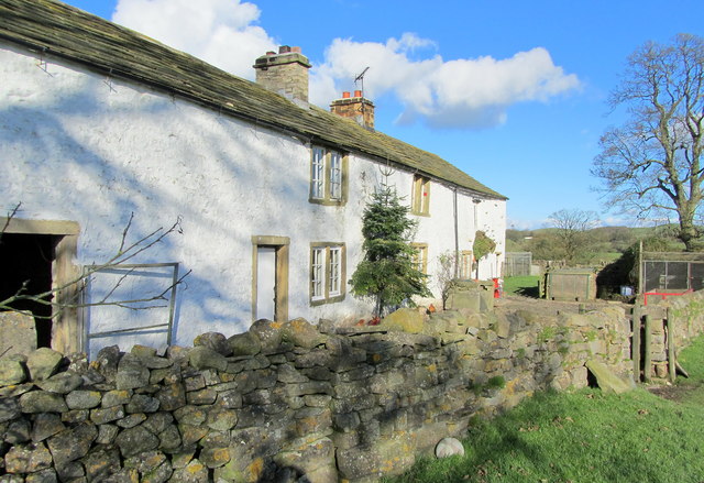
In addition to its natural beauty, Ged Beck Moor also has a rich cultural history. The area is dotted with historic landmarks, including ancient burial mounds and stone circles, providing glimpses into the region's past. Visitors can explore these archaeological sites and learn about the area's fascinating heritage.

Overall, Ged Beck Moor in Yorkshire offers a tranquil and immersive experience in the heart of nature. Whether one is seeking a peaceful walk, a challenging hike, or an opportunity to connect with the region's history, this moorland provides a captivating destination for all.

If you have any feedback on the listing, please let us know in the comments section below.

Ged Beck Moor Images

Images are sourced within 2km of 53.976886/-2.2467937 or Grid Reference SD8353. Thanks to Geograph Open Source API. All images are credited.
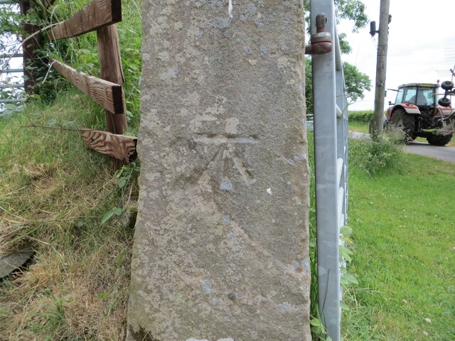
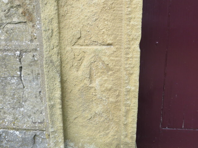
Ordnance Survey Cut Mark This mark can be found on the gatepost at the entrance to Long Bank Farm.
The benchmark has a recorded height of 155.9753 metres above sea level.
For more detail see : <span class="nowrap"><a title="https://www.bench-marks.org.uk/bm152156" rel="nofollow ugc noopener" href="https://www.bench-marks.org.uk/bm152156">Link</a><img style="margin-left:2px;" alt="External link" title="External link - shift click to open in new window" src="https://s1.geograph.org.uk/img/external.png" width="10" height="10"/></span>
Ordnance Survey Cut Mark
This mark can be found on the gatepost at the entrance to Long Bank Farm. The benchmark has a recorded height of 155.9753 metres above sea level. For more detail see : LinkExternal link
Ordnance Survey Cut Mark with Rivet This mark and rivet can be found on the top of a boundary stone at Carr Moor crossroads.
The benchmark has a recorded height of 165.7167 metres above sea level.
For more detail see : <span class="nowrap"><a title="https://www.bench-marks.org.uk/bm124037" rel="nofollow ugc noopener" href="https://www.bench-marks.org.uk/bm124037">Link</a><img style="margin-left:2px;" alt="External link" title="External link - shift click to open in new window" src="https://s1.geograph.org.uk/img/external.png" width="10" height="10"/></span>
[Since the earlier picture <a title="https://www.geograph.org.uk/photo/6038091" href="https://www.geograph.org.uk/photo/6038091">Link</a> the boundary stone seems to have been involved in a RTA and is now leaning at a 45 degree angle]
Ordnance Survey Cut Mark with Rivet
This mark and rivet can be found on the top of a boundary stone at Carr Moor crossroads. The benchmark has a recorded height of 165.7167 metres above sea level. For more detail see : LinkExternal link [Since the earlier picture Link the boundary stone seems to have been involved in a RTA and is now leaning at a 45 degree angle]
Ordnance Survey Cut Mark This mark can be found beside the doorway to Paythorne Methodist Church.
The benchmark has a recorded height of 132.7892 metres above sea level.
For more detail see : <span class="nowrap"><a title="https://www.bench-marks.org.uk/bm101370" rel="nofollow ugc noopener" href="https://www.bench-marks.org.uk/bm101370">Link</a><img style="margin-left:2px;" alt="External link" title="External link - shift click to open in new window" src="https://s1.geograph.org.uk/img/external.png" width="10" height="10"/></span>
Ordnance Survey Cut Mark
This mark can be found beside the doorway to Paythorne Methodist Church. The benchmark has a recorded height of 132.7892 metres above sea level. For more detail see : LinkExternal link
Paythorne Methodist Chapel Paythorne Methodist Church is the only church building in the small hamlet of Paythorne and is Grade 2 listed, dating from 1830.
Paythorne Methodist Chapel
Paythorne Methodist Church is the only church building in the small hamlet of Paythorne and is Grade 2 listed, dating from 1830.
Paythorne, Boundary stone The benchmark and rivet are cut into the top of the boundary stone found on the grass verge at the crossroads.
Paythorne, Boundary stone
The benchmark and rivet are cut into the top of the boundary stone found on the grass verge at the crossroads.
Paythorne, Boundary stone  There is a benchmark and rivet cut into the top of the boundary stone found on the grass verge at the crossroads.
Paythorne, Boundary stone
There is a benchmark and rivet cut into the top of the boundary stone found on the grass verge at the crossroads.
The Buck, Paythorne The inn is typical of many country pubs in that its main source of income now seems to be from dining rather than drinking.
The Buck, Paythorne
The inn is typical of many country pubs in that its main source of income now seems to be from dining rather than drinking.
Manor House Farmhouse, Paythorne The farmers, Mr. and Mrs. Calvert, have a herd of 180 pedigree Holstein cows. The farm featured in the October 2011 edition of Lancashire Life magazine.
Manor House Farmhouse, Paythorne
The farmers, Mr. and Mrs. Calvert, have a herd of 180 pedigree Holstein cows. The farm featured in the October 2011 edition of Lancashire Life magazine.
Railway Bridge at Nappa The A682 Gisburn/Long Preston Road at the scattered community of Nappa as it is crossed by a railway bridge.  It carries a mineral line that connects Clitheroe to Hellifield.
Railway Bridge at Nappa
The A682 Gisburn/Long Preston Road at the scattered community of Nappa as it is crossed by a railway bridge. It carries a mineral line that connects Clitheroe to Hellifield.
Buck Inn, Paythorne Local hostelry that serves the community of Paythorne
Buck Inn, Paythorne
Local hostelry that serves the community of Paythorne
Old Close Plantation Small patch of woodland above the River Ribble, seen from the south
Old Close Plantation
Small patch of woodland above the River Ribble, seen from the south
Ged Beck looking Downstream Crossing this stream below Black Plantation the scene looks down Ged Beck towards Gallaber Hole Plantation, on its journey to the River Ribble.
Ged Beck looking Downstream
Crossing this stream below Black Plantation the scene looks down Ged Beck towards Gallaber Hole Plantation, on its journey to the River Ribble.
Nappa Flats Farmhouse in the countryside of Mid Ribblesdale
Nappa Flats
Farmhouse in the countryside of Mid Ribblesdale
On the Track between Paa Hill and Nappa Flats Muddy track crossing the small drumlin of Priestbers
On the Track between Paa Hill and Nappa Flats
Muddy track crossing the small drumlin of Priestbers
Bridleway near Englands Head Part of the bridleway followed between Paa Hill and Nappa Flats - very boggy in texture
Bridleway near Englands Head
Part of the bridleway followed between Paa Hill and Nappa Flats - very boggy in texture
Paa Hill One of many glacial drumlins that are manifested in this area
Paa Hill
One of many glacial drumlins that are manifested in this area
Stone Barn off Paa Lane Laithe in a field beside Paa Lane
Stone Barn off Paa Lane
Laithe in a field beside Paa Lane
Start of Track leading over Bell Moor This track runs in a straight line from this gate on Settle Road across Bell Moor to Pie Cross Plantation
Start of Track leading over Bell Moor
This track runs in a straight line from this gate on Settle Road across Bell Moor to Pie Cross Plantation
Show me another place!

Ged Beck Moor is located at Grid Ref: SD8353 (Lat: 53.976886, Lng: -2.2467937)

Division: West Riding

Administrative County: Lancashire

District: Ribble Valley

Police Authority: Lancashire

What 3 Words

///duet.fees.poet. Near Hellifield, North Yorkshire

Related Wikis

Halton West

Halton West is a village and civil parish in the Craven district of North Yorkshire, England. North Yorkshire County Council estimated the population in...

Nappa, North Yorkshire

Nappa is a hamlet in the civil parish of Hellifield, in North Yorkshire, England. It is on the A682 road and 6 miles (9.7 km) north-west of Barnoldswick...

Paythorne

Paythorne is a small village and civil parish in Ribble Valley, Lancashire, England. It is situated alongside the River Ribble, north-east of Clitheroe...

Newsholme, Lancashire

Newsholme is a small village and civil parish in the Ribble Valley, Lancashire, England, but lies within the historic West Riding of Yorkshire. According...

Newsholme railway station

Newsholme railway station was a railway station that served the small village of Newsholme in Lancashire. It was built by the Lancashire and Yorkshire...

Swinden

Swinden is a village in the civil parish of Hellifield, in North Yorkshire, England. It is near Halton West and Nappa and about 7 miles north of Barnoldswick...

Hellifield

Hellifield is a village and civil parish in the Craven district of North Yorkshire, England (grid reference SD855565). Historically part of the West Riding...

Horton, Lancashire

Horton, historically known as Horton-in-Craven, is a village and a civil parish in the Ribble Valley district of the English county of Lancashire (historically...

Nearby Amenities

Located within 500m of 53.976886,-2.2467937
Ged Beck Moor
Natural: moor
Source: OS 1:25k
Lat/Long: 53.9766531/-2.2479913
The data included in this document is from www.openstreetmap.org. The data is made available under ODbL.

Have you been to Ged Beck Moor?

Leave your review of Ged Beck Moor below (or comments, questions and feedback).