Highgate Common

Downs, Moorland in Staffordshire South Staffordshire

England

Highgate Common

Highgate Path The view from near White House Lane of the footpath on Highgate Common Country Park.
Highgate Path Credit: Gordon Griffiths

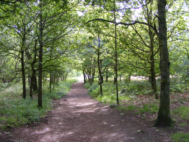
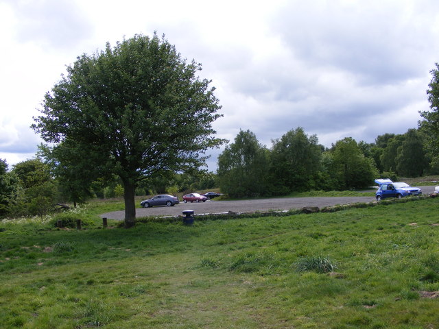
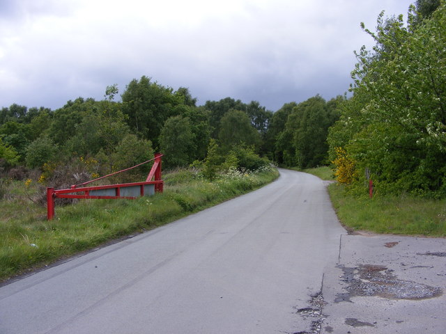
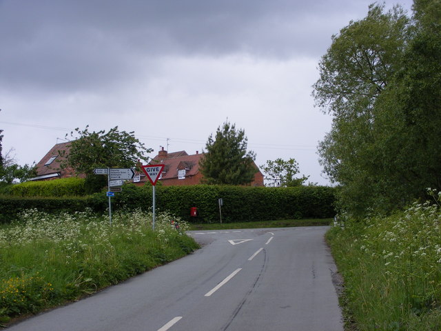
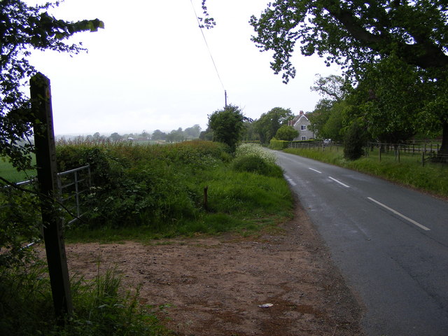
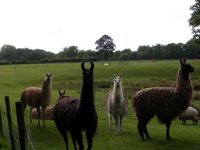
Highgate Common is a vast expanse of natural beauty located in Staffordshire, England. Covering an area of approximately 200 hectares, this stunning nature reserve is a combination of downs and moorland, offering a diverse range of habitats and wildlife.

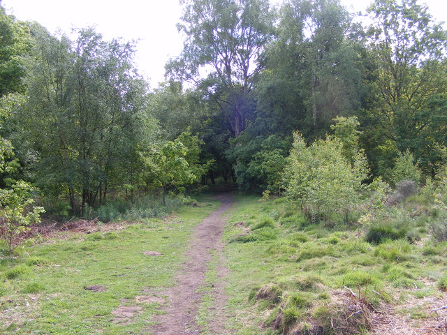
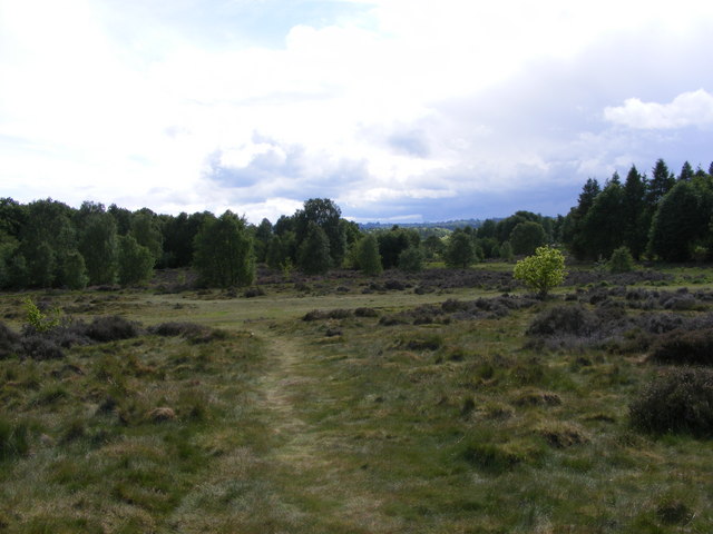
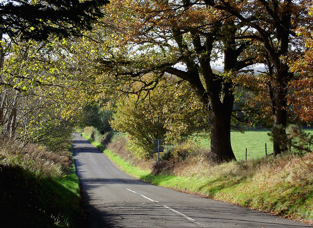
The common is characterized by its rolling hills, heathland, and open grassy areas, which are interspersed with patches of woodland and wetland. The landscape is dominated by heather, gorse, and grasses, creating a picturesque and serene environment.

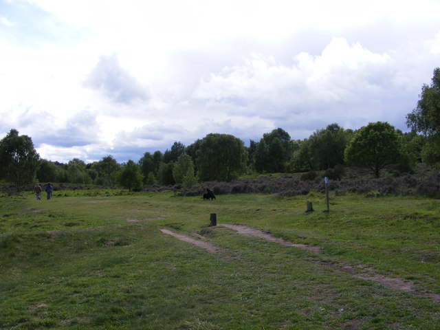
Visitors to Highgate Common can enjoy a variety of activities, such as walking, birdwatching, and nature photography. The reserve is home to a rich array of bird species, including stonechats, linnets, and warblers, making it a paradise for bird enthusiasts. Additionally, the common is a haven for butterflies and dragonflies, with species such as the common blue butterfly and the emperor dragonfly frequently spotted.

The reserve is also known for its diverse plant life, with a wide range of wildflowers and grasses adorning the landscape. Visitors can expect to see vibrant displays of heather, harebells, and orchids during the summer months.

Highgate Common is managed by a dedicated team of conservationists, who work tirelessly to protect and enhance the natural environment. They undertake regular habitat management, including controlled burning and grazing, to maintain the diverse ecosystems found within the common.

Overall, Highgate Common offers a unique and enchanting experience for nature lovers, providing a tranquil retreat where visitors can immerse themselves in the beauty of Staffordshire's countryside.

If you have any feedback on the listing, please let us know in the comments section below.

Highgate Common Images

Images are sourced within 2km of 52.50635/-2.2385117 or Grid Reference SO8389. Thanks to Geograph Open Source API. All images are credited.

Highgate Path The view from near White House Lane of the footpath on Highgate Common Country Park.
Highgate Path
The view from near White House Lane of the footpath on Highgate Common Country Park.
Highgate Clearing The view of the footpath on Highgate Common Country Park.
Highgate Clearing
The view of the footpath on Highgate Common Country Park.
Highgate View The view from Birches Coppice Car Park off White House Lane over Highgate Common Country Park.
Highgate View
The view from Birches Coppice Car Park off White House Lane over Highgate Common Country Park.
Highgate Common View The view over Highgate Common Country Park.
Highgate Common View
The view over Highgate Common Country Park.
Highgate Car Park View The view of the car park off Camp Hill Road from Highgate Common Country Park.
Highgate Car Park View
The view of the car park off Camp Hill Road from Highgate Common Country Park.
Highgate Road Gate The view of Camp Hill Road on Highgate Common Country Park.
Highgate Road Gate
The view of Camp Hill Road on Highgate Common Country Park.
Highgate Road Junction The view of Camp Hill Road and Highgate Road junction on Highgate Common Country Park.
Highgate Road Junction
The view of Camp Hill Road and Highgate Road junction on Highgate Common Country Park.
Staffordshire Way View The view of Crab Lane near Highgate Common Country Park.
Staffordshire Way View
The view of Crab Lane near Highgate Common Country Park.
Llama Herd The view by Mere Hall from the Staffordshire Way.
Llama Herd
The view by Mere Hall from the Staffordshire Way.
Chasepool Lodge trig in evening sunshine Looking NNE across the autumn fields, with Chasepool Farm in the middle distance.
Chasepool Lodge trig in evening sunshine
Looking NNE across the autumn fields, with Chasepool Farm in the middle distance.
Farmland south-west of Swindon, Staffordshire This is a telephoto assisted image cropped top and bottom to show Chasepool Farm and fields nearby. Beyond the farm is the village of Swindon.
Farmland south-west of Swindon, Staffordshire
This is a telephoto assisted image cropped top and bottom to show Chasepool Farm and fields nearby. Beyond the farm is the village of Swindon.
Farmland near Swindon, Staffordshire In the distance is the conurbation including Wall Heath and Kingswinford.
Farmland near Swindon, Staffordshire
In the distance is the conurbation including Wall Heath and Kingswinford.
Farmland south-west of Swindon, Staffordshire Chasepool Lane is behind the hedge.
Farmland south-west of Swindon, Staffordshire
Chasepool Lane is behind the hedge.
Camp Hill Road near Swindon, Staffordshire Off to the left is Enville Common Road. Ahead is the way to Highgate Common.
Camp Hill Road near Swindon, Staffordshire
Off to the left is Enville Common Road. Ahead is the way to Highgate Common.
Camp Hill Road south of Swindon, Staffordshire Looking down the hill towards Greensforge from near the junction with Chasepool Road.
Camp Hill Road south of Swindon, Staffordshire
Looking down the hill towards Greensforge from near the junction with Chasepool Road.
Camp Hill Road south of Swindon, Staffordshire Looking down the hill towards Greensforge from near the junction with Chasepool Road.
Camp Hill Road south of Swindon, Staffordshire
Looking down the hill towards Greensforge from near the junction with Chasepool Road.
Enville Common Road south-west of Swindon, Staffordshire Looking south-west from near the junction with Chasepool Road and Camp Hill Road.
Enville Common Road south-west of Swindon, Staffordshire
Looking south-west from near the junction with Chasepool Road and Camp Hill Road.
Show me another place!

Highgate Common is located at Grid Ref: SO8389 (Lat: 52.50635, Lng: -2.2385117)

Administrative County: Staffordshire

District: South Staffordshire

Police Authority: Staffordshire

What 3 Words

///dripped.winds.invisible. Near Wombourn, Staffordshire

Nearby Locations

Highgate Common

Related Wikis

Highgate Common

Highgate Common is a Staffordshire Wildlife Trust reserve containing a mix of heathland and woodland. It is about 129 hectares or 320 acres in size. The...

Wolverhampton Airport

Wolverhampton Halfpenny Green Airport (ICAO: EGBO), formerly Halfpenny Green Airport and Wolverhampton Business Airport, locally Bobbington Airport, is...

Greensforge

Greensforge is a scattered hamlet on the boundary of Kinver and Swindon parishes, in South Staffordshire, England. It is noted for its Roman associations...

Swindon, Staffordshire

Swindon is a village and civil parish located in the West Midlands. The nearest towns are Dudley and Stourbridge. It stands halfway between the town of...

Bobbington

Bobbington is a village and civil parish in the South Staffordshire district of Staffordshire, England, about 5 miles (8.0 km) west of Wombourne. According...

Ashwood, Staffordshire

Ashwood is a small area of Staffordshire, England. It is situated in the South Staffordshire district, approximately two miles west of the West Midlands...

West Midlands (region)

The West Midlands is one of nine official regions of England at the first level of International Territorial Level for statistical purposes. It covers...

Enville, Staffordshire

Enville is a village and civil parish in rural Staffordshire, England, on the A458 road between Stourbridge and Bridgnorth. Enville is in the South Staffordshire...

Nearby Amenities

Located within 500m of 52.50635,-2.2385117
Bench
Colour: green
Material: metal
Lat/Long: 52.5068154/-2.2431924
Bench
Colour: green
Material: metal
Lat/Long: 52.5093046/-2.239898
Bench
Material: wood
Lat/Long: 52.5095601/-2.2395895
Bench
Colour: green
Material: metal
Lat/Long: 52.50861/-2.2361845
Leisure: picnic_table
Material: metal
Wheelchair: yes
Lat/Long: 52.5057817/-2.2368397
Bench
Colour: green
Material: metal
Lat/Long: 52.5030893/-2.2356762
The data included in this document is from www.openstreetmap.org. The data is made available under ODbL.

Have you been to Highgate Common?

Leave your review of Highgate Common below (or comments, questions and feedback).