Rhydd Green

Downs, Moorland in Worcestershire Malvern Hills

England

Rhydd Green

Footbridges at the junction of footpaths near Blackmore End
Footbridges at the junction of footpaths near Blackmore End Credit: peter robinson

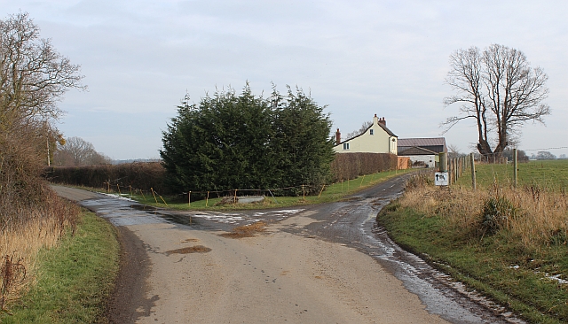
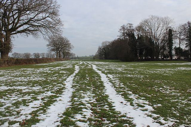
Rhydd Green is a picturesque area located in Worcestershire, England. Known for its stunning natural beauty, Rhydd Green is characterized by its rolling downs and expansive moorland. The area is a haven for nature enthusiasts and offers a variety of outdoor activities.

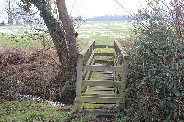
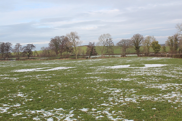
The downs of Rhydd Green are gently sloping hills covered in lush green grass and dotted with wildflowers. They provide stunning panoramic views of the surrounding countryside and are perfect for hiking, picnicking, and photography. The downs are also home to a diverse range of wildlife, including birds, rabbits, and foxes, making it a popular spot for birdwatching and wildlife observation.

The moorland of Rhydd Green is a vast expanse of open land characterized by its heather-covered hills and peat bogs. It is a unique ecosystem that supports a variety of rare plant and animal species. Visitors can explore the moorland through designated paths and trails, allowing them to immerse themselves in the untouched beauty of the landscape. The moorland is also popular among nature photographers and artists, who are drawn to its dramatic scenery and vibrant colors.

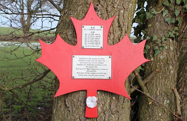
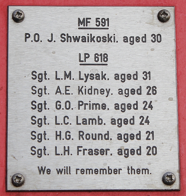
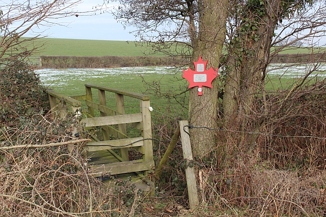
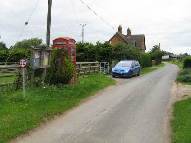
In addition to its natural attractions, Rhydd Green also boasts a rich history. The area is home to several ancient burial mounds and stone circles, providing a glimpse into its past. The nearby village offers amenities such as pubs, cafes, and accommodations, making it a convenient base for visitors to explore the area.

Overall, Rhydd Green is a captivating destination that offers a perfect blend of natural beauty, outdoor activities, and historical intrigue. Whether you are seeking tranquility or adventure, this Worcestershire gem has something to offer for everyone.

If you have any feedback on the listing, please let us know in the comments section below.
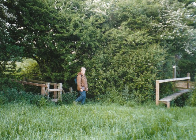
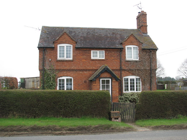
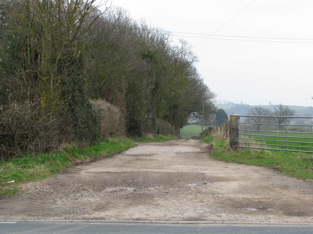
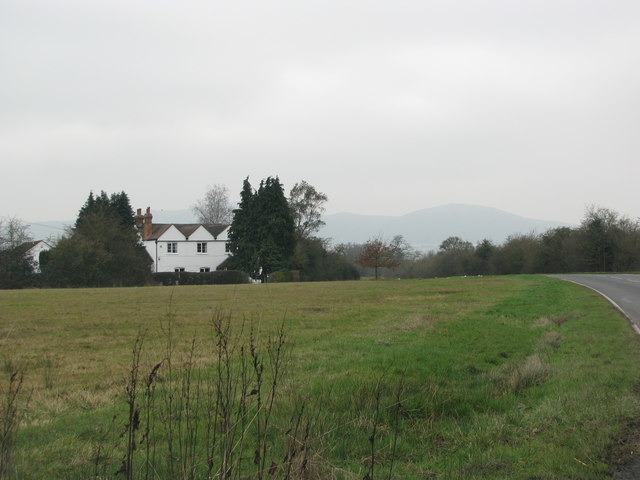
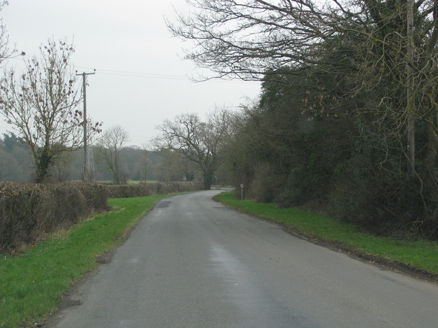
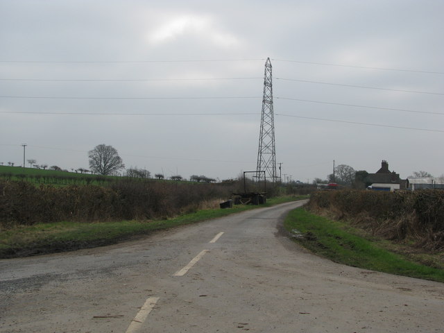
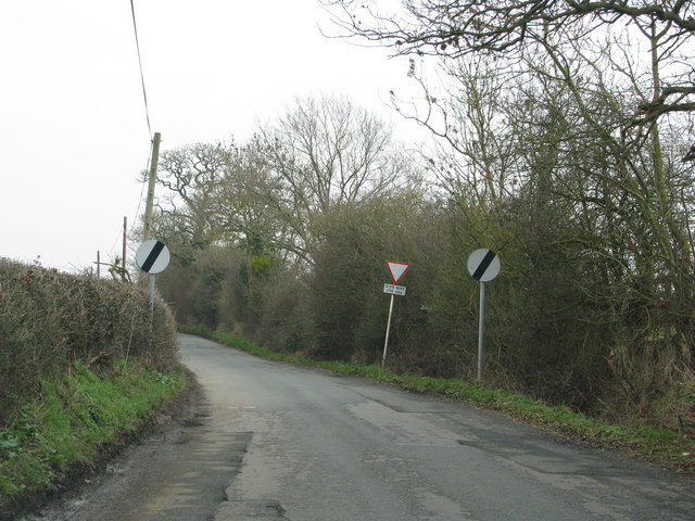
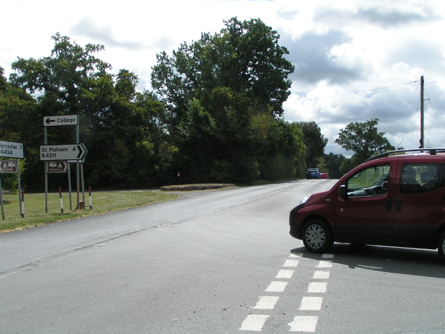
Rhydd Green Images

Images are sourced within 2km of 52.102845/-2.2493445 or Grid Reference SO8344. Thanks to Geograph Open Source API. All images are credited.

Footbridges at the junction of footpaths near Blackmore End
Brick-built roadside house
Track down the side of Cliffey Wood
Field by the white house near Rhydd
Minor road on the northern edge of Guarlford
Pylons cross the road near White House Farm
Road narrows approaching the B4424
B4424 at Rydd
B4424 at Rydd
Hangman's Lane - Green Lane junction Hangmans Lane forks to the left while the lane to the right becomes an unmetalled "green lane" after Broadacres Farm.
Hangman's Lane - Green Lane junction
Hangmans Lane forks to the left while the lane to the right becomes an unmetalled "green lane" after Broadacres Farm.
Snow field, Hanley Swan An interesting long narrow field with a stream on the right hand boundary.
Snow field, Hanley Swan
An interesting long narrow field with a stream on the right hand boundary.
Snow field, Hanley Swan An interesting long narrow field with a stream bordering its southern edge.
The Malvern Hills can be seen in the distance.
Snow field, Hanley Swan
An interesting long narrow field with a stream bordering its southern edge. The Malvern Hills can be seen in the distance.
Wooden Bridge near Hanley Swan Attached to the tree on the far side is a maple leaf memorial to Canadians killed in a mid air collision during WWII.
<a href="https://www.geograph.org.uk/photo/2806694">SO8243 : Footbridge and Maple Leaf memorial, Hanley Swan</a>
Wooden Bridge near Hanley Swan
Attached to the tree on the far side is a maple leaf memorial to Canadians killed in a mid air collision during WWII. SO8243 : Footbridge and Maple Leaf memorial, Hanley Swan
Canadian memorial near Hanley Swan In memory of the seven Canadian airmen who died in a mid-air collision between two Wellington bombers on the 11th August 1944.
<a href="https://www.geograph.org.uk/photo/2806687">SO8243 : Names on the Canadian War Memorial, Hanley Swan</a>
<a href="https://www.geograph.org.uk/photo/2806673">SO8243 : Plaque on the Canadian War Memorial, Hanley Swan</a>
<a href="https://www.geograph.org.uk/photo/2806694">SO8243 : Footbridge and Maple Leaf memorial, Hanley Swan</a>
Canadian memorial near Hanley Swan
In memory of the seven Canadian airmen who died in a mid-air collision between two Wellington bombers on the 11th August 1944. SO8243 : Names on the Canadian War Memorial, Hanley Swan SO8243 : Plaque on the Canadian War Memorial, Hanley Swan SO8243 : Footbridge and Maple Leaf memorial, Hanley Swan
Plaque on the Canadian War Memorial, Hanley Swan Dedicated to the memory of seven
Canadian airmen who lost their lives
as a result of a mid-air collision
between two Wellington bombers on the
11th August 1944.
Wellington MF 591 struggled back to base at
Honeybourne.
Wellington LP 618 crashed in a field near
Hanley Swan. Only the pilot survived.

<a href="https://www.geograph.org.uk/photo/2806694">SO8243 : Footbridge and Maple Leaf memorial, Hanley Swan</a>
Plaque on the Canadian War Memorial, Hanley Swan
Dedicated to the memory of seven Canadian airmen who lost their lives as a result of a mid-air collision between two Wellington bombers on the 11th August 1944. Wellington MF 591 struggled back to base at Honeybourne. Wellington LP 618 crashed in a field near Hanley Swan. Only the pilot survived. SO8243 : Footbridge and Maple Leaf memorial, Hanley Swan
Names on the Canadian War Memorial, Hanley Swan The plaque lists the Canadian airmen who died in the two colliding Wellington bombers under the serial number of the planes:

MF 591
P.O. J. Shwaikoski. aged 30

LP618
Sgt. L.M Lysak. aged 31
Sgt. A.E. Kidney. aged 26
Sgt. G.O. Prime. aged 24
Sgt. L.C. Lamb. aged 24
Sgt. H.G. Round. aged 21
Sgt. L.H. Fraser. aged 20

We will remember them.

<a href="https://www.geograph.org.uk/photo/2806694">SO8243 : Footbridge and Maple Leaf memorial, Hanley Swan</a>
Names on the Canadian War Memorial, Hanley Swan
The plaque lists the Canadian airmen who died in the two colliding Wellington bombers under the serial number of the planes: MF 591 P.O. J. Shwaikoski. aged 30 LP618 Sgt. L.M Lysak. aged 31 Sgt. A.E. Kidney. aged 26 Sgt. G.O. Prime. aged 24 Sgt. L.C. Lamb. aged 24 Sgt. H.G. Round. aged 21 Sgt. L.H. Fraser. aged 20 We will remember them. SO8243 : Footbridge and Maple Leaf memorial, Hanley Swan
Footbridge and Maple Leaf memorial, Hanley Swan The memorial is to the Canadian airmen who died from a mid air collision during WWII.
<a href="https://www.geograph.org.uk/photo/2806661">SO8243 : Canadian memorial near Hanley Swan</a>
<a href="https://www.geograph.org.uk/photo/2806673">SO8243 : Plaque on the Canadian War Memorial, Hanley Swan</a>
<a href="https://www.geograph.org.uk/photo/2806687">SO8243 : Names on the Canadian War Memorial, Hanley Swan</a>
Footbridge and Maple Leaf memorial, Hanley Swan
Snow patterns in pasture near Hanley Swan The thaw is reducing the snow on the grass covered pasture revealing the churned up areas months after the water troughs or feeders have moved on.
Snow patterns in pasture near Hanley Swan
The thaw is reducing the snow on the grass covered pasture revealing the churned up areas months after the water troughs or feeders have moved on.
Water trough near Hanley Swan On the path to Sink Farm.
The disturbed ground around the trough takes longer to lose it's snow cover.
Water trough near Hanley Swan
On the path to Sink Farm. The disturbed ground around the trough takes longer to lose it's snow cover.
Show me another place!

Rhydd Green is located at Grid Ref: SO8344 (Lat: 52.102845, Lng: -2.2493445)

Administrative County: Worcestershire

District: Malvern Hills

Police Authority: West Mercia

What 3 Words

///visitor.regal.ejects. Near Kempsey, Worcestershire

Related Wikis

The Rhydd

The Rhydd (formerly Rhydd Court) is an English country house alongside the River Severn, near the village of Hanley Castle, Worcestershire, about halfway...

Guarlford

Guarlford is a village and civil parish in the Malvern Hills district in the county of Worcestershire, England. The parish population was 261 in 2021.It...

Clifton, Worcestershire

Clifton is a village in Worcestershire, England.

Clevelode

Clevelode is a small village in Worcestershire, England. It is located around 5 miles south of Worcester just to the west of the River Severn. Clevelode...

British National Fencing Museum

The British National Fencing Museum is the national museum for Great Britain for the sport and martial art of fencing.The museum opened during the year...

Hanley Swan

Hanley Swan is a small village in the English county of Worcestershire. It lies in the Malvern Hills district, between the towns of Malvern (two miles...

Hanley Castle

Hanley Castle is a village and civil parish in Worcestershire, England, between the towns of Malvern and Upton upon Severn and a short distance from the...

Severn Stoke

Severn Stoke is an English village and civil parish in the Malvern Hills District, in the south of the county of Worcestershire, alongside the A38 trunk...

Nearby Amenities

Located within 500m of 52.102845,-2.2493445
The Rhydd
Naptan AtcoCode: 2000G058201
Naptan Bearing: SE
Naptan BusStopType: CUS
Naptan CommonName: The Rhydd
Naptan Indicator: opp
Naptan Landmark: School
Naptan NaptanCode: wocdjgjw
Naptan Street: B4424
Naptan Verified: no
Source: naptan_import
Lat/Long: 52.1042894/-2.2424262
Power: pole
Lat/Long: 52.0987543/-2.2513095
Power: pole
Lat/Long: 52.0993813/-2.2506107
Power: pole
Lat/Long: 52.1000091/-2.2499173
Power: pole
Lat/Long: 52.1005214/-2.2493608
The Farmery
Power: pole
Transformer: distribution
Voltage Primary: 11000
Lat/Long: 52.1033429/-2.2465153
Power: pole
Lat/Long: 52.1011879/-2.2486293
Power: pole
Lat/Long: 52.102917/-2.2472928
Power: pole
Lat/Long: 52.1025068/-2.2480184
Power: pole
Lat/Long: 52.1020784/-2.2487855
Power: pole
Lat/Long: 52.1017505/-2.2483456
Power: pole
Lat/Long: 52.1014095/-2.2479299
Power: pole
Transformer: distribution
Lat/Long: 52.101683/-2.2471896
Power: pole
Lat/Long: 52.1001474/-2.2443438
Power: pole
Lat/Long: 52.1007027/-2.2449285
Power: pole
Lat/Long: 52.1012546/-2.2455239
Power: pole
Lat/Long: 52.1018461/-2.2448654
Power: pole
Lat/Long: 52.1017497/-2.2460604
Power: pole
Lat/Long: 52.1019408/-2.243696
Power: pole
Lat/Long: 52.1024227/-2.2426593
Power: pole
Lat/Long: 52.1027679/-2.2492053
Power: pole
Lat/Long: 52.103553/-2.2497001
Power: pole
Lat/Long: 52.1047672/-2.2504377
Power: pole
Lat/Long: 52.1056205/-2.2505397
Power: pole
Lat/Long: 52.1063973/-2.2506053
Dripshill
Power: pole
Transformer: distribution
Voltage Primary: 11000
Lat/Long: 52.1069278/-2.2500341
Power: pole
Lat/Long: 52.1071967/-2.2497484
Power: pole
Lat/Long: 52.1040954/-2.250028
The data included in this document is from www.openstreetmap.org. The data is made available under ODbL.

Have you been to Rhydd Green?

Leave your review of Rhydd Green below (or comments, questions and feedback).