Monkland's Covert

Wood, Forest in Worcestershire Malvern Hills

England

Monkland's Covert

Footbridges at the junction of footpaths near Blackmore End
Footbridges at the junction of footpaths near Blackmore End Credit: peter robinson

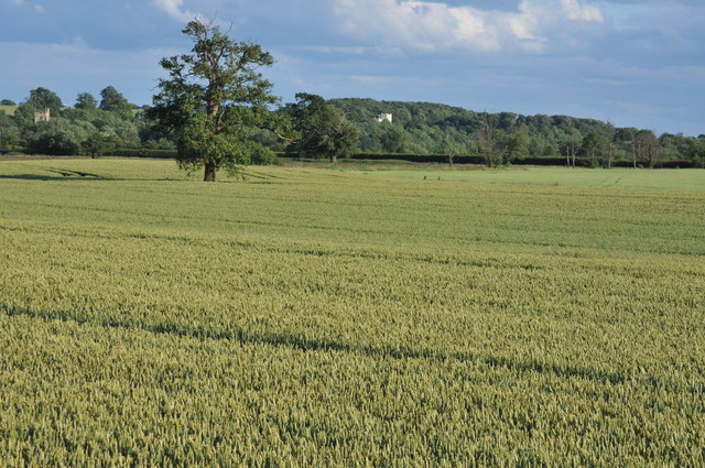
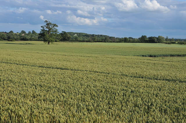
Monkland's Covert is a picturesque woodland located in Worcestershire, England. As part of the ancient Forest of Feckenham, it is a cherished natural treasure with a rich history and abundant wildlife.

Spanning approximately 200 acres, Monkland's Covert is predominantly composed of mature deciduous trees, including oak, beech, and ash. These tall trees create a dense canopy, providing a cool and shaded environment, especially during hot summer months. The woodland floor is adorned with a diverse array of flora, such as bluebells, wild garlic, and wood anemones, creating a colorful and fragrant carpet.

This woodland is a haven for wildlife enthusiasts, as it is home to a wide variety of animals and birds. Birdwatchers can spot species like woodpeckers, owls, and various songbirds, while mammals like deer, badgers, and foxes can also be seen roaming the area. In addition, the woodland is teeming with smaller creatures like squirrels, rabbits, and hedgehogs.

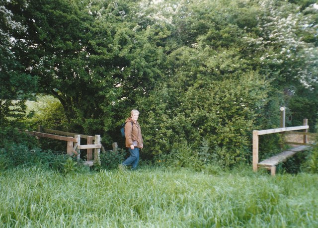
Monkland's Covert offers several walking trails and footpaths, allowing visitors to explore its beauty and tranquility. The paths wind through the trees, offering glimpses of enchanting clearings and small ponds. These natural features provide habitats for amphibians, dragonflies, and other aquatic creatures.

The woodland is carefully managed by the Worcestershire Wildlife Trust, ensuring its preservation and protection. Regular conservation efforts are undertaken to maintain the biodiversity and natural balance of the area.

Monkland's Covert is a true gem for nature lovers and a place of solace for those seeking respite from the hustle and bustle of daily life. Its serene atmosphere and stunning landscapes make it a must-visit destination for anyone wanting to immerse themselves in the beauty of Worcestershire's woodlands.

If you have any feedback on the listing, please let us know in the comments section below.

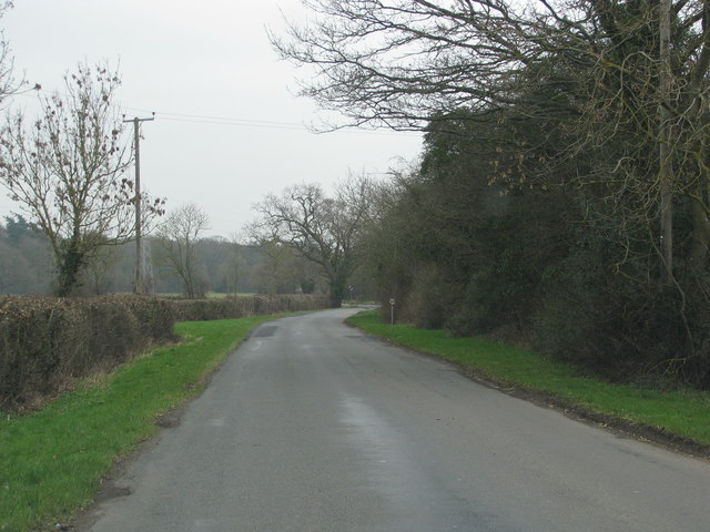
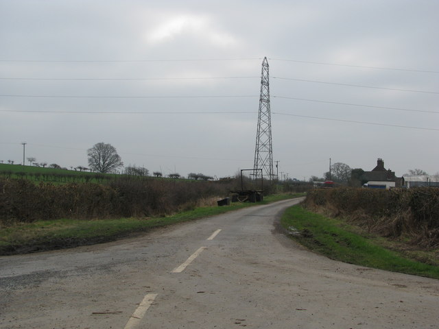
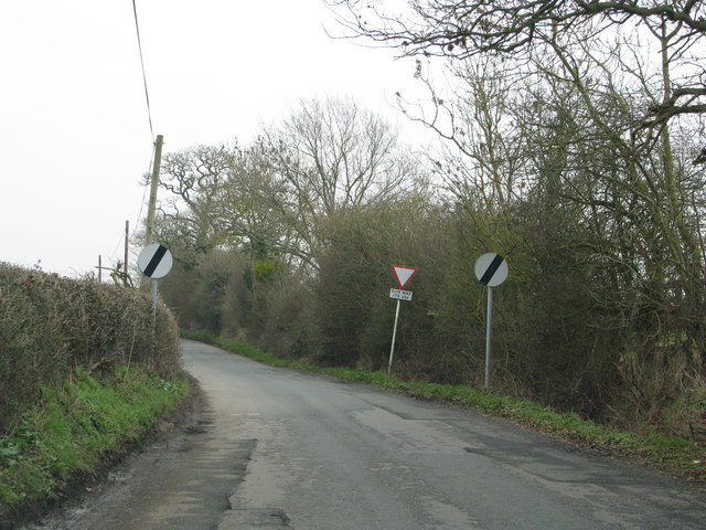
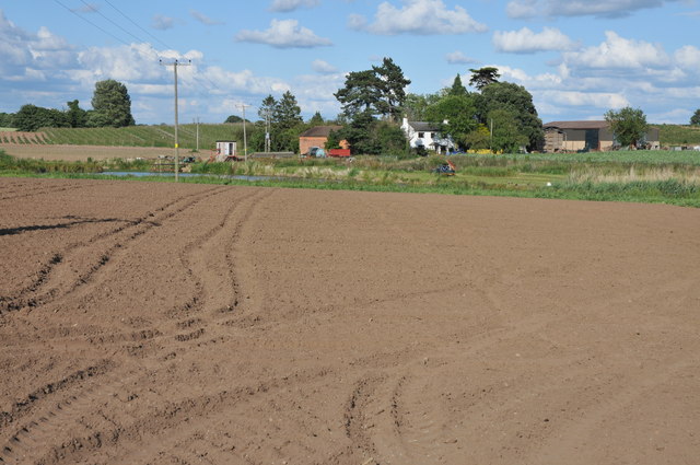
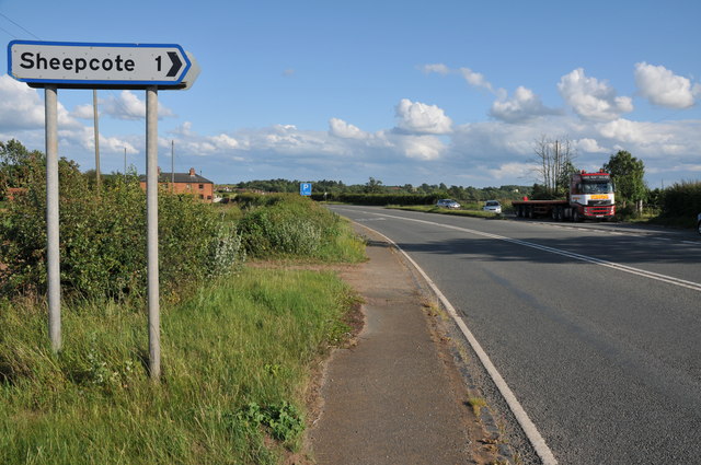
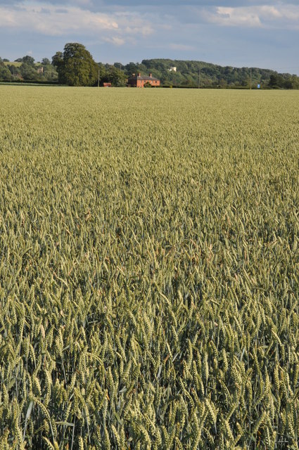
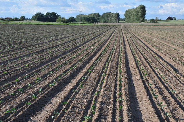
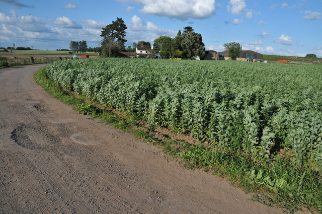
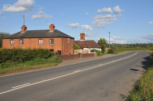
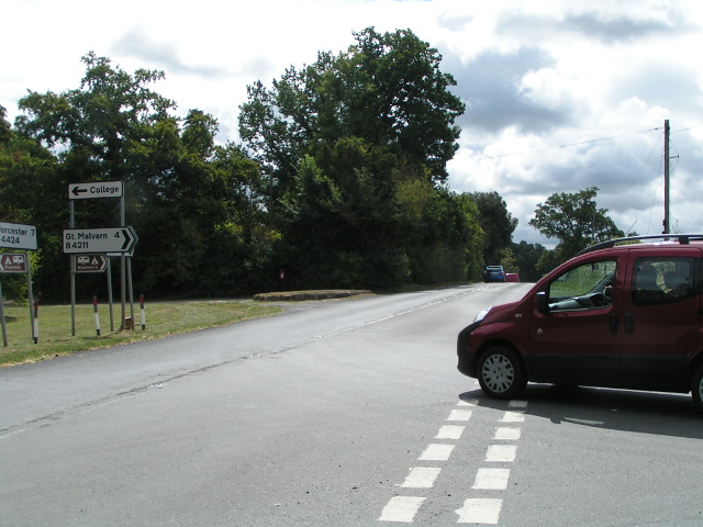
Monkland's Covert Images

Images are sourced within 2km of 52.101304/-2.2425911 or Grid Reference SO8344. Thanks to Geograph Open Source API. All images are credited.

Footbridges at the junction of footpaths near Blackmore End
Brick-built roadside house
Track down the side of Cliffey Wood
Field by the white house near Rhydd
Minor road on the northern edge of Guarlford
Pylons cross the road near White House Farm
Road narrows approaching the B4424
Track through a wheat field Track and bridleway through a field of wheat to a house to the north of Severn Stoke.
Track through a wheat field
Track and bridleway through a field of wheat to a house to the north of Severn Stoke.
Sandford Villa Farm Sandford Villa Farm near Severn Stoke viewed from the A38.
Sandford Villa Farm
Sandford Villa Farm near Severn Stoke viewed from the A38.
The A38 near Severn Stoke A road sign on the A38 north of Severn Stoke indicates the road to Sheepcote.
The A38 near Severn Stoke
A road sign on the A38 north of Severn Stoke indicates the road to Sheepcote.
Bridleway off the A38 A bridleway and track off the A38 near Clifton to the north of Severn Stoke.
Bridleway off the A38
A bridleway and track off the A38 near Clifton to the north of Severn Stoke.
Field of wheat near Severn Stoke View over a field of wheat towards Severn Stoke, the church tower can be seen in the distance on the left and the white building on the wooded bank is a country house called Severn Bank. See: <a href="https://www.geograph.org.uk/photo/2202058">SO8543 : Severn Bank House</a>
Field of wheat near Severn Stoke
View over a field of wheat towards Severn Stoke, the church tower can be seen in the distance on the left and the white building on the wooded bank is a country house called Severn Bank. See: SO8543 : Severn Bank House
Field of cabbages Field of young cabbage plants at Sandford Villa Farm near Severn Stoke.
Field of cabbages
Field of young cabbage plants at Sandford Villa Farm near Severn Stoke.
Sandford Villa Farm Sandford Villa Farm with a field of broad beans in the foreground.
Sandford Villa Farm
Sandford Villa Farm with a field of broad beans in the foreground.
View to Severn Stoke View across a wheatfield to Severn Stoke with church tower on the left and on the wooded bank on the right Severn Bank House.  View a view of this house in winter see: <a href="https://www.geograph.org.uk/photo/2202058">SO8543 : Severn Bank House</a>
View to Severn Stoke
View across a wheatfield to Severn Stoke with church tower on the left and on the wooded bank on the right Severn Bank House. View a view of this house in winter see: SO8543 : Severn Bank House
Fields of wheat at Severn Stoke Fields of wheat growing on the floodplain near Severn Stoke.
Fields of wheat at Severn Stoke
Fields of wheat growing on the floodplain near Severn Stoke.
Houses beside the A38 Houses beside the A38 to the north of Severn Stoke.
Houses beside the A38
Houses beside the A38 to the north of Severn Stoke.
B4424 at Rydd
B4424 at Rydd
Show me another place!

Monkland's Covert is located at Grid Ref: SO8344 (Lat: 52.101304, Lng: -2.2425911)

Administrative County: Worcestershire

District: Malvern Hills

Police Authority: West Mercia

What 3 Words

///pound.pampered.lively. Near Kempsey, Worcestershire

Related Wikis

The Rhydd

The Rhydd (formerly Rhydd Court) is an English country house alongside the River Severn, near the village of Hanley Castle, Worcestershire, about halfway...

Clifton, Worcestershire

Clifton is a village in Worcestershire, England.

Guarlford

Guarlford is a village and civil parish in the Malvern Hills district in the county of Worcestershire, England. The parish population was 261 in 2021.It...

Severn Stoke

Severn Stoke is an English village and civil parish in the Malvern Hills District, in the south of the county of Worcestershire, alongside the A38 trunk...

Hanley Castle

Hanley Castle is a village and civil parish in Worcestershire, England, between the towns of Malvern and Upton upon Severn and a short distance from the...

Clevelode

Clevelode is a small village in Worcestershire, England. It is located around 5 miles south of Worcester just to the west of the River Severn. Clevelode...

British National Fencing Museum

The British National Fencing Museum is the national museum for Great Britain for the sport and martial art of fencing.The museum opened during the year...

Hanley Castle High School

Hanley Castle High School is a non-selective mixed secondary school and sixth form centre located in the village of Hanley Castle, 1.4 miles (2.2 km) from...

Nearby Amenities

Located within 500m of 52.101304,-2.2425911
Source: Landsat photo
Lat/Long: 52.1048484/-2.2389446
Source: Landsat photo
Lat/Long: 52.1040477/-2.2385047
Source: Landsat photo
Lat/Long: 52.1033557/-2.237749
Source: Landsat photo
Lat/Long: 52.1027265/-2.2364928
Bus Stop
The Rhydd
Bus: yes
Naptan AtcoCode: 2000G058200
Naptan Bearing: SE
Naptan CommonName: The Rhydd
Naptan Indicator: Adj
Naptan NaptanCode: wocdjgjt
Naptan Street: B4211
Naptan Verified: no
Public Transport: platform
Source: naptan_import
Lat/Long: 52.1041641/-2.2421481
The Rhydd
Naptan AtcoCode: 2000G058201
Naptan Bearing: SE
Naptan BusStopType: CUS
Naptan CommonName: The Rhydd
Naptan Indicator: opp
Naptan Landmark: School
Naptan NaptanCode: wocdjgjw
Naptan Street: B4424
Naptan Verified: no
Source: naptan_import
Lat/Long: 52.1042894/-2.2424262
Post Box
Collection Times: Mo-Fr 15:45; Sa 10:15
Description: Blown up for a second time in 2010-12. Now (2011-01) replaced
Post Box Type: lamp
Ref: WR8 75
Lat/Long: 52.103708/-2.241759
Rhydd
Place: hamlet
Lat/Long: 52.1039871/-2.2416601
The Rhydd
Power: pole
Transformer: distribution
Voltage Primary: 11000
Lat/Long: 52.0991868/-2.2396794
Power: pole
Lat/Long: 52.0988276/-2.2411573
Power: pole
Lat/Long: 52.1005214/-2.2493608
The Farmery
Power: pole
Transformer: distribution
Voltage Primary: 11000
Lat/Long: 52.1033429/-2.2465153
Power: pole
Lat/Long: 52.1011879/-2.2486293
Power: pole
Lat/Long: 52.102917/-2.2472928
Power: pole
Lat/Long: 52.1025068/-2.2480184
Power: pole
Lat/Long: 52.1020784/-2.2487855
Power: pole
Lat/Long: 52.1017505/-2.2483456
Power: pole
Lat/Long: 52.1014095/-2.2479299
Power: pole
Transformer: distribution
Lat/Long: 52.101683/-2.2471896
Power: pole
Lat/Long: 52.0972854/-2.2412914
Power: pole
Lat/Long: 52.0978473/-2.2419083
Power: pole
Lat/Long: 52.0990451/-2.2431582
Power: pole
Lat/Long: 52.0996103/-2.2437269
Power: pole
Lat/Long: 52.0984948/-2.242544
Power: pole
Lat/Long: 52.1001474/-2.2443438
Power: pole
Lat/Long: 52.1007027/-2.2449285
Power: pole
Lat/Long: 52.1012546/-2.2455239
Power: pole
Lat/Long: 52.1018461/-2.2448654
Power: pole
Lat/Long: 52.1017497/-2.2460604
Power: pole
Lat/Long: 52.1019408/-2.243696
Power: pole
Lat/Long: 52.1024227/-2.2426593
Location Transition: yes
Power: pole
Lat/Long: 52.1028874/-2.2416723
Power: pole
Lat/Long: 52.1027679/-2.2492053
Rhydd Court
Power: pole
Transformer: distribution
Voltage Primary: 11000
Lat/Long: 52.1035505/-2.2413303
The data included in this document is from www.openstreetmap.org. The data is made available under ODbL.

Have you been to Monkland's Covert?

Leave your review of Monkland's Covert below (or comments, questions and feedback).